Sloviansk
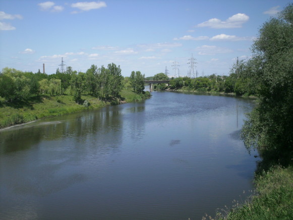
Sloviansk [Слов’янськ; Slov’jans'k]. Map: V-18, DB Map: DBII-3. A city (2020 pop 108,400) on the Kazennyi Torets River, a raion center in the northern part of Donetsk oblast, a major industrial and resort center, and an important railway and highway junction. Railway trunk lines (double track, electrified) lead from it in three directions: west to Lozova (and from there north to Kharkiv, west to Kyiv, and southwest to Dnipro), northeast to Lyman (and from there northwest to Kharkiv and southeast to other cities in the eastern part of the Donets Basin), and south (to Kramatorsk, Druzhkivka, Kostiantynivka, Horlivka, Donetsk, and Mariupol). The M-03 national highway (Kharkiv–Bakhmut–Debaltseve–Antratsyt) passes next to Sloviansk; the H-20 highway links highway M-03 and Sloviansk with cities to the south (Kramatorsk, Druzhkivka, Kostiantynivka, Donetsk, and Mariupol).
History. The city’s site was first mentioned as a temporary fortified outpost at a Crimean Tatar ford on the Tor River (1645). It gained permanency only after Ukrainian settlers (refugees from the Turkish-Polish war) established a fort at Maiak Lake in 1663 (now the village of Maiaky, 10 km north of Sloviansk, on the right bank of the Donets River) and then under its protection began salt extraction from saline lakes at Tor (1664), which gave rise to fort Tor (1676) and its settlement of Soliane (now Sloviansk).
Tor developed into a salt manufacturing and trading center. In 1685–1764 it was a company center of the Cossack Izium regiment in Slobidska Ukraine. Then it became a county center in Katerynoslav vicegerency. In 1784 Tor was reclassified as a town and renamed Slovenske; Tor River was re-named Kazennyi Torets River. A decade later the town was renamed Sloviansk and became a part of Slobidska Ukraine gubernia (from 1835, Kharkiv gubernia). With the construction of a railway line (1869), the town grew rapidly (in 1837, 5,900; 1860, 9,300; by 1897, 15,700). With their discovery, the Sloviansk salt deposits were mined by underground leaching (1876–1961).
In 1918, during Ukraine’s struggle for independence (1917–20), the Ukrainian National Republic designated Sloviansk to be the center of the Donechchyna (one of the new administrative units called ‘lands’), but the government of Hetman Pavlo Skoropadsky retained the old administrative divisions (May 29, 1918), so the city remained part of Kharkiv gubernia. In November 1918, in the course of the Ukrainian-Soviet War, 1917–21, the Bolsheviks took control of the city. In May 1919 the city was taken by the Russian ‘White’ Volunteer Army.
From 1920, Sloviansk became part of the Ukrainian SSR, in the Artemivsk (now Bakhmut) okruha. By 1926 the city’s population reached 28,800, of which the majority, 74.0 percent, were Ukrainians, 17.7 percent Russians, 4.4 percent Jews, 0.9 percent Poles, 0.6 percent Germans, and 0.4 percent Greeks. From 1932 the city was part of the newly established Donetsk oblast, when it experienced the greatest industrial expansion and population growth, reaching 77,842 in 1939. Meanwhile, its churches were closed (the Trinity Cathedral converted to a movie theater and the Alexander-Nevskii Church into a gym and then a dining hall). In 1934 the city gained USSR resort status for its medicinal mud baths.
During the Second World War the city was under German occupation from 28 October 1941 to 17 February 1943, and briefly from March 1 to September 6, 1943. German occupation authorities allowed churches to resume their services, but after the return of Soviet authorities, the churches were again closed. In December 1941, during the Holocaust, the Nazi SS-Sonderkommando 4b shot all of the Jews in the city, approximately 1,300 men, women and children.
After the war, the city’s population recovered (82,784 in 1959), grew to 143,000 (1987) and then began to decline. During that period, while the infrastructure and industries were re-built and new ones added, the population composition also changed, undergoing Russification.
Following the 1991 Ukraine’s Declaration of Independence, the city’s population continued to decline. According to the 2001 census there were 122,575 residents in the city, of whom 73.1 percent were Ukrainians and 23.6 percent Russians, but in terms of their mother tongue, 42.6 percent identified it as Ukrainian and 55.7 percent as Russian. Freedom of religion and privatization resulted in the revitalization of churches, commerce and industry.
In 2014 Sloviansk was struck by the Russo-Ukrainian war in the Donbas. On May 11, Special Forces and military volunteers from the Russian Federation with pro-Russian separatists took the city, terrorizing Ukrainian speakers, Evangelists, and political non-conformists. Ukrainian authorities in Kyiv responded (May 13) with an anti-terrorist operation, surrounding the city (May 25). The ensuing battles destroyed buildings; loss of power deprived the city of electricity and water; many fled the city. On July 5, the city was liberated from the Russian and pro-Russian forces, which fell back to Donetsk. Mass graves were uncovered. Reconstruction of damaged buildings and infrastructure in Sloviansk began. With de-Communization (2016), the historic names of many streets were restored.
Economy. Sloviansk was an important industrial and health resort center. Salt extraction gave rise to salt refining and packaging, soda and other chemicals manufacturing (est 1897 by a German company; expanded as ‘Khimprom’ in the Soviet period; by 1972 had 18 operations, including plastics and the making of vinyl records). Other mineral-based industries include brick works, ceramics manufacturing, armature insulator and high voltage insulator production. As a gateway to the Donets Basin, in the Soviet period it developed supporting machine-building plants, including the Sloviansk Heavy-Machine-Building Plant (‘Slovvazhmash,’ est 1931, privatized in 1994; making coke-chemical and rolled steel producing equipment, diversified to make other equipment), the Sloviansk Machine-Building Plant (machines and equipment for mining, metallurgy, hoists and cranes), and cement machine-building (‘Betonmash,’ founded in 1941). Agriculture-based industry includes oil-processing (‘Slavoliia,’ since 1954 producing oil, pellets, lard-like hydrogenated oil, soap and glycerin, privatized in 1995), and meat-processing. Wood is used to make furniture and pencils. Power comes from the Sloviansk Thermal-Electric Power Station (built in 1954 at Mykolaivka, 10 km east northeast of Sloviansk, on the right bank of the confluence of Kazennyi Torets River and Donets River, with a large water reservoir for cooling).
Sloviansk services include its resort and transport functions. The Sloviansk Resort is in a wooded area on the northeast periphery of the city. Based on the mud properties of its salt lakes Ripne and Slipne, it has three sanatoria and medical facilities. Its main season of operation is May through August. Its role in the economy has declined. The city has a railway mechanical service shop at the main Sloviansk station.
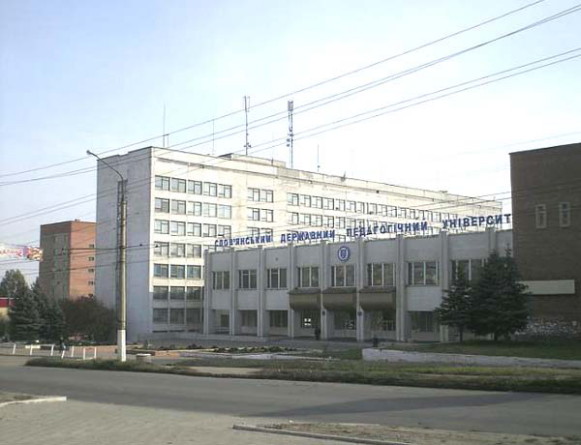
Culture. The city’s main educational institution is the Sloviansk Pedagogical University (until 2002 the Sloviansk Pedagogical Institute, established in 1939; in 1996 it opened up a pedagogical lyceum). In addition, there are the Sloviansk branch of the National University of State Fiscal Service of Ukraine, the Sloviansk College of the National Aviation University (formerly the Sloviansk Aviation-Technical School of Civil Aviation, which also had, from 1927 to 1941, the Sloviansk Aeroclub, and a grass-covered landing strip), a separate branch of Sloviansk Technical College of the Luhansk National Agricultural University (until 2010, the Sloviansk State Agricultural Tekhnikum), the Sloviansk College of Transport Infrastructure (formerly the Sloviansk Tekhnikum of Railway Transport), the Sloviansk Energy Construction Tekhnikum, and the Sloviansk Chemical-Mechanical Technikum. The city has three libraries (raion, city, and children’s), a regional studies museum, two art galleries, one of which is named after a native artist, P. Konchalovsky. Historical structures include the Holy Resurrection Church (1775); the Alexander Nevskii Church (19th century); and the remains of the Tor fortress (17–18th centuries). Soviet-era memorials and new ones co-exist; churches have been restored and new ones built or halls converted into houses of prayer. There are a number of confessions in Sloviansk: Orthodox (7 parishes), Evangelists (5), Baptists (3), Muslims (2), and one each of Jews, Christian Mission of Mercy, Jehovah’s Witnesses, and Seventh Day Adventists.
Although Sloviansk has no professional sports teams, it has a large stadium, ‘Khimik,’ and an amateur football club, ‘Slovkhlib’ (organized in 1999, amateur champion in Donetsk oblast in most years between 2001 and 2012, and earned silver in 2004 and bronze in 2009 in the national amateur championship).
Sloviansk has a radio and television broadcasting center. The official city newspaper is Visti: Slovians'ka hazeta (in Russian, Vesti), published since 1917.
City plan. On a map, the city of Sloviansk forms an irregular circular shape. With maximum dimensions 12 km east to west and 9 km north to south, it occupies 60.8 sq km, of which about 40 percent is in parks, orchards, gardens and open fields. Sloviansk is located on the west bank of the Kazennyi Torets River, just north of the confluence of the Sukhyi Torets River. The railway trunk lines follow the alignment of the two rivers and form a junction on the south side of Sloviansk. From this junction, two major spurs serve industrial plants: one northward toward the city center and the other, across Kazennyi Torets River, to the east. Factories at the junction are the ‘Slovvazhmash’ and ‘Zeus Ceramics.’ Industrial plants from the junction northward are: a meat-packing plant, an insulator-making plant, ‘Betonmash’, building materials plant, ceramics plant, and brick works. Industrial plants on the spur eastward are: ‘Khimprom’ and, beyond Sloviansk, at the city of Mykolaivka (pop 14,600), the Sloviansk Thermal Electric Power Station. On other spurs along the mainline to the northeast of the junction are: the ‘Slavoliia’ oil processing plant, the ‘Samotsvity’ pencil factory, the Sloviansk Machine-Building Plant, and the ‘Torelast’ plastics-making plant. North of it, along Veisove Lake, is the Sloviansk salt plant (abandoned).
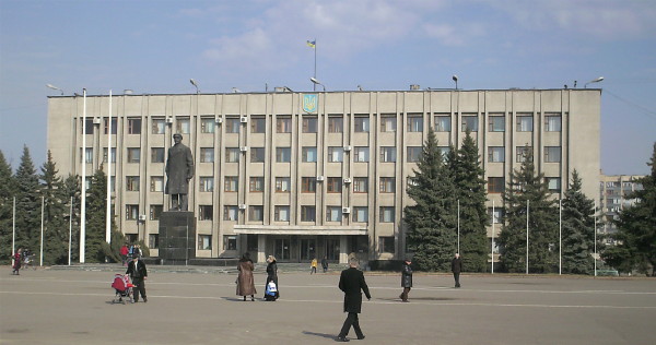
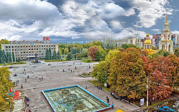
The city is served by three railway passenger stations: Slovianskyi Resort (in the northeast), ‘Mashchormet’ (at the junction), and Sloviansk (the main station, west of the junction, on the southwest side of the city). From the Sloviansk station and the adjacent Alexander Nevskii Cathedral, Station Street leads northeast toward the old city center. The city center contains most institutions, stores, and city parks with monuments. The central square, called Soborna Square, marks the center of the city. Its northern side is bound by University Street (with the Sloviansk Pedagogical University) and the southern side by Central Street. Beyond the city center, between and beyond the factory zones, are residential areas with parks, gardens, and orchards. Individual homes prevail, although there are several clusters of large apartment blocks, associated with specific factories. Northeast of the city center, on the shore of the Veisove Lake is the oldest functioning church in Sloviansk, the Holy Resurrection Church (1775). Beyond it is the entrance to the Sloviansk Resort.
Transportation in the city consists of buses and a trolleybus network of two permanent routes and one additional summer route.
BIBLIOGRAPHY
‘Slovians'k’ in Heohrafichna entsyklopediia Ukrainy (Kyiv 1993)
‘Slaviansk: Plan goroda’ 1:20,000 in Mista Ukrainy (Kyiv 2002)
Pirko, V. ‘Naidavnishi mista Donechchyny (mify i realnist),’ Skhid (September 2004)
Ihor Stebelsky
[This article was updated in 2020.]

.jpg)


