Perekop Isthmus
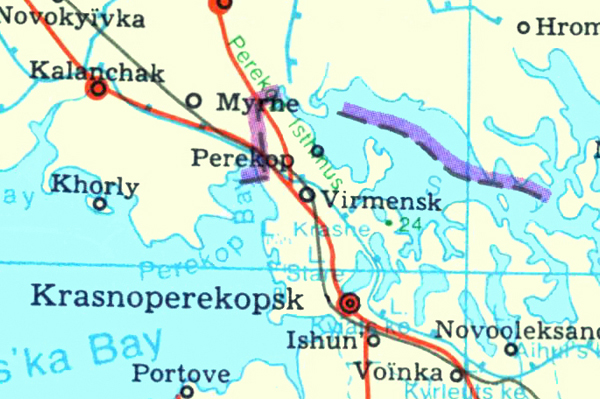
Perekop Isthmus (Перекопський перешийок; Perekopskyi pereshyiok). A thin tract of land connecting the Crimean Peninsula with the Ukrainian mainland. Located between Karkinitska Bay, in the Black Sea, and Syvash Lake, toward the Sea of Azov, the isthmus is approximately 30 km long and 8–23 km wide, with elevations reaching up to 20 m. It consists of poor, saline soils, some steppe, and a desertlike vegetation cover. Several natural salt lakes (the Perekop lakes) are located on its southern reaches. Because it provided the only land link between the Ukrainian mainland and the Crimea, the isthmus has long had great economic importance. It was used as a trade route by the Greeks of the ancient states on the northern Black Sea coast and the Genoese colonies and from the late 18th century by salt-trading chumaks. The building of the Lozova–Simferopol railway line over Syvash Lake in the 1870s diminished the importance of the isthmus considerably, although the construction of the Kherson–Dzhankoi line and the North Crimean Canal once more raised its fortunes. Because of its strategic significance the isthmus has been protected by fortified towns with defensive walls and moats (perekopani rovy, hence the name Perekop). The ancient Greeks built the town of Tafros there, and the Crimean Tatars had the fortress-town Or-Qapi and later Ferah Kermen. In the 15th and 16th centuries the Turks built fortifications (known as the Turkish Wall) across the entire isthmus, which was the scene of major battles during the Russo-Turkish wars of the 18th century. The Bolshevik forces fought their way through the isthmus’s fortifications in 1920 during the Perekop–Chouhar Operation to take control of the Crimea. Fighting also erupted in the isthmus during the Second World War, in 1941 and 1943.
[This article originally appeared in the Encyclopedia of Ukraine, vol. 3 (1993).]

