Maramureş Basin
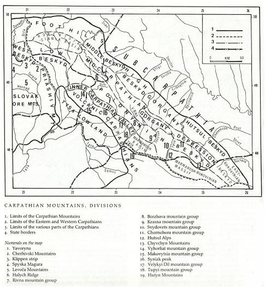
Maramureş Basin (also Khust-Solotvyna Basin or Upper Tysa Basin). A basin in Transcarpathia along the upper Tysa River. Situated between the Polonynian Beskyd in the northeast and the Volcanic Ukrainian Carpathians in the southwest, it is a continuation of the Inner Carpathian Valley. (See map: Carpathian Mountains, Division.) In the west the Basin connects (by way of the Tysa River valley) with the Tysa Lowland; its southeastern portion lies within Romania. The basin is over 50 km long and up to 30 km wide; it covers an area of nearly 1,400 sq km, with a population of approx 140,000. It is the main geographic feature of the Maramureş region.
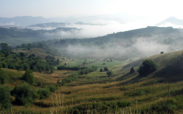
The basin itself is a tectonic depression, filled out by a thick layer of Miocene sedimentary deposits mixed with relatively thin layers of salt and tuff. Its northeastern part consists of gently rolling hills (300–600 m in height) divided by the tributaries of the Tysa River, the Rika River, the Tereblia River, and the Teresva River. In the southwest stretches the Tysa River valley (elevation, 160–240 m; width, 6–8 km), with well-defined terraces covered by alluvial sediment. The relief of the Maramureş Basin is also marked by cuestas of Miocene conglomerates, volcanic remains (notably Fortress Hill in Khust), and salt pillars (around Solotvyna). The climate of the region is more continental than that of the rest of Transcarpathia: the average temperature for the city of Khust is –4° C in January and +21.1° C in July, with precipitation of up to 900 mm per year. The soils in the region are of medium quality, with slightly clayey types in the valleys and meadows and light brown forest and clayey types in the hilly regions. The forests in the region are of oak and beech, although most of them have been transformed for agricultural applications. At present the forests make up approx 30 percent of the terrain, pastures and hayfields about 40 percent, and tillage 25 percent.
Because of advantageous natural conditions and a location along transport routes, the Maramureş Basin has long been densely populated, particularly in the Tysa River valley (average, 100 persons/sq km). The main occupation is agriculture, with corn and fruit (apples, pears, apricots, plums, and cherries) the predominant crops. The local industries include food processing, forestry, wood products, and salt industries (see Solotvyna rock salt deposits).
The major cities and towns of the region are on the Tysa River. Until 1918 the main center was Sighetul Marmaţiei (Syhit). Since then that city's role has been taken over in the northern part of the basin by Khust (1987 pop, 34,000). Other notable centers include Tiachiv, Solotvyna, Velykyi Bychkiv (the center of the salt-producing industry), Bushtyna, and Teresva.
Volodymyr Kubijovyč

