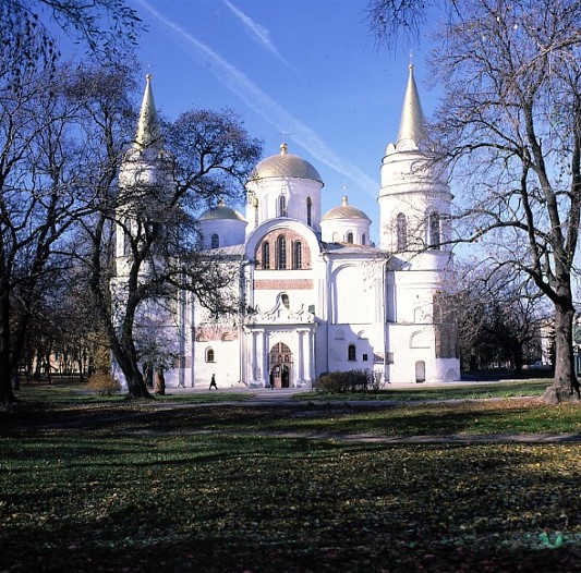
Chernihiv oblast
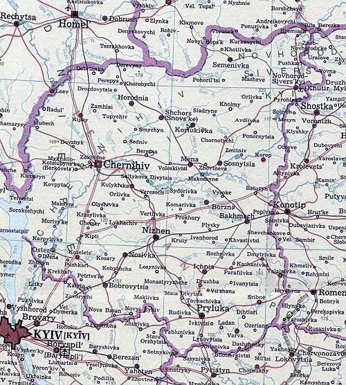
Chernihiv oblast [Чернігівська область; Černihivs'ka oblast']. Chernihiv oblast lies in the northern part of Left-Bank Ukraine. In the north the oblast borders on Belarus and the Russian Federation. For centuries the oblast’s territory was part of the geographical-historical Chernihiv region. Chernihiv oblast was established on 15 October 1932, one of seven large administrative units within the Ukrainian Soviet Socialist Republic. By 1940 it relinquished its eastern part to a newly-formed Sumy oblast, but retained 31,900 sq km. With a population (2018) of 1,020,100 (of which 65 percent is urban), the oblast has an average population density of 32 persons per square kilometer, the lowest among the oblasts of Ukraine. The oblast’s capital is Chernihiv. The oblast has 22 raions, 16 cities, 29 towns (smt), and 1,465 villages.
Physical geography. Most of Chernihiv oblast lies within the Dnipro Lowland. It is a somewhat swampy plain, sloping from the northeast (200–220 m above sea level) to the southwest (100–150 m above sea level). The climate here is moderate-continental: mean July temperatures range from 18.0̊ to 19.5̊C, and mean January temperatures from –6̊ to –8̊C. Average annual precipitation increases from 550 mm in the south to 580 mm in the northeast. The length of the growing season is 190–200 days. The Dnipro River and its left-bank tributary, the Sozh River, flow south along the western boundary of Chernihiv oblast. The main river of the oblast is the Desna River, which flows from the northeast to the southwest. The left-bank tributaries of the Desna River are the Seim River, Doch River, and Oster River; its right-bank tributaries are the Ubid River, Mena River, Snov River, and Bilous River. In the southeast of Chernihiv oblast, the Udai River meanders south into the Poltava oblast to flow into the Sula River and then the Dnipro. There are mainly podzol sandy soils in the northern, Polisian part and chernozems in the remaining southeastern third. Mixed forests of pine, oak, birch, hornbeam, aspen, alder, and poplar predominate in the northern part, while small oak forests characterize the southeastern, forest-steppe third of the oblast. Forests cover 20.2 percent of the oblast’s territory.
History. In the 10th century the territory of Chernihiv oblast formed the nucleus of the Chernihiv principality. During 11th-13th centuries that principality was one of the largest and mightiest political entities of Kyivan Rus’. In 1239 it was captured by the Tatars, in 1356 annexed by the Grand Duchy of Lithuania, and in 1503 it came under the control of Muscovy. In 1648 the territory of Chernihiv oblast became part of the Cossack Hetman state. Under the Russian Empire it became part of Kyiv gubernia (1708) and then formed Chernihiv gubernia (1801). After Ukraine’s struggle for independence (1917–21), the area was subdivided in the 1920s into smaller administrative units of the Ukrainian Soviet Socialist Republic, called okruhy, and then re-assembled into the larger Chernihiv oblast in 1932.
Population. In the 20th century the population of Chernihiv oblast suffered two catastrophes and then a slow natural decline. The Famine-Genocide of 1932–3 reduced its population from 1,977,000 in 1926 to a partial recovery of 1,777,000 in 1939; the Second World War reduced it again, so it partly recovered to 1,554,000 by the 1959 census. The oblast’s population peaked at 1,586,000 in 1966, following which it entered a long period of decline: 1,560,000 in 1970, 1,495,00 in 1980, 1,416,000 in 1989, 1,245,300 in 2001, and 1,020,100 in 2018. That decline is due, in part, to the fact that the natural population growth in the oblast was one of the lowest in Ukraine and, since the 1990s, also to a negative migration balance, amplified by a negative natural increase (whereby deaths exceed births). The loss of rural population has been particularly severe, declining from 1,020,000 in 1970 to 518,000 in 2001 and 358,000 in 2018. In contrast, the urban population grew from 540,000 in 1970 to peak at 784,600 in 1994, and then declined to 727,000 in 2001 and 662,400 in 2018. The three largest cities (2018) are Chernihiv (289,400), Nizhyn (70,000), and Pryluky (55,200). The oblast also hosts the city of Slavutych (25,000), 50 km west of Chernihiv and 45 km east of Prypiat, built to house the Chornobyl Nuclear Power Station employees after their evacuation in 1986. Slavutych remains subordinated to Kyiv oblast, thus forming a 2.5 square km exclave within Chernihiv oblast. The population of Chernihiv oblast is predominantly Ukrainian (93.5 percent in 2001, 91.5 in 1989, and 92.5 in 1979) with a small Russian minority (5.0 percent in 2001, 6.8 percent in 1989, and 5.8 percent in 1979).
In 2017 the oblast had 19 vocational-technical schools with 5,100 students and 16 postsecondary institutions with 20,100 students, including the Chernihiv National University of Technology and the Nizhyn State University.
Economy. Chernihiv oblast is one of many industrial-agrarian regions of Ukraine. Agriculture remains important in the oblast’s economy. It is varied and intensive, with an emphasis on grain, potatoes, meat, and dairy products. Between the two sectors, industrial production accounted for 66.4 percent of the oblast’s gross output in 1970 declining, with economic slowdown, to 59 percent in 1991. After 1991, with the transition to a market economy, state enterprises restructured, private firms and various services gained importance. By 2017, to the gross regional product of the oblast, industry contributed 21 percent, trade 10 percent, agriculture 31 percent, financial services 8 percent, transport and communications 4 percent.
Industry. Forestry with woodworking and farming with food processing were traditional. New industrial enterprises were added in the postwar years: fuel extraction (55 percent of Ukraine’s petroleum at its peak in 1970 and some natural gas), petrochemicals, synthetic fibers, equipment and machine building. In 1970 light industry accounted for 44.5 percent of industrial production by value, the food industry for 24.5 percent, the machine-building and metalworking industry for 9.4 percent, the chemical industry for 8.4 percent, the fuel industry for 5.3 percent, and the woodworking industry and paper industry for 3.2 percent. By 2017, the industrial profile of the oblast changed. Unable to compete internationally, light industry dropped to less than 11 percent and machine building to 5.7 percent, whereas food processing gained relative importance, rising to 54.7 percent, energy supply to 15.4 percent, and woodworking and paper production to 8.6 percent. Energy for the industry was derived in the 1970s from local peat deposits (the Zamhlai peat-brick plant), oil fields (at Hnidyntsi [see Hnidyntsi Petroleum and Gas Field], Pryluky, Leliaky, and Monastyryshche), natural-gas fields (Bohdanivka and Milky), the Chernihiv Thermoelectric Station, the Kyivenerho power system, and coal from the Donets Basin.
Of the light industry, the most developed branches in 1970 were the textile industry, knitwear industry, garment, flax-and-hemp-manufacturing, and leather industry. One of the largest textile plants in Ukraine—the Chernihiv Woolen Fabrics Manufacturing Complex—and a woolworking plant are still operating in Chernihiv. There were textile mills in Novhorod-Siverskyi and Oster; garment factories in Chernihiv, Pryluky, and Nizhyn; a leather-goods factory, hosiery factory, and knitting and spinning mills in Pryluky; and a felt factory in Chernihiv. Eight flaxworking plants, two hempworking plants, and several shoe factories were in Chernihiv, Pryluky, and Semenivka. The oblast remains famous for its handicraft industries: kilim weaving and artistic embroidery.
In the food industry sugar refining, distilling, meat packing, butter and cheese making, flour milling, and canning industry are highly developed. Sugar refineries are located in Bobrovytsia, Nosivka, Parafiivka, Lynovytsia, and Novyi Bykiv. The Chernihiv Union Distilleries are found in the Borzna, Koriukivka, Horodnia, and Kozelets raions. Chernihiv and Nizhyn have breweries. Starch factories are in Semenivka, Petrivka, Nekhaivka and Peliukhivka. There are meat-packing plants in Chernihiv, Nizhyn, Pryluky, Bakhmach, and Novhorod-Siverskyi. Butter and cheese factories are located in Ichnia and Bakhmach. In Nizhyn there is a large canning factory and an oil-and-fat rendering plant.
The chemical industry has gained importance in the oblast’s economy. In Chernihiv there is a large synthetic-fibers plant called Khimvolokno, (which started production in 1959); in Pryluky there is a synthetic-resins plant and polyethylene pipe-making; and in Nizhyn there is a lacquer and paint factory. The machine building and metalworking industry serve for the most part the needs of agriculture and the chemical industry. Agricultural machinery is built in Nizhyn and Pryluky; firefighting equipment and construction machinery are manufactured in Pryluky. Railway car repair works are located at the oblast’s principal rail junction in Bakhmach. In Chernihiv, a former Soviet-era supplier of auto parts and assembler for the Gorky Auto Works, the Chernihiv Auto Factory (ChAZ) has expanded to assemble several models of buses and a trolley bus. Electronic and optical medical instruments are designed and manufactured in Nizhyn. In the woodworking industry and paper industry there are six furniture factories, the Chernihiv Musical Instruments Factory (now defunct), and an industrial paper and carton plant in Koriukivka. The building-materials industry produces reinforced-concrete structures, roofing materials, brick, etc.
Agriculture. Since 1991, collective farms and state farms were replaced by commercial family farms, various forms of farming associations and corporate farms. Thus, while in 1984 in Chernihiv oblast there were 465 collective farms (614 in 1970 and 503 in 1976) and 59 state farms (40 in 1970 and 57 in 1976), by 2009 there were 480 commercial family farms, 313 farm corporations, 114 private farm enterprises, 41 farm co-operatives, 11 state farms and 69 other farming enterprises. Chernihiv oblast is known for the production of beef, pork, grain, potatoes, flax and sugar beets (in the south-eastern third of the oblast). In 1976 as well as in 1984, 68 percent of the oblast’s area was devoted to agriculture. Of this, 72 percent was cultivated land, and 26 percent was pasture and meadowland. Following the contamination of some land with radionuclides from the Chornobyl nuclear disaster, some agricultural land in Chernihiv oblast, notably west of the city of Chernihiv, was abandoned and cropping patterns modified to minimize the contamination of food. All agricultural land used by agricultural enterprises in Chernihiv oblast declined from 2,162,000 ha in 1984 to 2,077,300 ha in 1990, 1,879,400 in 2000 and 1,800,700 in 2007. The total land under cultivation also declined. In 1976 of the 1,587,100 ha under cultivation, 44.8 percent (711,800 ha) was devoted to grain, 6.3 percent (100,500 ha) to industrial crops, 12.2 percent (193,300 ha) to potatoes, 1.2 percent (19,400 ha) to fruit, particularly melons, and 35.4 percent (562,100 ha) to fodder crops. By 2007, cultivated land declined to 1,274,600 ha, of which 961,700 ha was sown as follows: 60.5 percent (581,500 ha) to grain and legumes, 8.0 percent (77,200 ha) to industrial crops, 10.3 percent (98,900 ha) to potatoes and vegetables, and 21.2 percent (204,100 ha) to fodder crops. Sown area continued to decline; the crop mix continued to change in favor of industrial crops and away from fodder crops. By 2017 the total area sown reached 1,241,000 ha, of which 56.2 percent (697,000 ha) were sown to grains and legumes, 28.0 percent (348,000 ha) to industrial crops, 7.2 percent (89,000 ha) to potatoes and vegetables, and 8.6 percent (107,000 ha) to fodder crops. The main grains grown are winter wheat (243,300 ha in 1976), barley (194,600 ha), rye, and corn. In terms of industrial crops most of the land is devoted to flax (45,900 ha in 1976), barley (45,900 ha), sugar beets (41,800 ha), and tobacco. More recently, sunflower and rape have gained importance. The oblast is Ukraine’s largest producer of potatoes (2,943,000 t in 1975) and flax (28,900 t). Crop yields increased since 2003. The average grain yield rose from 19.5 centners per ha from the 1970–5 period to 26.1 centners per ha in 2003–6 and to 47.3 centners per ha in 2011–15; sugar beet yield rose from 244.2 centners per ha to 298.4 centners per ha and 415.6 centners per ha; and potato yield from 141.8 centners per ha to157.2 centners per ha and 194 centners per ha.
Livestock numbers declined steeply in the aftermath of Ukraine’s independence, the demise of collective farms, and the increase in the costs of livestock raising. Thus in Chernihiv oblast, there were 1,305,500 head of cattle (of which 505,100 were cows) in 1976 and 1,434,200 head of cattle (of which 455,500 were cows) in 1990. Their numbers declined, respectively, to 504,400 (258,100) in 2000, 294,800 (170,000) in 2007 and 196,500 (113,300) in 2017. The number of hogs declined from 847,600 in 1976 and 760,800 in 1990 to 275,100 in 2000, 246,400 in 2007 and 185,600 in 2017; sheep and goats from 245,500 in 1976 to 199,000 in 1990, 52,200 in 2000 and 31,600 in 2017. The predominant breed of cattle was Simmenthal; of hogs, Large White; of sheep, Perekos. Poultry farming, rabbit breeding, apiculture, and fishing are also practiced.
Transportation. Railways, roads, rivers and pipelines form the oblast’s transport network. The length of effective railroads is 877 km (2009), down from 892 km (1976–90). The oblast is crossed by the Kyiv–Nizhyn–Konotop–Moscow electrified trunk line, the Homel–Bakhmach line, the Kyiv–Nizhyn–Chernihiv–Homel–Saint Petersburg line, the Chernihiv–Nizhyn–Pryluky line, the Chernihiv–Slavutych–Prypiat–Ovruch–Korosten line, and the Novhorod-Siverskyi–Novozybkov–Homel line. The main railway junctions are Bakhmach, Nizhyn, Chernihiv and Pryluky. There are 7,700 km of highway, of which 7,200 km are hard surface (2009). The network grew from 7,500 km of highway, of which 3,600 km were hard surfaced in 1976, to accommodate increased trucking and automobile traffic. The international highways Kyiv–Chernihiv–Homel–Saint Petersburg and Kyiv–Nizhyn–Moscow cut across the oblast. There is boat transportation on the Dnipro River, Desna River, and Sazh River, and on parts of the Snov River and Seim River. Chernihiv’s port on the Desna River was important for handling building materials; now its use is limited to river excursions. Chernihiv is served by an airport. The Dashava–Kyiv–Moscow gas pipeline runs through the oblast. A crude oil pipeline conveys the Pryluky oil some 200 km south to a refinery at Kremenchuk.
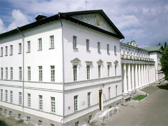
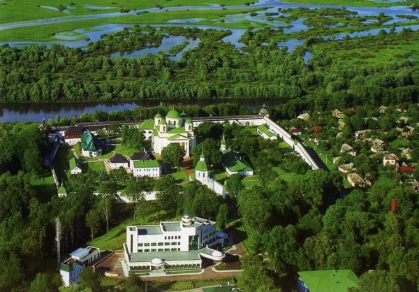
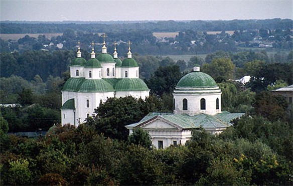
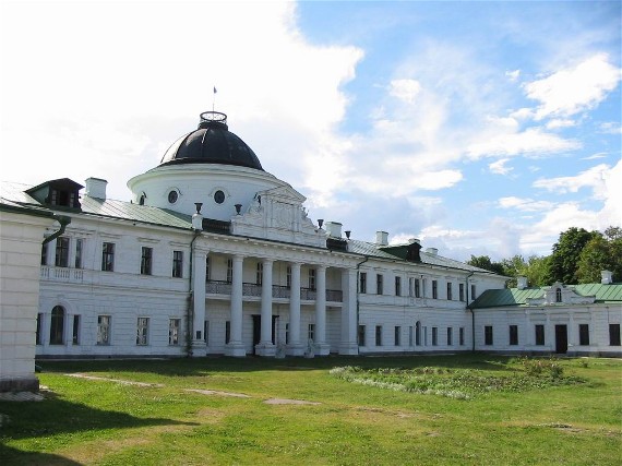
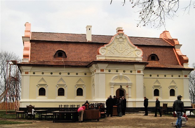
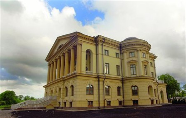
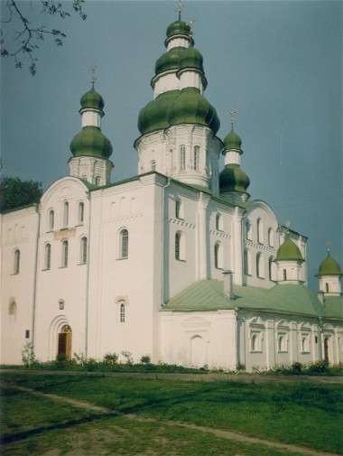
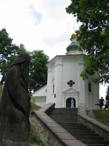
Tourism. Many tourists are attracted to Chernihiv oblast to see its historic places, notably in the cities of Chernihiv, Nizhyn, and Novhorod-Siverskyi. Historic sites of national significance include Baturyn and Kruty. Natural attractions include the Kyiv Reservoir, the banks of the Desna River, the Ichnia National Nature Park (established in 2004, 9,700 ha) and its affiliate, the historic Trostianets Dendrological Park. Tourists in Chernihiv oblast peaked in 2006 with a total of 37,800 visitors, of whom 3,800 were from abroad, staying at 49 hotels.
BIBLIOGRAPHY
Iatsura, M.; Iedomakha, I. Chernihiv (Kyiv 1958)
Symonenko, V. Chernihivs'ka oblast' (Heohrafichnyi narys) (Kyiv 1958)
Istoriia mist i sil Ukraïns'koï RSR. Chernihivs'ka oblast' (Kyiv 1972)
Chernihivs'ka oblast' (Ekonomiko-heohrafichna kharakterystyka) (Kyiv 1975)
Atlas Chernigovskoi oblasti (Moscow 1991)
“Chernihivs'ka oblast'” in Heohrafichna entsyklopediia Ukraïny , vol. 3 (Kyiv 1993)
“Chernihivs'ka oblast'” in Statystychnyi atlas Ukraïny (Kyiv 2017) http://www.ukrstat.gov.ua/
Yurii Savchuk, Ihor Stebelsky
[This article was updated in 2019.]
.jpg)
.jpg)
.jpg)
