Cherkasy oblast
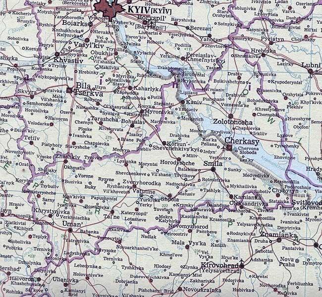
Cherkasy oblast [Черкаська область; Čerkas'ka oblast']. Cherkasy oblast lies on both banks of the Dnipro River in the forest-steppe belt of central Ukraine. It was formed on 7 January 1954 from the southern third of Kyiv oblast, the northern strip of Kirovohrad oblast and the western corner of Poltava oblast. Its area is 20,900 sq km and its population 1,220,000 (2018), of which 57 percent is urban. The oblast has 20 raions, 16 cities, 15 towns (smt) and 824 villages. Its capital is Cherkasy.
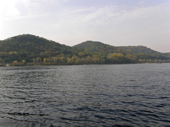
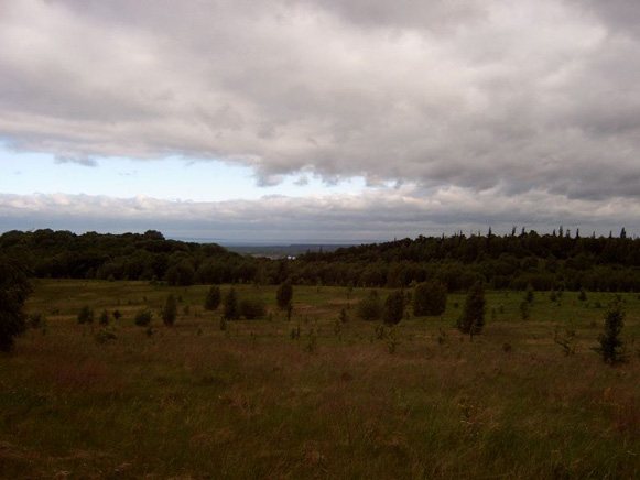
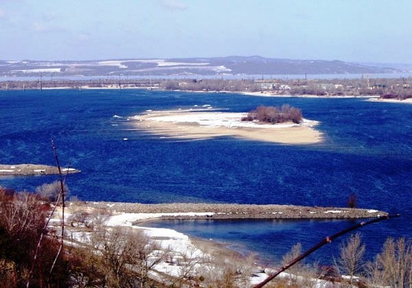
Physical geography. The larger, right-bank (western) part of Cherkasy oblast lies in the Dnipro Upland (maximum elevation, 266 m). This part is an undulating plateau dissected by river valleys, ravines, and gullies. The steep bank of the Dnipro River, which rises to 150 m above the riverbed, is picturesque. It forms the Kaniv Hills (maximum elevation, 253 m) and, along the right bank of the Vilshanka River, the Moshnohirskyi Ridge (160–180 m). The left-bank (north-eastern) part of the oblast (with an elevation of up to 150 m) is part of the Dnipro Lowland. The climate of the oblast is temperate-continental: summer is warm and dry; winter is mild with frequent thaws. The mean July temperature is 20°C, the mean January temperature –5.9°C, and the average annual temperature is 7.2°C. The growing season, with mean daily temperatures above 10°C, lasts 160–170 days of the year. The annual precipitation is 450–520 mm. The main river is the Dnipro River, with its Kaniv Reservoir and Kremenchuk Reservoir, and its tributaries: Ros River, Vilshanka River, and Tiasmyn River on the right and the Supii River and Sula River on the left. The soils, formed on wind-blown loess, are very fertile but prone to erosion when plowed. On the right bank of the Dnipro River the soils are mostly podzolized chernozems and degraded moderate-humus chernozems. On the left bank the soils are light and moderate clayey typical chernozems, meadow, and peat-bog soils. Natural vegetation here belongs to the East European forest-steppe. By the 1950s, natural vegetation of the forest-steppe survived only in ravines and on the slopes of river valleys, covering 4.5 percent of the oblast’s area. Oak or oak-hornbeam forests were preserved on the ridges and slopes of the right bank Dnipro Upland. The marshes of river valleys supported alder, aspen, poplar and willow. As the importance of forests for soil and water conservation gained appreciation, the share of forests increased from 11.5 percent of the oblast’s area in 1956 to 13.7 percent in 1973 and 15.1 percent in 2011. These included 14,800 ha of plantings: 1) shelterbelts against wind and gully erosion in the upland comprising oak, hornbeam, ash and linden, and 2) pine forests with juniper to anchor the loose sands on the Dnipro River terraces, mostly in the Dnipro Lowland.
History. In the 9th century most of what is now Cherkasy oblast was part of the southern borderland of Kyivan Rus’. With the devolution of Kyivan Rus’ into separate principalities, the right bank remained with the Kyiv principality and the left bank with the Pereiaslav principality. Following the Tatar invasion, as part of the Kyiv principality, it was subordinated to the Golden Horde (1340–62), then to the Grand Duchy of Lithuania and then, as part of the Kyiv voivodeship, to the Polish-Lithuanian Commonwealth (1569–1648). Cherkasy oblast was the place of origin of some of the Ukrainian Cossack campaigns and rebellions. It was the heartland of the Ukrainian Cossack Hetman state led by Hetman Bohdan Khmelnytsky with its capital in Chyhyryn. After this state’s partition in 1667, the larger right bank part belonged to Right-Bank Ukraine which, until 1793, was under Polish sovereignty, while the left bank part belonged to the Hetman state, a vassal and increasingly under the control of Muscovy. Under the Russian Empire in 1796 the right bank became part of Kyiv gubernia, and the left bank part of Poltava gubernia.
Population. Cherkasy oblast has a population density of 58.4 people per sq km (2018), lower than the average for Ukraine. Rural population densities are higher on its right bank (40–50 persons per sq km) and lower on its left bank (30–40 persons per sq km). The proportion of urban population is rising rapidly: it was 14.1 percent in 1940, 23.6 percent in 1960, 36.4 percent in 1970, 44.8 percent in 1979, 54.3 percent in 1993, and 56.6 percent in 2018. The population suffered several calamities (the Famine-Genocide of 1932–3, the Second World War) from which it recovered: 1,576,000 by 1939 and 1,503,000 by 1959. Subsequently the population grew slowly reaching 1,535,000 by 1970 and 1,547,000 by 1979; decreasing reproduction rates (by 1980 more people died than were born) and growing net outmigration caused it to decline to 1,536,000 in 1993, 1,387,000 by 2003 and 1,220,000 by 2018. The three largest cities (according to 2018 figures) are Cherkasy (278,000), Uman (84,000), and Smila (68,100); the next six smaller cities are Zolotonosha (27,800), Kaniv (24,200), Korsun-Shevchenkivskyi (17,900), Zvenyhorodka (17,000), Shpola (16,800) and Vatutine (16,500). The ethnic composition of the population is predominantly Ukrainian. The growth of the Russian component was reversed after Ukraine’s independence in 1991, while the Jewish component continued to decline. The shares of the three largest groups changed from 1959 to 1989 and 2001 as follows: Ukrainians, 94.0, 90.5, and 93.1 percent; Russians, 4.5, 8.0, and 5.4 percent, and Jews, 0.9, 0.4, and 0.1 percent. In 2017 the oblast had 21 vocational-technical schools with 7,800 students and 16 postsecondary institutions with 37,000 students. Among them were the Cherkasy National University, the Uman National University of Horticulture, the Cherkasy State Technological University, and the Uman State Pedagogical University.
Economy. Cherkasy oblast is an agrarian-industrial region. It is a region of intensive farming with specialization in grain, oil seeds, sugar beets, and meat and dairy cattle. Industry is an important part of the oblast’s economy and is based on the processing of local agricultural products. After the Second World War most enterprises were reconstructed, and some new branches of industry were established (equipment making, precision-instruments building, etc). In 1990, industry accounted for 66 percent of the value of production while agriculture, the remaining 34 percent. After 1991, as state enterprises closed or restructured and market economy developed, private firms and services gained importance and agriculture regained its prominence. By 2017, agriculture contributed 27 percent to the gross regional product of the oblast, industry 26 percent, trade 11 percent, financial services 9 percent, transport and communications 5 percent.
Industry. Cherkasy oblast is an important region for the food industry. In 1970 food processing accounted for 55 percent of the oblast’s industrial production. Its share declined to 33 percent by 1989 but then recovered to 48 percent by 2017. The machine-building industry and metalworking industry produced only 13.5 percent of the oblast’s industrial goods in 1970, rose to 24 percent by 1989, but then dropped to only 3.8 percent by 2017. The chemical industry and light industry gained importance in the 1970s, reaching shares of 14 percent and 12.5 percent of industrial output by value, respectively, in 1989, to decline again by 2017. The supply of power accounted for 22.8 percent of the value of industrial production in 2017. Electricity is generated at the Cherkasy Thermoelectric Station and the Kaniv Hydroelectric Station, supplemented by smaller thermoelectric stations at Uman, Talne, and Yurkivka. In 1970, the Chyhyryn Regional Nuclear Power Plant was planned, but its completion was abandoned in 1989 after the Chornobyl nuclear disaster (1986) and the ensuing protests. The lignite industry is concentrated near Vatutine, and the peat industry is centered in the Cherkasy area. Natural gas is brought in from Shebelynka or elsewhere.
Sugar is the main product of the food industry. There are 24 sugar refineries, which are located mostly in the right-bank part of the oblast, in such places as Horodyshche (Cherkasy region), Kamianka (Cherkasy oblast), Shpola, Smila, Talne, Verkhnia, and Zhashkiv. The milk industry is well developed. It has six plants, the largest being in Smila and Talne. Of the six meat-packing plants in the oblast the largest are in Cherkasy and Vatutine. There are also six distilleries, several breweries, and flour mills. The fruit and vegetable canning factory in Cherkasy is the largest in Ukraine.
The machine-building industry and metalworking industry serve mostly the needs of the local food industry, agriculture, light industry, communication and transportation. Food-processing equipment is made in Cherkasy and Smila. Commercial and food-service equipment is made in Monastyryshche; agricultural machines are built in Uman. Textile and chemical machinery is built in Kamianka (Cherkasy oblast) and Zolotonosha. Photographic equipment and telephone equipment are made in Cherkasy, while electronic measuring instruments are manufactured in Uman. At Zolotonosha railway cranes and transportation machinery are built. There are auto and bus repair plants in Cherkasy and machine-repair works in Korsun-Shevchenkivskyi. In Cherkasy the Bogdan Motors bought the bus repair facility in 1998 and then built assembly plants for its own buses and trucks equipped with Isuzu engines, and for Hyundai automobiles.
Light industry includes textile and clothing manufacturing (silk, cotton, knitwear, hemp-working) and shoemaking. The largest plants of this industry are in Cherkasy, where silk, knitwear, felt, and handicraft products are produced. Shoes are made in Cherkasy and Uman. Synthetic-fiber plants and chemical plants, notably a nitrogen fertilizer plant, are major enterprises in Cherkasy. Uman has a vitamin plant, and Zolotonosha has an ether plant. The furniture factories in Cherkasy and Shpola are of regional importance.
The building-materials industry draws on rich local resources. They include the largest bentonite deposits in Ukraine, indeed in Europe, as well as deposits of granite and labradorite. There are 11 reinforced-concrete plants, 6 rock-crushing plants, and 18 building-materials plants. Granite is quarried in the Uman raion and labradorite in the Horodyshche (Cherkasy region) raion. There is a refractory-clay plant in Vatutine, and a bentonite clay plant near the village of Semenivka, Lysianka raion.
Agriculture. Since 1991, collective farms and state farms were replaced by commercial family farms, farming associations and corporate farms. In 1984 in Cherkasy oblast there were 378 collective farms (decreasing in numbers through consolidation and conversion to state farms, from 457 in 1970 and 389 in 1976) and 71 state farms (increasing in numbers through conversion from collective farms from 38 in 1970 and 58 in 1976). By 2009 there emerged 1,139 commercial family farms; the collective and state farms were replaced by 436 farm corporations, 151 farm enterprises, 14 farm co-operatives, 7 state farms and 104 other farming enterprises.
In 1976 arable farmland occupied 1,462,700 ha, which represented 69.9 percent of the oblast’s total area of 2,091,600 ha or 74.8 percent of the oblast’s 1,955,200 ha of land area (without its water bodies). Of the arable farmland, 91 percent was cultivated; 7 percent was in hayfields and pastures; and 2 percent in orchards and berry plantings. By 1990 arable farmland was reduced to 1,293,700 ha, or 66.2 percent of the oblast’s land area. With improved conservation practices, the share of cultivated land declined to 90.1 percent of the arable farmland and orchards and berry plantings to 1.5 percent, while hayfields and pastures increased to 8.4 percent. Some 10,000 ha of land was drained and 54,000 ha irrigated. The area seeded was also reduced and the crop mix changed in favor of food crops. In 1976 the total area seeded was 1,320,700 ha, of which 609,000 ha (46.1 percent) was devoted to grain, 201,000 (15.2 percent) to industrial crops, 410,000 (31 percent) to fodder, and 96,000 (7.3 percent) to potatoes and vegetables. By 1992 the area seeded diminished to 1,269,000 ha, of which 556,000 ha (43.8 percent) was in grain, 184,000 ha (14.5 percent) in industrial crops, 428,000 ha (33.7 percent) in fodder and 101,000 ha (8.0 percent) in potatoes and vegetables. Further adjustments occurred by 2007, with a major reduction in fodder crops; the total seeded area was reduced to 1,182,600 ha, of which 690,900 ha (58.4 percent) was in grain, 264,900 ha (22.4 percent) in industrial crops, 133,400 ha (11.3 percent) in fodder and 93,400 ha (7.9 percent) in potatoes and vegetables. By 2017 the total seeded area increased slightly to 1,189,000 ha, of which 638,000 ha (53.7 percent) was in grain, 385,000 ha (32.4 percent) in industrial crops, 94,000 ha (7.9 percent) in fodder, and 72,000 ha (6.1 percent) in potatoes and vegetables. The principal grains were winter wheat (273,400 ha in 1976, 224,500 ha in 2007) and corn for grain (54,400 ha in 1976, 167,600 ha in 2007). Millet, barley, legumes, and buckwheat were also grown. For industrial crops the largest area was given to the sugar beet (152,000 ha in 1976) declining to 41,400 ha in 2007 and 16,700 ha in 2017; indeed, sugar beet was surpassed by the more lucrative sunflower (36,600 ha in 1976, 88,500 ha in 2007 and 204,700 ha in 2017) and rape (59,900 ha in 2007). The areas under orchards, berry patches, and vineyards declined from 48,000 ha in 1976 to 6,100 ha in 2007 and 6,300 ha in 2017. The Korsun-Shevchenkivskyi and Horodyshche (Cherkasy region) regions particularly continue to produce apples, pears, apricots, plums, and sweet and sour cherries.
Crop yields have been variable but relatively high in comparison to most other oblasts of Ukraine. In 1970–5 the average grain yield was 30.4 centners per ha, and the winter wheat yield was 35.4 centners per ha (one of the highest in Ukraine). The grain yield averages remained in the same range until about 2007; subsequently the 2013–7 grain yield average increased to 57.4 centners per ha. The average yields of sugar beets, sunflower, potatoes, vegetables, and fruit showed similar patterns. Thus the average yields of sugar beets increased from 267 centners per ha (1970–5) to 440 centners per hectare (2013–7), and of potatoes, from 120 centners per ha (1970–5) to 154 centners per ha (2013–7).
Animal husbandry consists mainly of dairy- and beef-cattle farming and hog-raising. This contributes to its high rank in beef and pork production among the oblasts of Ukraine. Sheep, poultry, and rabbits are also raised. Cattle feed, consisting of cultivated grasses, alfalfa, and the wastes of the food industry (particularly the sugar refining, oil extracting and distilling industries), is abundant. In 1975 there were 887,000 head of cattle (320,000 cows), 936,400 hogs, and 280,900 sheep and goats in the oblast. Since 1990, their numbers have declined (numbers are for the end of the year in 1990, 2000, 2007 and 2017, respectively): cattle: 958,500, 422,500, 243,600, and 163,900; of which, cows: 308,500, 188,700, 113,800, and 78,100; hogs: 1,056,700, 506,400, 448,900, and 339,000; sheep and goats: 261,600, 62,700, 44,500, and 29,600. The main breed of cattle was the Simmenthal; of hog, the Large White and Myrhorod; of sheep, Precocious. Poultry was traditionally kept by individual households. Commercial operations on collective farms or state farms developed slowly. The poultry numbers, after a dip, grew again since 2002 on corporate farms (the numbers are for end of the year in 1990, 2000, 2007 and 2017, respectively): 9,742,600, 5,475,100, 13,674,700, and 24,363,600. The Myronivska Poultry Farm at Stepantsi village of the Kaniv raion is the largest commercial producer of broilers in Cherkasy oblast and its brand, MHP Agroindustrial Holding, the largest broiler producer and exporter in Ukraine. Near Moshny village of Cherkasy raion there is mink farming.
Transportation. Railways, roads, rivers and pipelines form the oblast’s transport network. Rail tracks have been consolidated from 652 km in 1990 to 588 km in 2009. The primary railway line passing through the oblast at Smila but bypassing Cherkasy connects Kyiv from the north and Lviv from the west to Dnipro in the southeast and Donetsk to the east. The other mainline passing through Cherkasy connects Moscow with Odesa. The main railway junctions are Shevchenkove at Smila, Khrystynivka, and Tsvitkove. Motor roads were also consolidated and more were paved. In 1976 there were 6,500 km of motor highways, of which 4,700 km were hard surface. By 1990 the network was reduced to 6,200 km (of which 5,700 km were hard surface) and by 2009 the total was 6,100 km (of which 5,900 km were paved). Three main highways pass through Cherkasy oblast: 1) from Kyiv (past Zhashkiv and Uman) to Odesa; 2) from Kyiv, through Horodyshche (Cherkasy region) and Smila, to Dnipro, and 3) from Lviv, Ternopil, Khmelnytskyi, and Vinnytsia (past Uman) to Kropyvnytskyi, Dnipro, and Donetsk. Two trunk gas pipelines, the “Progress” and the “Soiuz”, pass through the oblast, transporting Russian gas to the western border of Ukraine. River transportation on the Dnipro River and its cascade of water reservoirs is useful for moving heavy and bulky goods, such as building materials. Cherkasy is well served with a commercial port and a marina for recreation on the Kremenchuk Reservoir. Cherkasy also enjoys airline connections with the main cities of Ukraine.
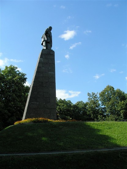
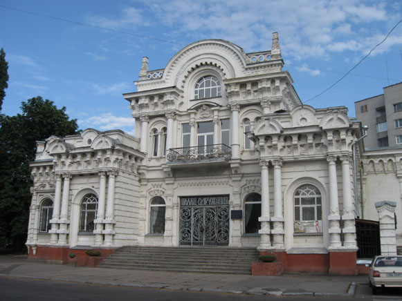
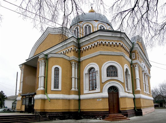
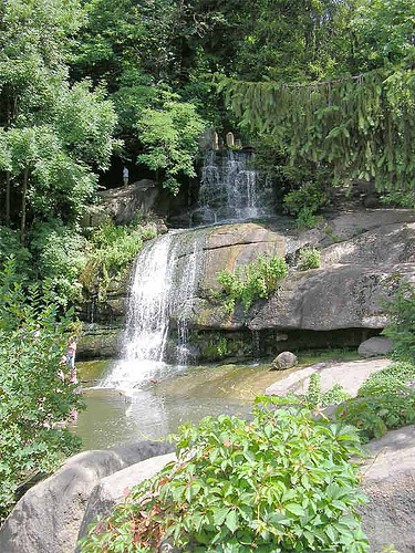
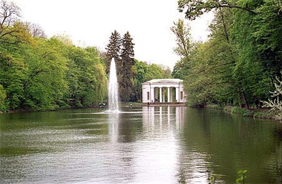
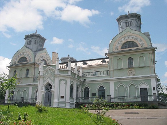
Tourism. The main attractions of Cherkasy oblast include natural landscapes and historic sites. On the picturesque right bank of the Dnipro River at Kaniv there is the gravesite and monument to Taras Shevchenko, the Bard of Ukraine, and the Shevchenko National Preserve. This national memorial attracts many day tours from Kyiv via bus or hydrofoil. The birth places of Taras Shevchenko and other prominent Ukrainian personalities are points of interest. The city of Cherkasy has two museums, two theaters, a symphony orchestra and the Kremenchuk Reservoir for water-based recreation. Other historic sites include Chyhyryn and the nearby Subotiv with their museums, and Uman with its three museums and the grave of Rebbe Nakhman of Bratslav, the focus of pilgrimages for Hasidic Jews. Natural attractions include the Kaniv Nature Reserve (est 1923, 2,027 ha) and 42 other small nature preserves of various sizes, the Sofiivka Park in Uman (est. 1983, 152 ha), the zoological park in Cherkasy (est. 1983, 8 ha), and many other small botanical gardens and hydrological and geological nature preserves. In 2008 the oblast accommodated 43,049 tourists (of whom 953 were foreign guests). There were 55 hotels and resorts (notably near Kaniv and Cherkasy) to house the visitors.
BIBLIOGRAPHY
Hudzenko, P. Cherkas'ka oblast' (Kyiv 1959)
Slava Cherkashchyny, 1917–1967 (Dnipropetrovsk 1967)
Istoriia mist i sil Ukraïns'koï RSR. Cherkas'ka oblast' (Kyiv 1972)
“Chekas'ka oblast'” in Heohrafichna entsyklopediia Ukraïny, vol. 3 (Kyiv 1993)
“Cherkas'ka oblast'” in Statystychnyi atlas Ukraïny (Kyiv 2017) http://www.ukrstat.gov.ua/
Yurii Savchuk, Ihor Stebelsky
[This article was updated in 2019.]
.jpg)
%20Cathedral.jpg)
.jpg)
.jpg)
.jpg)
.jpg)
.jpg)
.jpg)
