Carpathian Mountains
Carpathian Mountains (Карпати; Karpaty). (Map: Eastern Carpathians.) Folded, young mountains of medium elevation, stretching in an arc about 1,500 km long (with a chord of almost 500 km) from the city of Bratislava in the northwest to the Iron Gate on the Danube River in the southeast and covering an area of about 200,000 sq km. The Carpathians are part of the Alpine mountain system and border on the old Czech, Polish, and Ukrainian massifs and Dobrudja, being separated from them by a band of young depressions—along the Morava River and Vistula River, the Sian Lowland and Dnister Lowland, the Subcarpathian Depression, and the Wallachian Depression. The Pannonian Basin, which cuts north into the mountains along the Tysa River and Bodrog River and their tributaries, occupies the central part of the arc. The main center of scientific study of the Carpathian Mountains in Ukraine is the Institute of the Ecology of the Carpathians of the National Academy of Sciences of Ukraine.
Orography. The Carpathian Mountains consist of three geologically distinct bands: the outer flysch, the central crystalline, and the inner volcanic. Only the flysch band is continuous, connecting the Carpathians into one whole. The crystalline band is interrupted in the middle for a distance of over 200 km. Thus, the Carpathians are divided into three parts: the Western Carpathians and the Southern Carpathians, both of which consist of three bands, and the Eastern Carpathians, which are only 100-120 km in width and consist only of the flysch and volcanic bands. The Western Carpathians are settled mostly by Slovaks and Poles (with Czechs, Hungarians, and Ukrainians at the fringes), the Eastern Carpathians are settled by Ukrainians, and the Southern Carpathians, by Romanians. Sometimes the Carpathians are divided into two parts only: the Western and Eastern Carpathians are called the Northern or Slavic Carpathians, as distinguished from the Southern or Romanian Carpathians.
The Eastern Carpathians extend from the Biała River, Tylych Pass, and Toplia River in the west to the Tysa River, Prislop Pass, and Suceava River in the southeast. Sometimes the western limit of the Eastern Carpathians is defined by the Oslava River, Laborets River, and Sian River. In Soviet texts the Moldavian Carpathians are included in the Eastern Carpathians, which extend as far south as the Predeal Pass. The Eastern Carpathians (excluding the Low Beskyd) are known as the Forested or Ukrainian Carpathians. They consist of the flysch band (the Beskyds) and the volcanic band (the Volcanic Ukrainian Carpathians). In the southeast the Beskyds meet the crystalline Maramureş-Bukovynian Upland. With the Low Beskyd the Eastern Carpathians cover an area of almost 40,000 sq km and, without it, an area of 32,000 sq km. Ukrainian ethnic territory in the Carpathians up to 1946 covered 24,000 sq km and had a population of 1.7 million. Today 22,500 sq km of the Carpathians, with a population of approximately 1.2 million, belong to Ukraine.
The Carpathian Mountains, particularly Transcarpathia, are important to Ukraine from a geopolitical viewpoint. The Carpathian watershed defined for many centuries the political border of Ukraine, but not the ethnic border, since the mountain passes allowed Ukrainians to penetrate the southern slopes. Thus, the Carpathian region, along with the adjacent edge of the Transcarpathian Lowland, connects Ukraine with Hungary and Slovakia, which lie in the Pannonian Basin (for more detail see Transcarpathia).
Geological structure. The Ukrainian Carpathian Mountains lie on the border of the East European Platform and the Mediterranean Geosynclinal Province. Their geological structure is the result of successive periods of sedimentation, orogenesis, and denudation. The basic pattern in the structure of the Ukrainian Carpathians is their distinct division into longitudinal structural-lithological zones. The mountains were principally formed in the Tertiary period and, therefore, Cretaceous and Lower Tertiary rock formations are most widespread in the Carpathians. The older Paleozoic and Precambrian rocks are quite rare and are found mostly in the Rakhiv Mountains and the Chyvchyn Mountains, which are part of the Maramureş-Bukovynian Upland. Upper Cretaceous and Paleogene deposits appear in dislocated layers of flysch—interbedded sandstones, marls, and schists. Late Tertiary strata are common in Subcarpathia and Transcarpathia. Quarternary formations such as glacial deposits, alluvial deposits, and loess in the depressions are widespread.
The tectonic structure of the Ukrainian Carpathian Mountains is complex and is still being investigated by geologists. Generally, however, the structure is characterized by zonation and nappes. The Carpathian Mountains were formed during the Alpine orogeny in the Tertiary period. Prior to that, from the end of the Paleozoic to the Cretaceous period, mountains of the Hercynian orogeny (late Paleozoic era), known as the Protocarpathians, existed in their place. In the Cretaceous and Lower Tertiary periods the Protocarpathians were destroyed and were replaced by geosynclinal depressions filled with seawaters. The Rakhiv Mountains and isolated cliffs (klippen) are remnants of the ancient mountains. In the geosynclines flysch was deposited to a depth of 5,000–7,000 m. In the Upper Tertiary period the present mountains rose at the site of the geosynclinal depressions. Their formation was accompanied by violent volcanic effusions. The contours of the Carpathians were formed in the first half of the Miocene epoch. In the middle of the period the Carpathians underwent partial peneplanation, which was interrupted by uplifting followed by peneplanation again. The present relief of the mountains is the result of the two peneplanations, which produced large, flat surfaces and terraces at several altitudes. During the Quarternary period there was some glaciation of the Carpathians in the Riss and Würm ages. Transverse dislocations, which cut across the structural zones and frequently provide a path for rivers, play an important role in the geological structure of the Ukrainian Carpathians. (See diagram: Carpathian Mountains in Profile.)
Zonation is characteristic of the tectonic structure of the Ukrainian Carpathians. They consist of four longitudinal structural zones, which extend from the northwest to the southeast: (1) the outer or overthrust fold zone, 40 km wide, built of Cretaceous and Paleogene flysch (mostly sandstone) formed into anticlinal folds that were broken and thrust towards the southeast (at the edge of the Carpathians they often cover the Miocene strata of Subcarpathia); (2) the central synclinal zone, 30–40 km wide: at its surface intensely folded Upper Oligocene strata of soft, sand-clay sediment are most common; (3) the core of the inner anticlinal zone, consisting primarily of crystalline rock formations—crystalline schists, gneiss, quartzite, and crystalline limestones—and, to a lesser extent, of Triassic and Jurassic strata—limestones, sandstones, porphyrites, and conglomerates—which emerge to the surface only in the Maramureş-Bukovynian Upland; however, this basic core is often overthrust with flysch strata from the Cretaceous and Lower Paleogene periods, folded, frequently dissected, and in places pushed towards the north; (4) a zone of volcanic deposits—trachytes, andesites, rhyolites, and tuffs—separated from the rest of the Carpathians by the Inner Carpathian Valley and the Maramureş Basin, which are covered by horizontal layers from the Miocene period.
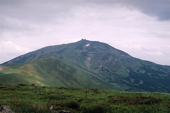
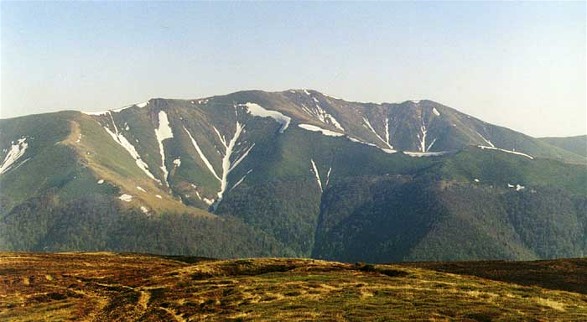
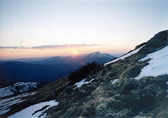
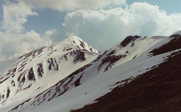
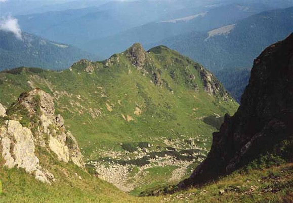
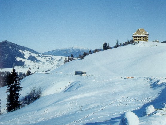
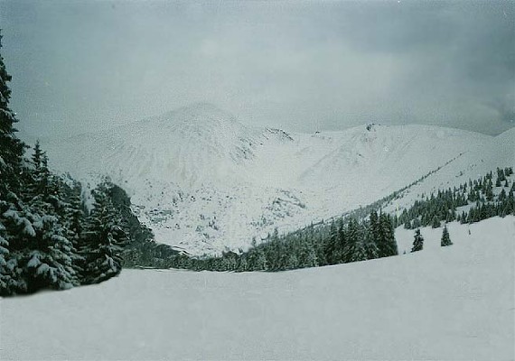
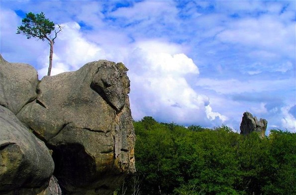
Landscape. The Ukrainian Carpathians are typical mountains of medium height with rock of low resistance. Gentle, broad, and little-dissected ridges and parallel valleys contrast with the deeply incised (up to 1,000 m) transverse valleys with steep slopes that are the result of the relief's rejuvenation. Only the highest parts of the Carpathians—mainly the Hutsul Alps and Chornohora—display a high-mountain landscape owing to past glaciation. Rock fields appear only here and, more markedly, in the Gorgany Mountains, but even the highest peaks of the Carpathians are covered with clays and continuous vegetation. (See map: Carpathian Mountains, Morphology.)
Despite a certain generally perceived uniformity of landscape, the Ukrainian Carpathians can be divided into a number of regions, based on different geological structure and altitude. These tend to form longitudinal belts stretching from the northwest to the southeast as is typical of all the Carpathians. The belts comprise (1) the high, outer flysch belt, separated by (2) the Middle-Carpathian Depression from (3) the inner, high flysch belt—the Polonynian Beskyd, which is in turn separated by (4) the Inner Carpathian Valley from (5) the Volcanic Ukrainian Carpathians. In the southeast the Polonynian Beskyd borders on (6) the Maramureş-Bukovynian Upland. The landscape varies within each belt. (See map: Carpathian Mountains, Division.)
The outer high belt of the Beskyds, which corresponds to the outer anticline, rises steeply beginning at 300–400 m above Subcarpathia. The lower parts of this belt have a well-developed banded structure with a trellised drainage pattern: the longitudinal ridges, with steeper northeastern slopes and gentler southwestern slopes, are built of limestones and are separated by parallel wide valleys carved out of soft marls and clay. In the higher parts ridges forming a feathered pattern with transverse valleys predominate; clearly defined peaks, rock fields, and weak traces of glaciation are evident. Several groups can easily be distinguished in the outer Beskyds: (1) the lowest range—the Middle Beskyd—which lies between the bend of the Sian River and the Turka-Boryslav line; (2) the High Beskyd, which rises above the Middle Beskyd by 300–400 m and extends to the east of it as far as the Mizunka River (its peaks are Mount Parashka, 1,271 m, and Magura Ridge, 1,368 m [see Magura mountains]); (3) the Gorgany Mountains—the highest (Syvulia, 1836 m) and most continuous part of the Outer Beskyds, which stretches to the Prut River; and (4) the lower Hutsul Beskyd, sometimes known as the Pokutia-Bukovynian Carpathians (Hordyi Peak, 1,478 m), which stretches to the Suceava River in the east.
The Middle-Carpathian Depression is a basin of gently contoured, low-mountain topography with an elevation 200–600 m below that of the two high sandstone zones. The main Carpathian watershed runs along this belt on a line from the source of the Sian River to the source of the Prut River, as do the main mountain passes such as Uzhok Pass (889 m), Veretskyi Pass (839 m), and Yablonytskyi Pass (931 m). The central part of the depression (25–30 km wide) borders on the High Beskyd and is the most developed part.
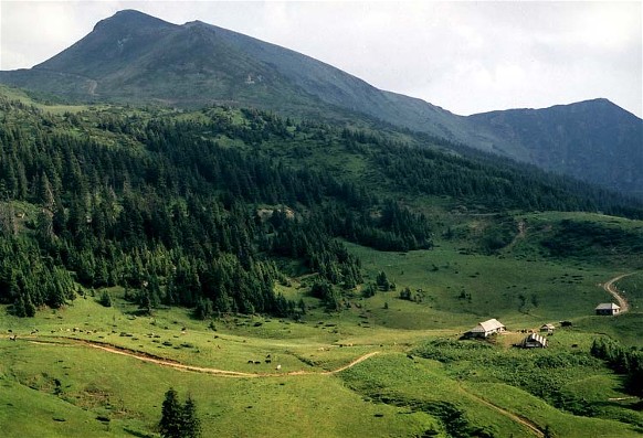
The Polonynian Beskyd is the highest and most blocklike part of the Eastern Carpathians. In the past it was the main watershed. Its broad and gentle tops are covered with meadows, the remnants of former peneplains, and provide a sharp contrast with the narrow valleys, which are almost 1,200 m deep. Postglacial cirques, some of them filled by lakes, appear on the mountain slopes. West of the Uzh River the ridges of the Polonynian Beskyd form a banded pattern and in a few places rise above 1,200 m. Farther east it consists of the high massifs Rivna (1,482 m). Borzhava (1,679 m), Krasna (1,568 m), Svydivets (1,883 m), and Hoverlia (2,061 m). Even farther to the east the Polonynian Beskyd narrows and splits into several longitudinal, broad ridges, which press closely to the Maramureş-Bukovynian Upland. In eastern Bukovyna the flysch zone shrinks to 40 km in width, and the division between the flysch belts disappears, forming the East Bukovynian Beskyd.
The Maramureş-Bukovynian Upland is more picturesque than other parts of the Ukrainian Carpathians because of its varied geological structure, its deeply incised rivers, and landscapes resulting from former glaciation. This applies particularly to the Hutsul Alps (1,961 m). The lower Chyvchyn Mountains, which are built mostly of crystalline schists, and the Bukovynian part of the range have gentler outlines, which are not much different from those of flysch mountains.
The Inner Carpathian Valley (400–500 m deep and 1–6 km wide) runs between the Polonynian Beskyd and the Volcanic Volcanic Carpathians. Its absolute elevation is 150–300 m; it can, however, reach 450 m in passes. Formed out of volcanic strata, the valley has gentle outlines and contains a series of terraces. Small longitudinal streams flow along it into the right-bank tributaries of the Tysa River. To the east the valley widens into the broad (30 km) Maramureş Basin, which lies flat along the Tysa River and becomes hilly farther from the river. The basin has an elevation of 200–600 m and is covered with thick layers from the Miocene period, with saline strata.
The last belt of the Ukrainian Carpathians consists of the Volcanic Ukrainian Carpathians, which rise steeply for 600–900 m above the Tysa Lowland and attain an elevation of 900–1,100 m. These mountains consist mainly of effusion centers joined by lava streams. The landscape is defined by massive, broad ridges, picturesque volcanic rings (the remains of craters), and cones. The transverse valleys, containing the tributaries of the Tysa River, divide the Volcanic Carpathians into the following massifs: Vyhorlat, Makovytsia Massif, Syniak, Velykyi Dil, Tupyi, and the Hutyn Mountains. A narrow band of gentle foothills stretches below this range.
West of the Laborets River, Oslava River, and Sian River the Carpathians consist only of a low flysch belt, 30–40 km wide, on both sides of the main watershed. This is the Low Beskyd. It is preceded by low foothills 300–400 m in elevation, which broaden out in the north and encompass the large, flat Gorlice-Sianik Basin (a continuation of the Middle Carpathian Depression). The highest peaks of the Low Beskyd hardly reach 1,000 m, and the passes lie at an elevation of 500–700 m (the Tylych Pass [688 m], Duklia Pass [502 m], and Lupkiv Pass [651 m]).
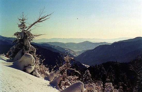
Climate. The climate of the Carpathians is determined by the climate of the adjacent plateaus, the height of the mountains, and the relief. Seasonal variations (which also affect the Danube Lowland) in barometric pressure from the winter maximum to the summer minimum have an important influence. The mountains protect southern Transcarpathia from the flow of cold air from the north. However, warm air masses from the Mediterranean Sea and the Atlantic Ocean bring cyclones and heavy rainfall to the southern and western slopes. The July temperature varies with altitude from 20°C at the southern edge of the Carpathians and 18°C in the north to 6°C on the highest peaks. The variation is smaller in winter—from -3°C to -10°C. The number of days with temperatures above 0°C fluctuates between 290 and 100 per year, and the number with temperatures above 10°C varies from 180 days in the south to 80–100 days at the upper limits of grain cultivation and to 50 days in the lower meadow belt. Annual precipitation varies from 600 to 1,600 mm and is usually 900–1,200 mm, depending on altitude and local conditions, such as the position of the slopes. The basins of the upper Teresva River and Tereblia River receive the largest amount of precipitation, while the intermontane depressions are relatively dry. The southern slopes get 100–200 mm more precipitation than do the northern slopes at the same altitude. Most of the precipitation occurs in June and July; the least, in January and February. In general, almost two-thirds of the precipitation comes in the warm half of the year; hence summers are quite cloudy, and winters are sunny.
Generally, the summer temperature rises towards the southeast by 1–2°C as the climate becomes more continental and the mountains more massive. Like all mountain climates, the climate of the Carpathians is subject to many local variations: the weather of the northern slopes differs from that of the southern slopes, gentle Foehn winds visit some parts, and temperature inversions occur in wintertime when the air is warmer on the slopes than in the valleys, which are filled with heavier, cold air.
Rivers. The Carpathians are rich in rivers. The Dnister River with its numerous tributaries (the Stryi River, Svicha River, Limnytsia River, Bystrytsia River, etc), the tributaries of the Danube River, including the Tysa River with its tributaries (the Teresva River, Tereblia River, Rika River, Borzhava River, Bodrog River and its tributaries [the Liatorytsia River, Uzh River, Laborets River], etc), the Prut River (with the Cheremosh River), and the Seret (Siret) River, as well as such tributaries of the Vistula River as the Sian River (with the Wisłok River) and the Wisłoka River, and others all originate in the mountains. The rivers are fed mostly by snow and rain. Flash floods are common in the spring and summer.
Soils. In the Carpathians the soils are determined by the type of parental mountain rock, elevation, and vegetation cover. The brown podzol forest soils are the most common, but they are not homogeneous. They vary from areas covered with beech woods to areas of fir-tree forests and are different still in deforested, farming areas (which have light-brown forest soils). The brown soils are acidic and of low fertility; hence, lime and mineral fertilizers are required for their improvement. The peat podzolic soils on the southern slopes of the Volcanic Ukrainian Carpathians are more fertile. Various meadow soils are found in the valleys. Above the timberline there are mountain podzol soils, mountain meadow soils, and peat soils, often containing many rock fragments.
Flora. The vegetation of the Ukrainian Carpathians belongs to the Central European province. Except for that of the Low Beskyd, the flora here is much richer than in the Western Carpathians and includes many Balkan and Transylvanian species and a number of endemic forms. At one time all the Carpathians were covered with forest and topped with meadows and rock fields. Even today about one-half of the region is forested. All the mountain vegetation belts are represented in the Ukrainian Carpathians.
The lowest belt, up to an altitude of 500–600 m, consists of deciduous and mixed forests, which contain mostly oak and some hornbeam, maple, linden, elm, birch, and pine. In Transcarpathia, up to an altitude of 400 m, there are also some warm-climate species such as the chestnut and walnut. This belt has been modified by humans more than any other, and today the forests form only small islands among the farmlands.
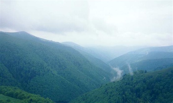
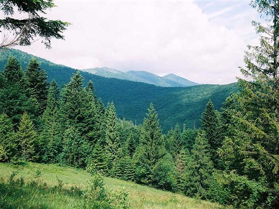
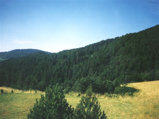
Above 500–600 m lies the belt of mountain forests. In Transcarpathia (apart from its northeastern and eastern parts) and in the upper Sian River basin beech forests occur exclusively; in other parts of the Ukrainian Carpathians mixed and coniferous forests predominate. Some oak is found at the lower levels of the beech forests, as well as maple, birch, and ash. The undergrowth includes elder, mezereum, raspberry, currant, honeysuckle, and willow. Grass cover is rare. The upper limit of the beech forests is rather well defined, at 1,100–1,200 m. Above 1,000 m the beech trees are somewhat shorter.
Other mountain forests in the Carpathians form two belts: a lower, mixed belt, which reaches an altitude of 900–1,200 m and consists mostly of beech, spruce, and fir, with an undergrowth similar to that of the beech forests; and a higher, spruce belt, with an admixture of fir, pine, larch, cembra pine, and ash. The grasses are poorly developed. The upper limit of the forests is 1,450–1,600 m. This zone is a transitional belt, about 100 m wide, consisting of individual trees, brush, and meadow.
Above the forests runs a belt of highland pastures—meadows and brush with subalpine (up to 1,750–1,850 m) and alpine vegetation. The typical plants of the subalpine belt are mugho pine, green alder, rhododendron, and dwarf juniper, which often form a large, hardly penetrable brush, particularly in the Gorgany Mountains and the Maramureş-Bukovynian Upland.
Grasslands cover all the higher ridges except the Gorgany. In the beech-forest belt they completely cover the ridges above 1,100–1,200 m, while in the pine-forest belt their lower limit is 100–150 m higher and they are partly taken over by brush, mainly by dwarf pines. In the Gorgany Mountains meadows are rare. By lowering the upper boundary of the forests, humans have increased the area of grasslands, but excessive pasturing has reduced the variety of plant forms. The mountain meadows are overgrown with sedge (Carex curvula, C. rupestris), hard rush (Juncus trifidus), sheep fescue (Festuca ovina), and smallreed (Calamagrostis). Low-quality grasses such as matgrass (Nardus stricta) and tufted hairgrass (Deschampsia caespitosa) predominate to an altitude of 1,500–1,600 m, while such valuable grasses as common meadow grass (Poa pratensis) and white dutch clover (Trifolium repens) are rare. In general, the variety of plants growing in the meadows increases towards the east. The variety is greatest on chalky soils.
Fauna. The vertical zoning of the vegetation in the Carpathians is reflected in the distribution of animals. Some high-mountain species are restricted to the subalpine zone; for example, the alpine snow vole and the alpine shrew. Some taiga species—the capercaillie, hazel grouse, woodcock, black grouse, rare lynx, and others—live only in the mountain forest zone. Most of the fauna consists of species typical of the Central European forests, and they can be found in the higher and the lower regions of the Carpathians; these include the brown bear and wildcat (both rare now), red deer, roe deer, wolf, fox, forest marten, ermine, Carpathian squirrel, dormouse, mole, and bat. Among the common birds are the berkut eagle, hawk, owl, woodcock, black stork, rock pupit, and white-throated blackbird. Many of the birds visit the Carpathians only in summer. There are quite a few species of amphibians and reptiles, particularly on the southern slopes, including the Carpathian newt, western bullfrog, spotted salamander, and smooth snake. Mink and otter reach the high regions by means of streams. The mountain streams contain trout, grayling, and Balkan barbel (Barbus meridionalis). The huchen (Hucho hucho) is endemic to the Cheremosh River and Tysa River.
A network of national parks and nature reserves (see Carpathian protected areas) has been established with the aim of protecting the biological and landscape diversity of the Ukrainian Carpathians.
Population. All of the eastern Carpathians are Ukrainian ethnic territory except for the Low Beskyd, where, until 1946, Ukrainians occupied only a narrow strip on both sides of the watershed known as the Lemko region. Thereafter the Lemkos who lived in Poland were resettled, and only the Lemkos in Czechoslovakia were left in their homeland. The ethnic boundaries between the Ukrainians and other nationalities in the Carpathians are fairly distinct, except in the case of the Slovaks. The mountains did not attract foreigners; hence, non-Ukrainians are few. Until the beginning of the 1940s the Jews were the largest minority (10 percent), while the Slovaks, Hungarians, Romanians, Czechs, Poles, and Germans together accounted for 12 percent of the population. Today less than 10 percent of the population is non-Ukrainian (see also Bukovyna, Galicia, Transcarpathia, and the Prešov region).
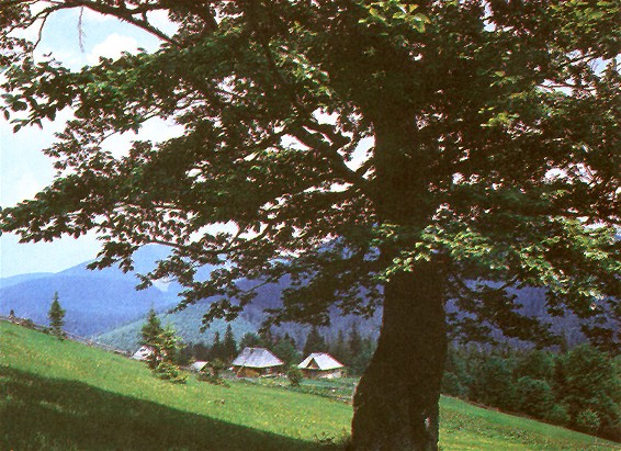
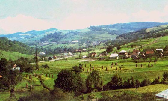
The Ukrainian highlanders are divided into several ethnographic groups: the Lemkos, in the Low Beskyd and the western part of the Middle Beskyd (almost all of them were resettled by the Polish authorities); the Boikos, up to the Bystrytsia Solotvynska River in the east; and the Hutsuls in the east. The central part of Transcarpathia is settled by the Zahoriany (tramontanes) or Dolyniany (lowlanders), who are related to the Boikos and speak a central Transcarpathian dialect. There are two forms of settlement and farming in the Carpathians, and they appear to be independent of the natural environment. The first is the Hutsul form; the second is practiced by all other highlanders. The Lemkos, Boikos, and Zahoriany are basically agricultural people. They cleared the forests to obtain arable land and built their elongated villages in the valleys. Their settlements are at low altitudes. The basic occupation of the Hutsuls is animal husbandry. Their land is used for pastures and hayfields. Their homesteads are attached to their fields; hence, their settlements are scattered and extend to considerable altitudes.
The distribution of the population and farm lots depends mostly on natural conditions. The lower, gently sloped areas have been deforested and settled. The higher and steeper areas remain forested or covered with meadows. The longitudinal valleys and lower strips are settled; the higher strips are not. Transverse valleys are important communication links but are not heavily populated. The narrow edges on both sides of the Carpathians, the Inner Carpathian Valley, and the Maramureş Basin are densely populated. The Middle Carpathian Depression, except for its central, elevated part; the Middle Beskyd, with its densely populated valleys and longitudinal forested ridges; and the Low Beskyd, with islands of forest (one-third of the area) and unpopulated land, are regions of moderate population density. About one-half of the area of the Ukrainian Carpathians is unpopulated. A large unsettled area extends from the Zolota Bystrytsia River in the southeast to the Opir River and Rika River in the northwest. The Volcanic Ukrainian Carpathians are also unsettled. (For more detail see the accompanying table, both based on 1920–30 data, which, except for those for the Lemko region, are still valid.)
Almost 30 percent of the population lives in towns that are located at the intersection of longitudinal and transverse highways. The largest towns are at the foot of mountain ranges or at some distance from them (Subcarpathia) and in the Maramureş Basin. There are only small towns in the mountains, the largest of them being Sianik and Turka. These towns are industrial, trade, and administration centers.
The upper boundary of permanent settlement coincides usually with the upper limit of grain growing. Both rise as the mountains become more massive, but they also depend on the form of settlement and farming. On the southern slopes of the Carpathians, where corn is grown, the boundary dips below 600 m. It rises above 1,000 m only in the Hutsul region.
Seasonal settlements exist at much higher altitudes. These are used only in the summer, when sheep and cattle are pastured in the remote mountain meadows. Herding is not practiced in the Low Beskyd, Middle Beskyd, or the Volcanic Ukrainian Carpathians. Only non-dairy cattle and horses are pastured in the meadows of the High Beskyd and Rivna. Herding is widely practiced in the Polonynian Beskyd, the Gorgany Mountains, and the Hutsul region: in the 1930s it involved about 5,000 herders, 9,000 horses, 55,000 head of cattle (including 8,000 cows), and 190,000 sheep and goats, which amounted to almost one-quarter of all cattle and two-thirds of all sheep in the Carpathians. The pasturing season lasts two and one-half to four and one-half months. It is extended even beyond this duration, especially in the Hutsul region, by the feeding of sheep in winter enclosures (zymarky) until the hay runs out.
Herding in the meadows was generally backward, particularly in Galicia and Bukovyna. Under the Soviet regime the old forms of pastoral life were disappearing; only pastoral artels existed.
Economy. Economic activity in the Carpathians was determined by the natural environment, folk customs, tribal relations, and the economic policies of the governments that had control of the region. As in the past the economy today is based on farming, which is closely associated with animal husbandry, and on the forest industry. Compared to that of neighboring plateau regions, the economy of the Carpathians is backward and quite primitive.
Agriculture plays a greater role in the economy of the Lemko region and Boiko region. Yet, even here the production is insufficient to feed the population. Much of the arable land is left fallow. In the Boiko region the more elevated fields are fertilized by means of sheep grazing. Traces of the tree-clearing system of farming can still be found. The main crops are potato and oats, which until the beginning of the 20th century was the main bread-baking grain. In the lower parts rye and wheat are grown, and corn is the main crop on the southern slopes. Much animal feed is produced. The trend is to grow more potatoes and feed and less oats. The fertility of the soil is low. In the 19th century animal husbandry specialized in non-dairy cattle raising in the Lemko region and Boiko region and dairy cattle in the Hutsul region, where sheep raising and horse breeding (of the famous Hutsul horse) were well developed. Since the second half of the 19th century these differences between the various regions of the Carpathians have diminished somewhat. As a result of the impoverishment of the peasantry, horse raising replaced ox raising, since the horse was useful in lumbering. Sheep raising declined in the western areas. In the 1950s the structure of animal husbandry in the Carpathians was as follows (proportion of the Ukrainian SSR production in parentheses): cattle, 80 percent (75.5 percent); hogs, 9 percent (18.8); sheep and goats, 11 percent (6.7). The per capita supply of domestic animals is somewhat higher here than in other parts of Ukraine.
The forest, which for centuries supplied the highlander with food (berries, mushrooms, animals), pasture, fuel, and materials and energy for small-scale industries, became the main source of exports and a very important economic factor in the second half of the 19th century. The exploitation of the Carpathian forests intensified at the end of the 19th century when a network of narrow-gauge railroads was built to transport lumber from remote mountain areas. Because of inadequate protective measures, the forests have sometimes been excessively exploited, particularly under the Soviet regime. Although the Carpathian Mountains possess only 22 percent of Ukraine's forests, in the 1950s they yielded over 60 percent of the lumber produced in Soviet Ukraine. Today young forests and deforested areas constitute over 50 percent of the forest land, while mature forests account for scarcely 11 percent instead of the expected 25 percent. Reforestation measures are inadequate. In the Gorgany Mountains alone, 1,470 ha of rocky slope have appeared. Floods have increased, and the importance of the mountains as a source of moisture has declined.
Industry in the Carpathians is insignificant. The hydroelectric resources of the mountains are unused. The Tereblia-Rika Hydroelectric Station (1956) is the only large hydroelectric station in the region. Larger hydroelectric plants can be found in Transcarpathia. In Galicia the woodworking industry is located at some distance from the mountains, in Subcarpathia. The largest woodworking complexes are located in Svaliava, Velykyi Bychkiv, Perechyn, and Skole. Salt is mined in Galicia at the foot of the mountains—in Dobromyl, Deliatyn, and Kosiv. In Transcarpathia a huge salt field is being developed at Solotvyna. The Carpathians are a source of valuable building materials: andesites, basalts, rhyolites, tufas, and marble in the Volcanic Ukrainian Carpathians and hard sandstone in other regions. The petroleum industry, located at the foot of the mountains, has a national importance. The main oil fields are Boryslav–Skhidnytsia, Dolyna (which is today the most important field), and Bytkiv. Ripne, Sloboda-Rungurska, and Kosmach have now lost their former significance. Gas fields are found in Subcarpathia. Since the 19th century the iron industry, based on small deposits of mud ores, and coal have had a slight importance.
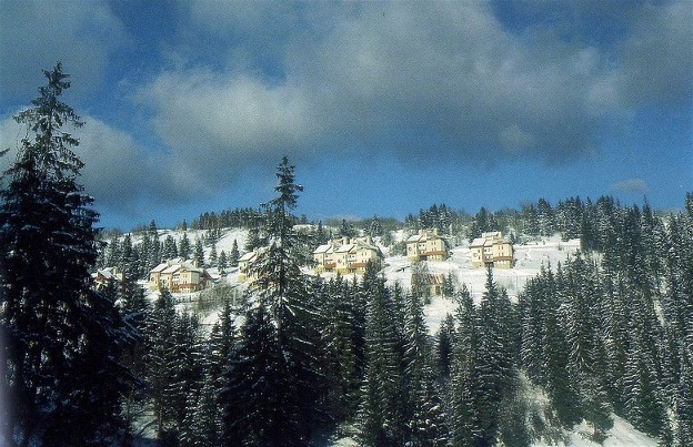
Because of the abundance of mineral springs, a healthy climate, and natural beauty, the Carpathians are the main resort and recreation area in Ukraine after the Crimea. Various mineral springs—carbonic acid, salt, iodine salt, bitter, and petroleum—occur. The most famous springs are in the Lemko region, which today lies beyond Ukrainian territories: in Krynytsia (Krynica), Bardejov, Iwonicz, Rymanów, Vysova, Zhegestiv, etc. At the foot of the mountains are found the Truskavets, Morshyn, Deliatyn, and Kosiv springs. Transcarpathia is rich in mineral springs, mostly in the Volcanic Ukrainian Carpathians. These include the Poliana, Kvasova, and Syniak springs, near Uzhhorod. Summer resorts are even more important. Before 1914 the Prut River Valley was the main summer-resort area. In the interwar period vacationers visited all parts of the Carpathians. Under Soviet rule the resort area was limited again. The most popular resorts are located in the Prut River Valley (Vorokhta, Yaremche [including the former villages of Yamna and Dora], etc) and the Opir River Valley. Smaller resorts are found in Transcarpathia.
Cottage industry has lost its importance except in the Hutsul area, which specializes in folk art. For a long time traveling craftsmen such as wiredrawers were important. Traveling salesmen sold tar to the Lemkos and fruit and salt to the Boikos. Common workers found seasonal work on the farms during harvest time and in the forests. Emigration, which began at the end of the 19th century, was vigorous. Generally, the economic resources of the Carpathians under all regimes (except for the Czechoslovak to some extent) were poorly developed. The population was poor and could not find enough employment. The situation was aggravated by the fact that the main natural resources, the forest industry, petroleum industry, resorts, and trade were foreign-owned (mainly by Jews, Poles, Hungarians, and Czechs). The economic conditions in the mountains are still bad and have become worse with the destruction of the forests.
The communication lines in the Carpathians have run in two directions since ancient times: longitudinally and transversely. The longitudinal lines are of greater importance locally; the transverse have connected Ukraine with Hungary for centuries. The Austrian government developed these old routes to connect Galicia with the other parts of the empire and built a number of railroads. From 1918 to 1945 these highways lost their importance, because the state border ran along the ridges of the Carpathians. However, when Transcarpathia was annexed to the Ukrainian SSR, these routes regained their importance. Since the Carpathians are narrow, the longitudinal railroad lines usually run parallel to the ridges: in the north, in Subcarpathia, there is the Peremyshl–Khyriv–Sambir–Stryi–Ivano-Frankivsk–Chernivtsi line; the Michalovce–Chop–Vynohradiv line is in the south, in the Tysa Lowland and the Maramureş Basin. Both of the longitudinal lines are intersected by four transverse lines that run through the mountain passes: the Peremyshl–Michalovce, Sambir–Uzhhorod–Chop, Stryi–Mukachevo–Vuzlove, and Ivano-Frankivsk–Syhit lines. The whole railway network was built before the First World War. Paved highways run the same way as the railroads. The important highways used for regular motor transportation are the Snina–Perechyn–Svaliava–Khust highway, which runs along the Inner Carpathian Valley and through the Duklia Pass, and the Nyzhni Vorota–Mizhhiria–Khust highway.
(For more detail on the population and economy of the Ukrainian Carpathians today see Bukovyna, Transcarpathia, Hutsul region, Lemko region, Lemkos, Boikos, Ivano-Frankivsk oblast, Lviv oblast, Chernivtsi oblast.)
BIBLIOGRAPHY
Uhlig, V. Bau und Bild der Karpathen (Vienna 1903)
Rudnyts'kyi, S. ‘Znadoby do morfolohiï stochyshcha Dnistra,’ Zbirnyk Matematychno-pryrodopysno-likars’koï sektsiï NTSh (Lviv 1905, 1907)
Kubijovyč, V. Rozšiτreni kultur a obyvatelstva v Severnich Karpatech (Bratislava 1932)
– Pastyřský život v Podkarpatské Rusi, 1-2 (Bratislava 1935)
Popov, M. Ocherk rastitel’nosti i flory Karpat (Moscow 1949)
Anuchin, V. Geografiia Sovetskogo Zakarpat’ia (Moscow 1956)
Bondarchuk, V. Radians’ki Karpaty (Kyiv 1957)
Herenchuk, K. (ed). Pryroda Ukraïns’kykh Karpat (Lviv 1968)
Voropai, L.; Kunytsia, O. Ukraïns’ki Karpaty: Fiziko-heohrafichnyi narys (Kyiv 1968)
Buchyns'kyi, I.; Volevakha, M.; Korzhov, V. Klimat Ukraïns’kykh Karpat (Kyiv 1971)
Geologicheskoe stroenie i goriuchie iskopaemye Ukrainskikh Karpat (Moscow 1971)
Stoiko, S., Iermolenko, Iu. Karpaty ochyma dopytlyvykh (Lviv 1976)
Stoiko, S. Karpatam zelenity vichno (Uzhhorod 1977)
Volodymyr Kubijovyč
[This article originally appeared in the Encyclopedia of Ukraine, vol. 1 (1984).]
.jpg)
.jpg)
.jpg)
.jpg)
.jpg)
.jpg)
.jpg)
.jpg)
.jpg)
.jpg)
.jpg)
.jpg)
.jpg)
.jpg)
.jpg)
.jpg)
.jpg)
.jpg)