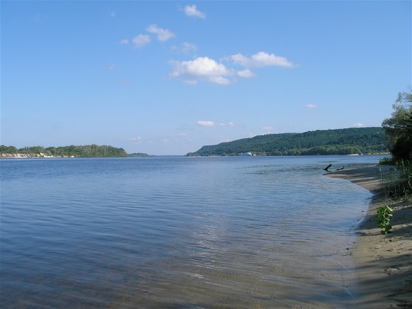
Dnipro River
Dnipro River (Дніпро; Dnieper; Βορυσθένης [Borysthenes] in ancient Greek; Danapris in Latin of the 4th century). The largest river in Ukraine and the third largest in Europe (after the Volga River and the Danube River). From the dawn of history the #Dnipro has been closely bound up with the life of the Ukrainian people. It is the ‘holy river’ of Ukraine. Its length is 2,285 km, of which 485 km lie within the Russian Federation, 595 km within Belarus, and 1,095 km within Ukraine. The #Dnipro Basin covers 504,000 sq km, of which 289,000 sq km are within Ukraine (48 percent of its area). The basin occupies 42 percent of the territory of the Ukrainian state and 36 percent of Ukrainian ethnic territory.
The Dnipro River flows south through the center of Ukraine and bisects its natural zones—forest, forest-steppe, and steppe—interconnecting them and connecting them with the Black Sea. Of the long-settled principal areas of Ukraine, only Galicia, western Volhynia, and Transcarpathia lie beyond the basin of the Dnipro. Travel is easy from the Dnipro Basin to basins northwest of it —the Vistula River, the Neman River, and the Daugava River—but difficult to other basins, such as the basins of the Dnister River, the Boh River, the Volga River, and the Don River. Easy communications between the Dnipro River, the Prypiat River, and the Buh River by means of the Vistula facilitated the expansion of Poland into Ukraine. The Dnipro’s role as a unifying force and gateway to the sea was, however, weakened by a 70 km stretch of rapids in the steppe belt. In spite of this obstacle, the Dnipro was the main axis of the first Ukrainian state—Kyivan Rus’. The nucleus of a second state—the Zaporozhian Sich—arose on the Dnipro. The river is the artery of Ukraine, its main highway, and its source of hydroelectric power.
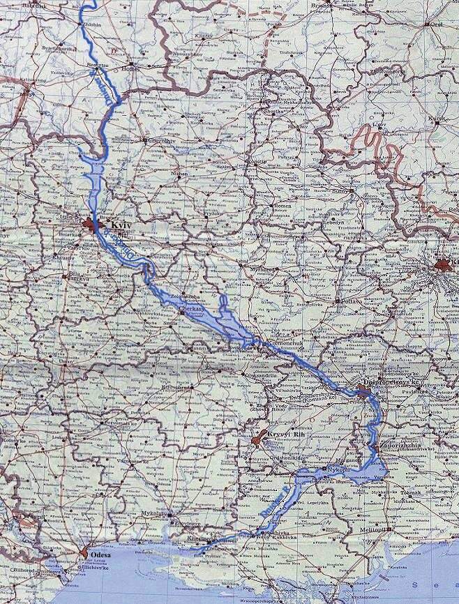
Physical geography. The Dnipro is a typical river of the plains, sloping gently and flowing slowly. The water level varies considerably, and the riverbed is unstable. There are many shallow parts, but relatively few turns. The Dnipro Rapids, which today are submerged, are a peculiar feature of the Dnipro. The river's general southerly flow can be broken up into several sections: from its source to Orsha (Vitsebsk oblast) the Dnipro flows southwest, then south to Kyiv, then southeast to Dnipro, then south for 90 km as far as Zaporizhia, and finally southwest to the Dnipro-Boh Estuary. Thus, the Dnipro forms a large open bow to the east, doubling the route from central Ukraine to the Black Sea (to 950 km, although Kyiv is only 450 km from the sea in a straight line).
The river can be divided into three sections: the upper Dnipro from the source to Kyiv (1,333 km, of which 255 km are within Ukraine); the middle, from Kyiv to Zaporizhia (536 km), including the above-mentioned stretch of rapids; and the lower, from Zaporizhia to the sea (331 km).
The source of the Dnipro lies in the northwest part of the Central Upland—in the Valdai Upland, at an elevation of 220 m, among turf swamps. Down to the town of Dorogobuzh (Smolensk oblast) the Dnipro is a small river, no more than 30 m wide, flowing through a forested plateau. Below Dorogobuzh to Orsha the river becomes wider—40–120 m—and navigable, even by steamship when the water is high. Above Orsha the river cuts into Devonian limestone, forming small rapids known as the Kobeliatskie Rapids. Below Orsha near Rahachou (Homel oblast), the Dnipro enters the Polisia Lowland, and from the town of Loev it flows through Ukrainian territory. From here on the river basin widens considerably, because the largest tributaries are in this section. On Belarusian territory the Biarezina River (613 km long; basin area, 24,530 sq km) joins the Dnipro from the left, and the Sozh River (648 km long; basin area, 41,400 sq km) joins it from the right. On Ukrainian territory the Prypiat River (748 km and 114,300 sq km) and the Desna River (1,126 km and 88,900 sq km) flow into the Dnipro. The Teteriv River (385 km) and Irpin River(162 km) are small tributaries within Ukraine. After the Dnipro receives these rivers, its basin expands to 328,000 sq km (near Kyiv), its width reaches 700 m, and its depth approaches 8 m. The rate of water flow at Orsha is 45 cu m/sec; at Rahachou it is 108 cu m/sec; and at Kyiv it increases to 1,380 cu m/sec. The basin of the upper Dnipro has the densest river network (0.3 km/sq km) and the most rainfall (550–650 mm per year). It is the most forested (25 percent) and swampy section of the Dnipro.
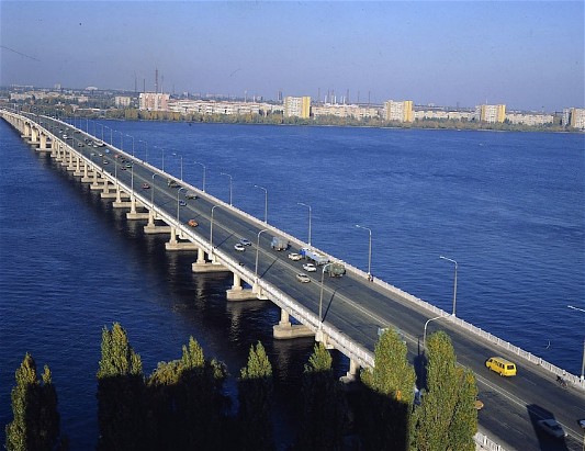
The construction of the Dnipro Cascade of Hydroelectric Stations and reservoirs from the mouth of the Prypiat River to the town of Kakhovka (the Kyiv Reservoir, the Kaniv Reservoir, the Kremenchuk Reservoir, the Kamianske Reservoir, the Kakhovka Reservoir, and Dnipro Reservoir) has led to great changes in the riverbed. The natural riverbed has been preserved only along short sections of the Dnipro: above the mouth of the Prypiat, above Kyiv, below Kaniv and Kamianske, and below Kakhovka.
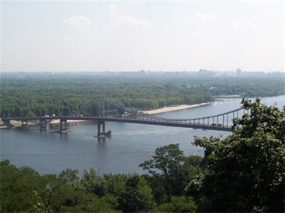
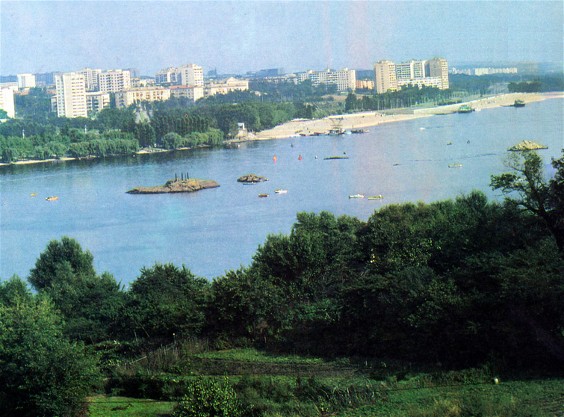
From Kyiv to the city of Dnipro the Dnipro flows along the boundary between the Dnipro Upland and the Dnipro Lowland. The river valley is asymmetrical here: the right bank rises to 100–150 m above the river, is deeply dissected by valleys and gullies, and is covered with forest. It forms a picturesque mountain landscape. Kyiv lies in these ‘Dnipro Mountains.’ Below Kyiv, in the Kaniv Hills, is located the grave of Taras Shevchenko. The left bank of the river is low, sandy, and often covered by pine forest. It rises towards the east in broad terraces. The river valley is wide—6–10 km, and at Pereiaslav and Cherkasy, 15–18 km—while the river is 200–1,200 m wide. Below Cherkasy the Dnipro splits into sidestreams and creates islands. Its depth varies frequently, from 1.5 to 12 m. The tributaries that empty into the middle Dnipro are smaller than those in the upper Dnipro and carry much less water. The tributaries on the right side—the Stuhna River (68 km), the Ros River (346 km), and the Tiasmyn River (194 km)—flow in short, narrow beds carved in granite. The tributaries on the left originate usually in the Central Upland and cross the whole Dnipro Lowland. They are longer and wider, with low banks and terraces. The rivers are the Trubizh River (113 km), the Supii River (130 km), the Sula River (310 km), the Psol River (692 km), the Vorskla River (425 km), and the Samara River (311 km). They do not greatly increase the water volume of the Dnipro.
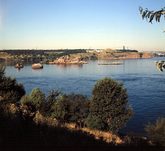
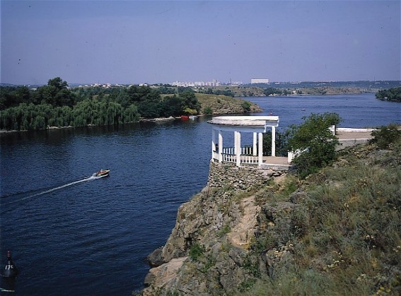
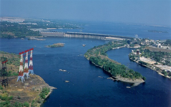
The slope of the Dnipro between Kyiv and the mouth of the Tiasmyn River is very gentle—6 cm/km. It becomes steeper where the Dnipro enters the Ukrainian Crystalline Shield. The river dissects the massif for 90 km between the cities of Dnipro and Zaporizhia. Originally it flowed through a narrow, deep (100 m), chiseled valley and formed a typical granite landscape. The riverbed narrowed here to 300–800 m, and at the village of Kichkas near Zaporizhia it contracted to 175 m. Here the renowned Dnipro Rapids rested on a firm, granite foundation. There were 9 rapids and 60 small barriers. The slope of the river reached 50 cm/km, and the current sometimes attained a velocity of 6 m/sec. When a dam was built on the Dnipro above Zaporizhia in 1932 (see Dnipro Hydroelectric Station), the rapids were submerged under Dnipro Reservoir, and the landscape changed completely.
The middle stretch of the Dnipro lies in the forest-steppe (to Kremenchuk) and steppe belts. The rainfall (400 mm near Zaporizhia) is less here than in the upper Dnipro (550 mm in the north). The forest covers scarcely 5 percent of the surface. The tributaries are small; hence, the Dnipro’s water volume does not increase in this part of its course.
Below Zaporizhia the Dnipro enters the steppe belt, the dry (300–400 mm of rainfall) Black Sea Lowland. Near Kichkas the Dnipro split into two branches, which encirled a large, steep, granite island—Khortytsia Island—on which the Zaporozhian Sich once stood. The valley here was 4 km wide. Farther on the valley widened to 20 km before the Kakhovka Reservoir was built, and the river divided into many branches as it flowed through the muddy flatland, which became flooded in the spring and during heavy summer rains. This floodplain was covered by islands of deciduous forests, wet meadows, lakes, and swamps, which were overgrown with reeds and bulrushes. The largest floodplains—the Velykyi Luh (20 km wide by 60 km long)—stretched from the Dnipro to its left-bank tributary the Konka River and were separated from the broad Bazavluk River floodplains by a narrow stretch of floodplains near Nikopol. Then the Dnipro again became narrow (floodplain 3–7 km wide, whereas it is 10 km wide at the Dnipro’s mouth). Both banks were high down to Kakhovka, and then the left bank became low. The Dnipro Valley above Kakhovka changed after a second large dam was constructed on the Dnipro near Kakhovka, and the large Kakhovka Reservoir (2,155 sq km) was created. It inundated all the floodplains.
The final stretch of the Dnipro begins below Kakhovka, 106 km above the Dnipro-Boh Estuary. Here the water flows on thick (up to 70 m) alluvial deposits, which resulted from the depression of the coastal strip of the Black Sea Lowland in the Quaternary period. This depression also led to the inundation of the Dnipro’s mouth (and the mouths of other rivers) and the formation of lagoons and marshy floodplains along the coast. From Kherson (32 km from the Dnipro Estuary) onward the Dnipro splits into branches and forms a large delta (350 sq km) with numerous islands and lakes. Two-thirds of the delta is floodplain, and one-third is water. The Dnipro empties into the Dnipro-Boh Estuary through several shallow mouths, the main ones being Zburiv, Kizylmyk, and Bokach or Rvach. The dredging of the Bokach mouth has made Kherson accessible to sea vessels. The tributaries of the lower Dnipro are small steppe rivers: the Konka River (140 km), Bazavluk River (150 km), Bilozerka River (88 km), and the larger Inhulets River (550 km). The slope of the lower Dnipro is 45 mm/km. The current's velocity depends on the slope and water level. At the rapids the current reached 5 m/sec and more, while it is almost unnoticeable in the low Dnipro. The upper and middle Dnipro has a velocity of about 1.5 m/sec.
Water regime. The Dnipro Basin receives on the average 235 cu km of precipitation per year. Scarcely 52 cu km (22 percent) of this gets to the sea; the rest evaporates. About 75 percent of the precipitation evaporates in the basin of the upper Dnipro, 87 percent in the basin of the middle Dnipro, and over 90 percent in the basin of the lower Dnipro. Snow is the principal source of the Dnipro’s water; groundwaters are second in importance; and rainfall comes third. In the upper Dnipro about 50 percent of the water comes from snow, 25 percent from rainfall, and 25 percent from groundwaters. Farther downriver the proportion of rainwater decreases while the proportion of meltwaters and especially groundwaters increases (33 percent in the middle and 42 percent in the lower Dnipro). Thus, the highest proportion of water (55–57 percent of the annual volume) is received in the spring (March to May), and the lowest proportion (12 percent) in the winter, when ground waters are the main source. Of the annual volume 17–21 percent comes in summer (June to August) and 12–14 percent in the fall (September to November). The divergence from these average figures can be quite large; for example, the springtime water volume at Kyiv varies from year to year from 46 to 78 percent of the annual volume. Most of the water that flows into the sea is supplied by the upper Dnipro above Kyiv; the upper Dnipro with the Biarezina River and the Sozh River provides 35 percent; the Prypiat River, 26 percent; and the Desna River, 21 percent. Thus, the water regime of the Dnipro is determined in the basin of the upper Dnipro and is not enriched downstream. At Kyiv the average flow rate is 1,380 cu m/sec (at Loev on the border above the Desna River and the Prypiat River it is 590; in Belarus above the Biarezina River it is scarcely 210), and it increases slowly to 1,480 cu m/sec at Kremenchuk and 1,670 cu m/sec at the Dnipro Estuary. The highest flow rate comes in spring: 7,000 cu m/sec is the average rate at Kyiv. During the great flood in the spring of 1931, the flow at Kyiv was 23,100 cu m/sec. The difference between the winter and spring water level depends on the area of the basin and on the morphology of the riverbed and valley. In Belarus it varies from 2 m to 8 m. In Ukraine it varies from 2 m to 5 m.
In winter the Dnipro freezes over, usually after a 20-day spell of subzero temperature. The average freezing and thawing dates for Kyiv are 17 December and 24 March; for Cherkasy, 23 December and 22 March; for Zaporizhia, 5 January and 9 March; for Kherson, 3 January and 3 March. The ice regime is not stable: sometimes the Dnipro freezes for short intervals, and sometimes it does not freeze at all. Ice jams and floods resulting from them are rare because the freezing moves southward and the thawing northward.
The Dnipro is not particularly turbid. The water becomes less turbid as it flows downstream; for example, the average amount of suspended silt near Mahiliou is 82 g/cu m of water; near Kyiv, 42.5 g/cu m; near Verkhnodniprovske, 27.5 g/cu m (because of the reservoir); near Kherson, 13 g/cu m.
The waters of the Dnipro have a moderate mineral content that varies with location and season. At Kyiv the mineral concentration is 70–100 mg/l in summer and 250–350 mg/l in winter. From Kyiv to the Dnipro Estuary the concentration does not change.
The water regime of the Dnipro has undergone significant changes because of the new reservoirs. The river has turned into a series of artificial lakes separated by dams and man-made falls from the natural segments of the river. Canals with locks run alongside these segments. The reservoirs have stabilized the regime of the Dnipro: the low-water level of summer and winter has risen remarkably. The duration of ice on the river has been shortened below the dams: for example, the Dniprohes dam causes earlier thawing on a 30 km stretch of the river.
The Dnipro in the past. The Dnipro was known as the Borysthenes to the ancient Greeks and Romans (Herodotus first used the name in the 5th century BC). Its lower part below the rapids was already used then as a water route. But it became an important route in medieval times, when it became part of the Varangian route between the Baltic Sea and Byzantium across the Black Sea. Kyiv, the Rus' capital, stood on the Dnipro at the confluence of important water routes. All the important Rus' towns (except those of the Principality of Galicia-Volhynia) were located on the Dnipro or in its vicinity, and on its large tributaries. The capitals of principalities—Chernihiv, Pereiaslav, Turiv, Smolensk—were built on or very near the Dnipro, as were other towns, such as Liubech, Vyshhorod, Trepol, Zarub, Kaniv, Rodnia, and Oleshia. After nomadic tribes occupied the steppes in the 10th century, the Kyivan state put most of its energy into retaining control of the Dnipro route, its sole link with the sea. In the 11th century the outposts of the Kyivan state—Khortytsia Island and the port of Oleshia—were situated far beyond the regions that were firmly controlled by the princes. As the nomads gained strength and the Kyivan state declined, the Dnipro route became less accessible and, by the end of the 12th century, the Dnister River route began to usurp its role. The Tatar conquest put an end to the Dnipro’s usefulness as a route and to the importance of the towns along the river. Control of the Dnipro by the Lithuanian grand duke Vytautas the Great in the early 15th century was short-lived.
The Dnipro regained its importance in the 16th–17th century, particularly two sections of it. The Zaporozhian Sich arose on the lower Dnipro, far in the steppes, and became the nucleus of the second Ukrainian state. The Sich changed locations but remained in the region of the Dnipro floodplains. The river became the Cossack route to the Black Sea. The swamps and floodplains protected the Sich from the Tatars and Turkish galleys. During the hetmancy of Bohdan Khmelnytsky, the Dnipro became the principal river of the Cossack state. In the Period of Ruin, when the Hetman state split into left-bank and a right-bank state governed by different hetmans, the struggle for unification involved continual crossings of the Dnipro (particularly during the campaigns of Pavlo Teteria, Ivan Briukhovetsky, and Petro Doroshenko in the 1660s). The Dnipro from Loev to Kremenchuk (except in the Kyiv vicinity) became the boundary between the Polish and Russian spheres of influence up to 1793. The upper Dnipro and its right-bank tributaries, especially the Prypiat River and the Desna River, were important communications routes in the Polish-Lithuanian Commonwealth. The transportation of forest products was directed west and northwest to the Vistula and Neman rivers and the Baltic Sea. In the 18th century, when the importance of river transportation became primary, canals were built to link the Dnipro with other rivers: in 1767–83 the Ogiński Canal linked the Dnipro with the Neman Basin; in 1775 the Dnipro-Buh Canal, linking the Dnipro and the Vistula River via the Mukhavets River (a tributary of the Buh River) and the Pyna River (a tributary of the Prypiat River), was begun. Both canals were built on private initiative to transport the forest resources of Polisia to the Baltic ports of Gdańsk and Klaipeda. In Belarus the Biarezina Canal was built in 1797–1805 to connect the Dnipro with the Daugava River.
The Dnipro in the 19th-20th century. By the end of the 18th century the whole Dnipro came under the control of the Russian Empire, and this affected its status as a water route. Projects were begun to regulate the river and to eliminate the rapids in order to have a continuous route. But these projects and the canal construction of 1843–54 were of no great importance (see Dnipro Rapids) and ceased altogether in the second half of the century, when all efforts turned to railroad construction. The Dnipro continued to be divided into two segments by the rapids. Until the middle of the 19th century wood was transported on the Dnipro by means of rafts, and grain by wooden boats. Steamships appeared on the river in 1857 (the first attempts were made in 1823). In the 20th century regulatory works were resumed to eliminate natural obstructions to shipping: the instability of the riverbed, variations in the water level, branching, shallows, etc. At the beginning of the century the riverbed near Kyiv was stabilized, and the river above Katerynoslav was cleared of barriers. This deepened the river by 0.8 m north of Kyiv, 1 m from Kyiv south to the rapids, and 4.2 m below Kakhovka. A port was built in Kyiv, and many harbors were improved. Projects to submerge the rapids, to build hydroelectric stations, and to connect the Dnipro with the Daugava River by canals navigable by steamship (Kherson–Riga route), the Dnipro with the Vistula River (Kyiv–Gdańsk route), and the Dnipro with the Donets River were not realized because of the First World War. Nor was the department of water resources of the new Ukrainian state (see Ukrainian National Republic) capable of realizing them. In spite of inadequate attempts at regulation, the importance of the Dnipro as a transportation route increased before the First World War, as the accompanying table illustrates (see Table).
In this period the average value of the cargo transported on the Dnipro in a year increased from 162 million rubles in 1888–92 to 270 million in 1908–12. In 1912, 2,260,000 t of cargo (5 percent of all river cargo in Russia and 2 percent of all cargo in Russia-dominated Ukraine) and 2.4 million passengers were transported. Above the rapids the main cargo was lumber, which was transported to the steppes (in Cherkasy, Kremenchuk, and Katerynoslav it was loaded on trains). Below the rapids grain was the main cargo.
From 1917 on, transportation on the Dnipro declined drastically: in 1924 there were only 24 steamboats and 131 other boats on the river, and only 300,000 t of cargo and 1.7 million passengers were transported. Harbors were in ruins, and channels were neglected for years. Gradually the movement of cargo increased: it amounted to 752,000 t in 1928, 2,018,000 t in 1930, and 2,296,000 t in 1932 (the figures cover the Dnipro Basin within the 1938 boundaries of the Ukrainian Soviet Socialist Republic).
Great Dnipro. The further development of the Dnipro waterway was connected with implementation of a series of proposals that fell under the heading of the Great Dnipro and were worked out at the beginning of the 20th century. The plans called for a number of co-ordinated measures: the upgrading of existing transport facilities; the utilization of secondary and tertiary tributaries; the construction of canals to neighboring waterways, supplying industry and agriculture with hydroelectricity; and the expansion of irrigation works. A continuous deep-water route with numerous locks and a constant water level was to be built, along with a series of hydroelectric stations. Excess water in the north was to be used in the dry south. The slope of the river was to be utilized for the production of hydroelectric power. Concurrently, Polisia was to be drained, and the southern Dnipro steppe was to be irrigated. The first stage of the plan was realized in 1927–32 when the Dnipro Hydroelectric Station was built near Zaporizhia. The rapids were submerged, and a hydroelectric station of 558,000 kW capacity was erected. With this construction the continuous waterway was completed, and the amount of freight on the Dnipro increased markedly: from 2,960,000 t in 1932 to 5.8 million in 1935 and almost 10 million in 1940 (in the whole Dnipro Basin within the 1938 boundaries of the Ukrainian SSR) or 2.5 percent of the total freight of the Ukrainian SSR. The Soviet government, however, did not realize the succeeding stages of the Great Dnipro project, such as the irrigation of the southern Dnipro steppe, and did not make proper use of the river's hydroenergy.
The second stage of the Great Dnipro project began after the destruction of the Dniprohes during the Second World War and its reconstruction (1948), which increased its production of hydroelectric power to 750,000 kW. In 1950–6, a second hydroelectric station—the Kakhovka Hydroelectric Station—was built. It provided electric power for the lower Dnipro area, irrigation for southern Ukraine and the northern Crimea, and a deep waterway from the Black Sea to Zaporizhia. The Kremenchuk Hydroelectric Station was built in 1954–60, the Kyiv Hydroelectric Station in 1960–4, the Kamianske Hydroelectric Station in 1956–64, and in 1963–75 the Kaniv Hydroelectric Station completed the Dnipro Cascade of Hydroelectric Stations. Reservoirs were formed as the cascade was built: the Kyiv Reservoir (922 sq km), Kaniv Reservoir (675 sq km), Kremenchuk Reservoir (2,250 sq km), Kamianske Reservoir (567 sq km), Dnipro Reservoir (420 sq km), Kakhovka Reservoir (2,155 sq km). The Dnipro-Kryvyi Rih Canal was built in 1957–61 to supply the inhabitants and industry of the Kryvyi Rih region with water. The Dnipro-Donbas Canal was begun in 1979.
Projects to connect the Dnipro with other rivers (the Don River, the Volga River, the Vistula River, the Neman River, the Daugava River, and the Neva River) have not proceeded beyond the planning stage.
Present economy. The Dnipro is the main river network of Ukraine. Half of Ukraine's waterways belong to this system. Almost 65 percent of shipping (75 percent when the Desna River and the Prypiat River are included) and 80–90 percent of passengers are carried by the Dnipro. In 1977, over 30 million t of cargo were shipped by the Dnipro. With economic changes and the completion of a continuous waterway, the nature of shipping changed. Before the Revolution of 1917 lumber constituted 55 percent of the cargo and grain 27 percent. In 1940 these products accounted for only 32 percent and 14 percent of the total shipping. Today the main commodities are building materials and cement, anthracite coal, iron ore, and manganese ore; grain, petroleum products, and metals are also transported. Lumber shipping is insignificant. Railway lines intersect at the main Dnipro ports. Kyiv is the most important port, handling half of the shipping of the Dnipro Basin. It is the gateway to the water routes (north and south along the Dnipro and its large tributaries—the Prypiat River, the Desna River, and the Sozh River) and a large shipping transfer center. By tonnage, the second most important port is Kherson, which is both a river and a sea port. By number of passengers, Kherson is in first place (6.2 million compared to Kyiv's 4.2 million in 1970). The city of Dnipro is an important port for the Donets Basin and its coal. The port of Zaporizhia exports coal and iron ore. Other important ports are Cherkasy, Kremenchuk, Kamianske, and Nikopol.
Since the completion of the Kaniv Reservoir, the Dnipro has been accessible to sea vessels of 3.65 m draft. Larger ships use the ports on the Danube River, the Black Sea, the Sea of Azov, and even on the Mediterranean Sea. Diesel-propelled cargo carriers predominate among the vessels on the Dnipro and have a displacement of 600, 1,800, and 2,000 t. Large diesel-electric vessels, comfortable passenger carriers (diesel and hydrofoil), and tugboats navigate the river. Transport is controlled by the Dnipro Steamship Authority.
The Dnipro Cascade of Hydroelectric Stations has a generating capacity of over 3.7 million kW and an average annual production of about 10 billion kW-h.
The water of the Dnipro is used by consumers and by industry, which is especially concentrated in Kyiv, Dnipro, and Zaporizhia. Because of canals Dnipro water is used in the Kryvyi Rih region and will be used in the Donbas and Kharkiv and the irrigation systems of southern Ukraine (the Inhulets Irrigation System, the Krasnoznamianka Irrigation System, etc) and the northern Crimea.
The Dnipro is rich in fish. Almost 80 percent of the river catch in Ukraine—about 70 million t in 1969—comes from the Dnipro. Since the construction of the reservoirs, many types of river fish have disappeared from the Dnipro and have been replaced by lake species. The main commercial fish are bream, perch, carp, sheatfish, tench, and pike. Fish farms and the artificial introduction of valuable species into the reservoirs should increase the catch.
The reservoirs have brought some economic losses: almost 9,000 sq km of useful land (2 percent of Ukraine’s land) have been submerged. Water surface area has increased and so has evaporation. The landscape has changed. Sewage enters the Dnipro, often without proper treatment. Pollution is great and increasing because of population growth and industrial development.
BIBLIOGRAPHY
Maksimovich, M. Dnepr i ego bassein (Kyiv 1901)
Oppokov, Ie. Rezhim rechnogo stoka v basseine verkhnego Dnepra do g. Kieva, 1-2 (Saint Petersburg 1904–14)
Ogievskii, A. Rezhim stoka verkhnego i srednego Dnepra (Kyiv 1932)
Artem'evskii, A. Issledovanie vesennego polnovodia na r. Dnepre za period 1877–1931 gg. (Kyiv 1933)
Voblyi, K. Problema Velykoho Dnipra: Krytyka, 1 (Leningrad 1933)
Shovheniv, I. Vodne hospodarstvo v baseini r. Dnipra na Ukraïni (Warsaw 1934)
Problema Bol'shogo Dnepra: Trudy soveshchaniia komissii po probleme kompleksnogo ispol'zovaniia vodnykh resursov USSR (Kyiv 1956)
Shvets', H. Stik Dnipra nyzhche Kyieva (Kyiv 1957)
Didkovs'kyi, M. Problema Velykoho Dnipra (Kyiv 1961)
Lebedych, M.; Stets', V. Velykyi Dnipro (Kyiv 1961)
Miroshnichenko, B. Po Dnepru (Putevoditel') (Moscow 1967)
Laponogov, A. Po Dnepru: Putevoditel' (Moscow 1970)
Volodymyr Kubijovyč, Ivan Teslia
[This article originally appeared in the Encyclopedia of Ukraine, vol. 1 (1984).]
.jpg)
.jpg)
.jpg)
.jpg)
.jpg)
.jpg)
.jpg)
.jpg)
.jpg)
.jpg)
