Alushta
Alushta [Алушта; Alušta]. See Google Map; see EU map: IX-15. City (2021 pop 31,364) in the Crimea. A coastal resort, it also serves as the administrative center of Alushta Municipality (aka Greater Alushta, 2021 pop 56,112), which covers 599.9 sq km in the eastern part of the Crimean southern shore. On 1 January 2014, Greater Alushta had a population of 52,253, of which 34,381 was urban and 17,872 rural.
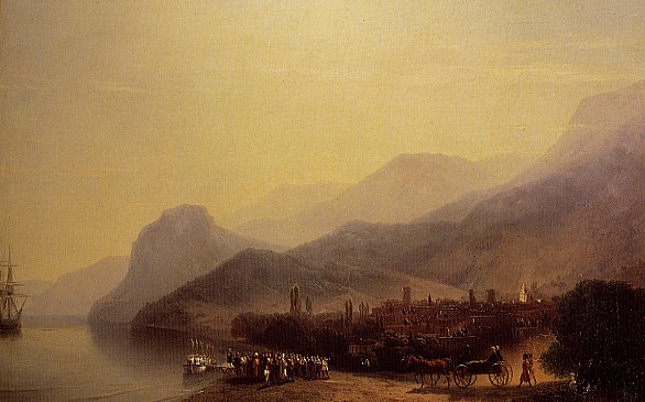
History. Alushta was founded in the 6th century AD on the site of the fortress Aluston, built during the reign of the Byzantine emperor Justinian facing the Angara Pass in the Crimean Mountains. It served as an anchor point for the powers controlling the Crimean southern shore: the Byzantine Empire (6–7th, and 8–12th centuries), the Khazar kaganate (7th century), and then as remnant of Byzantium, the Trapezund empire (1204–39). It was destroyed by the Mongols in 1239 and then restored as Alusta under the Theodoro principality coinciding with its eparchy of Gothia (1240s–1380). It fell under control of the Genoese (1381–1475, who called it Lusta, had its fort rebuilt with three towers, and provided it with a consul and a bishop), and was later taken by the Ottoman Turks (1475–1774, who destroyed its fort and reduced it to a village within the Sudak qadiliq [township]). During the Russo-Turkish War of 1735–9, it was the site of battles between Ottoman and Russian forces (1774, where lieutenant-colonel Mikhail Kutuzov survived a mortal wound); its Orthodox residents (mostly Greeks) were then removed to the present-day Mariupol area. After the Peace Treaty of Küçük Kaynarca Alushta became part of the Crimean Khanate (1774–83) until it was annexed by the Russian Empire in 1783.
Within the Russian Empire, the Crimea became part of New Russia gubernia where, within Tavriia oblast and Simferopol county, Alushta served as the latter’s volost center. As the Crimea and the Crimean southern shore underwent development, in 1802 they became part of Tavriia gubernia, Yalta became the seat of a separate county, and Alushta became the latter’s volost center. In 1826 the gravel road from Simferopol to Alushta was completed, spurting the settlement’s growth: from 763 in 1864 (120 houses, an Orthodox church and two mosques, quarantine post and customs house, district administration and post office) to 2,182 in 1897, comprising by religion (in percent) Muslim (mostly Crimean Tatars, 71.9), Orthodox (mainly Russians, 23.6) and others (4.5). The settlement now had a school, two hotels, a restaurant and a distillery, and a resort suburb on the coast to the south, called Professor’s Corner. By 1902 Alushta gained the status of a city. During this time a number of writers lived in this town, including the Ukrainian writer Mykhailo Kotsiubynsky (1896). Adam Mickiewicz dedicated two of his Crimean sonnets to Alushta. By 1910 the city’s population was about 4,200.
During the Revolution of 1917 and subsequent Civil War, Alushta was controlled by different forces: the Crimean Tatar Kurultai (that proclaimed the Crimean Republic on 12 December 1917), the Bolsheviks (who established Tavrida Soviet Socialist Republic [19 March–31 May 1918]), the Germans (from 25 June 1918, who supported a Crimean government), the Bolsheviks (who re-established the Crimean Socialist Soviet Republic on 31 May 1919), the White Army led by Gen Anton Denikin (from 30 June 1919), with the short-lived South Russia government led by Petr Wrangel (May–November 1920), then again the Red Army (from 14 November 1920).
The Communist authorities nationalized businesses and estates and later closed all houses of prayer. In 1923, the Professors’ Corner resort suburb’s 14 properties were converted into a trade union resort and re-named Workers’ Corner and in nearby Crimean Mountains the Imperial Hunting Reserve was converted into the Crimean State Reserve (now the Crimean State Hunting Reserve). From 1921 to 1945 the city was within the Crimean Autonomous Soviet Socialist Republic of the Russian Soviet Federated Socialist Republic, where it served as a raion center (1921–24, 1930–41). Its population (1926 census) reached 4,759, comprising (in percent) Crimean Tatars (38.2), Russians (33.0), Ukrainians (10.9), Jews (5.1) and others (12.8). By 1939 the city’s population grew to 8,799 and that of the Alushta raion (including the city) 25,996.
From 4 November 1941 until 14 April 1944 Alushta was under Nazi German occupation. In November and December 1941 all 280 Jews from the city and vicinity were shot to death by Sonderkommando 10b and 11b. Later 231 residents were taken to Germany as Ostarbeiter for slave labor. On 14 May 1944 the returned Soviet authorities conducted the deportation of Crimean Tatars, changed the names of villages, resettled them with Russians and some Ukrainians who knew grape cultivation, and changed the Crimea’s designation from an ASSR to an oblast.
With the transfer of the Crimea to the Ukrainian Soviet Socialist Republic in 1954, the city retained its role as raion center until 1964, when the raion entity was replaced by the Alushta city council or Greater Alushta. The city gained status as being subordinated to the Crimean oblast in 1962 and to the Crimean Autonomous Republic after 1991. The inter-city trolleybus line from Simferopol, having reached Alushta in 1959 and Yalta in 1961, facilitated the growth of Alushta/Greater Alushta as follows: 1959, 12,337/24,076; 1970, 22,016/38,986; 1979, 28,547/50,642; 1989, 36,413/58,858. The construction of the Izobylne Water Reservoir on the Ulu-Uzen River in 1979 (at 70 meters, the deepest of Crimean reservoirs) enhanced its water supply.
Following the 1991 Ukraine’s Declaration of Independence, churches were re-opened and new houses of worship established; after some Crimean Tatars returned, mosques were opened or re-built, and the Russian historic name of Professors’ Corner suburb was reinstated (2000). The population of the city of Alushta peaked in 1992 at 38,200; with aging population the number declined to 35,900 in 1998, 31,440 in 2001, 29,303 in 2009, and 28,418 in 2013. Similarly the population of Greater Alushta declined to 53,727 in 2001, 52,413 in 2009 and 52,221 in 2013. The ethnic composition of Greater Alushta in 2001 (in percent) was predominantly Russian (67.1), with a significant Ukrainian (23.0) and a smaller Crimean Tatar (5.9) national minority. The distribution of population (in percent) by ‘mother tongue’ testified to the linguistic Russification by 2001: Russian (83.7), Ukrainian (9.7), Crimean Tatar (5.6). Highest concentration of Russian speakers (in percent by ‘mother tongue’) was in the city of Alushta (88.0), of Ukrainians in the town of Partenit (15.9) and of Crimean Tatars in the rural councils of Pryvitne (28.0) and Izobylne (27.3). Efforts by the Crimean Tatar Mejlis to include the instruction of their language in the government schools of Greater Alushta were limited, and those of the Crimean Republic Society of Ukrainian Language even less so.
After the Russian annexation of the Crimea in March 2014 both Alushta and Greater Alushta experienced a renewed small annual growth in its population: from 29,078/52,318 (September 2014) to 31,364/56,112 (January 2021). Ethnic composition of Greater Alushta, as tallied in the special census of September 2014, showed a slight increase in the percentage of Russians (67.4), a decrease in the declared Ukrainians (15.2) and Crimean Tatars (5.8), and a significant number who refused to declare their ethnicity (7.5). The language of instruction in all schools became exclusively Russian.
Economy. As a seaside resort city endowed with Mediterranean type climate, beaches, mountains and waterfalls, the city attracts many vacationers and people for medical treatment. Greater Alushta has 78 resort establishments, including 32 sanatoria (the largest in 2001 were Alushtynskyi, Golden Resort, and Slavutych in Alushta and Krym in Partenit) and boarding complexes (boarding houses, like Dubna, Profug, and Severnaia Dvina), 8 hotels and 4 camping facilities, and many cafes and restaurants. The city offers venues for professional meetings (like the 2 symposia of Ukrainian philosophers held in 1989 and 1995 at the Yunist boarding complex) and attractions for movie-making (at least 4 were made here in the Soviet period). In addition to 30.2 km of pebble beaches and parks with evergreen trees, local attractions include 3 dolphinaria (2 in Alushta and 1 in Partenit), an aqua park, an aquarium-terrarium featuring 250 kinds of fish and Nile crocodiles, a dendrological park with its museum, a Crimea in Miniature park, a museum of rocks and semi-precious stones in Alushta and a museum of rocks in Partenit.
Nearby farms provide grapes for 4 wineries (part of the Masandra complex), one of which is in the city, and crops for an essential oils plant. Residents and visitors are supported with food-processing (bakery, dairy, food preparation), knitwear and clothing, banking, medical (the Alushta Central Hospital, a dental and 3 other clinics), printing, travel, and transportation services. In 2005 there was production of souvenirs and toys (at the local branch of Tavriia enterprise), calculators, plastics and building materials (at a reinforced concrete plant and a quarry at Malyi Maiak [8 km SSW of Alushta]).
Educational employment in Greater Alushta includes 13 schools (3 of which are in the city and 1 in Partenit), 3 urban and 5 rural library branches, and 3 local branches of postsecondary schools. For entertainment there are 4 movie theaters. In the city the Spartak Olympic Center has 2 football pitches, Olympic sports training facilities and accommodations; established in 1956 by the Ukrainian SSR, it was considered one of the best in the Soviet Union and remains excellent today. The Crimean mountain-forest scientific research station of the Institute of Forestry and Forest Melioration employed scientists as part of the National Academy of Sciences of Ukraine; the station, established in 1952, became part of Ukrainian SSR (1954) and independent Ukraine (1991) until the Russian occupation (in 2014); it has a nature museum for public viewing. Nearby are accessible forests, waterfalls (notably the Dzhur-Dzhur, 15 m), and the Crimean State Hunting Preserve.
Culture. After Russian annexation of the Crimea in 1783, the dominant culture in Alushta (via administration, church, schools and media) became Russian. There was a token representation of Crimean Tatar (in the 1920s) and Ukrainian (1955–59), with renewed token representation of both after 1991. Since 2014 there are 7 local newspapers in print and 2 on internet (all in Russian), 18 radio channels (1 in Crimean Tatar, none in Ukrainian), and 6 television channels (all in Russian). This is also reflected in the monuments to the visiting literati Aleksandr Pushkin (built 1937, rebuilt 1970), Maxim Gorky (built 1956), Sergei Sergeev-Tsensky (built 1966), Aleksandr Griboyedov (built 2002) and museums to luminaries who lived in the city: the literati Sergei Sergeev-Tsensky (est 1962) and the Russian emigré Ivan Shmelev (est 1993). Only the house of the Kharkiv-born architect-professor-academician Oleksii Beketov (built 1896 at Baar-Dere, re-named Professors’ Corner; est as museum in 1987) also served as a meeting-place for Ukrainian artists and educators, like the painter Mykhailo S. Tkachenko, the architect Vasyl H. Krychevsky, and the educator Khrystia Alchevska and other memebrs of her family. Soviet period monuments include one to the first Soviet Government in the Crimea (1940, restored 1987) and a memorial to Soviet partisans (1941). Following the Russian annexation in 2014, overt pride in the Russian Empire is exemplified with a monument to Tsarevich Nicholas Romanov’s engagement with Princess Alexandra in Alushta (unveiled in 2020).
The Alushta Regional History Museum, established in 1923, was closed and then re-opened in 1966, then relocated and re-opened with new material in 1971 as branch of the Crimean Central Museum. The Museum of the Crimean State Reserve (est. 1923, destroyed in 1942, re-established in 1976) provides displays of natural history, flora and fauna for its main forest component of the Crimean Mountains as well as its new branch reserves: the Lebedyni ostrovy (Swan Islands) and Karkinit Preserve, both in NW Crimea.
Of historic sites, the city boasts of the foundations of the 6th century Aluston fortress with the remaining Genoese re-built circular tower (13–15th centuries) of the fortified Lusta, and in the mountains 9 km N of the city are the remains of the fort Funa, built by the Mangup Prince Alexander the Elder in 1422 to counter the Genoese Lusta. In the town of Partenit there are ruins of an 8th century three-nave stone basilica of SS. Peter and Paul, and a complex of medieval monasteries and churches, houses, and defense structures on mount Aiu-Dag (from 8th to 10th centuries and from the 12th to the beginning of 17th century).
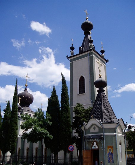
Older churches in the city include 1) the All Crimean Saints and Theodore Stratilat Russian Orthodox Church (built in 1842, architect G. Torichelli of Odesa; the bell tower, added in 1909, removed in Soviet times, restored thereafter; church closed in 1938, re-opened for service during German occupation in 1941 but closed in 1964 and converted into a clubhouse; returned to believers and restored by 1995); and 2) the St. Luke Russian Orthodox Church (a cemetery chapel built in 1914, closed in Soviet period, passed to the Ukrainian Orthodox Church – Moscow Patriarchate in 1991, re-built into a church in the 1990s, consecrated in honor of St. Luke of Crimea in 1999).
Of the two mosques in the city, only one, the Yukhary Jami (Upper Friday Mosque, built in the 19th century) remains; it was returned to the use of and restored by the Crimean Tatars in 1994; the Lower (smaller) mosque, damaged by the 1927 earthquake, was dismantled with its stonework used to help rebuild Yaly-Bakhcha (in Turkic, Seaside-Orchard) Hotel (built in 1914, served as wartime soldiers’ hospital, then school and library, later became a miner’s sanatorium, now the ‘Riviera Sunrise Resort and Spa’). The Alushta synagogue, built 1910–13, was closed in 1927 and converted into a movie theater, fell into disrepair and was dismantled in 2008.
Rebuilt mosques include the Korbek Jami (in the Crimean Tatar village of Korbek, renamed Izobylne in 1945, mosque destroyed by fire in 1994, rebuilt by 2014) and Uskut Jamisi (in the Crimean Tatar village of Uskut, re-named Pryvitne in 1945, mosque built in 1825, closed and re-purposed in the Soviet period, rebuilt in 2007). Other active mosques are in Malorichenske (formerly Kiuchiuk-Uzen) and Soniachnohirske (formerly Kuru-Uzen). Remains of two other mosques in Greater Alushta are in the town of Partenit (end of 18th century) and in the village of Malyi Maiak (formerly Biuiuk Lambat, 2nd half 19th century).
Post-Soviet construction of churches in Alushta city include 1) the Tsaryst Martyrs Russian Orthodox Church (built 2007–15); 2) the renewal of Kosma-Damian Monastery, 11 km E of the city (20 km by road; est 1856, closed in 1896 and re-opened as nunnery, closed in 1920s and used as headquarters for the Crimean State Preserve, destroyed during the Second World War, revived as monastery in 1994); and 3) the Evangelical Christian Baptist Church. In the town of Partenit there are two Russian Orthodox churches, the small Annunciation of the Holy Mother of God (unknown date) and the Saint John of Gothia Church (built in 1996 near the ruins of the Peter and Paul Basilica on the grounds of the monastery founded by Saint John of Gothia); there is also an Evangelical Christian church. Some villages within Greater Alushta (Malyi Maiak, Rybache, Soniachnohirske, Zaprudne) gained new churches since 1991.
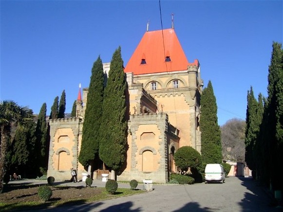
Of architectural interest in the city are: 1) the Villa Otrada (Stakheev’s dacha, built 1882, now center for children creativity), 2) Villa Holubka, built 1827, now the city’s Sergeev-Tsensky Central Library. In Partenit, at the foot of Mount Aiu-Dag, are two palaces: the Prince Raevsky’s (19th century park and villa) Karasan (now hotel) and the Princess Gagarin Palace (built 1902–7, now the Utios Sanatorium) in Utios (an outlier of Partenit 2 km NE on the coast), both of which feature associated chapels: the Assumption Church and the Aleksandr Nevsky Church, respectively.
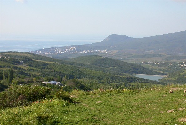
City plan. Greater Alushta forms an irregular elongated rectangle along the Crimean Mountains and Crimean southern shore. Extending along the Black Sea coast about 47 km, it reaches inland 20 km in the SW near Partenit but 10 km at Alushta and at its NE end near Pryvitne. The highest elevations are reached at Mount Roman-Kosh (1,537 m above sea level, on the Babuhan Yaila Ridge) 6 km NW of Partenit. The mountain slopes NW of Alushta and Partenit support beech and pine forests; mountain meadows occupy the crests of ridges. To the NW, mostly beyond the bounds of Greater Alushta in the Bakhchysarai raion is the Crimean State Hunting Preserve. Greater Alushta, however, hosts the Aiu-Dag Preserve (on the coast, 1 km S of Partenit, covering 527 ha on the Aiu-Dag (Bear Mountain, a laccolith rising 577 m above sea level) for protecting 2 varieties of oak and other endemic species) and the Demerdzhi Natural Monument (eroded limestone columns at the Demerdzhi Yaila Ridge, 12 km N of Alushta). Lower slopes support villages with vineyards and orchards and resorts with parks.
Administratively, in 2014 Greater Alushta was comprised of 7 councils, including the city of Alushta (6.9 sq km) the resort town Partenit (4.4 sq km), and 5 rural councils (Izobylne, Luchyste, Malyi Maiak, Malorichenske, and Pryvitne) with 18 villages and 6 settlements.
The settlements (mostly villages), located at lower elevations or in mountain valleys are listed from the southwest to the northeast (with their historic names and January 1, 2014 populations): Lavrove (Kurkiulet, 270), Zaprudne (Degirmenkoi, 788), Nyzhnie Zaprudne (Nyzhnii Degirmenkoi, 161), the town of Partenit (6,086), Pushkino (Kyzylkoi, 273), Utes (Kuchuk-Lambat, 274), Kyparysne (Kuchukkoi, 434), Malyi Maiak (Biiuk-Lambat, 2,298), Bondarenkovo (Karabakh, 30), Chaika (30), Vynohradnyi (Kastel, 274), Rozovyi (227), Izobylne (Korbekul, 2,333), the city of Alushta (28,295), Lavanda (206), Verkhnia Kutuzovka (Shuma, 751), Nyzhnia Kutuzovka (Shuma, 976), Luchyste (Demirci, 1,180), Semidvorie (Yedi-Ev, 102), Heneralske, Soniachnohirske (Kuru-Ozen, 1,150), Malorichenske (Kuchuk-Ozen, 1,313), Rybache (Tuvak, 1,414) and Pryvitne (Uskiut, 1,867).
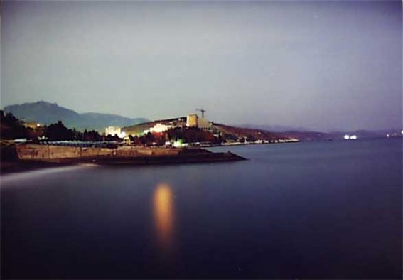
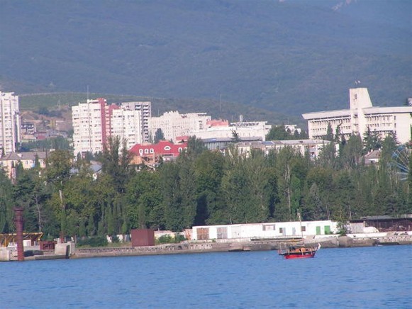
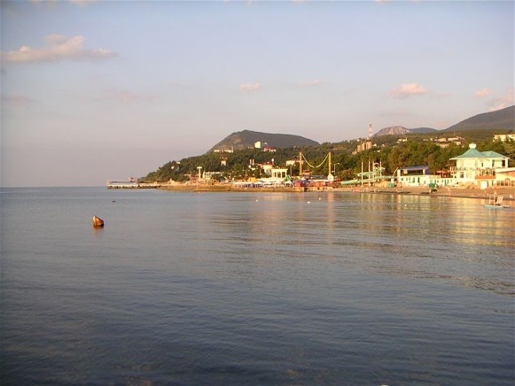
The city of Alushta is nested in an amphitheater overlooking a broad bight of the Black Sea. Forming an irregular shape with extensions along the coast and valleys, its center lies between two streams: the Demerdzhi in the NE and the Ulu-Uzen in the SW. Overland access is provided by Highway E 105 from Simferopol, which cuts through the northern part of the city and meanders westward to Yalta. Public transit, in and out of the city, is provided by bus and trolley bus.
Alushta’s main streets follow the valleys as they lead the traffic from Highway E 105 to downtown and the coast: the Lenin Street along the Demerdzhi in the east and the Gorky Street along Ulu-Uzen in the west, with the Partisan Street between the two leading to the central square of Alushta. On the north side of the central square is city hall; on the east side, the central market. From the central square, the narrow Volodymyra Khromykh Street leads south past the All Crimean Saints and Theodore Stratilat Church, then turns SE at the Yukari Jami mosque to merge with 15 April Street; south of this junction, on a hill (W side of the 15 April Street) are the remains of the fortress Aluston.
East of the central square, is the Olympic Center Spartak; SE of the square, is the city court; farther SE, the central branch of the city library and south of it, the Alushta Regional History Museum; east of the library and museum is the Seaside (Prymorskyi) Park which contains, at its N side, the Alushta ‘Nemo’ Dolpinarium and near the seashore, on the west side near the museum, several monuments; on the east side, the Villa Otrada within its Sukheev Park.
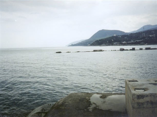
Lenin Street, upon reaching the shore, turns SW to become Naberezhna Street with tourist facilities (including the Shmelev memorial museum) on the inland side and a beach on the seaside, followed, at 0.4 km, by a small dock, the rock and semiprecious stone museum and the Riviera Sunrise Resort and Spa; there, it spins off Gorky Street to the NW and continues SSW along the shoreline to the Professors’ Corner complex (with its Oleksii Beketov memorial museum) and other resorts beyond.
Along Gorky Street, 0.2 km NW of Naberezhna Street, are the Alushta trolleybus terminal (NE side) and a park with the Crimea in miniature (SW side); beyond that park to the SW along Zhovtneva Street are several boarding complexes and, along the Chervonoflotska Street, the tour base Hotel Voskhod and the Sergeev-Tsensky monument and museum. To the NW Gorky Street leads past mostly old residential corridor to the Alushta traffic circle on Highway E 105 with the Alushta bus depot, a nearby hotel and shopping. From this traffic circle another thoroughfare, the Komsomolska Street, curves S, SE and S past apartment blocks, a transformer station, residential housing and apartment blocks, the Sergei Tsensky Literary Memorial Museum (W side) and Professors’ Corner and other beach resorts (E side).
Beyond the Alushta traffic circle west of the highway are two multi-story apartment neighborhoods with a market and a school between them, and industrial plants to the west. Between the market and the highway stands the Tsaryst Martyrs Russian Orthodox Church.
From the city’s central square, the Partisan Street leads WNW past some apartments, a hotel (N side) and Alushta Central Hospital (S side) followed by newer apartments on both sides and the main school south of the complex; beyond E 105 are the offices of the Crimean Nature Preserve with its Nature Museum and the dendrological park and zoo (N side). Vineyards flank Partisan Street on both sides as it becomes the Romanov Highway, aka highway P 34, as it leads to Izobylne where the Izobylne Water Reservoir was built (in 1979, at 70 meters, deepest of Crimean reservoirs, to supply Greater Alushta) on the Ulu-Uzen River. From Izobylne, highway P 34 passes the village of Rozovyi and the Kosmo-Diaman Monastery over the mountains to Yalta.
To the northwest of the city’s central square the Horbachova Street also leads to Highway E 105 past some apartments and houses; beyond the highway are two cemeteries: the first, with a memorial to the military and partisans killed in 1941-2 and the Saint Luke Church; the second is flanked to its east and north by the Tourist Street, with the Evangelical Christian Baptist Church abutting the cemetery.
Directly north of the central square, between Horbachova Street and Lenin Street, are several narrower streets lined with row apartments, one with a branch library, and then mixed housing, leading up to the Alushta winery. Beyond the winery and a vineyard and gardens, Lenin Street merges with Highway E 105. Beyond the city, Highway E 105 passes Kutuzovka (historically, Shuma) on the Demerdzhi, where the Kutuzovka water reservoir (1985) was built.
Northeast of the city’s central square, the Red Army Street crosses the Demerdzhi, passes the Slavutych Sanatorium (SE side) and the Golden Resort, some hotels and an employment center (NW side); on the SE side, it passes some residential, the Cypress Child Health Camp, up to the traffic circle. Beyond the traffic circle, on the south side, the city also includes the Veterans’ Sanatorium. Beyond this point, the Sudak Highway (P 29) winds along the coast connecting other settlements of Greater Alushta NE of the city on the way to Sudak.
South of the Red Army Street, the Perekop Street marks the west bank of the canalized Demerdzhi and borders the east side of the Olympic Center Spartak and the Seaside Park. To the east its branch Perekop Lane serves two boarding houses and several hotels; its more southerly branch, the Eastern Naberezhna Street, follows the coast past a hotel (N side) and a pier with an office and more beaches (on the sea side) and beyond the city limits to three clusters of cottages.
BIBLIOGRAPHY
‘Alushta’ in Heohrafichna entsyklopediia Ukrainy, vol 1 (Kyiv 1989)
Vermenych, Ya. ‘Alushta’ in Entsyklopediia istorii Ukrainy, vol 1 (Kyiv 2003)
Teslenko, I., Lysenko, A. ‘Nizhniaia mechet' v Alushte’ in Terra Alustiana MMXI (Simferopol 2015)
‘Karta Alushty, Kryma, z vulytsiamy’ Mapa Ukrainy https://kartaukrainy.com.ua/Alushta
Tsyhannyk, L. ‘Beketova O. Budynok-muzei’ in Entsyklopediia suchasnoi Ukrainy (Kyiv 2003; updated 2023: https://esu.com.ua/article-39006)
Ihor Stebelsky
[This article was updated in 2024.]

.jpg)
