Teodosiia
Teodosiia (Ukrainian [1928]: Теодосія; Teodosija) or Feodosiia (Russian and Ukrainian [1933–2019]: Феодосія; Feodosija; English: Theodosia from original Greek Θεοδοσία). See Google Map; see EU map: VIII-16. A city and seaport (2021 pop 66,293, 2014 pop 69,040) in southeastern Crimea on the Black Sea coast. It is the administrative center of Greater Teodosiia district (2021 pop 100,516; 2014 pop 104,895), comprising the city and six subdivisions containing towns and rural areas. They are, from west to east, Shchebetovka, Koktebel, Nasypne, Ordzhonikidze, Teodosiia, Berehove, and Prymorskyi. Within them, the five towns (2014 pop) are: Shchebetovka (3,601) and Kurortne (337); Koktebel (2,869); Ordzhonikidze (2,650); and Prymorskyi (14,975). The rural population (11,423) lives in villages, including Nasypne just west and Berehove just east of Teodosiia. The coastal city is served by a railway (single-track) and a branch from Prymorskyi, leading north to Vladyslavivka junction and thence east to Kerch or northwest to Dzhankoi and beyond. Highways connect Teodosiia NE to Kerch and W to Staryi Krym and Simferopol (E97, formerly M25) and SW along the rugged coast to Sudak and Alushta (P29, formerly A294).
History. The city originated in the 6th century BC as Theodosia (meaning ‘God-given [place]’), a colony of the Greek city-state of Miletus. It developed into an important trading center, buying from the Taurians, Cimmerians, and Scythians grain, leather, fish and salt and selling to them textiles, weapons, wine, pottery, and jewelry. In 355 BC it was annexed by the Bosporan Kingdom to become its second largest city after Panticapaeum. In the 4th century AD Theodosia was sacked by the Huns, and at the end of the 6th century what remained of it was captured by the Khazars. During the second half of the 1st millennium the diminished city had close ties with Byzantium. Having fallen to the Pechenegs (10th century) and the Cumans (mid-11th century), it ceased to exist.
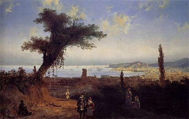
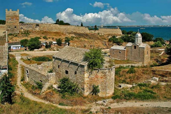
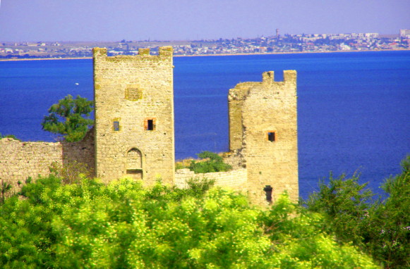
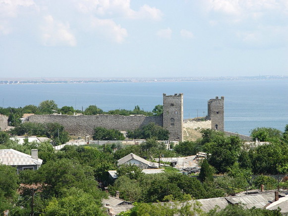
In 1223 the Crimea was invaded by Mongol-led Tatar hordes and by 1239 the peninsula became one of the Golden Horde’s administrative subdivisions. Since the Golden Horde provided a conduit to the silk trade route, the Genoese merchant republic bought the site and established (1275) a trading post called Caffa (also spelled Kaffa) at the Greek-inhabited village, Kafas, on the remains of Theodosia. The Genoese merchants developed Caffa into the largest city in the Crimea, with its citadel and fortifications (inner [1340–52] and outer [1383–85] walls), port (accommodating 200 vessels and main base of the Genoese Black Sea navy) and market. From the Orient came spices, incenses, silk and silk goods; from the forested Rus’ came furs and wax; from the Crimea and adjacent steppes, grain, leather, fish, and salt; slaves (non-Christian Tatar captives) were also a growing commodity; most of these goods went to Genoa. During a reprisal siege of the city in 1346–47, Jani Beg, Khan of the Golden Horde, ordered dead corpses infected with the Black Death to be catapulted over the wall to infect Genoese sailors, who then transmitted the disease to Genoa and the rest of Europe. Accounts of Caffa’s population by travelers as more than 70,000 (exceeding that of Constantinople), were recently deemed unreliable; critical estimates suggest only 10,000 in 1386. Although the Genoese were a ruling minority with the city’s governor appointed annually in Genoa, Caffa’s population was diverse by ethnicity and religion. Most were non-Genoese: the well-to-do citizens of Caffa and the poor people, living in quarters according to ethno-religious identity and professional categories. In 1386 the most numerous were Greeks, then Armenians, Tatars (who considered themselves subjects of the Golden Horde and/or Crimean Khanate), Georgians, the Rus’ (Ruthenians), Goths, Jews and others. Caffa served as the administrative center for other Genoese holdings in the Crimea: Vosporo or Cerco (Cherkio, now Kerch), Soldaia (now Sudak), both seized from the rival Venetians, and Cembalo (now Balaklava), from the Kingdom of Theodoro. It also was the seat of the Latin Church diocese (established in 1318 by Pope John XXII, with territorial jurisdiction from Bulgaria and Rus’ through the Mongol Empire to China) and of the Armenian Church (known since 1423). The city had a branch of the Saint George Bank, minted its own coins, and housed a theater.
The Ottoman Turks, having taken Constantinople (1453), blocked Genoese access to their colonies on the Black Sea. In 1454 Caffa was besieged by the Crimean Tatars on land and the Ottoman navy from the sea. The huge tribute it was forced to pay led to bankruptcy (Saint George Bank assumed ownership of the city) and the decline of Caffa. Genoese possession ended in 1475, when the Ottoman forces took Caffa and its other possessions, converting them into a new province of the Ottoman Empire.
The city, re-named Kefe (nicknamed Küçük İstanbul [Little Istanbul]), became its administrative center and stronghold in the Crimea. The Italian population was killed or deported to Istanbul, where they founded a quarter (Kefeli Mahalle) named after the town they were forced to leave, their Catholic churches destroyed or converted into mosques. Registers (1520, 1542) suggest a permanent population of about 20 thousand, comprising Turks, Greeks, Armenians, and Jews. In 1485 the city became the seat of the Kaffa Orthodox Eparchy (which was combined in 1678 with the Gothic Metropolitanate). The Turks developed Kefe into the largest slave market in the Crimea. On any day, some 20 thousand captives taken in Crimean Tatar raids, mostly from Ukraine, were sold at the Kefe slave market. In reprisal, the Zaporozhian Cossacks (led by Hetman Petro Konashevych-Sahaidachny) destroyed the Turkish fleet, sacked Kefe and freed the slaves in 1616; they again (led by Hetman Mykhailo Doroshenko) attacked the city in 1628 and later (under the command of Ivan Sirko) took it in 1675. Contenders for Crimean Tatar leadership also took Kefe, with the aid of Zaporozhian Cossacks, in 1624 and 1636.
During the Russo-Turkish War (1768—1774) the Zaporozhian Cossacks, under the command of Colonel Opanas Kovpak, captured Kefe in 1771 and freed 7000 slaves. At that time Kefe comprised three parts: 1) a walled citadel with a grid street layout containing the governor’s palace, four mosques and Turkish residential quarters; 2) the large walled city with curved streets containing the central grand market (near the port) and several quarters with 21 mosques, 22 Armenian and 11 Orthodox churches, 1 synagogue and 1 kenesa, and at the northern tip of the city, a bastion with its own mosque; and 3) three settlements outside the outer wall, extending over an area as large as the walled city. The defeat in 1771 caused many religious officials and mirzas to flee from Kefe to Istanbul.
Following the Peace Treaty of Küçük Kaynarca (1774), the city became part of the Crimean Khanate, which now became dependent on Russia. The Khanate governance, however, was unstable. Fighting between competing khans, Sahib and Devlet Girei also involved Russian military intervention, with the destruction of Kefe in 1778 that was greater than that in 1771. Russian forces also relocated most Christian and some Jewish merchants from the Crimea, thus reducing its entrepreneurial economy.
In 1783 the Crimea was annexed by the Russian Empire and became part of Tavriia district (1774). The city’s ancient name (in the Russian reading, Feodosiia) was personally restored by Catherine II upon her visit in 1787. Despite hosting some of Russia’s naval vessels, Teodosiia’s residents declined to 325. To help the city recover, it was granted the right to tax-free imports and the use of profits from salt and wine sales for its own needs (1798–1812). German colonists were attracted with free land to develop. It also became a county center within Tavriia gubernia in 1802. Because of its ice-free status, plans were considered (1825, 1857) to make Teodosiia the main commercial port of the Russian Empire on the Black Sea, but the slow start to railway construction towards it thwarted its realization in comparison to the expansion of Sevastopol and Balaklava as military ports and Kherson and Odesa as commercial ports. Teodosiia also lost many of its Crimean Tatars after the Crimean War; some emigrated to the Ottoman Empire, others moved to Bakhchesarai. Only the completion of a railway line (1892), new port facilities (1895) and the re-direction (1899) of the commercial seaport from Sevastopol to Teodosiia stimulated the city’s economic development. The number of factories increased from 13 in 1891 to 30 in 1894. These included 3 large tobacco factories, several brick and tile works and a state grape-processing plant. The main exports were grain and tobacco. The city’s population in 1897 was 24,096, with Russian speakers the largest group (46.8 percent), followed by Tatar (18.8 percent), Yiddish (11.4 percent), Ukrainian (7.7 percent), and Greek (5.3 percent). The prevalent religion now was Orthodox (59.0 percent), followed by Muslim (14.1), Jewish (12.9, mostly Yiddish-speaking, some Russian-speaking, or the Tatar-speaking Krymchaks [0.5]), and Karaite (5.1, most of Karaites spoke Tatar and a few who spoke Russian). In 1904 the population of Teodosiia reached 30,600 and by 1914, 38,000.
During the Revolution of 1917 and the Civil War (1917–21) Ukrainian sailors in the Black Sea Fleet stationed in Teodosiia supported the Ukrainian independence movement; others joined the Bolsheviks. The control of Teodosiia passed from one opponent to another several times: the Bolsheviks (February–April 1918, led by Ivan Fedko), the Germans (May–November 1918), the Anglo-French Allied Powers (November 1918 to April 1919), the Bolsheviks (May 1919), the White Army under the command of Anton Denikin (June 1919 to April 1920) replaced by Petr Wrangel (April–November 1920). The final arrival of the Bolsheviks (November 1920) was marked by mass executions of the White Army captives and their local sympathizers. During the famine in the Crimea (1921–22), Teodosiia served as a center through which international organizations provided support to the starving; the city’s population declined from 35,392 (1921) to 22,737 (1923).
Under Soviet rule Teodosiia was part of the Crimean ASSR from 1921. Its population recovered to 28,700 by 1926. While the share of Russians increased to 61.2 percent and Jews to 16.0 percent, the Crimean Tatars declined to 6.7 percent, Ukrainians to 5.9 percent, and Greeks to 3.2 percent. In 1928 the Institute of Physical Therapy was established in the city, which facilitated its development as a resort center. Under the five-year plans Teodosiia developed into a health resort center with some manufacturing. By 1939 its population reached 45,000.
During the Second World War Teodosiia was occupied by the Nazi German army twice: November–December 1941 and (after a brief liberation by landed forces) 18 January 1942–13 April 1944. As a result of the Holocaust (the city’s Jewish population, numbering 3,248, was shot by SD-Einsatzgruppe D between November 16 and December 15, 1941), wartime losses (executions, deportations for slave labor to Germany, about 5,000) and post-war deportations (all Crimean Tatars were accused of collaboration with the Nazis, sent to Kazakhstan, Uzbekistan, and other Central Asian republics of the USSR and deprived of their Crimean Tatar identity for assimilation there), the multi-ethnic population of the city was reduced and became predominantly Russian.
In postwar years (1945–50) the economy of the city recovered. At the beginning of the 1950s the city was included in the Kerch-Teodosiia Naval Base and thus became a semi-closed city until the beginning of the 1970s. In 1954, along with the rest of the Crimea, it became part of the Ukrainian SSR and benefitted from the development of joint infrastructure. Its water supply, dependent on local sources including the Buibuha River, was increased in 1972 when a branch of the North Crimean Canal was built to deliver water from the Dnipro River to the Teodosiia Reservoir and thence the city’s water system. The military-industrial complex was expanded to employ 57 percent of the city’s labor force: in scientific research institutes for naval shipbuilding, instrument-making, optics and hydro-acoustics for defense and aerospace applications, a training base for cosmonauts and military and space testing grounds. Its port was used to send material for ballistic missile placement in Cuba in 1962. The city’s population recovered after the Second World War and grew from 43,000 in the beginning of 1956 to 46,300 (1959), 64,900 (1970), 76,400 (1979), 83,900 (1989) and 86,000 (1991). Population of Greater Teodosiia grew accordingly: 106,960 (1979), 117,768 (1989). In summertime the population would double because of tourists at its resorts and sanatoria. The Ministry of Defense Sanatorium was located in Teodosiia. Many retirees from the Soviet military-industrial complex elsewhere moved to live in the warmer climate of Teodosiia, thus giving the city an older demographic profile. A growth spurt beginning in 1990–91 occurred when Crimean Tatars started returning from exile.
Following the 1991 Ukraine’s Declaration of Independence, the return of Crimean Tatars intensified. Ukrainians also began to increase their presence. This resulted in a temporary growth of the city’s population, to peak at 87,000 in 1993–94. Since then, population aging with deaths exceeding births contributed to population decline: 85,000 (1995), 81,000 (1998), 74,669 (2001 census), 72,400 (2005), 71,100 (2009), 69,500 (2014). The ethnic composition of Greater Teodosiia, with a population of 108,571 on 5 December 2001 became more diverse (in percent): Russians (72.2), Ukrainians (18.8), Crimean Tatars (4.6), Belarusians (1.8), Armenians (0.5), Tatars (0.2), Jews (0.2), Moldavians (0.2), Azeris (0.2), Poles (0.1), Georgians (0.1), Germans (0.1), and Greeks (0.1). Since the Crimean authorities insisted on education to continue in the Russian language (only one school in the city provided education in the Ukrainian language), Russification, in terms of declared mother tongue, was significant (in percent): Russian (87.4), Ukrainian (7.4), Crimean Tatar (4.2), Belarusian (0.3), and Armenian (0.3). The economic profile of the city also shifted: the military-industrial complex ceased to function, marine transport was opened to foreign ships, the oil depot continued to operate, while tourism and recreation, supported by some industries and services, increased. Teodosiia also was the site of anti-NATO protest. Local activists of the Party of Regions, the Communist Party of Ukraine, and the Progressive Socialist Party of Ukraine blocked the unloading of the US cargo ship ‘Advantage’, leading to the cancellation of the Ukraine-NATO Partnership for Peace Sea Breeze 2006 military exercise in the Crimea.
The Russian invasion and occupation in 2014 changed the economy and population of the city. The city’s links became more integrated with the Russian Federation and military contracts revived. Western sanctions constrained tourism; even Russians were impacted. The special population census of 14–25 October 2014 found the city of Teodosiia had 69,038 residents (compared to 69,500 estimated for 1 January 2014). The ethnic make-up of the city’s population was (in percent): Russians (79.39), Ukrainians (11.44), Crimean Tatars (1.01), Tatars (0.85), Belarusians (1.01), Armenians (0.67), Jews (0.20), Azeris (0.19), Greeks (0.16), Moldavians (0.15), Georgians (0.11), Poles (0.10). Ethnic affiliation was not declared by 3.73 percent of the respondents.
Economy, science, and education. The city’s military industries were: 1) ‘Sea’ Shipyard (building naval vessels, sanctioned since 2014), 2) ‘Sudokompozit’ plant (ship design R&D naval hardware, sanctioned since 2014), 3) ‘Kasatka’ and ‘Gidropribor’ (torpedo manufacturing plants, both sanctioned since 2014), 4) Russia Black Sea Fleet navy ship repair yards, 5) the ‘Opto’ state optics plant, 6) the ‘Feodosiia FMZ’ machine-building plant, and 7) the ‘Feodosiia FPZ’ instrument-making plant. Others included an old tobacco factory (est 1861), a building-materials manufacturing complex and another building materials plant, a furniture factory, a stocking factory, a printing plant, several food-processing plants (meat, milk, bread), mineral water bottling, juice processing, wine making (‘Koktebel’ and ‘Krymskii vinnyi dom’ brands) and fishing.
In the 1990s the military-industrial complex atrophied. By 2009 the city’s industries employed only 2,500 workers. As a result, most of Teodosiia’s inhabitants were again occupied in the city’s resort and marine transport functions. Endowed with its unique Golden Beach made of small crushed seashells some 15 km along Teodosiia Bay (by contrast, the Crimean southern shore beaches are mainly pebble), mud baths and mineral waters, Teodosia drew many visitors who doubled its summer population. Many stayed in tourist centers, while others in sanatoriums, rest homes, and children’s resorts. The largest, belonging to Ukrainian institutions until the 2014 occupation, were the children’s sanatorium ‘Khvylia’ (Wave) of the Ministry of Health of Ukraine, the Sanatorium ‘Skhid’ (East), the military clinical sanatorium of the Ministry of Defense of Ukraine, the guest house ‘Ukraina’ of the Mariupol Metallurgical Plant, the ‘Feodosiia’ guest house of the Dnipro Division of Ukrainian Railways and the private ‘Ukraina’ guest house.
Services focus on health resorts, tourism (restaurants, hotels), industry (applied scientific research institutes) and transportation (marine, rail and automobile). Supporting them in Greater Teodosiia are medical (3 hospitals), educational (23 schools, 18 libraries, including the A. Grin Central City Library [est 1897]) and administrative services.
Scientific research institutes, up to 1991, focused on military applications. After demilitarization the remaining six were: 1) Scientific Research Institute of Aeroelastic Systems, re-oriented to sport applications of balloons and parachutes; 2) Design Bureau ‘Sudokompozit’ (composite materials for vessels); 3) Scientific Production Testing Center ‘Ai-Petri’, which carried out orders on special topics for the Ministry of Defense of Ukraine; 4) State Aviation Research Center of the Air Force of Ukraine (in Prymorskyi); 5) Scientific testing units of the Black Sea Fleet of the Russian Federation and the Armed Forces of Ukraine (in Teodosiia and Prymorskyi); 6) Kara-Dag Biological Station of the Institute of the Biology of Southern Seas of the National Academy of Sciences of Ukraine (at the Kara-Dag Nature Reserve, in Kurortne).
Postsecondary institutions in the Soviet period comprised of the Teodosiia Polytechnical Institute and three vocational-technical schools. There was also an institute for teachers (est as the Teodosiia Teachers’ Institute in 1874, re-named Institute of People's Education [1920], then Pedagogical Tekhnikum [1923] for training teachers for rural schools; there were special sections to teaching in German and Yiddish, but not in Ukrainian; it ceased operation after 1941). After 1991, when part of Ukraine, Teodosiia was enriched with the establishment of the private Teodosiia Finance Academy and four branch institutions: of the Eastern Ukrainian National University (Luhansk), the Admiral Makarov National University of Shipbuilding (Mykolaiv), the Kerch Marine Technological University (in Prymorskyi) and Tavriia National University (Simferopol, this branch was closed in 2008). Since 2014 all branches of Ukraine-based institutions in the city were closed. Aesthetics were taught at two music schools, an art school and its affiliate, the Teodosiia Center for Child Creativity.
Culture. Towards the end of the 19th century, Teodosiia became an attraction to wealthy visitors for its seaside attributes and old architectural monuments and so remains to this day. Its parks provide fine setting for passive recreation and many monuments of cultural and historic nature focusing on both imperial Russian and Soviet periods.
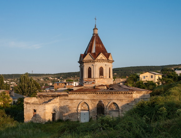
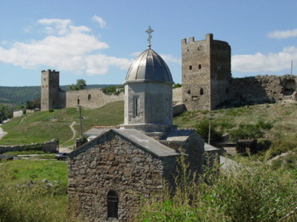
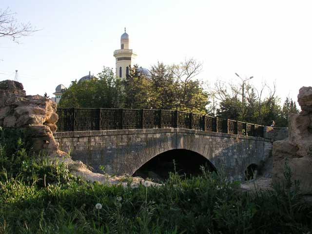
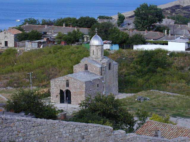
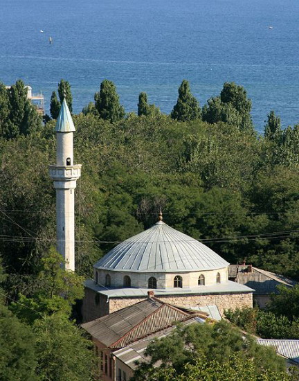
Its main architectural monuments are the remaining walls and turrets of the Genoese fortress (14th–15th century), many Greek and Armenian churches of the same period, and the Mufti Cami (mosque, built in 1623). Houses of worship were revived in the post-Soviet period, during Ukraine’s jurisdiction over the Crimea. The five functioning heritage houses of worship are: 1) Presentation of the Blessed Virgin Mary Church (built 8–9th century, oldest Greek church in Teodosiia, but its current appearance reflects its 19th century reconstruction; in 1787 it was the seat of the Greek Teodosiia eparchy, closed in 1937 and its Greek parishioners executed, converted into a gym, re-sanctified in 1993 as a Ukrainian Orthodox Church-Moscow Patriarchate); 2) Surb Sarkis (Saint Serge) Armenian Church (est 1330, oldest Armenian church in Teodosiia, home of artists, philosophers, poets and historians, center of illumination and engraving of manuscripts, now preserved in the National Library of France [Paris], the library of the Armenian Patriarch [Jerusalem] and the library of the Armenian Mekhitarist Monastery [Vienna]); 3) Saint John the Baptist Armenian Church (est 1348, converted to the Iberian Icon of the Mother of God Russian Orthodox church in 1875 when Russia re-settled Armenians to the Azov gubernia, then closed and vandalized in the Soviet period, restored in 1996 and reactivated as a Ukrainian Orthodox Church-Moscow Patriarchate); 4) Saint George’s Church (built in 1385 as Armenian catholicon of its monastery which was then beyond the city walls, re-built in 19th century, closed in 1921, returned to the Armenian community in 1998 [but in 2019 the adjacent Armenian cemetery was opened for building an apartment complex]); and 5) the Mufti Cami (mosque, built 1623–37, with Russian annexation (1783) transferred to Armenian Catholics to become the Dormition Church until the 1920s, restored in 1975, returned to Muslim community, with Friday prayers since 1998). The four non-functioning heritage churches are: 1) Saint George’s, 14th century Greek; 2) Saint Demetrius of Thessaloniki, 14th century Greek (by end of 15th century became Armenian and re-named Saint Stephen, restored 1955–6, 2010–22); 3) Saint John the Apostle, 14–15 centuries Armenian; and 4) Archangels Michael and Gabriel, Armenian, est 1408, restored 1967–70s. Other active churches (all of them now under the Russian Orthodox church) include: the All Saints Church (built 1880s, closed in 1938, re-opened in 1942, detonated in the 1961, rebuilt in 2004 by the Ukrainian Orthodox Church-Moscow Patriarchate); Cathedral of the Kazan Icon of the Mother of God (Kazan Cathedral, built 1907–11, seat of the Russian Orthodox church Teodosiia eparchy and cathedral of the Toplovsky Monastery, pillaged in 1919, opened in 1942 for Romanian servicemen, returned to Russian Orthodox service in 1944, renewed its building in 2011); Saint Catherine the Martyr (built 1891, closed in 1937 and converted into a warehouse, re-opened under German occupation in 1941, renovated and expanded in 2002).
Destroyed places of worship include: 1) the Karaite Kenesa (built originally in 850, re-built in 1292, destroyed during the Second World War), 2) the Old Synagogue (built in 909, destroyed during the Second World War), 3) the Biuk Cami (aka Suleiman khan Cami, the grand mosque of Kefe, built in 1510–22 on the site and using the materials of the Genoese Saint Agnes Catholic Church; the mosque was dismantled by Russians in 1833 to build the Aleksandr Nevsky Cathedral), 4) the Aleksandr Nevsky Cathedral (built 1871–73 on the site of the Turkish Biuk Cami [1522, dismantled in 1833], destroyed in 1933), 5) the Choral Synagogue (built 1904, converted by the Soviets into a gym, during German occupation used as a horse barn, in 1952 converted into navy officers’ quarters), and 6) the Krymchak Synagogue (built 1911, destroyed during the Second World War).
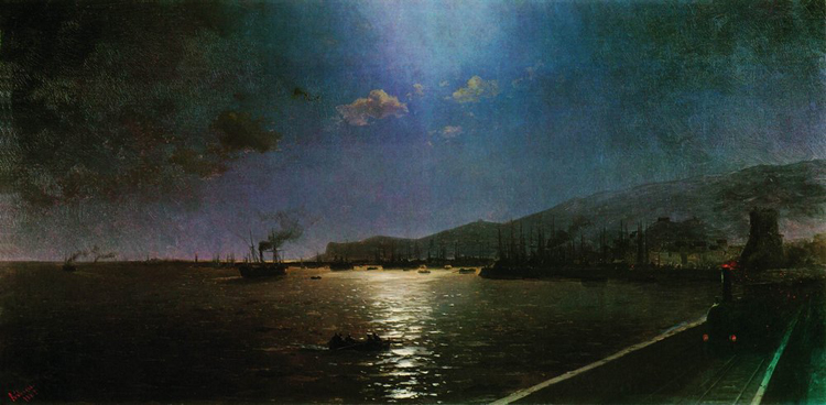
Teodosiia has the Museum of Antiquity (a regional studies museum, est 1811, the first in the city and one of the oldest in Europe), the Ivan Aivazovsky Art Gallery (collection began in 1845, where the artist taught and grew the ‘Cimmerian School’ of landscape art [including the painters K. Bohaievsky, M. Voloshyn], gallery est 1880, first in the Russian Empire of an individual artist, third after the Hermitage and the Rumiantsev art galleries), the Aleksandr Grin Literary Memorial Museum (est 1970), Hang Gliding Museum (est 1990, unique in Europe), Teodosiia Numismatic Museum (est 2003).
For entertainment, there is the ‘Krym’ (a Soviet era concert hall, now movie theater), the ‘Paradox’ Theater (est 1992), the ‘Zvezdnyi’ Concert Hall, the grand ‘Ukraina’ movie theater, and the Vladimir Shaiderov Football Stadium, home of the Football Club ‘Kafa’ (Feodosiia). When part of Ukraine, open air festivals were introduced in the Crimea, among which the Koktebel Jazz Festival (founded in 2003) was the largest, featuring 300 musicians from 15 countries.
City Plan. Teodosiia is located at the eastern end of the Crimean Mountains, abutting the Tepe-Oba Ridge, on the southwest end of the Teodosiia Bay. It extends as a crescent from Point Illi in the south along the bay some 10 km to the northwest, north, and then northeast and inland from 1 to 3 km, occupying an area about 27 sq km. Most of its area is either built up or in parks and other green spaces. Greater Teodosiia is much larger. It extends along the irregular coast from Kurortne in the southwest to Prymorskyi in the northeast about 54 km and inland between 6 and 17 km, enclosing an area of about 270 sq km. In addition to towns and villages, it includes the Kara-Dag Nature Reserve between Kurortne and Koktebel, vineyards north of Koktebel and west of Teodosiia, and cropland north of Teodosiia and Prymorskyi.
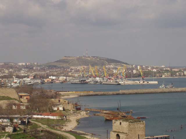
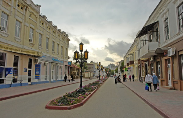
The old part of Teodosiia occupies the southern third of the city. Shaped like the moon’s waning crescent along the bay, it corresponds to the walled city of Caffa and contains the Genoese fortress and the remaining heritage buildings of that period. Some of its streets have been widened or straightened. In the south, the citadel now has Russian Black Sea Fleet quarters; east of it, among four heritage churches (Saint Demetrius, Saint Stephen, Saint George, Saint John the Apostle, and Saint John the Baptist), a workers’ quarter and a hospital were added. Northwest of the citadel, Gorky Street (in 1914 it was called Italian Street) leads through what was the portside of old Caffa towards present-day city center. On the seaside of Gorky Street, where the old port was, stands the Teodosiia Vessel Mechanical Plant; on the other side, between Gorky and Lenin streets (the latter was called Catherine Street in 1914), where the Caffa central market once stood, are apartment buildings and the ‘Morsad’ aka ‘Matroskyi Sad’ park. Across from the park, on the southwest side of Lenin Street, is the Mufti Cami (mosque) and west of it at Armenian Street, the Surb Sarkis Armenian Church with a small cemetery and the grave of Ivan Aivazovsky. South of this are narrow winding streets leading up to Mount Mitridat and the remains of Thomas Tower, a high point of the old city wall, but along the way the Karaite Kenesa and the Old Synagogue are no longer there. On the seaside is the city’s port, protected by a breakwater from the east and partly enclosed from the north by a broad wharf with large cranes. On the west side some fine 19th century buildings were added. At Greek Street they house the Fish and Fishery Museum and farther inland, the Teodosiia city courthouse.
Teodosiia’s city center is where Kefe’s suburb, Ser Bazar once stood. Rebuilt on a 19th century N-S / E-W grid, it has most of the city’s main institutional buildings. From Jubilee Park in the south it extends 0.6 km north to Gallery Street (in 1914 it was Aivazovsky Street), and from Aivazovsky Avenue in the east, 0.5 km to Soviet Street in the west. On the west side of Jubilee Park is the ‘Krym’ Theater (1959), a music school, the Aleksandr Grin Central Public Library. North of Jubilee Park, along Aivazovsky Avenue, on its east (sea) side is the Teodosiia Railway Station (rebuilt in 1956) and, on the west side, the Teodosiia city palace of culture, and the Teodosiia Museum of Antiquities; on the NW corner of Gallery Street and Aivazovsky Avenue, facing the sea, is the Aivazovsky Art Gallery with a monument to Ivan Aivazovsky. On the next parallel street inland, Zemskaia Street (same name as in 1914), are the city hall, the numismatic museum, the Aleksandr Grin Museum and just beyond it the Ministry of Internal Affairs branch office. On the SW corner of the city center, at the intersection of Soviet and Nazukin streets, on the west side, is the All Saints Church, with a large cemetery behind it, and on the south side, next to the central market, the city transit bus depot.
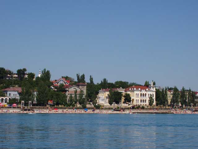
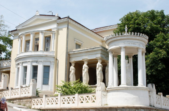
A newer and larger part of Teodosiia lies to the north of the city center. Its main attraction is the golden beach. It consists of 3 segments: 1) the old, near the city center, 2) the newer, within the city limits, and 3) the newest and least developed, from the village of Berehove to Prymorskyi. The old segment has a walkway embankment with a park-like strip and beyond the railway track, on Aivazovsky Avenue facing the sea, a series of attractions and facilities (from south to north): the Ivan Aivazovsky Gallery, a park with a light-sound fountain, some grand ‘villas’ built in the beginning of the 20th century, the ‘Zvezdnyi’ Concert Hall, and the ‘Stamboli Dacha’ of the Teodosiia tobacco manufacturer Joseph Stamboli, now a specialty museum; this segment ends with the Komsomol Park featuring some classical columns and sculptures and monuments to Ivan Fedko and to Militant Internationalists. The newer segment, beginning at the seashore side of the park, has the old building of the Teodosiia Polytechnic Tekhnikum and north of it a sports complex with the Dynamo Stadium. This segment ends with industrial uses. The third segment is beyond the industries and mostly beyond the city limits. Its beach is accessed from the Kerch Highway, has some hotels, and across the highway the Golden Beach Camping Park and the Nemo Dolphinarium near Berehove.
On the northeast side, the railway enters the city from the north. There it serves the bulk goods industries with multiple spurs and its sorting yard. Among the industries there are: the petroleum depot, the ‘Buddetal’ building-materials manufacturing complex and the Teodosiia grain receiving depot. From there the railway line follows the coast past the Aivazovsky passenger station, the Teodosiia passenger station and the spurs at the wharf to its terminus at the Teodosiia Vessel Mechanical Plant.
Some industries or institutions are located beyond the city. The ‘More’ (‘Sea’) Shipyard is in Prymorskyi, served by a branch railway line, has its own dredged port and helicopter pad. On its west side is the Marine Professional Tekhnikum and the Albatros Stadium; on the east side, a military base with multiple helicopter pads. The ‘Gidropribor’ torpedo manufacturing plant is in Ordzhonikidze with its own wharf. The ‘Koktebel’ winery and cognac-making plant is in Koktebel, and the Research Station for the Kara-Dag Nature Reserve is in Kurortne.
City transit is provided by buses with 22 routes serving the entire Greater Teodosiia district; most connect to the city transit bus depot. Inter-city transport includes the railway (two stations) and bus (one terminal). Marine excursions include the bay (one hour) and Kara-Dag (four hours); summer season (May – September) trips on catamarans are along the Anapa–Teodosiia–Yalta route. The nearest commercial airport is in Simferopol, accessible by ground transport. Closer airfields serve other purposes: 12 km west of the city (on the Uzun-Syrt Ridge, north of Koktebel and south of the village Vidvazhne) is the ‘Koktebel’ gliding center; and 18–20 km northwest of the city (beyond Greater Teodosiia) is the Kirov Air Force Base.
BIBLIOGRAPHY
Plan Goroda Feodosii (Simferopol 1914)
Balakhonov, V. Gorod-kurort Feodosiia. Ocherk-putevoditel' (Simferopol 1961)
Tarasenko, N. Feodosiia (Simferopol 1978)
‘Feodosiia,’ Heohrafichna entsyklopediia Ukrainy vol 3 (Kyiv 1993)
Nemyrovs’kyi, O. ‘Feodosiia,’ Entsyklopediia istorii Ukrainy T10 (Kyiv 2013)
Karta Feodosii (2023) https://kartaukrainy.com.ua/Feodosiya
Ihor Stebelsky
[This article was updated in 2023.]
.jpg)
.jpg)
.jpg)
.jpg)
