Starobilsk
Starobilsk [Старобільськ; Starobil's'k]. IV-19, DB Map: DBI-5 A city (2020 pop 16,650) on the left bank of the Aidar River and a raion center in Luhansk oblast.
History. The site of Starobilsk, a military outpost in the 16th century, was settled as sloboda Bilska by Cossacks from the Ostrohozke regiment in 1686. The settlement was wiped out by the Muscovite army during Kondratii Bulavin’s rebellion in 1708. The new sloboda, established in 1732, was called Stara Bila. In 1797 it was promoted to city status, renamed Starobilske, and designated a county center in Slobidska Ukraine gubernia. From 1835 it was a county center in Kharkiv gubernia (pop 1,800) and hosted fairs. By 1897 its population grew to 9,800; it was comprised of 78.5 percent Ukrainians, 20.3 percent Russians, and 0.9 percent Jews.
During Ukraine’s struggle for independence (1917–20), Starobilsk was nominally part of Ukraine, but contested by the Bolsheviks and the anti-Bolshevik ‘White’ Russian Volunteer Army. It was here the anarchist rebel leader Nestor Makhno, who controlled Starobilsk from September to October, 1920, signed an agreement with the Red Army to collaborate in battles against the Russian ‘White’ Army led by General Petr Wrangel.
After Bolshevik victory and the establishment of the Ukrainian SSR and the territorial-administrative reorganization, Starobilsk became the administrative center of Starobilsk okruha, a large rural area. By 1926 the population of Starobilsk grew to 14,000, of whom 91.8 percent were Ukrainians, 5.6 percent Russians, and 1.2 percent Jews.
The new territorial-administrative restructuring of 1932 included Starobilsk in a very large Donetsk oblast, where it continued to serve as okruha center. In 1932–3 its rural areas suffered enormous losses during the Famine-Genocide of 1932–3; even in the city of Starobilsk 409 starved to death. After Donetsk oblast was split in 1938, it became part of Voroshylovhrad oblast (presently Luhansk oblast) and assumed the role of a raion center. This restructuring drew Starobilsk into the industrial growth of the Donets Basin by a direct railway line through the city (completed in 1937) from Moscow to Luhansk. By 1939, the city had 14,300 inhabitants.
During the Second World War its former nunnery served as an internment camp for Polish prisoners of war (1939–40), most of whom were executed in Kharkiv in April–May 1940. From 13 July 1942 until 23 January 1943 the city was occupied by Nazi German troops. After its liberation by the Soviet Army, it accommodated for a few days the government of the Ukrainian SSR.
Starobilsk was rebuilt after the war. By 1975 its population increased to 22,700, reached 25,000 in 1989, but declined to 22,400 by 2001 and continued to decline annually due to aging population and net out-migration.
The Russo-Ukrainian war in the Donbas had an impact on Starobilsk. The Ukrainian 80th Airborne Brigade and the Aidar Battalion suffered casualties from an ambush (5 September 2014) near the city of Shchastia; the bodies that could not be identified were buried in Starobilsk, and a memorial was erected for them the following year. In September 2014 Starobilsk provided refuge to the Luhansk National University from the occupied city of Luhansk.
Economy. Starobilsk is primarily a food processing center. It has a grain elevator, a grain mill, a bakery, an oil extraction plant, a fruit and vegetable cannery, and a dairy. Other entreprises include the Starobilsk Mechanical Factory (makers of radiators and central heating tanks), a furniture factory, a sowing factory, and a reinforced-concrete plant. Services include raion and city administration, education and health (notably the Starobilsk Oblast Physiotherapy Clinic), and regional farm equipment and supplies for nearby farms by ‘Silhosptekhnika’.
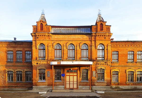
Culture and education. Before 2014, Starobilsk had four postsecondary institutions: 1) the Starobilsk branch college of the Luhansk National Agricultural University (began as a technical school [1892]; a school of agricultural mechanization [1931], and of collective farm management [1956]; a school on a state farm as its campus for training [1968]; re-named Starobilsk State Agricultural Tekhnikum and Elite Seed Farm ‘Rozdolne’ [1998]; became branch campus of the Luhansk National Agricultural University [2005]); 2) the Starobilsk Humanities-Pedagogical College of the Luhansk National University (established in May 2013; the main building originally housed a women’s gymnasium [established 1917], then the Starobilsk State Teachers’ Institute [1940–1954]); 3) the Starobilsk Medical College (established in 1932 to train doctor’s assistants and nurses [1952], upgraded to Starobilsk Oblast Medical School [2005] and renamed Starobilsk Medical College [2017]); and 4) the Starobilsk Professional Lyceum (established in 1962 as a school for building trades, elevated to technical school [1984], re-named professional lyceum [2004]). In addition, it had 5 secondary schools, 2 music schools, a sports school, and a chess club. Since 2014, the Starobilsk Humanities-Pedagogical College became a refuge and a new home of the Luhansk National University.
The city has a system of libraries: the main, youth, and children’s branches in the city, and a network of 23 rural libraries. There are also the Luhansk National University Library (its branch opened in 1998), and the Luhansk Oblast Universal Scientific Library (established in 1897 in Luhansk, named after Maxim Gorky [1936], attained a scientific library status [1973], its administration and documents evacuated to Starobilsk [2015] where its collection is being rebuilt, and dropped M. Gorky from its name [1919]).
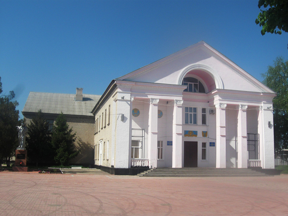
As a raion center, Starobilk has a regional studies museum (established in 1919, conducted significant research in the 1920s), hosts the Taras Shevchenko Cultural Center where 5 amateur groups are active, including the dance ensemble ‘Veselka,’ the women’s vocal ensemble ‘Berehynia,’ the miniature theater ‘Shukachi,’ and a brass orchestra. Starobilsk also has the sports complex ‘Kolos’ with its ‘Kolos’ stadium, with its football team competing in raion and oblast championships.
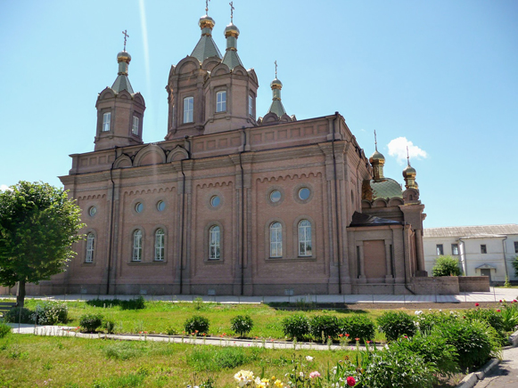
Since the 19th century, Starobilsk has a women’s monastery, a grand church (at the convent) and a cathedral, all of the Ukrainian Orthodox Church-Moscow Patriarchate. The All Grieving Joy Convent began as an orphanage and home for widows in 1851, funded and managed by Anna Bulych, wife of a local captain. In 1862 she became a nun and converted the home into a convent. The convent added a masonry church and cells housing 300 nuns by 1890, and a then a grand church, completed in 1899. In 1919 the Bolsheviks induced it to sell church valuables to help the starving of the Volga region, and in 1924 converted the convent into a state orphanage. Its cathedral became a theatre; its cemetery, a military parking lot; and its library disappeared. In 1992 the faithful initiated the return of the former convent to the Starobilsk eparchy, the revival of the monastery (1995), and the restoration and consecration (2015) of the grand church in honor of the icon of the Mother of God of All Grieving Joy. The city’s Saint Michael’s Cathedral (built 1859–62 in the Baroque style) was the only place for liturgies (1924–94) during the Soviet period in Starobilsk. There is also an Evangelical church in Starobilsk, established after the 1991 Ukraine’s Declaration of Independence.
Local media is limited. Both the Starobilsk City Council and the Starobilsk Raion State Administration have their websites, and the raion newspaper Visnyk Starobil'shchyny has a Facebook page.
City plan. On a map Starobilsk sits on the left bank of the Aidar River, on a north-south railway line (single track) and the intersection of the east-west (H 26) and to the south (H 21) minor highways. With an irregular circular area 6 km east to west and 5.5 km north to south, its city limits contain about 18 sq km, of which about 70 percent is built up with residential (mainly single story homes), industrial, and institutional buildings, and roadways, and 30 percent is covered by green spaces (meadows, orchards, woodlots, parks and cemeteries). The city is surrounded by 7 villages: from the northeast, in clockwise direction, they are (on the left bank of the Aidar River) Zaporizke, Chmyrivka, Pishchane, Butove, and on the right bank, going north, Novoselivka, Pidhorivka, and Prokazyne.
The city center lies along the river and occupies the western side of the city. The intersection of the city’s main arterials, Slobozhanska Street (part of H 26, leading west to Kharkiv and east to Bilovodsk and Milove [on the border with the Russian Federation]) and Convent Street (part of H 21, leading south to Shchastia and Luhansk), are located here. The city center contains Starobilsk’s main institutions: the Starobilsk Gymnasium, the Saint Michael’s Cathedral, the Taras Shevchenko Cultural Center, the Starobilsk Raion Administration building, the city hall, and the central library. To the west, overlooking the Aidar River, is the Starobilsk city park with fountains, statues, a chapel, a look-out point and dock with boat rides on the river; and east of the park, the Kolos Stadium. The All Grieving Joy Convent, located on the east side of Convent Street, occupies a walled-in area of 631 sq m. A major medical complex is 1 km south of the convent, and beyond it, the medical college. The universities are also located in the city center: the Luhansk National Agricultural University and the Luhansk National University. The Starobilsk railway station is located 2.4 km east of the city’s main intersection, in the east-central part of Starobilsk. Most industries are located along the railway tracks in the east-central part of the city. Near the Starobilsk machine-building plant (now the Starobilsk Mechanical Factory) a neighborhood of apartment buildings was constructed in the 1970s.
Public transport in the city is provided on two routes using small busses (13 and 16 persons seating capacity), one in the city center and south of it, and the other in the broader, eastern part of the city. Inter-city transport is by bus, car, or train. Since 2014, with access to Luhansk and the rest of Ukraine’s rail network cut off, the connection from Starobilsk by commuter train has been limited to stations on the line operating between the border with the Russian Federation in the north (the Lantrativka station, near Troitske) and down to the front with the so-called ‘Luhansk People’s Republic’ (LPR) in the south (the Kindrashivska-Nova station at Stanychno-Luhanske).
BIBLIOGRAPHY
Vyrs'kyi, D. ‘Starobil's'k’ in Entsyklopediia istorii Ukrainy (Kyiv 2012)
Karta Starobil's'ka, Luhans'koi oblasti (2020) https://kartaukrainy.com.ua/Starobilsk
Ihor Stebelsky
[This article was written in 2021.]
.jpg)


.jpg)


