Southern Ukraine
Southern Ukraine [Південна Україна; Pivdenna Ukraina]. The largest (250,000 sq km) historical-geographic region of Ukraine, stretching from the Black Sea and the Sea of Azov in the south to the forest-steppe in the north. Also known as Steppe Ukraine, it was permanently and conclusively settled by Ukrainians only in the second half of the 18th century. From the end of the 18th century until 1917 Southern Ukraine, as part of the Russian Empire, was known as New Russia.
Location and boundaries. The history of Southern Ukraine and the ethnic composition of its population were influenced by its location on the littoral of the Black Sea (into which flow all the major rivers of Ukraine) adjacent to the Asiatic steppes (the steppes of Southern Ukraine are their western extension). Throughout its history the region was repeatedly invaded by hordes of nomads from Asia, who severed the main territory of Ukraine and its inhabitants from the Black Sea. At the same time the Mediterranean seafaring powers tried to establish colonies and extend their influence on the northern littoral of the Black Sea, and the peoples inhabiting the main territory of Ukraine also tried to reach the Black Sea shore. Those three directions of expansion intersected on the territory of Southern Ukraine and resulted in conflicts that endured for millennia.
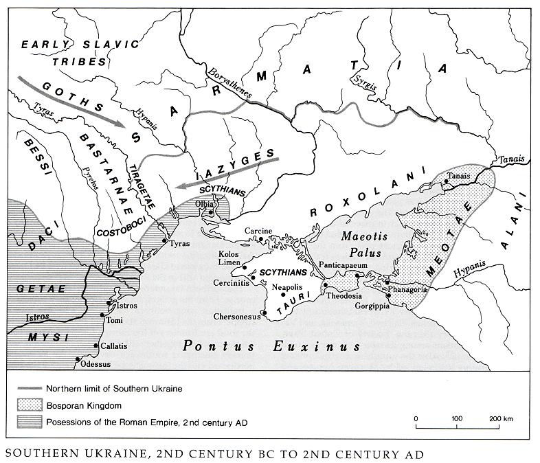
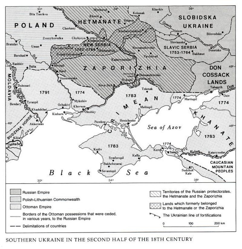
Evidence of human habitation in Southern Ukraine dates back to the Upper Paleolithic Period (eg, camps of Paleolithic bison hunters: the Velyka Akarzha archeological site in today’s Odesa oblast or the Amvrosiivka archeological site in the southern Donets Basin). In antiquity the Greeks established ancient states on the northern Black Sea coast, some of which were subsequently united into the Bosporan Kingdom and later incorporated into the Roman Empire and its successor, the Byzantine Empire. The influences of the highly developed Mediterranean cultures extended from them deep into the interior. Trade with them and Byzantium contributed to the growth of the Kyivan Rus’ state. The latter state's link with the south became tenuous in the 10th to 12th centuries, when the Pechenegs and then the Cumans invaded Southern Ukraine, and was almost completely severed in the 13th century after the Mongol (Tatar) invasion. The collapse of Byzantium and the occupation of Southern Ukraine at the end of the 15th century by Turkey through its vassal, the Crimean Khanate, converted Southern Ukraine into a depopulated steppe controlled by the nomads. The emergence of the Cossacks around the Zaporozhian Sich in the mid-16th century resulted in a protracted struggle for control of the steppes. The matter was resolved only in the late 18th century, after Turkey's defeats in the Russo-Turkish wars created the conditions for permanent Ukrainian settlement in the steppes and their unification with the rest of Ukraine. Southern Ukraine thus joined Ukraine, which by that time had been incorporated within the Russian Empire.
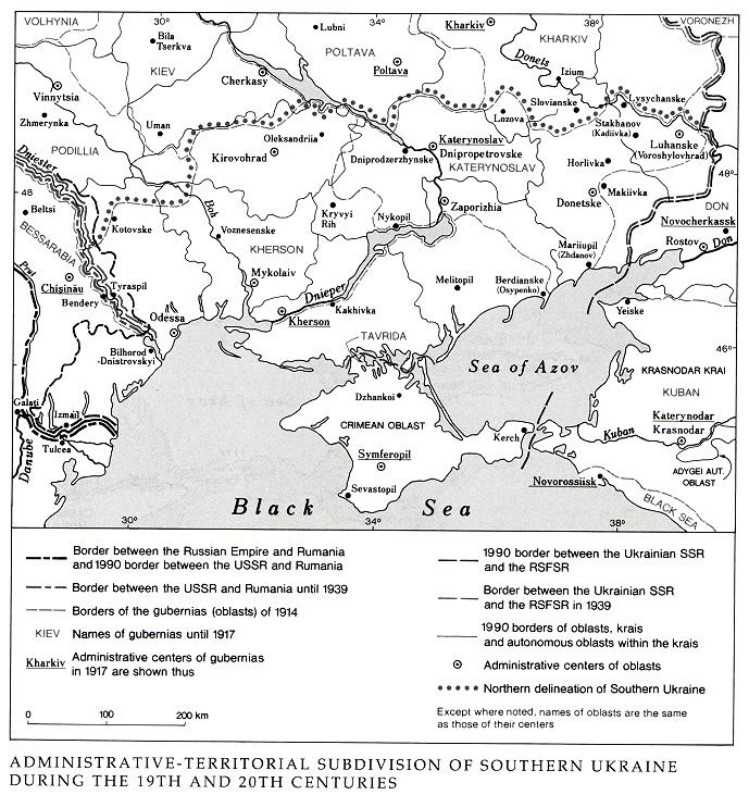
The northern boundaries of Southern Ukraine are not precise. From the geographical standpoint they consist of a transition zone between the steppe and the forest-steppe. From the historical standpoint they correspond to the southern frontiers of the states of Kyivan Rus’, Grand Duchy of Lithuania, and Poland, which together with the Ukrainian farming settlement fluctuated southward deep into the steppe or northward into the forest-steppe. From the end of the 18th century the northern boundary of Southern Ukraine corresponded to the northern limit of the new possessions of the Russian Empire. That limit followed the old frontiers between Poland and Turkey (from the Dnister River to the Boh River), Poland and the Zaporizhia (to the Dnipro River), and Hetman state or Left-Bank Ukraine and the Zaporizhia (along the Dnipro and its left-bank tributary, the Orel River). It was also the northern boundary of the three gubernias that succeeded New Russia: Kherson gubernia, Katerynoslav gubernia, and Tavriia gubernia. The other boundaries of Southern Ukraine included the southern part of Bessarabia in the west and the western part of the Don region in the east, both of which were peopled by Ukrainians.
With the rise of industry in the Donets Basin and the Dnipro Industrial Region from the 1880s, Southern Ukraine underwent economic differentiation. Over time the division became pronounced, and today Southern Ukraine consists of the agricultural steppe (Odesa oblast, Mykolaiv oblast, Kirovohrad oblast, Kherson oblast and the Crimea), the Donets Basin (Donetsk oblast and Luhansk oblast), and the Dnipro Industrial Region (Dnipropetrovsk oblast and Zaporizhia oblast).
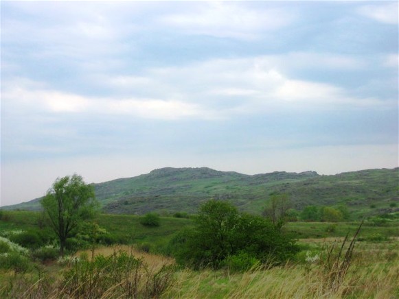
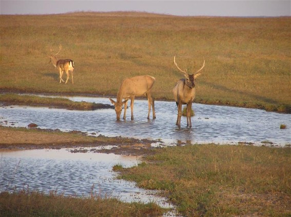
Physical geography. With the exception of southern Crimea, Southern Ukraine presents a monotonous, flat, predominantly low-lying landscape, with its particular steppe climate, vegetation, and fauna. All those characteristics vary over the great distances of Southern Ukraine, particularly on the fringe of the forest-steppe and in the east.
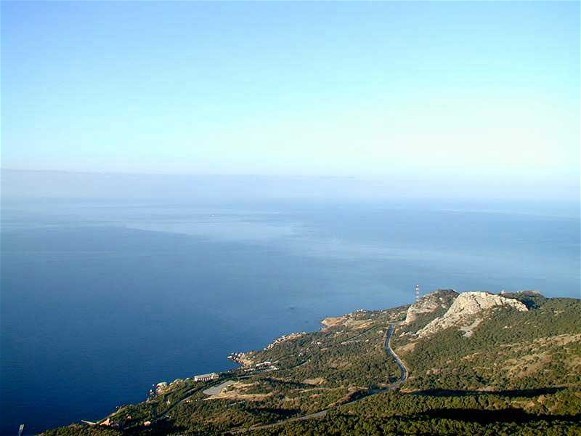
The largest part of Southern Ukraine is occupied by the Black Sea Lowland and its extension: to the south, the Crimean Lowland, and to the east, the narrow Azov Lowland, which widens eastward into the broad Lower-Don Lowland. The northwestern part of Southern Ukraine is occupied by the southern extremities of the undulating Pokutian-Bessarabian Upland between the Danube River and the Dnister River, and the severely dissected Podolian Upland. A considerably larger area is occupied by the southern part of the Dnipro Upland, the Zaporozhian Ridge, and the Azov Upland. The northeastern part of Southern Ukraine is occupied by the extensions of the Dnipro Lowland and the Central Upland, the Donets Lowland, and the highest part of Southern Ukraine, the Donets Ridge (reaching 367 m). The southern part of the Crimea is occupied by the Crimean Mountains.
The climate of Southern Ukraine differs from that of the rest of Ukraine. Influenced to a greater extent by the easterly winds, it is moderately continental and dry. The mean annual temperature ranges from 7°C to 10°C. The coldest winters occur in the northeast (mean January temperature, –7°C); the warmest are recorded in the southwest (–2°C). Absolute minimum temperatures range from –42°C to –28°C. Summer temperatures are nearly the same throughout Southern Ukraine (July means range from 21°C to 23°C). The frost-free period increases from 150 days in the northeast to 210 days in the southwest; the growing period, from 200 to 230 days. The mean annual precipitation is highest along the border with the forest-steppe (475 mm) and lowest over the sea (250–300 mm); from year to year, however, it varies widely (from 200 to 800 mm). Maximum precipitation is obtained in May, June, and July, when downpours prevail. The snow cover is uneven and may last from 30 to 100 days per year. Strong winds often include hurricanes, desiccating winds or sukhovii, and dust storms. Long, warm summers are conducive to the production of heat-loving crops, but frequent droughts and sukhovii cause wide fluctuations in yields.
The river network of Southern Ukraine is not dense, but the region is crossed by several large rivers: the Danube River, the Dnister River, the Boh River, the Inhul River, the Dnipro River and its tributaries (the Inhulets River, the Orel River, the Samara River, and others), and the Don River and its tributary (the Donets River). A number of small rivers flow toward the Black Sea (such as the Kohylnyk, the Velykyi Kuialnyk, the Malyi Kuialnyk, and the Tylihul) and the Sea of Azov (the Salhyr River, the Molochna River, the Obytochna River, the Berda River, the Kalmiius River, the Miius River, and others), most of which empty into coastal lakes or limans. In the summer the small rivers of Southern Ukraine are shallow or dry up completely. Between the Dnipro River and the Molochna River and on much of the Crimean Lowland there are no rivers at all. Along the coast there are many lakes, formed out of former inlets cut off from the sea by bars.
The soils and vegetation of Southern Ukraine reveal a zonal distribution reflecting the availability of moisture.
Southern Ukraine, especially the Donets Basin and the Dnipro Industrial Region, is the richest part of Ukraine for mineral resources. Here one finds almost all the bituminous coal (the Donets Basin, with total proven reserves of coal of 55.6 billion t in 1977) and iron ore (the Kryvyi Rih Iron-ore basin, with proven reserves of 15.9 billion t in 1975) of Ukraine, all the manganese ore (the Nikopol Manganese Basin, with reserves of approximately 2 billion t), most of the common salt (the Bakhmut rock salt deposits), and all the nonferrous metal ores (mercury at Mykytivka Mercury deposit, northwest of Horlivka, in the Donets Basin, bauxite deposits in Dnipropetrovsk oblast, chromite and nickel near Zavallia, on the Boh River). Refractory and flux materials, lignite coals, limestones, marls, gypsum, kaolin, graphite, marble, and all kinds of building materials are abundant.
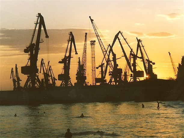
Economy and demography. In the 1860s and 1870s, great changes occurred in the economy and demography of Southern Ukraine in conjunction with the abolition of serfdom (1861), the construction of railroads (1865 to the 1880s), which provided an all-season connection between the interior and the sea, and the beginnings of heavy industry. Large-scale industrial development of Southern Ukraine began at the end of the 1870s in conjunction with the exploitation of the Donets Basin coal (the output of which increased from 1.3 million t in 1880 to 23.5 million t in 1913), Kryvyi Rih iron ore (0.1 million t in 1881, but 6.4 million t in 1913), and Nikopol manganese ore (beginning in 1886 and reaching 276,000 t in 1913) as well as the construction of a dense network of railroads connecting the Donets Basin with seaports and with Kryvyi Rih (the railroad to Katerynoslav was completed in 1884). Industrial development was favored by the convenient geographical location of the coal and iron-ore deposits, not far from one another or from the sea, and stimulated by a rapid influx of foreign capital. Within a short period of time on the territory of Southern Ukraine arose two of the largest centers of heavy industry in Eastern Europe, the Donets Basin (bituminous coal mining, metal smelting, and chemical industries) and the Dnipro Industrial Region (including the cities of Katerynoslav, Oleksandrivsk, Kryvyi Rih, and Nikopol and specializing in the mining of iron and manganese ores, metal smelting, and machine building). Of secondary significance were the industrial cities of Mariupol and Kerch. Meanwhile the seaports, notably Odesa, Mykolaiv, Kherson, and Sevastopol, grew in industrial importance as they became sites of shipbuilding, food processing, machine building (especially for agriculture), and other branches of industry that used imported raw materials. As ports they were important centers of trade and commerce.
The ethnic composition of the population in Southern Ukraine, the most varied in all Ukrainian lands, changed over time. Until 1820 the influx of Ukrainians was by far the strongest. Later the inflow of Jews and, especially after 1880, of Russians markedly increased (see table 1).
Odesa and Katerynoslav emerged as the main cultural centers in Southern Ukraine. Lower on the scale of significance were Yelysavethrad, Kherson, and other towns.
The First World War and especially the Revolution of 1917 brought about an economic decline in Southern Ukraine. Foreign trade came to a standstill, and the port cities declined. During the Ukrainian struggle for independence (1917–20) Southern Ukraine was a battleground for the Army of the Ukrainian National Republic, the Bolsheviks, the French Army, the Volunteer Army led by Anton Denikin and later Petr Wrangel, and the detachments of the anarchist Nestor Makhno, as well as other insurgent forces (see Partisan movement in Ukraine, 1918–22). Ukraine incorporated Kherson gubernia, Katerynoslav gubernia, and Tavriia gubernia, although the Crimean Peninsula became an autonomous republic within the Russian Soviet Federated Socialist Republic. The western part of the former Don Cossack lands also went to Ukraine, but by 1924 Tahanrih and Shakhty counties had been transferred to the RSFSR. In the west, part of Bessarabia was occupied by Romania.
During 1919–20 the heavy industry of Southern Ukraine collapsed. The sown area had declined to one-half its prewar levels by 1921–2, and the grain harvest to one-quarter by 1921, a drought year; the result was famine (see Famine of 1921–3). Livestock declined to two-thirds of its 1916 level.
The national composition of the population changed between 1910 and the 1920s, with an increased number of Ukrainians and a decreased number of Germans, Jews, and Russians. The Ukrainian presence grew most markedly in the agricultural steppe but diminished in the Donets Basin, which continued to register an inmigration of Russians.
The development of Southern Ukraine was interrupted once more by the Second World War. Political borders again underwent change. In 1940 the southern part of Bessarabia was annexed by Ukraine, and until 1954 it formed Izmail oblast (subsequently it became part of Odesa oblast). The western portion of the Moldavian ASSR, settled by Romanians, was ceded by the Ukrainian SSR to the newly formed Moldavian SSR. In 1946 the Crimean ASSR was transformed into an ordinary oblast which, in 1954, was transferred from the RSFSR to the Ukrainian SSR. After frequent changes in the economic regionalization of the USSR, stabilization was achieved in 1962, and Southern Ukraine was defined to include all of the South region (Crimea, Kherson oblast, Mykolaiv oblast, and Odesa oblast) and most of the Donets-Dnipro region (Dnipropetrovsk oblast, Donetsk oblast, Kirovohrad oblast, Luhansk oblast, and Zaporizhia oblast).
The population of Southern Ukraine as just defined reached 23.2 million on 1 January 1990. (At the end of the 18th century it was about 1 million, and in the mid-19th century 2.5 million, but by 1897 it had grown to 6.7 million, by 1926 to 11.4 million, and by 1959 to 17.2 million.) The population growth rate of Southern Ukraine has been considerably higher than that of the rest of Ukraine, and the region's share of Ukraine's population has grown continually: from 23 percent in 1897 (still within the Russian Empire) to 30 percent in 1926, 41 percent in 1959, and 45 percent in 1990. Fully 78 percent of the people in Southern Ukraine live in cities or urban-type settlements, compared to only 22 percent in 1926.
The distribution of the population is not uniform. Population densities are highest in the two industrial regions, around Odesa, and along the southwestern coast of the Crimea (see Crimean southern shore), where dense clusters of cities, urban-type settlements, and suburbs abound. Rural population densities are related to natural conditions (soil fertility and moisture availability) and have not changed much since 1897, except for an increase in northern Crimea, where irrigation has been introduced. The distribution of population as of 1 January 1987 is shown in table 2. The growth of population has also been uneven. Since the 1930s the urban population has increased rapidly, and the rural population has generally declined (see table 3). As in all of Ukraine, the ethnic composition of the urban population differs from that of the rural population. Notably, Ukrainians are largely overrepresented (75.3 percent in 1970) in the rural population category.
The present distribution of population (density of settlement) is shown on the map. The ethnic composition of the population is shown in table 4.
In the 1880s the steppes of Southern Ukraine became completely plowed. Since then land use has not changed significantly. Recent land uses are shown in table 5. Lands held by agricultural enterprises, which account for 85 percent of the entire land area, are mostly devoted to agricultural land uses, as shown in table 6.
The sown area of Southern Ukraine represents 45 percent of the sown area of Ukraine. The structure of the sown area in Southern Ukraine is indicated in table 7. The main grain crops of Southern Ukraine, their significance among all the grains of the region, and their share of the sown areas in Ukraine are illustrated in table 8. The number of livestock (as of 1 January 1976) and the livestock density per 100 ha of agricultural land, with comparisons to the Ukrainian averages, are given in table 9. The annual output of animal products (the mean for 1971–5, inclusive) is given in table 10.
Southern Ukraine may be divided into several agricultural zones: (1) grain-oil seed, with the production of sugar beets and milk-meat animal husbandry, in the northern part of the steppe; (2) grain-oil seed, milk-meat animal husbandry, poultry farming, and fruit and vegetable gardening in the middle zone of the steppe; (3) grain-oil seed, fruit and vegetable gardening, melon growing, vineyard keeping, and milk-meat animal husbandry in the southern and Crimean steppe; (4) vineyard-orchard, tobacco, and vegetable growing, milk-meat animal husbandry, and sheep raising in the foothills of the Crimea and southern Crimea; and (5) milk production and fruit and vegetable growing in suburban areas in the Donets Basin, the Dnipro Industrial Region, and around large cities.
Industry. Possessing the largest supply of conveniently located extractable mineral reserves in Eastern Europe, and having developed both heavy industry and other derivative, more complex branches of industry on the basis of those reserves, Southern Ukraine is the most industrialized part of Ukraine and one of the most highly industrialized regions in what was the Union of Soviet Socialist Republics. In 1968 it produced 185.2 million t of bituminous coal in the Donets Basin (93 percent of the Ukrainian output, 31 percent of the USSR output), 8 million t of lignite (from part of the Dnipro Lignite Coal Basin), 87.8 million t of iron ore (from Kryvyi Rih and Kerch, accounting for all of the republic's production and 55 percent of the USSR's), and 4.8 million t of manganese ore (from the Nikopol Manganese Basin, contributing all of the republic's and 56 percent of the USSR's output). Ferrous metallurgy in the Donets Basin, Mariupol (formerly Zhdanov), and the Dnipro Industrial Region contributed 36.7 million t of pig iron (all of the republic's and 49 percent of the USSR's output), 42.8 million t of steel (all of the republic's and 42 percent of the USSR's output), and 30.6 million t of rolled metal (all of the republic's and 43 percent of the USSR's output). Southern Ukraine also provided all the nonferrous metallurgy of Ukraine (notably aluminum smelting in Zaporizhia), almost all its heavy-machine building (Donets Basin, Dnipro Industrial Region), and almost all the shipbuilding (in the seaports). Agricultural-machine building also was important. The region led Ukraine in the production of chemicals, especially coke-chemicals (100 percent of the country's production), sulfuric acid, caustic soda, mineral fertilizers, paints, synthetic tars, and plastics (all in the Donets Basin, the Dnipro Industrial Region, and Odesa). Southern Ukraine also produced about two-thirds of the electric power in Ukraine. The largest generating stations are found in the Donets Basin (thermal), the Dnipro Industrial Region (hydro as well as thermal), and Odesa (thermal). In addition four nuclear reactor complexes were to be built: near Zaporizhia, on the Boh River (the South-Ukrainian), near Odesa, and in the Crimea (the plans for the Odesa and the Crimea nuclear plants have been canceled). Of considerable significance is the preparation of building materials (Donets Basin, Dnipro Industrial Region, Crimea, Odesa), especially cement. The food-processing and textile industries are also important, particularly in the southwest steppe.
BIBLIOGRAPHY
Lebedintsev, A. Khanskaia Ukraina (Odesa 1913)
Bahalii, D. Zaselennia Pivdennoï Ukraïny (Kharkiv 1920)
Stepova Ukraïna: Ekonomichno-heohrafichni narysy (Kharkiv 1929)
Ohloblyn, O. Narysy z istoriï kapitalizmu na Ukraïni, 1 (Kyiv–Kharkiv 1931)
Polons’ka-Vasylenko, N. The Settlement of the Southern Ukraine (1750–1775) (New York 1955)
Khizhniak, A. Nizhnee Pridneprov’e (Moscow 1956)
Druzhinina, E. Severnoe Prichernomor’e v 1775–1800 gg. (Moscow 1959)
Polons’ka-Vasylenko, N. Zaselennia Pivdennoï Ukraïny v polovyni XVIII st. (1734–1775), 2 vols (Munich 1960)
– Zaporizhzhia XVIII stolittia ta ioho spadshchyna, 2 vols (Munich 1965, 1967)
Druzhinina, E. Iuzhnaia Ukraina v 1800–1825 gg. (Moscow 1970)
Kabuzan, V. Narodonaselenie Bessarabskoi oblasti i levoberezhnykh raionov Pridnestrov’ia (konets XVIII–pervaia polovina XIX v.) (Kishinev 1974)
– Zaselenie Novorossii (Ekaterinoslavskoi i Khersonskoi gubernii) v XVIII–pervoi polovine XIX veka (1719–1858 gg.) (Moscow 1976)
Zelenchuk, V. Naselenie Bessarabii i Podnestrov’ia v XIX v. (Etnicheskie i sotsial’no-demograficheskie protsessy) (Kishinev 1979)
Friesen, L. Rural Revolutions in Southern Ukraine: Peasants, Nobles, and Colonists, 1774-1905 (Cambridge, MA 2008)
Volodymyr Kubijovyč, Yaroslav Pasternak, Mykola Arkas, Mykhailo Zhdan, Nataliia Polonska-Vasylenko, Oleksander Ohloblyn, Ihor Stebelsky
[This article originally appeared in the Encyclopedia of Ukraine, vol. 4 (1993).]
.jpg)
.jpg)
.jpg)
.jpg)
.jpg)
.jpg)
.jpg)
.jpg)
