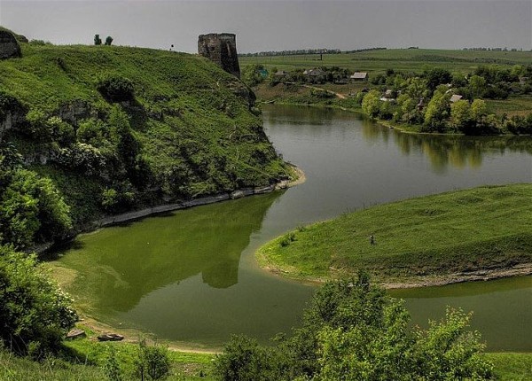
Dnister River
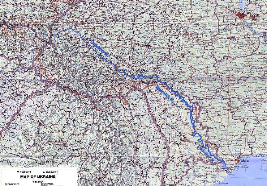
Dnister River (Dniester) [Дністер]. (Map: Dnister River.) The second-largest river in Ukraine. It is 1,360 km long, and its basin covers 72,100 sq km. At one time the Dnister flowed only through Ukrainian territory. But after the ancestors of the Romanians settled the lands east of the Carpathian Mountains (beginning at the end of the 14th century) and after Bessarabia was Romanianized, the Dnister from Mohyliv-Podilskyi to its mouth (about one-third of its length) marked the Ukrainian-Romanian ethnic boundary. Below Rybnica, Romanian ethnic territory even crosses to the left bank of the Dnister. Hence, almost 25 percent of the Dnister Basin lies outside Ukrainian ethnic territories and beyond the borders of Ukraine.
The Dnister is the main river in Galicia. For this reason Galicia is sometimes called Naddnistrianshchyna (Land by the Dnister). The historical and ethnographical significance of the Dnister as the symbol of the Principality of Galicia-Volhynia outlived its economic and political importance. This is the source of the piety towards the river that is found in the romantics of Western Ukraine—Markiian Shashkevych and Yurii Fedkovych. This also explains frequent references to the river in the names of Galician institutions and organizations.
Geographic description. (Map: Dnister River Basin.) The Dnister originates on the slopes of Mount Rozluch in the Middle Beskyd of the Carpathian Mountains, close to the village of Vovche, at an elevation of about 900 m. The river can be divided into an upper part, from the source to Nyzhniv; a middle part, to Tyraspil; and a lower part. The upper Dnister is a rushing mountain stream for about 50 km, running northwest first and then northeast. This section of the river slopes steeply, and the current is swift—4 m/sec and more. It carries a lot of rocks. Near Staryi Sambir the Dnister leaves the mountains and 10 km farther on enters the muddy Dnister Lowland. It runs along the lowland to the mouth of the Svicha River. This section of the Dnister has a gentler slope. Its bed consists of alluvium and divides into branches, forming numerous islands. From the Svicha River the left bank of the Dnister begins to rise. At Nyzhniv both banks come to the water's edge, and the river enters the Podilia Gorge. The longest tributaries are in the upper stretch of the Dnister: the Bystrytsia Tysmenska River (72 km) with the Tysmenytsia River, the Stryi River (230 km) with the Opir River, the Svicha River (107 km) with the Mizunka River and the Sukil River, the Limnytsia River (122 km) with the Chechva River, the Bystrytsia Solotvynska River (82 km), and the Bystrytsia Nadvirnianska River (94 km), all on the right side. The left-side tributaries are the Stryvihor River (93 km), the Vereshchytsia River (92 km), the Shchyrets River, the Zubria River, the Bibrka River, the Svir River, and the Hnyla Lypa River (80 km).
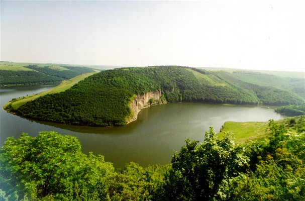
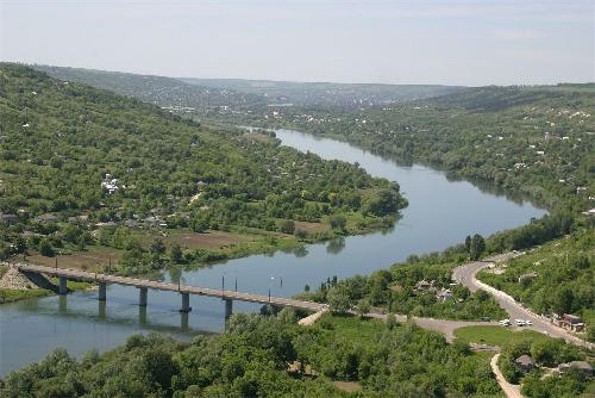
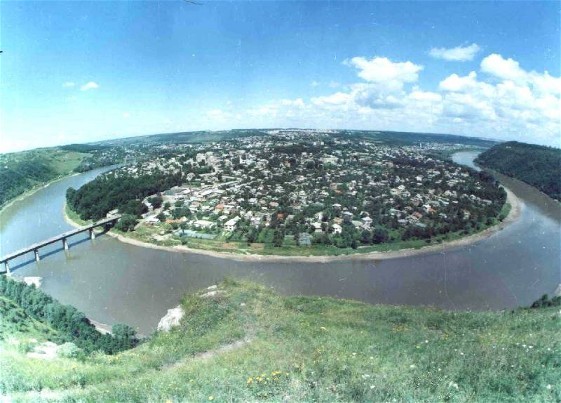
The riverbed of the middle Dnister is deep, narrow, and winding. (Map: Dnister River near Khotyn.) Its average width is 160–200 m, the minimum being 60 m and the maximum 400 m. The slope of the river and the current velocity are uneven. They are greatest near Yampil (Vinnytsia oblast), where the Dnister penetrates the Ukrainian Crystalline Shield and forms rapids. The average slope from the mouth of the Zbruch River to the town of Mohyliv-Podilskyi is 30 cm/km, and the current velocity does not exceed 1 m/sec. From Mohyliv-Podilskyi to Dubosari the Dnister is almost without Bessarabian tributaries on the right side (there are only the Reut River, the Ikel River, the Byk River, and the Botna River). Left-bank tributaries, like the Dnister itself, flow through gorges; they include the Zolota Lypa River (140 km), the Koropets River, the Strypa River (170 km), the Dzhuryn River, the Seret River (250 km), the Zbruch River (245 km), the Smotrych River (169 km), the Ushytsia River (112 km), the Kalius River, the Liadova River, the Murafa River (162 km), the Rusava River, the Yahorlyk River (173 km), and the Kuchurhan River (123 km). Thus, the Dnister Basin is asymmetrical. Below the town of Dubosari the Dnister Valley widens to 8 km and below Tyraspil to 16 km as it enters the Black Sea Lowland. Twenty kilometers below Tyraspil lies a broad stretch (up to 20 km) of marshland covered with cattail and brush. The breadth of the riverbed here is 100–240 m; it becomes narrower at the mouth. The Dnister flows into the Dnister Estuary, which is separated from the sea by a spit with two gaps. The slope of the lower river hardly reaches 4 cm/km and is only 2 cm/km at the mouth. The current velocity is minimal.
The water level of the Dnister varies considerably. In spring the melting snows cause it to rise. Summer downpours in the upper and middle parts of the river basin have the strongest effects in the upper stretch. Summer floods are often catastrophic. The lowest and most stable water level occurs in the fall and winter. The greatest variation in the water level is observed in the middle stretch of the river, which lies in gorges (up to 10 m deep). The average discharge at the mouth of the Dnister is 360 cu m/sec, or 11 cu km/yr. The discharge is greatest in the spring. Only 15–20 percent of the discharge occurs in winter. The Dnister is usually frozen over from the end of January to mid-March.
Water route. The Dnister was called the Tyras River by the ancient Greeks, who built Tyras at its mouth. The Dnister then formed part of the main route from the Baltic to the Black Sea (along the Oder River, the Vistula River, the Sian River, and the Dnister River). The lands beyond the middle Dnister were among the earliest settled parts of Ukraine. Greek and then Roman (after Dacia's annexation) commercial, cultural, and even political influence penetrated through the Dnister deep into Ukrainian territory. During the period of migrations these influences ceased, and for a long time the Dnister lost its importance.
When the Dnister Basin was settled by Ukrainian tribes and became part of Kyivan Rus’, the Dnister became the second subordinate economic and political axis after the Dnipro River. It was the axis of the Principality of Galicia-Volhynia, which expanded south along the Dnister River and the Prut River and which encompassed Ponyzia on the middle Dnister. Halych, the capital of the principality, was located on the Dnister, as were towns such as Onut, Vasyliv (Bukovyna), Ushytsia, and Bakota. After the Tatar invasions in the 13th century the Dnister route declined in importance, and the Buh River became the economic axis of the Principality of Galicia-Volhynia. The Dnister acquired a new importance when the Tatars were forced out of Ponyzia by Lithuanian and Rus’ princes in the mid-14th century. Galicia was already under the control of Poland at the time. The right bank of the middle and lower Dnister was annexed by the new state of Moldavia at the end of the 14th century. A number of towns along the Dnister gained importance: Bilhorod-Dnistrovskyi was built at the mouth, Genoese trade centers were established above Bendery. Besides the Dnister route, the land route of Lviv–Suceava–Iaşi–Bendery–Khadzhybei (Odesa today)–Ochakiv was of major importance. When Moldavia fell under Turkish rule (beginning of the 16th century), the Dnister route lost its importance. For three centuries the river served as a border between Poland and Turkey from Krystynopil to Yahorlyk. The towns on its right bank—Akkerman (Bilhorod-Dnistrovskyi), Bendery, Soroky, Khotyn—became Turkish fortresses.
After the partitioning of Poland and the annexation of Bessarabia by Russia (1812), the basin of the upper Dnister became part of Austria, and the rest of its basin belonged to Russia. Because water routes were becoming less important, owing to unfavorable conditions (in the case of the Dnister: water scarcity, numerous windings, gorges, rapids), and because the Dnister Basin was divided between two states that did not seriously plan to regulate the river, the Dnister never regained its importance as a trade route. Shipping on the Russian stretch of the Dnister began in 1843, but basic work on the waterway was done only in 1884–94. After this the Dnister became accessible to steamboats; yet it continued to be of minor commercial importance. Until 1917 steamboats traveled down to the sea from Mohyliv-Podilskyi, although the river is navigable by steamboat from Halych (for 800 km). Logging was more important than shipping on the Dnister. In general, shipping on the Dnister did not reach even 5 percent of that on the Dnipro River.
During the Ukrainian Struggle for Independence (1917–20) the Dnister became the border between Ukraine and Romania, although the Ukrainian government did not recognize Romania's occupation of Bessarabia. In June 1919 the Dnister covered the left flank of the advancing Ukrainian Galician Army after the breakthrough at Chortkiv (see Chortkiv offensive). Between the world wars the Dnister served as the Soviet-Romanian boundary, and shipping on it ceased.
Today shipping on the Dnister is underused. The river's hydroenergy is unused except for the Dubosari Hydroelectric Station, built in 1954–5, in Moldavia. Today steamships navigate the river up to Soroky. The bulk of the shipping consists of building materials and lumber. The main ports are Mohyliv-Podilskyi, Soroky, Bendery, and Tyraspil. The Dnister could easily be connected by canals with the Sian River and the Vistula River (such projects were proposed under Austrian rule), which would increase its importance. The Dnister is used as a source of water for consumption and irrigation. Its fish resources are small; only perch, carp, bream, whitefish, sturgeon, and pike are of commercial value.
BIBLIOGRAPHY
Lokhtin, V. Reka Dnestr, ee sudokhodstvo, svoistva i uluchshenie (Odesa 1886)
Puzyrevskii, N. Dnestr, ego opisanie i predpolozhenie o ego uluchshenii (Saint Petersburg 1902)
Shtykh, V.; Pilat, I. Po Dnestru. Putevoditel' (Uzhhorod 1969)
Volodymyr Kubijovyč, Ivan Teslia
[This article originally appeared in the Encyclopedia of Ukraine, vol. 1 (1984).]
