IEU'S FEATURED TOPICS CONCERNING THE LAND AND REGIONS OF UKRAINE
I. Kyiv, the Capital of Ukraine, and the Kyiv Region
II. The Landscapes and People of the Ukrainian Carpathian Mountains
III. Natural Treasures of the Ukrainian Carpathian Mountains
IV. The Cherkasy Region: The Heartland of Ukraine
V. The Ancient City of Chernihiv and the Chernihiv Region
VI. The City of Chernivtsi and the Northern Bukovyna Region
VII. The Crimea (1): The Southernmost Region of Ukraine
VIII. The Crimea (2): Crimean Mountains and Crimean Southern Shore
IX. The Dnipro, the Dnister, and Other Rivers of Ukraine
X. The Dnipro Industrial Region
XI. The Fauna of Ukraine and Wildlife Preservation
XII. The Flora of Ukraine: Forests, Forest-Steppe, and Steppes
XIII. The City of Lviv and the Historic Region of Galicia
XIV. Ivano-Frankivsk and the Central Subcarpathia and Pokutia Regions
XV. The City of Kharkiv and the Historic Slobidska Ukraine
XVI. Vinnytsia, Khmelnytskyi, and the Land of Middle and Eastern Podilia
XVII. The Ternopil Region and Western Podilia
XVIII. The Quintessentially Ukrainian Poltava Region
XIX. Southcentral Ukraine (1): The City of Kropyvnytskyi and Its Region
XX. Southcentral Ukraine (2): The City of Dnipro and Its Region
XXI. Southeastern Ukraine (1): Donetsk Oblast
XXII. Southeastern Ukraine (2): Luhansk Oblast
XXIII. Southern Ukraine (1), Western Part: The Odesa Region
XXIV. Southern Ukraine (2), Central Part: The Kherson and Mykolaiv Regions
XXV. Southern Ukraine (3), Eastern Part: The Zaporizhia Region
XXVI. Ukraine's Southern Boundary: The Black Sea and the Sea of Azov
XXVII. The Sumy Region and its Rich Historical Heritage
XXVIII. The Picturesque Transcarpathia: The Westernmost Region of Ukraine
XXIX. The Historical Region of Volhynia in Northwestern Ukraine
XXX. The Zhytomyr Region and Central Polisia
XXXI. Castles and Palaces of Ukraine
XXXII. National Parks and Nature Preserves in Ukraine
 I. KYIV, THE CAPITAL OF UKRAINE, AND THE KYIV REGION
With the founding of Kyivan Rus' in the second half of the 9th century, Kyiv became its capital and the heart of this first state to arise among the Eastern Slavs. From the 9th to the 14th centuries today's Kyiv region constituted parts of two major principalities of Kyivan Rus': Kyiv principality and Pereiaslav principality. At that time, Kyiv was the religious center of Eastern Europe. A metropolitan's see, it had numerous churches and monasteries (the most famous being the Kyivan Cave Monastery). It was also a center of learning, writing, book transcribing, and painting. The first Rus' chronicles were written there. The Saint Sophia Cathedral housed the prince's library--the first library in Ukraine. However, the richness and fame of Kyiv attracted many plunderers, and the city sustained numerous attacks and ruin as a result of foreign invasions and the internecine struggle between Rus' princes. In 1240, Kyiv was sacked by the Mongol-Tatar army of Batu Khan, which decimated its population. In 1362-3 Grand Duke Algirdas of Lithuania annexed the Kyiv land to the Grand Duchy of Lithuania as an appanage principality. In 1497 the entire city received the rights of Magdeburg law. In 1569, in keeping with the provisions of the Union of Lublin, Kyiv and Kyiv voivodeship came under Polish rule and cultural influence as part of the Polish-Lithuanian Commonwealth. During Cossack period, in the early 17th century, Kyiv underwent a renaissance, becoming the political, religious, and cultural center of Ukraine. The Cossack hetman Petro Konashevych-Sahaidachny (ca 1610-22) resided there and belonged to the Kyiv Epiphany Brotherhood. In 1620 Patriarch Theophanes III of Jerusalem restored the Ukrainian Orthodox church hierarchy and Kyiv metropoly. The school founded by Metropolitan Petro Mohyla at the Kyivan Cave Monastery was amalgamated with the brotherhood school in 1633 to form the famous Kyivan Mohyla College (renamed the Kyivan Mohyla Academy in 1701). During the Cossack-Polish War, Hetman Bohdan Khmelnytsky and his army triumphantly entered Kyiv in December 1648. His army cleared the city of Polish forces, and Kyiv became the capital of Kyiv regiment. However, after the Pereiaslav Treaty of 1654, a Muscovite fortress was built in the upper city. In the 1830s and 1840s, after the suppression of the Polish Insurrection of 1830-1, intensive government-directed Russification of the city occurred. In 1835 Kyiv's rights of Magdeburg law was officially rescinded. Despite Russification and repression, a Ukrainian national movement arose in Kyiv. The secret Society of United Slavs (1823-5) and the Cyril and Methodius Brotherhood (1845-7) were based there. The Ukrainophile student society, which later became the famous Hromada of Kyiv in 1859, had among its members many figures who came to play leading roles in the development of modern Ukrainian life... Learn more about Kyiv, the capital of Ukraine, and the Kyiv region by visiting the following entries:
_s.jpg)
|
KYIV. The historic and current political, religious, scientific, and cultural capital of Ukraine. It is also the largest city (2017 pop 2,931,347) in Ukraine (with a metropolitan area of 847.66 sq km), one of the largest industrial centers, financial center, and an important transport and communications hub. According to the Rus' Primary Chronicle, the founders of Kyiv were the brothers Kyi, Shchek, and Khoryv, leaders of the Slavic tribe of Polianians, and the city was named after the eldest, Kyi. According to Soviet historiography, Kyiv was founded in the latter half of the 5th, or the early 6th century, and in 1982 its 1,500th anniversary was officially celebrated. For centuries, the upper city (the Starokyivska Hora) was primarily the administrative, military, and cultural center, while the more populous lower city (Podil) was mainly the commercial and manufacturing district, with many shops, merchants' quarters, and foreign enclaves. In the late 18th century, Kyiv still consisted of three separate, fortified, and built-up settlements: Podil, which had its own town council; the fortified upper (old) city, where the metropolitan resided; and Pechersk, around the Kyivan Cave Monastery and the Kyivan Cave Fortress, where the Russian military and civil authorities were based from 1711. Today the city is divided into 14 city raions (administrative districts) and extends along both banks of the Dnipro River... |
| Kyiv |
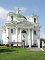
|
BILA TSERKVA. City (2017 pop 208,192); a raion center in Kyiv oblast, situated on the Ros River, 87 kilometers south of Kyiv. It was built on the site of Yuriiev, a fortified town founded by Yaroslav the Wise in 1032 that served as part of the southern line of fortifications defending Kyivan Rus' from the attacks of nomadic tribes. The town endured numerous attacks by Cumans and other nomads and was devastated during the Mongol invasion in the mid 13th century. Its reconstruction began only after Rus' warriors led by Prince Yurii Slutsky defeated the Mongols on the Rotok River in 1311. The town was renamed Bila Tserkva after the remains of a white stone church built in Yuriiev in 1050 by Yarsolav the Wise. In the 1360s Bila Tserkva, together with the Kyiv region, came under Lithuanian rule. In the 1550s a fortified castle was built there. Under Lithuanian and subsequently Polish rule, Bila Tserkva was an important county center and was considered to be a crucial defense post against the Tatars. In 1589 the town was granted Magdeburg law. During the Cossack-Polish War of 1648-54, Bila Tserkva became the seat of a Cossack regiment. In 1651 Bohdan Khmelnytsky signed the Treaty of Bila Tserkva with the Poles at his camp near the town. In 1702 Bila Tserkva was the center of an anti-Polish uprising led by Semen Palii, and later in the 18th century the town was actively involved in the haidamaka uprisings, including the Koliivshchyna rebellion...
|
| Bila Tserkva |
_s.jpg)
|
PEREIASLAV. A city (2017 pop 27,548) on the Trubizh River and a raion center in Kyiv oblast. In the Princely era it was known as Pereiaslavl, and then as Pereiaslav until 1943 when it was renamed Pereiaslav-Khmelnytskyi. In 2017 the city's name was changed back to Pereiaslav. It is one of the oldest cities of Ukraine: it is first mentioned in 907, in a treaty between Prince Oleh and Byzantium, where it is ranked third in importance after Kyiv and Chernihiv. Pereiaslav was a strategically important fortress that defended Kyivan Rus' against the steppe nomads. According to the chronicles, Volodymyr the Great built up its fortifications in 992, after his victory over the Pechenegs. From the mid-11th to the early 13th century it was the center of Pereiaslav principality and the seat of Pereiaslav eparchy. A number of monumental buildings were erected in the period, but in 1239 Pereiaslav was destroyed by the Tatars, and none of the medieval architecture survived. Pereiaslav began to revive only in the mid-16th century, as a Cossack center in Kyiv voivodeship. In 1648 the town became a regimental center in the Cossack Hetman state established by Hetman Bohdan Khmelnytsky. It was the site of the negotiations culminating in the Pereiaslav Treaty with Muscovy of 1654. Today Pereiaslav is a museum town, with little industry, but with 17 museums and many architectural monuments... |
| Pereiaslav |
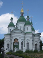
|
VASYLKIV. A city (2017 pop 37,841) on the Stuhna River and a raion center in Kyiv oblast. According to the chronicles it was founded in 988 by Volodymyr the Great--who, it is believed, was christened there--and was named Vasyliv after his new Christian name. In the 11th century a fort was built there, and the town became an important defense and trade center. In 1240 it was destroyed by the Mongols, and declined to village size. In 1648, during the Cossack-Polish War, Vasylkiv became a company center of Kyiv regiment. In 1796 it was promoted to city status and made a county center of Kyiv gubernia. In 1825 the local units of the Cherkasy regiment took part in the anti-tsarist Decembrist movement. By the mid-19th century the town was an active manufacturing and trading center with a population of 11,000. Today it is an industrial city with a refrigerator plant, an electric-appliance factory, and a leather factory. Its architectural monuments include the baroque Saints Anthony and Theodosius Church and bell tower (1756–9) and Saint Nicholas's Church (1792)... |
| Vasylkiv |
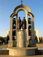
|
VYSHHOROD. A city (2016 pop 27,825) on the Dnipro River and a raion center in Kyiv oblast. It was first mentioned in the chronicles under the year 946, as the residence of Princess Olha. In 1019 the bodies of Saints Borys and Hlib were ceremoniously buried in the local Saint Basil's Church. During the time of Kyivan Rus', Vyshhorod was a strategic fortress that defended the northern approach to Kyiv. It repelled Cuman attacks in 1093, 1136, and 1146. In 1240 it was destroyed by the Mongols. In the 15th and 16th centuries Vyshhorod was merely a village owned by the Mezhyhiria Transfiguration Monastery. In 1934-37 and 1947 archeologists uncovered the remains of houses and smithing, bronzing, and pottery implements. In 1968 Vyshhorod was promoted to city status. It is the site of the Kyiv Hydroelectric Station and of the first accumulation power station built in the USSR. In 1994 the Vyshhorod State Historical and Cultural Preserve was established which includes the remnants of the fortifications from the Princely era, the Vyshhorod Historical Museum, and other institutions... |
| Vyshhorod |
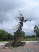
|
CHORNOBYL. City (2015 pop 550) in Ivankiv raion center, Kyiv oblast; former port on the Prypiat River in Kyivan Polisia. Chornobyl was first mentioned in the chronicles in 1193 as a town in Kyiv principality. Before the Revolution of 1917 Chornobyl was an autonomous (zashtatne) town in Radomyshl county with a population employed in agriculture and small trades. For some time it was an important centre of Hasidism. The city has experienced periods of decline: in 1897 it had 9,300 inhabitants, while in 1926 it had 9,000. The main industry was food processing, but the city also had a pig-iron foundry and a ship-repair base. Since 1977 the Chornobyl Nuclear Power Station has been located in the vicinity of the city. In 1986 the city population was 12,500 and Chornobyl was a raion center in Kyiv oblast. However, following the Chornobyl nuclear disaster on 26 April 1986, the majority of the city's residents were evacuated and Chornobyl turned into a ghost town... |
| Chornobyl |
The preparation, editing, and display of the IEU entries about Kyiv, the capital of Ukraine, and the Kyiv region were made possible by the financial support of the IVAN AND ZENOVIA BOYKO ENDOWMENT FUND at the CANADIAN INSTITUTE OF UKRAINIAN STUDIES (Edmonton, AB, Canada).
 II. THE LANDSCAPES AND PEOPLE OF THE UKRAINIAN CARPATHIAN MOUNTAINS
The Ukrainian Carpathians are mountains of medium height with rock of low resistance. Gentle and broad ridges and parallel valleys contrast with the deeply incised (up to 1,000 m) transverse valleys with steep slopes. Only the highest parts of the Carpathians--mainly the Hutsul Alps and Chornohora--display a high-mountain landscape. The Ukrainian Carpathian Mountains are known for its beautiful landscapes and unique flora and fauna. Because of the abundance of mineral springs, a healthy climate, and natural beauty, they are the main resort and recreation area in Ukraine after the Crimea. At the same time, they represent an ethnographic region rich in history and cultural heritage and include such subregions as the Hutsul region, Boiko region, Lemko region, as well as parts of Bukovyna and Transcarpathia. Learn more about this natural jewel of Ukraine by visiting the following entries:
|
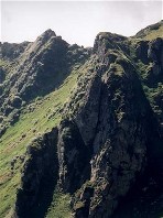
CARPATHIAN MOUNTAINS. Folded, young mountains of medium elevation, stretching in an arc about 1,500 km long (with a chord of almost 500 km) from the city of Bratislava in the northwest to the Iron Gate on the Danube River in the southeast and covering an area of 200,000 sq km. The Carpathians are part of the Alpine mountain system and border on the old Czech, Polish, and Ukrainian massifs and Dobrudja, being separated from them by a band of depressions--along the Morava and Vistula rivers, the Sian and Dniester lowlands, the Subcarpathian Depression, and the Wallachian Depression. The Pannonian Basin, which cuts north into the mountains along the Tysa and Bodrog rivers and their tributaries, occupies the central part of the arc. Despite a certain generally perceived uniformity of landscape, the Ukrainian Carpathians can be divided into a number of regions, based on different geological structure and altitude. These tend to form longitudinal belts stretching from the northwest to the southeast as is typical of all the Carpathians... |
| Carpathian Mountains |
_s.jpg)
|
BUKOVYNA. The territory between the middle Dniester River and the main range of the Carpathian Mountains, around the source of the Prut River and the upper Seret River, the border area between Ukraine and Romania. Today Bukovyna is divided between Ukraine (incorporating Chernivtsi oblast or most of northern Bukovyna) and Romania (containing most of the Suceava region or southern Bukovyna). The name of this territory is derived from its great beech (buk) forests and dates back to the 14th century when it designated the lands on the Moldavian-Polish border. From a historical perspective, Bukovyna is a strategically important border area between Galicia and Moldavia. The region's transitional location influenced its history; it belonged to the Principality of Galicia-Volhynia, then to Moldavia. Polish and Hungarian influences intersected here in the 14th and 15th centuries. In 1919-40 and 1941-4 all of Bukovyna belonged to Romania. It was only in 1940 that Bukovyna was divided, along ethnic lines, between Ukraine and Romania... |
| Bukovyna |
_s.jpg)
|
HUTSUL REGION (Hutsulshchyna). A region in the southeasternmost part of the Carpathian Mountains of Galicia, Bukovyna, and Transcarpathia (the basins of the upper Prut, upper Suceava, upper Bystrytsia Nadvirnianska, and upper Tysa valleys), inhabited by Ukrainian highlanders called Hutsuls. Except for eight settlements in Romania, the Hutsul region lies within the present-day borders of the Ukraine. In the southeast the Hutsul region borders on ethnic Romanian lands; in the west, on the region of the Boikos; in the north, on the region of the Subcarpathian Pidhiriany; and in the southwest, on long-cultivated Transcarpathian Ukrainian lands. The region is located in the most elevated and picturesque part of the Ukrainian Carpathians. The gently sloping mountains are densely populated, and the land there is cultivated to a considerable height owing to the moderating climatic influence of the Black Sea and the massiveness of the ranges, which make summers in the region warmer than in other parts of the Carpathians... |
| Hutsul region |
|
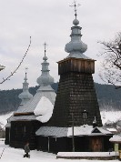
LEMKO REGION (Lemkivshchyna). The territory traditionally inhabited by the Lemkos forms an ethnographic peninsula 140 km long and 25-50 km wide within Polish and Slovak territory. After the deportation of Lemkos from the northern part in 1946, only the southern part, southwest of the Carpathian Mountains, known as the Pre?ov region in Slovakia, has remained inhabited by Lemkos. The Lemko region occupies the lowest part of the Ukrainian Carpathian Mountains-most of the Low Beskyd, the western part of the Middle Beskyd, and the eastern fringe of the Western Beskyd. The landscape is typical of medium-height-mountain terrain, with ridges reaching 1,000 m and sometimes 1,300 m. Only small parts of southern Low Beskyd and the northern Sian region have a low-mountain landscape. A series of mountain passes along the Torysa River and Poprad River facilitate communications between Galician and Transcarpathian Lemkos... |
| Lemko region |
The preparation, editing, and display of the IEU entries dedicated to the Carpathian Mountains region were made possible by a generous donation from TEOFIL SUDOMLAK of Renown Park, S.A., Australia.
 III. NATURAL TREASURES OF THE UKRAINIAN CARPATHIAN MOUNTAINS
The Ukrainian Carpathian Mountains constitute one of the most important and unique ecoregions in Europe. The World Wildlife Fund (WWF) recognized the Carpathians as a natural treasure of global importance and included it in its "Global 200" list of the most significant ecosystems on our planet. The rich and unique flora and fauna of the region is being preserved within a network of national parks and nature preserves established with the specific aim of protecting the biological and landscape diversity of the Ukrainian Carpathians. Because two-thirds of Ukraine?s territory lies within the steppe and forest-steppe zones, characterized by lowland landscapes and steppe flora and fauna, the Carpathian Mountains have a particular significance for Ukraine and are considered part of the national heritage. While protected areas occupy about 4 percent of Ukraine?s entire territory, in the Ukrainian Carpathians they occupy 8 percent, and in Transcarpathia oblast over 13 percent. Learn more about the natural treasures of the Ukrainian Carpathian Mountains by visiting the following entries:
|
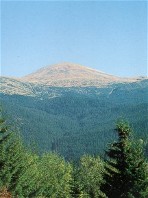
CARPATHIAN PROTECTED AREAS. The first Carpathian protected areas were established in the early 20th century. Several forest reserves were set up in Transcarpathia: the Stuzhytsia beech-forest reserve (est 1908), the Tykhyi fir-forest reserve (est 1908), and the Pip Ivan spruce-forest reserve (est 1912). In 1913, in accordance with Metropolitan Andrei Sheptytsky?s decree, the Kniazh-Dvir yew-forest reserve was established on the territory of today?s Ivano-Frankivsk oblast. The current network of Carpathian protected areas consists of several types of parks and reserves: the Carpathian Biosphere Reserve; the Gorgany Nature Reserve; the Carpathian National Park, Synevyr National Nature Park, Uzhanskyi National Nature Park, Vyzhnytsia National Park, Skole Beskyd National Park, and Hutsulshchyna National Park; and the Sian Regional Landscape Park, Zacharovanyi Krai Landscape Park. The largest and most interesting among them from the nature-conservation point of view is the Carpathian Biosphere Reserve... |
| Carpathian Protected Areas |

|
CARPATHIAN BIOSPHERE RESERVE. One of the Carpathian protected areas established in 1992 with the aim of preserving the unique mountain landscapes, fauna, and flora of the Ukrainian Carpathian Mountains. The Carpathian Biosphere Reserve covers 53,630 ha and consists of six detached complexes: the Chornohora, Svydivets, Maramures, Kuzii, Uhlia-Shyrokyi Luh, and the Narcissus Valley complexes; as well as two partial reserves: Chorna Hora and Yulivska Hora. Since 1992 the reserve has been a part of the UNESCO World Network of Biosphere Reserves. In 1998, the Carpathian Biosphere Reserve become the first Ukrainian protected area to be awarded a European Diploma by the Council of Europe. More than 1,000 species of vascular plants, 64 species of mammals, 173 species of birds, 9 species of reptiles, 13 species of amphibians, 23 species of fish, and more than 10,000 species of invertebrates are protected in the reserve. Among them there are 64 plant and 72 animal species included in the IUNC Red List of endangered species... |
| Carpathian Biosphere Reserve |

|
GORGANY NATURE RESERVE. A nature reserve established in 1996 in the Gorgany Mountains on the territory of Ivano-Frankivsk oblast with the aim of protecting the unique local mountain landscapes, flora, and fauna. The reserve, covering the total area of 5,344 ha, is located in the central part of the Ukrainian Carpathians and its highest peak is Mount Dovbushanka (1,755 m). The distinguishing features of the local landscape are steep stony slopes and numerous inaccessible mountain peaks. Over eighty percent of the reserve?s territory is covered with mixed forests, such as beech-fir-spruce, fir-spruce, and relict pine-spruce forests. Rare Swiss stone pine forest stands are located at altitudes of 1,000-1,400 m. A vast zone of mountain-pine krummholz growth is located above the forest belt. The reserve?s flora and fauna features a number of rare and endemic species, including twenty plant and twenty two animal species listed in Ukraine?s Red Data Book of endangered species and three animals listed in the IUCN Red Data Book... |
| Gorgany Nature Reserve |
|
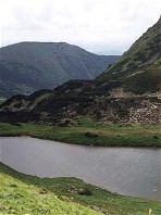
CARPATHIAN NATIONAL PARK. Ukraine?s first national park, established in 1980 on an area of 50,303 ha with the aim of preserving the ecosystem as well as historical, architectural, and ethnographical monuments in the Chornohora and Gorgany Mountains. The park stretches along the eastern slopes of the Ukrainian Carpathian Mountains at altitudes ranging from 500 to 2,061 m and is located in Ivano-Frankivsk oblast. It borders on the Carpathian Bioshepre Reserve with which it shares Ukraine?s highest peak, Hoverlia (2,061 m). Chornohora?s largest lakes--Nesamovyte and Maricheika--as well as numerous glacial peat bogs are located on the park?s territory in the upper reaches of the Prut River and Chornyi Cheremosh River. One of the distinctive features of the Carpathian National Park are relict patches of Scots pine, Swiss stone pine, and European white birch--the largest in the Ukrainian Carpathians. More than 1,100 vascular plant species, 35 of which are endemic to the region, have been registered in the park... |
| Carpathian National Park |
|
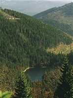
SYNEVYR NATIONAL NATURE PARK. The third national park to be created in Ukraine, after the Carpathian National Park and the Shatsk National Park. Established in 1989, the park covers 40,400 ha in the central part of the Ukrainian Carpathians, in the upper reaches of the Tereblia and the Rika rivers in Transcarpathia oblast. The park is located in the Gorgany Mountains. The highest peak on the park?s territory is Mt. Nehrovets (1,712 m). The park?s unique feature is the Synevyr Lake, the largest lake in the Ukrainian Carpathians, that has recently been added to the list of Ramsar wetlands of international importance. A widely popular site associated with many local legends, the lake is one of the best-recognized symbols of the Ukrainian Carpathians. The park also has sources of mineral water, and valued historical and cultural structures, particularly wooden churches. The Synevyr National Nature Park houses eastern Europe?s only wood-rafting museum built on the Ozerianka River... |
| Synevyr National Nature Park |

|
UZHANSKYI NATIONAL NATURE PARK. A national park in the Carpathians established in 1999 in Transcarpathia oblast and extending over the total area of 39,159 ha. The park is located in the upper reaches of the Uzh River and its tributaries in the Low Beskyd, along the Ukrainian border with Slovakia and Poland, and on the western slopes of the Polonynian Beskyd. It's highest peak is Velyka Ravka (1,304 m). The Uzhanskyi National Nature Park was created on the basis of the Stuzhytsia Regional Landscape Park and other nature preserves some of which had existed in this area since the early 20th century. For example, the Stuzhytsia and Tykhyi nature preserves, established in 1908 as the first protected areas in the Ukrainian Carpathians, served to protect the unique local beech and fir forests. Today the Uzhanskyi Park constitutes an integral part of the Eastern Carpathians Biosphere Reserve which was designated in 1998 as a first trilateral biosphere reserve in the world, uniting the Polish-Slovak reserve with the Ukrainian one... |
| Uzhanskyi National Nature Park |
The preparation, editing, and display of the IEU entries featuring the natural wonders of the Ukrainian Carpathians were made possible by the financial support of the CANADIAN FOUNDATION FOR UKRAINIAN STUDIES.
 IV. THE CHERKASY REGION: THE HEARTLAND OF UKRAINE
Located at the very centre of Ukraine, the Cherkasy region has a particularly ancient and rich history. Archeological excavations have shown that more than 40 thousand years ago primitive inhabitants of the region used flint and bones of gigantic animals (mammoths, fleecy rhinoceroses, and bisons) as tools for land-tilling and bunting. More than six thousand years ago, very large Trypilian culture settlements (the largest of them was home to 15-20 thousand inhabitants) were established in the western part of the region. Scythians, Sarmatians, and later Antes and Polianians inhabited these fertile lands along the Dnipro River during the subsequent centuries. During the times of Kievan Rus', the region played the role of an important military forepost against the steppe nomads and it controlled a vital part of the Varangian trade route to Constantinople. The Cherkasy region gained paricular importance during the Cossack era. In the 16th cetury such Cherkasy starostas as Ostafii Dashkevych and Prince Dmytro Vyshnevetsky established the Cossack military force in the region to fend off Tatar incursions. During the Cossack Polish War of 1648-1657 the Cherkasy region was one of the most vital Cossack strongholds and Hetman Bohdan Khmelnytsky's capital of the Cossack Hetman state was located there in the town of Chyhyryn. The region is also famous as a birthplace of Ukraine's national poet Taras Shevchenko, who was buried at the city of Kaniv... Learn more about the city of Cherkasy and the Cherkasy region by visiting the following entries:
|
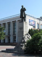
CHERKASY. A city (2011 pop 287,583) on the right bank of the Kremenchuk Reservoir, the capital of Cherkasy oblast, and a river port on the Dnipro River. Founded, most probably, in the 13th century, Cherkasy was first mentioned in documents in 1394 as a fortified city in the appanage Kyiv principality of the Lithuanian-Ruthenian state. From the end of the 15th century Cherkasy was an important defense outpost against surprise attacks by the Tatars. In the early 16th century Cherkasy was the center of the Cherkasy starostvo. Among its administrators were Ostafii Dashkevych and Prince Dmytro Vyshnevetsky who organized Cossack forces to defend the frontier region against Tatar incursions. After the Union of Lublin in 1569 Cherkasy became part of Poland. Most of its population was Cossack, and the city played an important role in the Cossack insurrections against Poland. From 1648 Cherkasy was one of the principal cities in the Hetman state of Hetman Bohdan Khmelnytsky; it was a regimental city and the seat of the Cherkasy regiment until 1686... |
| Cherkasy |
|
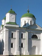
KANIV. City (2011 pop 25,748) and raion center in Cherkasy oblast, situated on the right bank of the Dnipro River. One of the most important cities in Kyivan Rus', it was mentioned in the Kyivan Cave Patericon as existing in the last half of the 11th century. Kaniv arose on the site of, or near, the fortified city of Roden. From the middle of the 12th century it was an important trade center on the Varangian route along the Dnipro to Constantinople and a fortress defending the frontier of Rus' and traders from Cuman invaders. Under Lithuanian rule (1362-1596) it was governed by starostas. In 1556 it was granted the rights of Magdeburg law. In the Cossack period it was a regimental center of the Kaniv regiment (1637-78). Saint George's (Dormition) Cathedral, built in 1144 by Vsevolod Olhovych, has been preserved there to this day. The Shevchenko National Preserve, where Taras Shevchenko is buried, the Kaniv State Nature Reserve, and the archeological sites of Kniazha Hora and the Kaniv settlement are located nearby... |
| Kaniv |

|
UMAN. A city (2011 pop 87,424) on the Umanka River and a raion center in Cherkasy oblast. It was first mentioned in historical documents in 1616, when it was under Polish rule. In 1648 it was liberated from the Poles by Ivan Hanzha, a colonel of Bohdan Khmelnytsky, and became the administrative center of Uman regiment. After being returned to Poland in 1667, the town was abandoned by many residents, who moved to Left-Bank Ukraine. Under the ownership of the Potocki family of Polish magnates (1726-1832) the town grew in economic and cultural importance. The Uman region was the site of the haidamaka uprisings in 1734, 1750, and 1768, when the town was captured by Maksym Zalizniak and Ivan Gonta and most of its Polish, Jewish, and Uniate residents were killed. After the partition of Poland in 1793, Uman was annexed by Russia. At the beginning of the 19th century Uman became an important center of Hasidic Judaism. At the end of the 19th century Uman was linked by railway to Kyiv and Odesa, and its manufacturing industries began to develop rapidly... |
| Uman |
|
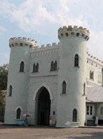
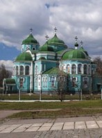
KORSUN-SHEVCHENKIVSKYI. City (2007 pop 18,266) and raion center in Cherkasy oblast, situated on the Ros River. Founded as a fortress by Grand Prince Yaroslav the Wise in 1032, until 1944 it was called Korsun. The town was first mentioned in a historical document in 1169. From 1195 to its destruction by the Mongols in 1240, Korsun was the centre of an appanage principality ruled by the descendants of Prince Volodymyr Monomakh and an important defensive fortress. In 1320 it became part of the Lithuanian-Ruthenian state, and after the Union of Lublin of 1569 it came under Polish rule. In 1585 a Polish fortress was built there, the town received the right of Magdeburg law, and it became the centre of the Korsun starosta district. During the Cossack-Polish War the Battle of Korsun took place there in 1648, and the town was the center of Korsun regiment from 1648 to 1712. In 1702-4 the Korsun colonel Zakhar Iskra was one of the leaders of a popular rebellion. In 1768, during the Koliivshchyna rebellion, the Polish garrison was destroyed by the forces of Maksym Zalizniak... |
| Korsun-Shevchenkivskyi |
|
ZOLOTONOSHA. A city (2011 pop 28,464) on the Zolotonoshka River and a raion center in Cherkasy oblast. It was first mentioned in a document in 1576, as a fortified town. In 1640 it was acquired by Jeremi Wisniowiecki. After throwing off Polish rule in 1648 during the Cossack-Polish War, Zolotonosha became a company center in Cherkasy regiment and, in the 1660s, in Pereiaslav regiment. In 1781 it was given city status and made a county center of Kyiv vicegerency. In the 19th century it was part of Poltava gubernia. By 1885 there were 30 manufacturing enterprises in the city. The Bakhmach-Krasne railway (1897) ran through Zolotonosha and gave it access to agricultural markets. Today its main industry is food processing. It also has a large building-materials factory, a perfume factory, and a sewing plant. Its chief architectural monument is the Church of the Dormition (1760-7), built by Ivan Hryhorovych-Barsky... |
| Zolotonosha |
|
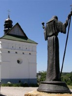
CHYHYRYN. City (2007 pop 10,600) and raion center in Cherkasy oblast, located on the Tiasmyn River. Chyhyryn was a fortified winter station of the Cossacks in the first half of the 16th century. In 1592 the town was granted Magdeburg law and began to grow. In 1638-47 the head of Chyhyryn county was Bohdan Khmelnytsky. In 1648 Chyhyryn became the residence of Hetman Khmelnytsky, the center of the Chyhyryn regiment, and the capital of the Hetman state. After the capital was moved to Baturyn in 1663 and Chyhyryn was sacked by the Turks in 1678, the town declined. Khmelnytsky's palace, the town hall, and the Church of the Savior, which were built in the second quarter of the 17th century, have not survived. The Chyhyryn Historic and Cultural Preserve (which includes also the village of Subotiv) was established in 1989 and was granted national status in 1995. The process of reconstructing Chyhyryn's several historic monuments, including Hetman Bohdan Khmelnytsky's residence and the Church of SS Peter and Paul was completed in 2009... |
| Chyhyryn |
The preparation, editing, and display of the IEU entries featuring the city of Cherkasy and the Cherkasy region were made possible by the financial support of the of the FOUNDATION OF THE ENCYCLOPEDIA OF UKRAINE (Toronto, ON, Canada).
 V. THE ANCIENT CITY OF CHERNIHIV AND THE CHERNIHIV REGION
The Chernihiv region in northeastern Ukraine has been inhabited since the middle Paleolithic Period (ca 40,000 BC). Some of the earliest examples in Ukraine of art (ornamented jewellry) and architecture (dwellings constructed out of mammoth bones), dating back to 18,000 BC, have been discovered in the region (the Mizyn archeological site). Relicts from the Tripillian culture of the Neolithic Period (ca 4,000 BC) as well as later remains of Scythian fortified settlements (5th century BC) have also been discovered. In the 7th-8th century the tribe of Siverianians settled on the Desna, Seim, and Sula rivers and made Chernihiv their center. In the 9th century the region became a part of Kyivan Rus', and Chernihiv became an important political, cultural, and economic center in the new state, the capital of Chernihiv principality. Devastated by the Mongol invasion in the mid 13th century, the city of Chernihiv and the region recovered in the mid-14th century, after Algirdas, the grand duke of Lithuania, defeated the Tatars and gained control of the region. At first Lithuania respected the autonomy of the appanage principalities, leaving them in the hands of local princes. At the beginning of the 15th century, however, the small principalities were abolished, and administrators were appointed. In the war of 1500-3 Lithuania lost the region to Muscovy. Poland obtained the territory by the Truce of Deulino in 1618. The Polish administration exploited the local population, and the Polish nobility seized lands belonging to Ukrainian peasants or burghers. Hence the population of the region took part in the Cossack uprisings of Pavlo Pavliuk (1637) and Yakiv Ostrianyn (1638) against the Poles. At the end of 1648, during Bohdan Khmelnytsky's uprising (the Cossack-Polish War), the Chernihiv, Starodub, Nizhyn, and Pryluky regiments were formed and incorporated into the Hetman state. The Polish-Ukrainian reconciliation under Hetman Ivan Vyhovsky (Treaty of Hadiach) led to the Ukrainian-Muscovite war, in which the tsar's army was crushed at Konotop on 8 July 1659. The Treaty of Andrusovo, signed on 30 January 1667, divided Ukraine between Poland and Russia. The Chernihiv region, along with the rest of Left-Bank Ukraine, was annexed by Russia. The capitals of the Russian-ruled Hetman state were Baturyn (1669-1708 and 1750-64) and Hlukhiv (1708-50). In the 17th-18th century the region played a leading cultural role in Left-Bank Ukraine, and indeed the whole of Ukraine. Such cultural and religious leaders as Lazar Baranovych, Ioanikii Galiatovsky, and Ioan Maksymovych lived and worked there. In 1700 Ioan Maksymovych founded Chernihiv College on the model of the Kyivan Mohyla Academy. Printing was an important factor in the growth of culture and education: in 1675 a printing press was established in Novhorod-Siverskyi and was later transferred to Chernihiv. During the Hetman period and at the end of the 18th century architecture in the Chernihiv region attained a high degree of development. Monuments of the Princely era were restored, and new architectural ensembles in the style of the Cossack baroque were erected... Learn more about the history and culture of Chernihiv and the Chernihiv region by visiting the following entries
|
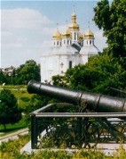
CHERNIHIV. City (2019 pop 288,268) situated on the high right bank of the Desna River, principal city of the Chernihiv region and capital of Chernihiv oblast, railway and highway junction, with a river port and an airport. The center of the tribe of Siverianians, Chernihiv was incorporated into Kyivan Rus' in the 9th century and became one of the most important and wealthiest cities of the realm. The first mention of Chernihiv in the chronicles occurred in 907. In the 11th-13th century Chernihiv was the capital of Chernihiv principality, whose first ruler was Prince Mstyslav Volodymyrovych, the son of Volodymyr the Great. The broad national scope of the Chernihiv dynasty's (the Olhovych house) political activity secured favorable conditions for cultural development and promoted the culture of Chernihiv to an all-Ukrainian level, particularly in the areas of architecture and painting. But in 1239 Chernihiv was devastated by the Mongols. It fell under the control of Briansk principality in the second half of the 13th century and was incorporated into the Grand Duchy of Lithuania in the second half of the 14th century. In 1503 Chernihiv, along with the whole Chernihiv-Siversk land, came under Muscovy's rule. In accordance with the Truce of Deulino (1618), Chernihiv was transferred to the Polish Commonwealth and in 1635 became the principal city of Chernihiv voivodeship. In 1623 Chernihiv was granted the Magdeburg law, and in 1648 it became part of the Cossack Hetman state and the capital of Chernihiv regiment. After the abolition of the Cossack Hetman state Chernihiv became the capital of Chernihiv vicegerency (in 1781), of Little Russia gubernia (in 1797), and of Chernihiv gubernia (in 1802). At the time the city had 4,000 inhabitants. Its population increased to 12,000 by 1844, to 27,000 by 1897, and to 35,000 by 1913... |
| Chernihiv |
|
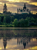
CHERNIHIV REGION. A historical-geographic region in northeastern Ukraine on the border with Russia and Belarus. In the west the Chernihiv region borders on the Kyiv region; in the east, on Slobidska Ukraine; in the northwest, on Belarus; and in the north, on Russia (Briansk region). The precise boundaries of the Chernihiv region have changed over the centuries. The territory has an area of about 55,700 sq km. During the Princely era the Chernihiv region formed the nucleus of Chernihiv principality, which also encompassed large territories in the north (Briansk region), the northeast (Kursk region, Murom-Riazan land), and the southeast (Tmutorokan principality). In 1239 the Chernihiv region was captured by the Tatars, in 1356 most of the region was annexed by the Grand Duchy of Lithuania, and in 1503 it came under the control of Muscovy. The Truce of Deulino (11 December 1618) transferred the region to Poland, and it became Chernihiv voivodeship. In 1648 the Chernihiv region became part of the Hetman state and encompassed the Chernihiv regiment, Starodub regiment, and Nizhyn regiment as well as parts of the Pereiaslav and Pryluky regiments. After the abolition of Ukraine's autonomy the Chernihiv region was divided into two vicegerencies in 1782--the Chernihiv vicegerency and Novhorod-Siverskyi vicegerency--which survived until 1797 and then became part of the Little Russia gubernia (covering the territory of the Hetman state). In 1802 the gubernia was reorganized into two gubernias--Chernihiv gubernia and Poltava gubernia--which endured until 1917. In 1917-19 the Chernihiv region, including its northern part (now in the Russian Federation), belonged to the Ukrainian National Republic... |
| Chernihiv region |
_s.jpg)
|
NIZHYN or Nizhen. A city (2017 pop 71,078) on the Oster River and a raion center in Chernihiv oblast. It is first mentioned as Unenezh or Unenizh under the year 1147 in the Hypatian Chronicle. The town was destroyed by the Tatars in 1239, and it recovered slowly. In the mid-14th century it came under Lithuanian rule, and in 1514 it was renamed Nizhen. In 1618 it was taken by Poland, and in 1625 it was granted the rights of Magdeburg law. In the Hetman state it was a regiment center of Nizhyn regiment (1648-1782) and then a county center of Chernihiv vicegerency and Chernihiv gubernia (1802-1917). The chorna rada in Nizhyn in 1663 elected Ivan Briukhovetsky hetman. By the Treaty of Andrusovo in 1667 Nizhyn was handed over to Russia. Situated at the junction of several major trade routes, Nizhyn developed into an important manufacturing and trade center in the 17th and 18th centuries. A large Greek merchant colony sprang up in the second half of the 17th century and received special privileges from Hetman Bohdan Khmelnytsky. In 1785 a Greek brotherhood and a Greek municipal council were set up. In 1696 the Greeks organized their own school. When Russia gained a foothold on the Black Sea, the trade routes shifted to the Black Sea and Sea of Azov ports, and the Greek merchants moved to Odesa, Mariupol, and Tahanrih. The town's commercial importance declined, but its cultural influence grew. In 1820 a gymnasium was opened, which in 1832 was reorganized into the Nizhyn Lyceum (now the Nizhyn State University)... |
| Nizhyn |
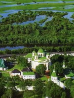
|
NOVHOROD-SIVERSKYI. A city (2019 pop 13,031) on the Desna River and a raion center in Chernihiv oblast. According to archeological evidence it was founded in the 980s. It is first mentioned in the chronicles under the year 1044, and the Laurentian Chronicle lists it as the center of the Siversk principality in Kyivan Rus'. One of its rulers was Ihor Sviatoslavych, the central figure of Slovo o polku Ihorevi (The Tale of Ihor's Campaign). In 1356 Novhorod-Siverskyi was annexed by the Grand Duchy of Lithuania, and in 1503 by Muscovy. In 1620, while under Polish rule (1618-54), it obtained the rights of Magdeburg law. Under the Hetman state it was a company center in Nizhyn regiment (until 1663) and then Starodub regiment (until 1781). Within the Russian Empire it was the capital of Novhorod-Siverskyi vicegerency (1782-96) and then a county center in Little Russia gubernia and Chernihiv gubernia. In the 17th and 18th centuries the Novhorod-Siverskyi Transfiguration Monastery and its printing press and the Novhorod-Siverskyi Gymnasium played an influential role in Ukraine's religious and cultural life. Today the city is a railway junction and a river port. It produces asphalt, construction materials, dairy products, and cotton fabric. Its many architectural monuments include the Dormition Church (1671-1715) and its bell tower (1820), the wooden Saint Nicholas's Church (1760) and the Church of Saint Mary the Protectress (1767), the Transfiguration Monastery complex (11th-17th centuries), and the Transfiguration Cathedral (1791-6), which stands on the ruins of the 12th to 13th-century cathedral... |
| Novhorod-Siverskyi |
_s.jpg)
|
PRYLUKY or Pryluka. A city (2017 pop 56,270) on the Udai River and a raion center in Chernihiv oblast. It was first mentioned, as a fortress, in the Hypatian Chronicle under the year 1092. It was destroyed by the Mongols in 1239. Rebuilt by the Hlynsky princes in the 15th century, Pryluky belonged to the Grand Duchy of Lithuania, and from 1569, to the Polish Commonwealth. After Bohdan Khmelnytsky's uprising (the Cossack-Polish War) it became a regiment center of the Hetman state (1654-1781) (the Pryluky regiment) and then a county center of Chernihiv vicegerency (1781-1802) and Poltava gubernia (1802-1925). It was granted the rights of Magdeburg law in 1783. Before the industrialization drive of the 1930s Pryluky's main occupations were farming and tobacco processing. Today the city is an industrial and communications (railway) center. Its chief industries are machine building, the chemical industry, the building-materials industry, the tobacco industry, the petroleum industry, the woodworking industry, the textile industry, and food processing. Its architectural monuments of the baroque period include the Cathedral of the Transfiguration (1705-16), the regiment treasury (1708) (both built by Colonel Hnat Galagan), Saint Nicholas's Church (1720), and the Church of the Nativity (1806-17). The historic Hustynia Trinity Monastery is located in the vicinity of Pryluky. In 1990 archeologists discovered remnants of a Cherniakhiv culture settlement (2nd to 5th centuries AD) in the city... |
| Pryluky |
_s.jpg)
|
BATURYN. Historic center and former Cossack capital, now a town smt (2017 pop 2,571) in Bakhmach raion, Chernihiv oblast. It is located on the south bank of the Seim River. In the 11th century a small fortress was constructed at this site for the protection of the southeastern border of Chernihiv principality. In 1275 this fortified settlement was razed by Mongols invading Kyivan Rus'. It re-emerged as a provincial town in the early 17th century. In 1648 the Ukrainian Cossacks wrested control of Baturyn from the Poles, and it became a local Cossack company center. As its economic significance continued to expand, the town was granted Magdeburg law in 1654. In 1669 it became the capital of the Hetman state, in part because it had been spared the sort of damage inflicted on other major centers in Left-Bank Ukraine during the turmoil of the so-called Ruin. Baturyn went on to serve in succession as the residence of Hetmans Demian Mnohohrishny (1669-72), Ivan Samoilovych (1672-87) and Ivan Mazepa (1687-1708). During Ivan Mazepa's hetmancy, Baturyn reached the pinnacle of its vitality and became one of the large and prosperous towns in early modern Ukraine. After Mazepa and his Cossack troops sided with the Swedish king Charles XII in 1708, the Russian tsar Peter I ordered his field marshal Aleksandr Menshikov to destroy the hetman capital. A Russian force of 10,000 men captured and burned the town and massacred its inhabitants. Baturyn stood in ruins and was deserted for about forty years. The last of Left-Bank Ukraine's hetmans, Kyrylo Rozumovsky (1750-64) rebuilt Baturyn and ushered in a brief renaissance... |
| Baturyn |
The preparation, editing, and display of the IEU entries dealing with the history and culture of Chernihiv and the Chernihiv region were made possible by the financial support of the CANADIAN FOUNDATION FOR UKRAINIAN STUDIES.
 VI. THE CITY OF CHERNIVTSI AND THE NORTHERN BUKOVYNA REGION
Located in southwestern Ukraine, between the middle Dniester River and the main range of the Carpathian Mountains, Bukovyna is a transitional land between Ukraine and Romania. The name of this territory is derived from its great beech (buk) forests and dates back to the late 14th century when it designated the lands on the Moldavian-Polish border. From a historical perspective it is a strategically important border area between Galicia and Moldavia. Bukovyna's transitional location influenced its history; it belonged to the Principality of Galicia-Volhynia, then to Moldavia. Polish and Hungarian influences intersected here in the 14th and 15th centuries. Between 1774 and 1918 Bukovyna was under Habsburg rule within the Austrian Empire. In 1919-40 and 1941-4 all of Bukovyna belonged to Romania. It was only in 1940 that Bukovyna was divided, roughly along ethnic lines, between Ukraine and Romania. Today Chernivtsi oblast or most of northern Bukovyna is located in Ukraine, while most of the Suceava region or southern Bukovyna belongs to Romania. The present political border does not exactly coincide with the ethnic border: Romania contains the southern part of the Ukrainian ethnic peninsula with Seret and a string of mountain villages, while Ukraine contains the Romanian ethnic wedge that extends to Chernivtsi. Chernivtsi is Bukovyna's capital and the region's largest city... Learn more about the city of Chernivtsi and the historic Bukovyna region by visiting the following entries:
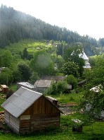
|
BUKOVYNA. In early times Bukovyna was inhabited by the Thracian tribes of the Getae and Dacians. In the 10th century the region became part of the Kyivan Rus' state. When this state was divided at the end of the 11th century, Bukovyna was eventually incorporated into the Principality of Galicia-Volhynia. With the Mongol invasion in 1241 Bukovyna fell under Tatar domination. When the Hungarian king Louis I defeated the Tatars in 1342, southern Bukovyna came under Hungarian rule. During this period Romanians from Transylvania and the Maramures region began to settle in Bukovyna. Voevode Bogdan I, the founder of the Moldavian state, freed Bukovyna from Hungary. From then to 1774 Bukovyna belonged to Moldavia and shared its fate. In 1774, taking advantage of the Russo-Turkish War, Austria annexed the part of northern Moldavia that included Chernivtsi, Seret, Radauti, and Suceava. The new administrative entity was given the name of Bukovyna (first used in a document in 1412)... |
| Bukovyna |
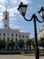
|
CHERNIVTSI. The historical capital and political, cultural, and religious center of Bukovyna. The city (2005 pop 243,500) lies on the border of Subcarpathia and on the boundary separating Ukrainian and Romanian ethnic territories. Situated on both banks of the Prut River, it covers the valley and surrounding hills. Chernivtsi is a highway and railway junction and has an airport. Human settlements at the site of Chernivtsi date back to the Paleolithic Period. Relics of Trypilian culture and Bronze Age and Iron Age settlements have been discovered in the suburbs of the city. In the period of Kyivan Rus' the area was inhabited by White Croatians and Tivertsians (9th-11th century). The defensive fortifications of Chernivtsi were erected on the left bank of the Prut River in the second half of the 12th century by Prince Yaroslav Osmomysl of the Halych principality. The fortress endured until the middle of the 13th century, when it was destroyed by the Mongols. The new town was built on the high right bank of the Prut... |
| Chernivtsi |
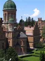
|
CHERNIVTSI UNIVERSITY. The university was founded in 1875, succeeding the Chernivtsi Higher Theological School, which had existed since 1827. Until 1918 it was known as Franz-Josefs Universitat, with German as the language of instruction and separate departments of Ukrainian and Romanian language and literature. From 1919 to 1940 it was the Universitatea Regele Carol i din Cernauti, with instruction in Romanian, and in 1940 it became the Chernivtsi State University, with instruction in Ukrainian. Public efforts to rename the university in honor of Yurii Fedkovych, led by the literary scholar Yevhen Kyryliuk, for many years did not gain the consent of the Soviet authorities, but in 1989 Fedkovych finally became the university's patron. In 2000 the university was granted a national university status and its name was changed to Chernivtsi National University. Today it has 16 faculties and an enrollment of close to 16,000 students...
|
| Chernivtsi University |
|
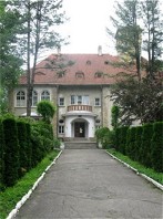
STOROZHYNETS. A city (2001 pop 14,693) on the Seret (Siret) River and a raion center in Chernivtsi oblast in Bukovyna. The town was first mentioned in historical documents in 1448, when it was part of the Moldavian principality. In the 16th century it was under Turkish rule, and from 1774, under Austria. In 1854 the town was granted city status. By the end of the 19th century it had developed into a small manufacturing and trading center with a population of 7,000. In 1904 it became a county center. After the First World War the city was occupied by Romania, and in 1940 it was annexed by the Ukrainian SSR. Today it has a lumber-manufacturing complex. It's forestry tekhnikum, located partly in the Orenstein family palace (1912), includes a large dendrological park... |
| Storozhynets |
|
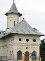
SERET (SIRET). A town (2002 pop 9,329) on the Seret (Siret) River in southern Bukovyna, Romania, just south of the Ukrainian-Romanian border. According to archeological evidence the site has been inhabited since the Neolithic Period. It is first mentioned in historical documents in 1334. In 1365-88 it was the capital of Moldavia, and in 1370-1435, the seat of a Catholic diocese. Under Austrian rule (1774-1918) Seret was a county administrative center of Bukovyna crown land (1868-1918). At the beginning of the 20th century branches of the Ruska Besida in Bukovyna and the Ukrainska Shkola society were active in Seret. In 1910 Ukrainians accounted for 41.8 percent of the population of Seret county. In 1918 all Bukovyna, including Seret, was occupied by Romania. In 1940 Seret county was divided between Romania and the Ukrainian SSR, and Seret, along with some 14 Ukrainian villages, remained in Romania... |
| Seret (Siret) |
The preparation, editing, and display of the IEU entries featuring the city of Chernivtsi and the Bukovyna region were made possible by the financial support of the CANADIAN FOUNDATION FOR UKRAINIAN STUDIES.
 VII. THE CRIMEA (1): THE SOUTHERNMOST REGION OF UKRAINE
The Crimean Peninsula, which forms the southernmost tip of Ukraine (and is currently illegally occupied by the Russian Federation), was, throughout its history, often dominated politically and culturally by southern states and, at the same time, influenced by governments that controlled the Ukrainian mainland. The peninsula itself was too small to organize a strong, independent state. The earliest historical population in the Crimea was the Cimmerians, of Iranian descent, who arrived there around 10,000 BC. They were forced out by the Scythians in the 7th century BC. In the 6th century BC the Greeks began to establish colonies on the Crimean coast. The most successful colonies were Chersonese Taurica (now Sevastopol), Panticapaeum (now Kerch), and Teodosiia. From the 5th century BC until the 4th century AD the Bosporan Kingdom, with Panticapaeum as capital, controlled the eastern Crimea. At the end of the 5th century AD the Crimean coast came under the rule of Byzantium. For a time the Crimea mediated between Kyivan Rus' and the Byzantine Empire. Prince Volodymyr the Great of Kyiv captured Chersonese Taurica in 988 and in the 10th-12th century the eastern part of the Crimea belonged to Tmutorokan principality, which was part of the Kyivan Rus' state. When the Crusaders took Constantinople, the Byzantine Empire lost its influence in the Crimea. In the mid-13th century Venetian and, more importantly, Genoese trade colonies were established there. From the mid-13th century the Crimea, except for the Italian colonies, was seized by the Tatars of the Golden Horde who eventually organized a separate state known as the Crimean Khanate. In 1474 Turkey captured the Italian colonies in the southern Crimea, and in 1478 the Crimean Khanate recognized the supremacy of the Ottoman Empire. Tatar forces invaded the Ukrainian lands almost annually, destroying the towns and villages and seizing inhabitants, whom they later sold at slave markets. In the 16th century the Ukrainian Cossacks came to the defense of the population, and by the beginning of the 17th century they took the offensive against the Tatars. In the 18th century the Cossacks helped the Russian Empire wrest control of the Black Sea coast from Turkey and the Crimean Khanate. The Russo-Turkish peace treaty of 1774 led to Russia's annexation of the Crimea in 1783. In 1775 the population of the Crimea consisted primarily of Crimean Tatars (200,000 or 80 percent of the population). However, following the Russian annexation, the number of Tatars declined continuously in absolute and relative terms: in 1897 there were 194,000 or 35.5 percent; in 1926 there were 179,000 or 25.1 percent. After the Second World War, in 1944, the Soviet authorities forcefully deported the entire Crimean Tatar population from the Crimea to the Soviet interior... Learn more about the Crimea, its ancient history and major cities, by visiting the following entries:
|
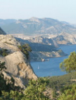
CRIMEA. The most southerly part of Ukraine (illegally occupied by the Russian Federation since 2014), the Crimea is a quadrangular peninsula situated between the Black Sea (in the west and south) and the Sea of Azov (in the east). It has a breadth of 200 km north to south, a maximum length of 320 km east to west, and an area of 27,000 sq km. It is connected to the Ukrainian mainland by the narrow, 7 km Perekop Isthmus. In the east it is separated from the Kuban (the Taman Peninsula) by the Kerch Strait. The Crimea consists of two very different parts--the semiarid, treeless steppe of the Crimean Lowland in the north and the Crimean Mountains in the south. The Crimean steppe, with its continental climate and steppe soils and vegetation, is a continuation of the Ukrainian steppe and together with the Kerch Peninsula occupies four-fifths of the Crimea's territory. The Crimean Mountains consist of a narrow range of foothills and a low mountain chain covered with forests and high pastures. Below the mountains in the south is a narrow (2-12 km) coastal lowland--the Crimean southern shore--with a Mediterranean climate and vegetation. Because of its geographical location, the Crimea has the most ancient and richest history of all the regions of Ukraine... |
| Crimea |
|
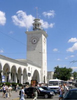
SIMFEROPOL. A city (2022 pop 340,000) on the Salhyr River and the capital of the Autonomous Republic of Crimea within Ukraine. The vicinity has been inhabited since the Paleolithic Period. The Scythian capital of Neapolis (3rd century BC to 4th century AD) occupied the southeastern part of present-day Simferopol. By the early 16th century the Tatar stronghold of Kermenchyk and settlement of Ak-Mechet had been established at the site. After annexing the Crimea, Catherine II of Russia set up the fortified town of Simferopol as the capital of Tavriia oblast. The opening of the Kharkiv-Sevastopol railway line in 1874 ushered in rapid industrial growth. The city expanded to the other bank of the river, where a residential district was developed. Following the Revolution of 1917 Simferopol was occupied by various armies. On 24 April 1918 the Army of the Ukrainian National Republic took the city, followed by the German military. The German forces, however, installed General Suleiman Sulkevich to lead their preferred Crimean government. After the departure of Germans, the city fell to the right-wing Russian forces under General Anton Denikin. In November 1920 Simferopol was occupied by the Red Army, and in 1921 the city became the capital of the Crimean Autonomous Soviet Socialist Republic...
|
| Simferopol |
|
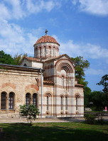
KERCH. City (2021 pop 154,621) and port in the eastern Crimea. It originated in the 6th century BC as the Greek colony of Panticapaeum, which in the succeeding century became the capital of the Bosporan Kingdom. From the middle of the 1st century BC it was under Roman and then Byzantine control. From the 10th to the 12th century the Slavic settlement of Korchev, which belonged to the Kyiv-controlled Tmutorokan principality, was a center of trade between Kyivan Rus' and the Crimea, Caucasia, and the Orient. In the 14th and 15th centuries the Genoese colony of Cerco (Cerchio) was established there, which in the late 15th century passed to the Turks, who built a citadel there. By the Peace Treaty of Kucuk Kaynarca in 1774, Kerch and the neighboring fortress of Yenikale (built in 1706) were ceded to the Russian Empire. Kerch is the center of the Kerch Iron-ore Basin, the base of a fishing fleet, and an important fish-processing center for numerous varieties of fish products. Its most impressive architectural monuments are Demeter's Vault with Greek mythological frescoes (1st century AD), the Church of Saint John the Baptist (10th century, with murals from the 13th-14th century), and the Yenikale fortress... |
| Kerch |
|
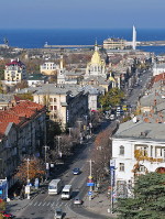
SEVASTOPOL. The largest city in the Crimea (2021 pop 429,922) and port on the Black Sea. The region was inhabited by the Taurians from the early 1st millennium BC. In the 5th century BC the Greek colony of Chersonese Taurica was established at the site. In 1784, after annexing the Crimea, Catherine II ordered the fortress and naval port of Sevastopol to be built at the site of the Tatar village of Akhtiar. In 1804 it became the home of the Russian Black Sea Fleet. The city grew from 30,000 inhabitants at the beginning of the century to 47,400 in 1853. During the Crimean War (1853-6) Sevastopol was almost completely destroyed. In the 1870s its naval facilities were rebuilt and expanded, and a railway connecting it with the grain-growing interior was set up. The population of the city grew rapidly, from 11,000 in 1875 to 53,000 in 1897. From the 1840s, the Kobzar organization spearheaded Ukrainian national enlightenment in the city; after 1905, it gained legal status. It was led by Viacheslav Lyshchenko and its main work was performed by Ukrainian officers of the Black Sea Fleet, including the legendary captain Lev Matsiievych (one of the earliest aviators in the Russian Empire). In March 1917 Kobzar held a meeting of Ukrainian sailors, which began a process of the Ukrainization of the Black Sea Fleet... |
| Sevastopol |
|
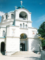
YEVPATORIIA. A city (2021 pop 108,000) and Black Sea port on the west coast of the Crimea. In the 6th century BC the Greek colony of Kerkinitis was established at the site. A significant colony, from the 330s BC it became part of the Chersonese Taurica state. In the mid-2nd century BC it was captured and settled by the Scythians. The last written reference to Kerkinitis was in 134 AD. The Khazars re-settled the site and re-named it Guzliev (literally 'beautiful house'), but then it came under control of the Pechenegs (10th century), the Kyivan Rus' merchants (10th-11th centuries), the Cumans (11th century), and the Tatars (13th century), who called it Kezlev. It became part of the Crimean Khanate (1440s), which became dependent (1475) on the Ottoman Empire. Being the Khanate's only city on the coast, it outgrew the capital, Bakhchysarai. Kezlev acquired the Khan's Grand Mosque (built in 1552-64) that was used for enthronement of the Crimean khans. In the 16th and 17th centuries, as Kezlev developed into a slave trading center, it became the target of frequent raids by the Zaporozhian Cossacks. After Russia's annexation of the Crimea in 1783 the town was renamed Yevpatoriia (1784), although Crimean Tatars continued to call it Kezlev (and still do)... |
| Yevpatoriia |
|
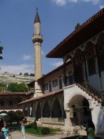
BAKHCHYSARAI (or Bakhchesarai). A city (2021 pop 28,600) on the northwestern slope of the Crimean Mountains. It is the historic capital of Crimean Tatars, established as capital in 1532. In the mid-17th century Bakhchysarai was a thriving city with a khan's palace, mosques, inns (caravanserais) and 2,000 homes, of which about one-third belonged to the Greeks. By the end of the 17th century it became the second largest city in the Crimea after Caffa (Teodosiia). With a population of about 6,000, it was divided into 30 neighborhoods (quarters) with a mosque in the middle of each quarter. Following the annexation of the Crimean Khanate by the Russian Empire in 1783, Bakhchysarai became an ordinary town, having lost its administrative significance. However, it retained its oriental heritage: the khan's palace and mosque on the main street, neighborhood mosques and traditional houses on terraced narrow streets, and a clay pipe duct providing water to 70 fountains. By 1897 its population reached 12,960, of whom 11,148 (86 percent) spoke Crimean Tatar. Thus Bakhchysarai remained the cultural center of the Crimean Tatars even in the 19th and early 20th centuries and was an inspiration for the visiting literati (Russian: Aleksandr Pushkin; Polish: Adam Mickiewicz; and Ukrainian: Lesia Ukrainka, Mykhailo Kotsiubynsky)... |
| Bakhchysarai or Bakhchesarai |
The preparation, editing, and display of the thoroughly updated IEU entries about the Crimea, its history and major cities, were made possible by the financial support of the CANADIAN FOUNDATION FOR UKRAINIAN STUDIES.
 VIII. THE CRIMEA (2): CRIMEAN MOUNTAINS AND CRIMEAN SOUTHERN SHORE
The exotically picturesque Crimean Mountains lie in the southernmost part of Ukraine, in the southern part of the Crimean Peninsula. Their highest range, the Yaila, forms a large, high plateau, which drops suddenly several hundred meters to the Black Sea coast. The original flora and fauna of the region are preserved best at the Crimean Game Preserve. In the west the Crimean Mountains descend directly into the Black Sea. East of Foros the mountains recede from the sea for a few kilometers and create a sheltered shore. This narrow (2-12 km) coastal lowland, known as the Crimean southern shore or the Crimean Riviera, has a subtropical Mediterranean climate and vegetation. Composed of the low-resistance schist, susceptible to abrasive activity, the mountains on the Black Sea shore form numerous cliffs and caves above and below water. Owing to its mild climate, the curative powers of the sea, salt lakes, and curative muds, and its natural beauty, the Crimean southern shore constitutes a major tourist attraction. Prior to the Russian annexation of the Crimea in 2014, the Crimean southern shore was the principal resort and tourist area of Ukraine and one of the most important ones in Eastern Europe. After the Russian occupation in 2014 cut off vacationing Ukrainians and Western sanctions have discouraged international tourists, the inflow became limited to Russian visitors, thus very considerably reducing the level of tourism in the Crimea... Learn more about the Crimean Mountains and Crimean Riviera by visiting the following entries:

|
CRIMEAN MOUNTAINS. Young, folded mountains of the Alpine mountain system located in the southern part of the Crimea. Including the foothills, they cover one-fifth of the peninsula's area. They extend for about 150 km from Sevastopol to Teodosiia and are 40-50 km in width. The Crimean Mountains consist of three long, parallel ranges, separated by valleys. They descend gradually towards the north and fall sharply towards the south. The first two ranges starting from the north constitute the foothills; the third range, called the Yaila (the name is sometimes applied to the Crimean Mountains as a whole), constitutes the mountains proper. The top of the range of the Crimean Mountains forms a large, high plateau, which drops suddenly several hundred meters to the southern shore. In the west this range is quite unbroken and is divided into the Ai-Petri Yaila (1,320 m), Yalta Yaila (1,406 m), Nikita Yaila (Demir-Kap peak, 1,504 m), and Babuhan Yaila (which has the highest peak, Roman-Kosh, 1,545 m). Between the steep southern slope of the mountains and the Black Sea lies a hilly coastal strip, the Crimean southern shore...
|
| Crimean Mountains |
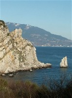
|
CRIMEAN SOUTHERN SHORE (also known as the Crimean Riviera). Narrow (2-12 km) strip of land in the southern Crimea lying between the slope of the Crimean Mountains and the Black Sea. It stretches for about 150 km from Foros (east of Sevastopol) eastward to Mount Kara-Dag (west of Teodosiia), covering an area of about 600 sq km. Sheltered from north winds, the shore has a Mediterranean climate and flora. Its agriculture is subtropical. Because of its natural beauty and healthy climate, this area is heavily populated and famous for its health resorts and tourism. Visitors greatly outnumber residents: at the beginning of the 1880s about 8,000 people visited Yalta each year; in 1910, 50,000 came to Yalta; and up until 2014 over 500,000 visited the shore. Yalta is the main resort area. Other important areas, from west to east, are Foros, Simeiz, Alupka, Koreiz and its coastal district of Miskhor, Haspra, Livadiia, Masandra, Nikita, Hurzuf, Partenit, and Alushta. The shore east of Alushta is less adequately protected from the north winds and has a more continental climate. It is less important as a tourist destination. Its main resort is Sudak... |
| Crimean southern shore |
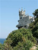
|
YALTA. A city (2014 pop 78,200; 2021 pop 74,652), a resort of national importance and a port of call on the Crimean southern shore. Sheltered by the Crimean Mountains from the north, it lies on the subtropical coastal slopes overlooking Yalta Bay. The earliest recorded reference to settlement on the site is a reference to a Greek colony named Yalita (Halita) in the 1st century BC. Control of the area later passed to Byzantium. By the 12th century Yalta (called Dzhalita) had become an established port and fishing village. Genoese traders had control of the town they would call Etalita in the 13th to 15th centuries until they were succeeded by the Turks in 1475. Destroyed by an earthquake in 1471, the town was rebuilt by Greek and Armenian residents who then called it, as the Turks did, Yalta. Yalta fell under Russian control in 1783. At that time the Russian government forcibly removed (1778-80) Greeks and Armenians to the vicinity of present-day Mariupol. Many Crimean Tatars of Yalta emigrated to the Ottoman Empire. These residents were replaced by imperial Russian military. By the early 19th century the area around Yalta began to be colonized by estate owners... |
| Yalta |
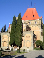
|
ALUSHTA. A city (2021 pop 31,364) in the eastern part of the Crimean southern shore. It was founded in the 6th century AD on the site of the fortress Aluston, built during the reign of the Byzantine emperor Justinian. It served as an anchor point for the powers controlling the Crimean southern shore: the Byzantine Empire (6-7th, and 8-12th centuries), the Khazar kaganate (7th century), and then as remnant of Byzantium, the Trapezund empire (1204-39). It was destroyed by the Mongols in 1239 and then restored as Alusta under the Theodoro principality coinciding with its eparchy of Gothia (1240s-1380). It fell under control of the Genoese (1381-1475, who called it Lusta), and was later taken by the Ottoman Turks (1475-1774, who destroyed its fort and reduced it to a village). It was annexed by the Russian Empire in 1783. By 1902 Alushta gained the status of a city. During this time a number of writers lived in this town, including the Ukrainian writer Mykhailo Kotsiubynsky (1896). The Polish poet Adam Mickiewicz dedicated two of his Crimean sonnets to Alushta. By 1910 the city's population was about 4,200... |
| Alushta |
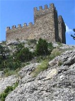
|
SUDAK. A city (2014 pop 15,532; 2021 pop 17,834) on the Crimean southern shore. A fortress called Sugdei was built on that site in 212. At the end of the 8th century it became an important seaport, which maintained economic ties with Byzantium. In the Kyivan Rus' documents it was called Surozh; it maintained commercial and cultural ties with various Rus' principalities, notably those of Chernihiv, Tmutorokan, and Volodymyr (in Volhynia). In the 13th century it became part of the Crimean Khanate. Retaining its autonomy, it prospered from trade on the Silk Road. Meanwhile, the Genoese merchants secured a concession from the Golden Horde for Caffa (now Teodosiia, in 1266) and in 1365 seized Sugdaia, which they renamed Soldaia. On the hill east of the city, they built a sprawling fortress with 16 turrets, which today is the best preserved medieval fortress in the Crimea. In 1475 Soldaia was captured by the Ottomans (with the help of Crimean Tatars) who renamed it Sudak. The city lost its commercial importance but retained its strategic position. In 1783 it was annexed to the Russian Empire... |
| Sudak |
|
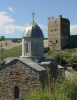
TEODOSIIA or FEODOSIIA. A city and seaport (2014 pop 69,040, 2021 pop 66,293) in southeastern Crimea on the Black Sea coast. The city originated in the 6th century BC as Theodosia (meaning 'God-given [place]'), a colony of the ancient Greek city-state of Miletus. In 355 BC it was annexed by the Bosporan Kingdom to become its second largest city after Panticapaeum. In the 4th century AD Theodosia was sacked by the Huns, and at the end of the 6th century what remained of it was captured by the Khazars. In 1227 the Geonese merchant republic bought the site from the Golden Horde and established (in 1275) a trading post called Caffa. In 1454 the city was besieged by the Crimean Tatars and the Ottoman navy. The huge tribute it was forced to pay led to bankruptcy of Caffa. The Ottomans took it over, renamed it Kefe, and developed it into the largest slave market in the region. On any day, some 20 thousand captives taken in Crimean Tatar raids, mostly from Ukraine, were sold at the Kefe slave market. In reprisal, the Zaporozhian Cossacks destroyed the Turkish fleet, sacked Kefe and freed the slaves in 1616; they again attacked the city in 1628 and later took it in 1675... |
| Teodosiia or Feodosiia |
The preparation, editing, and display of IEU articles about the Crimean Mountains and Crimean Riviera were made possible by the financial support of the CANADIAN FOUNDATION FOR UKRAINIAN STUDIES.
 IX. THE DNIPRO, THE DNISTER, AND OTHER RIVERS OF UKRAINE
From the dawn of history the Dnipro River has been closely bound up with the life of the Ukrainian people. It is the ?holy river' of Ukraine. It was known as the Borysthenes to the ancient Greeks and Romans (Herodotus first used the name in the 5th century BC). All the important towns of Kyivan Rus' (except those of the Principality of Galicia-Volhynia) were located on the Dnipro or in its vicinity. In the 16th?17th century the Zaporozhian Sich arose on the lower Dnipro and became the nucleus of the second Ukrainian state. The river became the Cossack route to the Black Sea. During the hetmancy of Bohdan Khmelnytsky, it became the principal river of the Cossack state. Today the Dnipro is the main river network of Ukraine. Half of Ukraine's waterways belong to this system. Ukraine's second-largest river, the Dniester, is the main river in Galicia. For this reason Galicia is sometimes called Naddnistrianshchyna (Land by the Dniester). Other large rivers of Ukraine?the Donets in the east, the Boh in the southwest, and the Desna in the north?have had and continue to have a profound influence on the history of Ukraine and the life of its people. Learn more about the rivers of Ukraine by visiting the following entries:
|
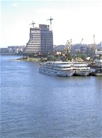
DNIPRO RIVER. The largest river in Ukraine and the third largest in Europe (after the Volga River and the Danube River). Its length is 2,285 km, of which 485 km lie within the Russian Federation, 595 km within Belarus, and 1,095 km within Ukraine. The Dnipro Basin covers 504,000 sq km, of which 289,000 sq km are within Ukraine (48 percent of its area). The basin occupies 42 percent of the territory of the Ukrainian state and 36 percent of Ukrainian ethnic territory. The Dnipro became an important water route in medieval times, when it became part of the Varangian route between the Baltic Sea and Byzantium across the Black Sea. Kyiv, the Rus' capital, stood on the Dnipro at the confluence of important water routes. The capitals of principalities--Chernihiv, Pereiaslav, Turiv, Smolensk--were built on or very near the Dnipro...
|
| Dnipro River |
|
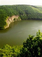
DNISTER RIVER. The second-largest river in Ukraine. It is 1,360 km long, and its basin covers 72,100 sq km. At one time the Dnister flowed only through Ukrainian territory. But after the ancestors of the Romanians settled the lands east of the Carpathian Mountains (beginning at the end of the 14th century) and after Bessarabia was Romanianized, the Dnister from Mohyliv-Podilskyi to its mouth (about one-third of its length) marked the Ukrainian-Romanian ethnic boundary. The Dnister is the main river in Galicia. The historical and ethnographical significance of the Dnister as the symbol of the Principality of Galicia-Volhynia outlived its economic and political importance. This is the source of the piety towards the river that is found in the romantics of Western Ukraine. This also explains frequent references to the river in the names of Galician institutions and organizations? |
| Dnister River |
|
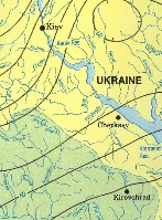
RIVERS OF UKRAINE. There are approx 30,000 rivers crossing Ukrainian ethnographic territory. Of that number about 23,000 are in Ukraine. With a combined length of nearly 180,000 km, most are small; in Ukraine there are 117 rivers the watercourses of which exceed 100 km, but only 13 that are longer than 500 km. The characteristics of rivers, such as the density of the river network as well as the volume and the seasonality of the flow, depend on factors such as climate, geology, relief, vegetation, and human modifications of the landscape. The rivers of Ukraine generally flow southward into the Black Sea or the Sea of Azov. The notable exceptions are in the northwest, where the prevalent flow is northward into the Prypiat River, a tributary of the Dnipro River, or into the Vistula River, which flows through Poland into the Baltic Sea? |
| Rivers of Ukraine |
|
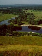
DONETS RIVER (also known as Dinets and Donets Siverskyi). The largest tributary of the Don River. The Donets is 1,050 km long and has a basin area of 98,900 sq km. Almost the entire stretch of the river lies within Ukrainian ethnic territory, and 950 km of it lie within Ukraine. The Donets rises in the Kursk region, south of the Central Upland, at an altitude of 215 m. Its upper stretch, above Belgorod, is narrow; farther down, the river attains a width of 100 m and an average depth of 1 m. Below Belgorod the river forms the Pechenihy Reservoir (86 sq km in area), which supplies Kharkiv with water. From there the right bank of the Donets is usually high and frequently dissected (especially the chalk hills called the Holy Hills [Sviati Hory] below Izium). The left bank is flat. About 220 km above its mouth the Donets cuts into the Donets Ridge near Hundorivka? |
| Donets River |
|
BOH RIVER (ancient Greek: Hipanis; now called Pivdennyi Buh [Southern Buh]). One of the largest rivers of Ukraine, 857 km in length (792 km to the liman). Its drainage basin covers an area of 63,740 sq km. In its upper section in the Podolian Upland the Boh flows slowly through a wide, muddy valley. Its middle section cuts into a crystalline massif, and the gradient increases as it flows between craggy banks. Rapids appear and are most concentrated in the 70 km stretch between the town of Pervomaiske and the village of Oleksandrivka, where the steep banks reach a height of 90 m (here the Myheiski, Bohdanivski, and other rapids are found). Below the rapids the river flows through the Black Sea Lowland. It spreads out to 800 m (2?3 m deep) and enters the deep Dnipro-Boh Estuary near the town of Nova Odesa? |
| Boh River |
The preparation, editing, and display of the IEU entries dedicated to the Dnipro and other rivers of Ukraine were made possible by the financial support of the FOUNDATION OF THE ENCYCLOPEDIA OF UKRAINE (Toronto, ON, Canada).
 X. THE DNIPRO INDUSTRIAL REGION
After the Donets Basin (Donbas), the Dnipro Industrial Region is the second-largest concentration of heavy industry in Ukraine. It is located in the central part of the steppe (in Dnipropetrovsk and Zaporizhia oblasts, and parts of Kirovohrad and Poltava oblasts), at the bend of the Dnipro River, and covers 16,900 sq km and has a population of about 3,250,000. The industry of the region is grouped into several heavily populated centers, which contain 90 percent of the region's population. The largest and most important center is the Dnipro Industrial Region proper, which consists of the city of Dnipro (2018 pop 1,000,506) and its neighboring cities--Kamianske, Novomoskovsk, and Verkhnodniprovsk. Another center, the city of Zaporizhia (2016 pop 754,619) and its suburbs, and the smallest center, Nikopol (2018 pop 112,102), lie on the Dnipro River. The industrial development of the Dnipro region is the result of the mining of large deposits in the Kryvyi Rih Iron-ore Basin and the Nikopol Manganese Basin (and, partially, the Dnipro Lignite Coal Basin), the proximity of the Donets Basin and its huge deposits of coal, the region's convenient geographical location at the intersection of north-south and east-west transportation routes, and the availability of industrial water, river transportation, and hydroelectric power from the Dnipro River (the Dnipro Hydroelectric Station of the Dnipro Cascade of Hydroelectric Stations). Among the natural resources of the region are building materials, refractory clays, and clayey soil. At the end of the 19th century (1897) the population of the Dnipro Industrial Region was about 700,000 (estimate), 27 percent of which (186,000) lived in towns. The population was 950,000 in 1914 (estimate), 1,100,000 in 1926, and 3,250,000 in 1978. Thus, in 52 years the population tripled. Prior to industrialization, almost 90 percent of the region's population consisted of Ukrainians, if one excludes the cities, particularly Katerynoslav, which had a mixed population of Ukrainians, Russians, Jews, and some Germans. Industrialization stimulated the in-migration of Russians: insignificant at first, it increased in the 1930s and continued to increase until the 1990s. After 1950 the population of the region increased more rapidly than that of the Donbas, and the populations of Dnipropetrovsk (now Dnipro), Dniprodzerzhynsk (now Kamianske), and Zaporizhia grew more rapidly than that of any other Ukrainian city except Kyiv... Learn more about the Dnipro Industrial Region by visiting the following entries:
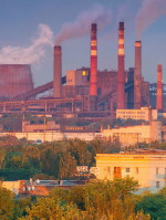
|
DNIPRO INDUSTRIAL REGION. Until 1880 the Dnipro Industrial Region and the rest of Katerynoslav gubernia, to which it belonged, formed an agricultural region. Its small towns--Katerynoslav (now Dnipro), Oleksandrivske (now Zaporizhia), and Novomoskovsk--were commercial-administrative centers. The development of the region was connected with the construction of a number of railway lines which connected the Donets Basin with the Kryvyi Rih region and its iron ore. At Katerynoslav and neighboring Kamianske, where the railway lines crossed the Dnipro River, metallurgy, using iron ore from Kryvyi Rih (120 km away) and coal from the Donbas (150 km away), sprang up. In 1887 the huge Alexander Metallurgical Plant (now the Dnipro Metallurgical Plant) began operating in Katerynoslav. In 1889 a pipe factory, then a steel plant and a wire and nail factory, were built. In 1887-9 the largest plant of the region--the Dnipro Metallurgical Plant (now the Dnipro Metallurgical Complex)--was constructed in Kamianske. Owing to its proximity to the large metallurgical plants of Katerynoslav and Kamianske, industry in Oleksandrivske (Zaporizhia) also developed rapidly, and by the end of the 19th century Oleksandrivske had become the leading supplier of agricultural machinery in Ukraine. On the eve of the First World War the Alexander and Dnipro plants produced together almost 830,000 tonnes of pig iron annually. This was 26.7 percent of Ukraine's production (the Dnipro region produced 29 percent and the Donbas 58.7 percent) and 18 percent of the production in the Russian Empire. The Dnipro Industrial Region had the highest production of pig iron, steel, and rolled steel in the Russian Empire...
|
| Dnipro Industrial Region |
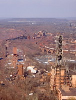
|
KRYVYI RIH IRON-ORE BASIN. The most important Ukrainian iron-ore-producing region and the largest single source of iron in the former USSR. A narrow strip about 100 km long and 2-7 km wide, extending through western Dnipropetrovsk oblast from the town of Zhovti Vody in the north to Inhulets in the south, the basin covers an area of approximately 300 sq km. The city of Kryvyi Rih is the major industrial center in the region. The Kryvyi Rih Basin has been excavated for iron ore since the time of the Scythians, but detailed prospecting and commercial exploitation began only in the second half of the 19th century. In 1881 Oleksander Pol founded a joint-stock company with French capital to develop mining in the basin. In its first year the company mined 37,400 tonnes of iron ore. Production rose rapidly when a railway was constructed in 1884 connecting Kryvyi Rih with the coal-producing region of the Donets Basin. By 1913 the Kryvyi Rih Basin provided 6.4 million tonnes, or 74.5 percent of all the iron ore produced in the Russian Empire. Fifty-one mines had been sunk and 23,600 miners worked in the region, making the area one of the largest industrial centers in Ukraine. Today, the Kryvyi Rih Basin, producing 85 percent of total Ukrainian output, supplies iron ore to several metallurgical plants in the Dnipro Industrial Region and the Donets Basin... |
| Kryvyi Rih Iron-ore Basin |
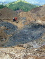
|
NIKOPOL MAGNANESE BASIN. One of the world's largest formations of manganese ore. It is part of a larger manganoferrous basin stretching from Bulgaria through southern Ukraine to Georgia and containing 70 percent of the world's continental reserves of manganese ore. The Nikopol Manganese Basin extends from the small deposits at Inhulets to two large deposits north of Nikopol and then southeast of the Dnipro River to Tokmak. The ore deposit is 1-20 km wide and on average 2-3.5 m thick. The total reserves amount to 2.3 billion tonnes. The ores consist of high-grade oxides, mixed, and lower-grade carbonates with an average manganese content of 23-26 percent, 11-35 percent, and 15-17 percent respectively. The mining of high-grade ores began at Marhanets, northeast of Nikopol, in 1886. Production was greatly expanded in the 1950s, when open-pit mining of carbonate ores began at Ordzhonikidze (now Pokrov), northwest of Nikopol. In 1980 the basin included seven mines, two quarries, and five enrichment plants. As the Nikopol Manganese Basin proper becomes exhausted, the Tokmak Basin assumes greater economic importance... |
| Nikopol Manganese Basin |
|
DNIPRO LIGNATE COAL BASIS or DNIPROBAS. The largest lignite coal basin in Ukraine, the Dniprobas lies in the central part of the country. It extends from the northwest to the southeast, mostly on the right bank of the Dnipro River and within the boundaries of the Ukrainian Crystalline Shield. The Dniprobas covers an area of almost 150,000 sq km. The coal reserves are connected with the Paleogene and Neogene deposits of the Cenozoic era. Over 120 fields in the Dniprobas have been located. Coal seams lie at depths of 10-170 m in one to three layers, which are 4-5 m and in some places even 25 m thick. The coal has a high ash content (15-45 percent) and a carbon content of 60-70 percent. Its heat value is 1,800-2,000 kcal/kg. On heating, it yields 54-71 percent volatile content, 3-12 percent bitumen, and 10-18 percent tar. The Dniprobas was first mined in the second half of the 19th century. Today 90 percent of the coal is mined in open pits. Only the fields at Korostyshiv, Yurkivka, Semenivka-Oleksandrivka (Kirovohrad oblast), Bandurivka, Balakhivka, and Mykhailivka, in Kirovohrad oblast and Dnipropetrovsk oblast, are mined. The coal is used exclusively for local needs: 80 percent is used in the form of fuel briquettes in various branches of the economy; 26 percent is used in the form of dust in thermoelectric stations; and 4 percent is used as raw material in the chemical industry. Over 11 million tonnes are mined annually... |
| Dnipro Lignite Coal Basin |
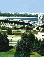
|
DNIPRO HYDROELECTRIC STATION. The largest hydroelectric station in Ukraine and, before the construction of the Volga stations, the largest in Europe. The station is located on the right bank of the Dnipro River above the city of Zaporizhia (and above Khortytsia Island, below the last rapids). The earliest plans for a hydroelectric station date back to 1905, but plans for a dam to inundate the Dnipro Rapids and make the whole length of the river navigable had been made in the 19th century. Its construction by the Dniprobud trust began in 1927, and its potential was to be 558,000 kW. By 1932 the first five of its nine generators were in operation. American specialists under the direction of Col H. Cooper took part in the construction. All the building machines and the first electrical equipment were imported from the United States. A reinforced-concrete dam 760 m long and 60 m high raised the water level of the Dnipro 37.8 m and inundated the Dnipro Rapids, making the river navigable year-round. An enormous reservoir formed above the dam, filling the narrow valley of the Dnipro as far as the city of Dnipro. This artificial lake, known as the Dnipro Reservoir, is almost 140 km long, 1.5 km wide at its upper end and 3 km wide at its lower end, and reaches a depth of up to 60 m. In 1941 the retreating Soviet forces blew up the dam and evacuated or destroyed the electrical machines and equipment. The Germans partly rebuilt the station but destroyed it again when they began to retreat in 1943. In 1944-7 three aggregates were rebuilt, and the rest were rebuilt in the 1950s. By 1979 nine aggregates with a total capacity of 1,312,000 kW were in operation... |
| Dnipro Hydroelectric Station |
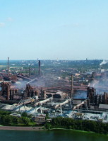
|
DNIPRO METALLURGICAL COMPLEX. Located in Kamianske, this is the largest metallurgical plant in Ukraine. It was built with foreign capital in 1887-9 by the South Russian Dnipro Metallurgical Company as the Dnipro Metallurgical Plant. By the First World War it was the largest metallurgical plant in the Russian Empire. In 1913 the plant produced over 499,000 tonnes of pig iron, 368,000 tonnes of steel, and 299,000 tonnes of rolled steel. Following the Revolution of 1917 it resumed operations in 1925, after undergoing reconstruction until 1924. The plant was expanded in the 1930s, evacuated in 1941, and again reconstructed and modernized after the Second World War. By 1949 it was producing 44 percent more pig iron and 37 percent more steel than before the war. After a new blast furnace (no. 12) was put into operation, the plant began to smelt more iron than was produced annually in all of the Russian Empire before 1917--4.2 million tonnes. Its basic output consists of agglomerated ores, pig iron, steel, rolled steel, pipes, rails, plates, and axles. In 1958 the plant became the first plant in the world to apply the technology of oxygen-enriched forced air and natural gas to the smelting of refined pig iron. In 1984 the Dnipro Metallurgical Plant was reorganized into the Dnipro Metallurgical Complex. Today the complex annually produces 4.35 million tonnes of pig iron, 3.85 million tonnes of steel, and 3.83 million tonnes of rolled steel... |
| Dnipro Metallurgical Complex |
The preparation, editing, and display of the IEU entries about the Dnipro Industrial Region were made possible by the financial support of the CANADIAN FOUNDATION FOR UKRAINIAN STUDIES.
 XI. THE FAUNA OF UKRAINE AND WILDLIFE PRESERVATION
Zoogeographically, the fauna of Ukraine belongs to the Euro-Siberian zone. Only the Crimean Mountains belong to the Mediterranean subzone. Because of Ukraine's border locations and the absence of natural barriers, its fauna is intermediate between the fauna of Europe and Central Asia, and between the fauna of the forest belt and the steppe belt and that of the subtropics. The western boundaries of the habitats of many eastern animal species run through Ukraine; similarly, the eastern and northern limits of the habitats of many western European and Mediterranean species are found in Ukraine. The Dnipro River is an important natural barrier to the east-west distribution of animals. In general, there are about 28,000 animal species on the territory of Ukraine, among them more than 690 species of vertebrates (101 mammal, 350 bird, 21 reptile, 19 amphibian, and over 200 fish, 110 of which are freshwater species). The widespread and increasingly intensive use of land for agriculture, the growth of large-scale exploitation of forests and minerals, and rapid industrialization and urbanization resulted in the need to protect what remains of the rich flora and fauna of Ukraine from extinction through a network of nature preserves that provide full protection to wildlife as well as wildlife refuges that provide partial protection... Learn more about the fauna of Ukraine and wildlife preservation efforts by visiting the following entries:

|
FAUNA. The present fauna of Ukraine began to develop in the late Eocene epoch, if not earlier. Among the mammals at the end of the Paleocene was the hornless rhinoceros; among the birds were the cormorant, sea gull, stork, wild duck, and owl. The rivers were inhabited by crocodiles and the seas by whales and many forms of mollusk and fish. During the several ice ages in the Pleistocene epoch much of Ukraine's territory was covered with glaciers. In the tundra bordering them lived species adapted to the cold climate. In the Middle Holocene the climate became similar to what it is today. Many species of the earlier period gradually perished (mammoth, rhinoceros); some species moved farther north (musk-ox). Human activities--hunting, herding, agriculture--contributed to the impoverishment of the mammoth fauna. The cultivation of the steppes, destruction of the forests, and draining of the marshes contracted the habitat of many species and contributed to their migration from Ukraine or to their extinction... |
| Fauna |

|
NATURE PRESERVES. Territories recognized as having intrinsic value that are designated for protection from commercial exploitation so that their natural characteristics will be maintained. In Ukraine a system of different kinds of nature preserves has evolved. The preserves differ in the scope of their protection activities, the jurisdiction under which they serve, the size of the territory they control, and the extent to which they are open to the public for popular education and outdoor recreation. As of 2007, the total area of all types of protected areas, nature preserves, and parks in Ukraine was approximately 2.8 million ha which represents about 4.7 percent of the total land area of Ukraine. Nature preserves represent the principal focus of Ukraine's nature preservation effort. The system was initiated in the former USSR shortly after the Revolution of 1917, and by 1988 it encompassed more than 150 nature preserves, of which 12 were in Ukraine... |
| Nature preserves |

|
WILDLIFE REFUGE. An area of land or a body of water designated for the purpose of protecting some specific plants or animal species. Such areas do not constitute fully rounded natural complexes, as in nature preserves. The most common wildlife refuges were established to protect valuable wild animals and birds by means of the prohibition of hunting on their territory for 10 years or more. Fishing refuges protect spawning grounds or young fish. A landscape refuge may protect a picturesque river valley or lake so that its esthetic qualities will be maintained for the benefit of outdoor recreation and tourism. Small plots of forest, steppe, or wetlands may be designated as plant refuges for the purpose of protecting their unique flora. Geological features such as caves or sites rich in fossils may also be protected. Even a site of historical significance may be designated as a wildlife reguge. In 2007 Ukraine had 2,709 wildlife refuges of various kinds, occupying a total area of over 900,000 ha... |
| Wildlife refuge |
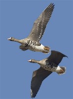
|
MIGRATORY BIRDS. Migration is a part of the life cycle of some birds. It is an annual phenomenon involving whole populations of birds in long-range displacements from their breeding grounds to wintering sites and back. Migration depends on a complex internal rhythm affecting the whole organism, particularly the endocrine glands. The geographical position of Ukraine and its climatic variations support several patterns of migratory behavior among the more than 150 species of migrating birds found there: seasonal translocation, overflights, mixed sedentary/migratory movements, and vertical movements. Most birds fly south or southwest for the winter, but some prefer eastern directions (finch, willow warbler). Massive seasonal translocation is typical for swallows, storks, geese, glareolas, sandpipers, nightingales, and other birds. The birds arrive in April or May and depart in September or October. Many water birds remain in their breeding areas as long as the lakes and rivers stay ice-free... |
| Migratory birds |

|
LIZARDS. A family representing a large group of scaly reptiles found throughout the world in tropical and temperate zones; its genus Lacerta includes most of the species of European lizards. Lizards are multicolored and blend with their surroundings. Most feed on insects and small invertebrates, some eat snails and crabs, and others are vegetarians. Lizard eggs, enclosed in a soft, leathery shell, are laid under rocks, in crevices, or in the sand. In Ukraine the green lizard lives in the steppe on the right bank of the Dnipro River. The fast lizard is found all over Ukraine. The viviparous lizard inhabits areas of Polisia, the northwestern forest-steppe, and the Carpathian Mountains. The Crimean lizard lives along the shores of the Black Sea. The cliff lizard is also a Crimean native. The sand lizard inhabits semidesert, arid steppe, and forest-steppe areas. Other species include the Crimean gecko, the multicolored chameleon, the steppe lizard, and the short-tail lizard... |
| Lizards |

|
ZOOLOGICAL GARDENS AND PARKS. Cultural and educational establishments in which wild and sometimes domesticated animals are kept for display, scientific research, and reproduction. The only difference between gardens and parks is in their size and the extent of their collections. In recent times zoological gardens have become responsible for the preservation and even breeding of rare or endangered species of animals; others have undertaken the task of acclimatizating animals to new geographic environments, research on various diseases and their prevention, and so on. In Ukraine the first zoological park was organized in 1875 in what is now the Askaniia-Nova Biosphere Reserve. Others followed in Kharkiv (1896), Mykolaiv (1901), Kyiv (1908), Odesa (1936), the town of Mena in Chernihiv oblast (1977), and Cherkasy (1979). The largest of these is the zoological park in Kyiv, covering an area of 40 ha, where over 1,600 animals representing more than 240 species are kept... |
| Zoological gardens and parks |
The preparation, editing, and display of the IEU entries featuring the fauna of Ukraine and wildlife preservation were made possible by the financial support from the CANADIAN FOUNDATION FOR UKRAINIAN STUDIES.
 XII. THE FLORA OF UKRAINE: FORESTS, FOREST-STEPPE, AND STEPPES
Ukraine, like any other world region, is shaped by and fully dependent on its vegetation. The plants support critical functions in the biosphere, at all possible levels. They regulate the flow of numerous biogeochemical cycles; they influence the climate and affect soil characteristics; they serve as wildlife habitat and the energy source for animals and humans; they are also critically important to the national and world economy. In Ukraine, the close relation between vegetation and climate, relief, humidity, and soil is apparent in the organization of plant life into wide meridional belts stretching from the southwest to the northeast. Moving from north to south the belts are forest, forest-steppe, steppe, and the zone of Mediterranean vegetation. Human agricultural activity greatly altered the original vegetation of Ukraine. Almost all the steppe is under cultivation and devoted to agricultural species. Large areas of the forest belt have also been converted to agricultural use. Intense long-term logging in the Carpathian Mountains has diminished the protective influence of the forests, as frequent floods and increasing erosion have shown. Between 1814 and 1914 the forest area in Ukraine diminished by 30.5 percent. Only a few ancient tracts remain untouched by humans, and for their preservation they have been placed under state protection... Learn more about Ukraine's vital natural resource--its flora--by visiting the following entries:

|
FLORA. The vegetation of Ukraine evolved through long geologic epochs and through many developmental phases before it attained its present form. In the Paleocene and Eocene, Ukraine had a tropical and subtropical flora. Palms, cinnamon trees, figs, laurels, eucalyptus, sequoias, and other trees grew in Ukraine. In the mid-Oligocene Mediterranean plants began to spread gradually to Ukraine, including oleander, pomegranate, beech, maple, and poplar. In the Miocene the vegetation generally assumed a temperate broad-leaved or broad-leaved-coniferous character, with a preponderance of deciduous forms such as beech, oak, and walnut. Gradually the flora changed to temperate warm-climate vegetation. In the Pliocene most of Ukraine was covered with forest vegetation. Among the evergreens were species of pine, with an admixture of hemlock, spruce, fir, and others; and among deciduous trees were birch, oak, hornbeam, maple, chestnut, walnut, and magnolia. The southern region was covered with steppe grasses... |
| Flora |

|
FOREST. One of the basic types of vegetation groupings, consisting of trees and shrubs and covering an extensive area. Forests have an effect on climate; the hydrological regime of the soil and the environment; the retention of surface soils, particularly on steep slopes and sands; and the composition of flora and fauna. Forests also have an enormous economic and esthetic importance. The degree of forestation and the variety of forest species in Ukraine are determined by Ukraine's geographical position between the humid region of Western Europe and the dry steppes of Asia. The forests in the western part of Ukraine have a Western European character; in the southern part small woods rather than forests are found. As Ukraine's climate, relief, soils, and water regime change from the west and north towards the east and south, large differences arise in the extent of forestation and the composition of the forests. The eastern and part of the southern limits of dispersal for such tree species as the fir, spruce, beech, hornbeam, and ash dissect Ukraine... |
| Forest |
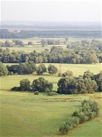
|
FOREST-STEPPE. A natural belt characterized by the alternation of forests--mostly deciduous--with steppe vegetation and fauna. In Ukraine the forest-steppe is the central belt stretching between the forest belt in the north and the steppe belt in the south. It is part of the Eastern European forest-steppe and covers about 30 percent of Ukraine's territory. The boundary with the forest belt (Polisia) runs along the line Lviv-Kremianets-Zhytomyr-Kyiv-Nizhyn-Hlukhiv and is distinct. Northwest of the main forest-steppe belt lies a large forest-steppe island called the Volhynia?Kholm forest-steppe. In the west the forest-steppe borders on a belt of forests of the Central European variety, covering Roztochia, the Sian Lowland, Subcarpathia, and the Opilia Upland. The southern border of the forest-steppe is not as distinct and is defined in different ways. The Ukrainian forest-steppe is a gently undulating plain, covered for the most part by a thick, loess stratum that overlies various geological layers dissected by gullies and ravines... |
| Forest-steppe |
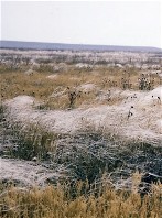
|
STEPPE. A term, originally applied to the natural grasslands of Southern Ukraine, which has been generalized to designate any natural grassland plain with a temperate, semiarid climate and chernozem or chestnut soils. The Ukrainian steppe encompasses most of the western segment of the Eurasian steppe that is known as the Black Sea (or Pontic) steppe province. The province forms a wedge, delimited by the forested foothills of the Crimean Mountains and the Caucasus Mountains in the south, the forest-steppe zone to the northwest, and the drier, more continental steppes east of the Volga River. The steppe thus occupies about 240,000 sq km (40 percent) of Ukraine, nearly 300,000 sq km (40 percent) of the compact Ukrainian ethnographic territory, and 460,000 sq km (48 percent) of both compact and mixed Ukrainian national territory. The steppe, endowed with the greatest heat resources in Ukraine, has the longest growing season, but receives the least precipitation and often suffers from drought... |
| Steppe |
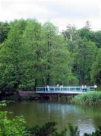
|
PARK. A tract of wild or cultivated ground set aside for recreation. Larger parks, such as nature preserves, wildlife refuges, and national parks, are set aside by the state for the purpose of conservation and scientific research. Smaller parks or gardens are maintained by municipalities for decorative and recreational purposes. Specialized botanical gardens and zoological gardens and parks usually belong to scientific institutions and serve scientific ends. The earliest parks in Ukraine, dating back to the Princely era, were either royal hunting preserves or gardens cultivated by monasteries and princes. Private parks appeared only in the first half of the 18th century. They were designed in the Italian baroque or the French style, with a symmetrical composition and a clearly defined center. A large number of parks were established in the second half of the 18th and at the beginning of the 19th century. Almost all of them were of the landscape or English type, based on the principle of free planning with the fullest utilization of natural conditions... |
| Park |
|
MEDICINAL PLANTS. Using plants for scientific medicine or folk medicine is known as phytotherapy. The roots, tubers, bulbs, leaves, flowers, seeds, and bark of medicinal plants are selectively used in making teas, infusions, tonics, juices, tinctures, powders, and poultices. About 80 percent of the ingredients in drugs for heart disease, gastrointestinal or nervous disorders, and other grave illnesses are taken from medicinal plants. A great number of plants have been used in Ukraine from time immemorial for the prevention or cure of sickness in humans and animals alike. Since the Second World War over 20 research institutions connected with medical and pharmaceutical institutes and universities have conducted research on medicinal plants in Ukraine. The Kharkiv Pharmaceutical Institute plays a leading role in this field. The gathering of wild plants and the cultivation of medicinal plants have expanded, and the research on new plants has led to the introduction of many foreign species and the adoption of many plants by official medicine... |
| Medicinal plants |
The preparation, editing, and display of the IEU entries about the flora of Ukraine's forests, forest-steppe, and steppes were made possible by the financial support of the CANADIAN FOUNDATION FOR UKRAINIAN STUDIES.
 XIII. THE CITY OF LVIV AND THE HISTORIC REGION OF GALICIA
After the death of Grand Prince Yaroslav the Wise in 1054, Kyivan Rus' began to fall apart into its component principalities. From 1084 Yaroslav's great-grandsons, Riuryk, Volodar, and Vasylko Rostyslavych, ruled the lands of Peremyshl, Zvenyhorod, and Terebovlia in the western regions of the Rus' state. Volodar's son, Volodymyrko made princely Halych his capital, and his son, Yaroslav Osmomysl, enlarged Halych principality during his reign (1153-87) to encompass all the lands between the Carpathian Mountains and the Dnister River as far south as the lower Danube River. This region assumed the historic name of Galicia. Prince Roman Mstyslavych united Galicia with Volhynia and thus created the Principality of Galicia-Volhynia, which fourished during the reign of Prince (and later King) Danylo Romanovych (1238-64). In 1272 Lviv became the capital, and in 1303 Halych metropoly was founded. But resurgent boyar defiance, the Mongol invasion, and the territorial ambitions of Poland and Hungary took their toll. In 1349 King Casimir III the Great of Poland invaded Galicia and progressively occupied it. The entire region remained under Polish rule until 1772 when it was annexed by the Ausrian Empire. All this time, however, Galicia was a very important centre of Ukrainian national, cultural, and religious life. The defence of Ukrainian interests in the face of strong Polish pressures was assumed by the Orthodox brotherhoods. One of the first was the Lviv Dormition Brotherhood, which existed as early as 1463, but which became most active after the 1580s. However, it was only under Austrian rule in the 18th and 19th centuries that Galicia found favorable conditions to the Ukrainians' religious life and education. Under the impact of Romanticism and developments in central and eastern Ukraine, a Ukrainian cultural and national renaissance began in Galicia in the 1820s. This renaissance reached it apogee in the Revolution of 1848-9 in the Habsburg monarchy when the Supreme Ruthenian Council was founded to represent Galician Ukrainian national aspirations. In the period 1867-1914, Ukrainian cultural and, to some extent, political life in Galicia underwent a remarkable growth. After the Ems Ukase prohibited Ukrainian publications in Russian-ruled Ukraine in 1876, Galicia became the 'Piedmont' of the Ukrainian movement. When the First World War broke out, the Ukrainian parties founded the Supreme Ukrainian Council in August 1914 in Lviv. Before the collapse of the Habsburg state, Galician and Bukovynian political leaders met in Lviv and proclaimed a Ukrainian state on the territories of Galicia, northern Bukovyna, and Ukrainian Transcarpathia--the Western Ukrainian National Republic (ZUNR). On 3 January 1919 the ZUNR officially united with the Ukrainian National Republic, creating thus a unified independent Ukrainian state... Learn more about the city of Lviv and the historic region of Galicia by visiting the following entries:
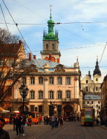
|
LVIV. A city (2015 pop 729,429) and the center of Lviv oblast, the historical capital of Galicia and Western Ukraine, and, after Kyiv, the second cultural, political, and religious center of Ukraine. By population it is the seventh-largest city in Ukraine and the largest in the western oblasts. Standing at the meeting place of three geographical-economic regions--the Roztochia woodlands, the cultivated fields of the Buh Depression, and the fields of Podilia--Lviv has been for centuries a natural exchange center among them. But the main reason for its development was its location at the intersection of natural trade routes--the north-south route from the Baltic Sea to the Black Sea (Kholm-Halych) and the east-west route (Cracow-Kyiv). Lviv was founded in the mid-13th century by Prince Danylo Romanovych near Zvenyhorod, which had been razed by the Tatars, and named after his son Lev Danylovych. The city is first mentioned in the Galician-Volhynian Chronicle under the year 1256. In the 1260s, during the reign of Prince Lev Danylovych, Lviv became the capital of the Principality of Galicia-Volhynia; it remained its capital until the principality's dissolution in the 1340s. Because of its location Lviv became an important commercial and cultural intermediary between Western and Eastern Europe, a role assumed from the declining cities of Zvenyhorod, Halych, and Kholm. Lviv's influence fluctuated between national and regional, according to historical events, particularly the power of Galicia. Its western location, far from the usual invasion routes of the Tatars, assured it a more peaceful development than Kyiv's. As Kyiv declined, Lviv rose to national stature. Nevertheless, for centuries it was the principal arena of Polish-Ukrainian conflict... |
| Lviv |
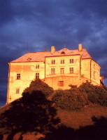
|
GALICIA. A historical region in southwestern Ukraine. Its ethnic Ukrainian territory occupies the basins of the upper and middle Dnister River, the upper Prut River and Buh River, and most of the Sian River, and has an area of 55,700 sq km. Its population was 5,824,100 in 1939. The name is derived from that of the city of princely Halych, a former capital of the medieval Principality of Galicia-Volhynia. Galicia is linked to the rest of Ukraine by land routes only. It is bounded by Poland in the west, Transcarpathia and the Lemko region in the southwest, Bukovyna in the southeast, Podilia in the east, Volhynia in the northeast, and the Kholm region in the northwest. Its location on the crossroads to the seas led its expansionist foreign neighbors, especially Poland and Hungary, to strive repeatedly to gain control of Galicia. Galicia's location protected it from the incursions of Asiatic nomadic peoples and facilitated contact with the rest of Europe. After the demise of Kyiv as the capital of Kyivan Rus', the main trade route linking the Baltic Sea with the Black Sea and Byzantium passed through Galicia. Because of its distance from the Eurasian steppe, medieval Rus'-Ukrainian statehood survived there as the Principality of Galicia-Volhynia for another century after the sack of Kyiv by the Mongols in 1240. At that time Galicia became a reservoir of Ukrainian population, much of which later remigrated to the east. Under Polish rule (1340-1772) Galicia constituted first Rus' land (Regnum Russiae) and then from 1434 Rus' voivodeship (palatinate) and the western part of Podilia voivodeship. The region was under Austrian rule in 1772-1918...
|
| Galicia |
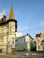
|
DROHOBYCH. City (2015 pop 76,795) in Subcarpathia on the Tysmenytsia River; the center of the Drohobych-Boryslav industrial region in Lviv oblast. The population of Drohobych was 32,300 in 1931, 42,000 in 1959, and 56,000 in 1970. The town probably existed in the Kyivan Rus' period. It was first mentioned in documents in the second half of the 14th century. In 1496 it received Magdeburg law. Under the Polish Commonwealth Drohohobych was the center of a large rural county (starostvo). In the 14th-16th century a large salt industry and trade developed. From the beginning of the 17th century a Ukrainian Catholic brotherhood was active in the town. After Austria's annexation of Galicia, one of the two urban Ukrainian schools in Galicia was located in Drohobych from 1775 to 1830. In the middle of the 19th century ozokerite began to be mined, and then oil and natural gas. Petroleum refineries were built at the beginning of this century. The influx of foreigners who worked in industry and trade changed the composition of Drohobych's population: in 1869, of the town's 16,880 inhabitants 28.7 percent were Ukrainian, 23.2 percent were Polish or Roman Catholic, and 47.7 percent were Jewish; in 1939, when the population was 34,600, the respective figures were 26.3 percent, 33.2 percent, and 39.9 percent. Until 1939 Drohobych was a Ukrainian national and cultural center, with a Ukrainian gymnasium, music school, and Basilian monastery. In 1939-41 and 1944-59 the town was the capital of Drohobych oblast, which later became incorporated into Lviv oblast. By 1959 Ukrainians constituted 70 percent of the town's population; Russians, 22 percent; Poles, 3 percent; and Jews, 2 percent... |
| Drohobych |
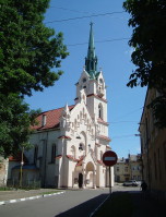
|
STRYI. A city (2015 pop 59,629) on the Stryi River and a raion center in Lviv oblast. It is first mentioned in historical documents in 1385, when Galicia was under Polish rule. In 1460 the town was granted the rights of Magdeburg law. Stryi's economic development can be attributed largely to its strategic location on the main trade route to Mukachevo through the Carpathian Mountains. Under Austrian rule (1772-1918) Stryi became a county center and the seat of a circuit court. It developed into an industrial and commercial town, and its population grew from 8,000 in 1843 to 12,600 in 1880, 23,200 in 1900, and 30,900 in 1910. By the end of the 19th century Stryi was an important center of the Ukrainian national movement in Galicia. The town's chief civic leaders were Yevhen Olesnytsky and Ostap Nyzhankivsky. Stryi was one of the first centers of the Ukrainian women's movement: the first women's rally was held there in 1891, and the first edition of the women's almanac Nasha dolia (Our Fate, 1893) was published there. Stryi was an important center of the Ukrainian co-operative movement: the Provincial Dairy Union (later the Maslosoiuz Provincial Dairy Union) was founded there in 1907, and the first Ukrainian provincial exhibition was held there in 1909. A Ukrainian gymnasium was opened in Stryi in 1906, and the newspapers Stryis'kyi holos (1894-5) and Hospodar i promyslovets' (1909-11) appeared there. During the Ukrainian-Polish War in Galicia, 1918-19, the headquarters of the Stryi Brigade of the Ukrainian Galician Army were located in Stryi... |
| Stryi |
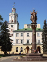
|
SAMBIR. A city (2015 pop 35,076) on the Dnister River and a raion center in Lviv oblast. When Staryi Sambir was destroyed by the Tatars in 1241, the survivors settled in the fortified settlement of Pohonych and renamed it Sambir, Novyi (New) Sambir, or Nove Misto (New Town), although the name Pohonych was used until the mid-15th century. Sambir was part of the Principality of Galicia-Volhynia (until 1349), the Polish-Lithuanian Commonwealth (1387-1772), and the Austrian Empire (1772-1918). It was under Polish rule (1919-39) and after the Second World War became part of the Ukrainian Soviet Socialist Republic. In 1390 it was granted the rights of Magdeburg law. In the 15th and 16th centuries it was an important trading and manufacturing town. Under Austrian and then Polish rule it was a county center. Today Sambir is an industrial and transportation center. Its factories produce radio parts, instruments, glass, furniture, clothes, and sugar and repair road-building machinery. Its chief architectural monuments are a Gothic Roman Catholic church (1530-68), Stephen Bathory's hunting lodge (16th century), the ruins of the town walls (16th-17th century), the city hall (1668) with a tall Renaissance tower, the theological seminary (1679), the Byzantine cathedral (1738, restored 1893-4), a Jesuit church (1751), an 18th-century park, and residential buildings of the 18th and 19th centuries. More recently the Les Kurbas Memorial Museum (1987) and the Boikivshchyna Historical-Ethnographical Museum (1989) have been opened... |
| Sambir |
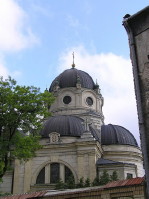
|
ZHOVKVA. A city (2014 pop 13,629) on the Svynia River and a raion center in Lviv oblast. According to archeological evidence the site was inhabited as early as the 3rd or 2nd century BC. A settlement at the location is first mentioned in historical documents under the name Vynnyky in 1368. In 1597 a new town was established at this site and named Zhovkva in honor of its owner, the Polish field hetman Stanislaw Zolkiewski. The town was granted the rights of Magdeburg law in 1603. A castle was built to protect the town from Tatar raids, and King Jan III Sobieski established a residence there. Zhovkva developed into a trade and manufacturing center. It was noted for its talented craftsmen and artists, who at the beginning of the 18th century formed the Zhovkva School of Artists. The town was also an important religious center, with many churches and monasteries. The Zhovkva Monastery of the Basilian monastic order, which was built in the 17th century, developed into an important publishing center at the end of the 19th century. Under Soviet rule Zhovkva was called Nesterov in 1951-1992 in honor of Russian pilot P. Nesterov. Zhovkva's architectural monuments include the large, well-preserved castle, a church and monastery of the Dominican order from the 17th century, a synagogue, two wooden churches from the beginning of the 18th century, the Basilian church and monastery, which were restored in 1907, the remnants of the brick defensive walls and two city gates, and the old market square with some original buildings... |
| Zhovkva |
The preparation, editing, and display of the IEU entries about the city of Lviv and the historic region of Galicia were made possible by the financial support of the IVAN AND ZENOVIA BOYKO ENDOWMENT FUND at the CANADIAN INSTITUTE OF UKRAINIAN STUDIES (Edmonton, AB, Canada).
 XIV. IVANO-FRANKIVSK AND THE CENTRAL SUBCARPATHIA AND POKUTIA REGIONS
The picturesque region of Subcarpathia, spreading to the east of the Carpathian Mountains, and the region of Pokutia, located still further to the east, belong to the most densely populated parts of Ukraine. The average population density in these regions approaches 220 persons (including 80 rural residents) per sq km. The central Subcarpathia with its main city of Ivano-Frankivsk (formerly Stanyslaviv) and Pokutia with its main city of Kolomyia, are also among the most ethnically homogeneous regions in Ukraine, with ethnic Ukrainians constituting over 90% of the population (over 97% in Pokutia), while Russians, Poles, and Jews represent the most numerous national minorities. During the Middle Ages these regions formed the centre of the Halych Principality in Kyivan Rus' and subsequently, of the Galician-Volhynian state. Controlled by Poland for several centuries and then ruled by the Austrian Empire until 1918, these regions constituted a vital part of the short-lived Western Ukrainian National Republic with Stanyslaviv (now Ivano-Frankivsk) serving as the republic's capital from December 1918 to May 1919. Today Ivano-Frankivsk oblast is one of the most vibrant cultural and economic region of western Ukraine... Learn more about the city of Ivano-Frankivsk and the central Subcarpathia and Pokutia regions by visiting the following entries:
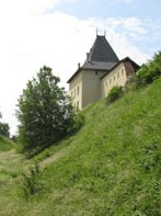
|
SUBCARPATHIA. A physical-geographic region located between the Carpathian Mountains to the southwest, the Pokutian-Bessarabian Upland to the east, the Podolian Upland with its subregion, the Opilia Upland, to the northeast, and the Roztochia plateau to the north. To the northwest Subcarpathia passes into the Sian Lowland. The length of Subcarpathia (excluding the Sian Lowland) is 250 km; the width varies from 30 km in the southeast to 60 km in the northwest, for an approximate area of 10,000 sq km. Subcarpathia occupies approximately one-fifth of the historical regions of Galicia and Bukovyna and has a population of about 1.4 million. The towns in the Carpathian foothills are generally small. The larger cities are located at some distance from the Carpathians: Sambir, Drohobych, Stryi, Kalush, Ivano-Frankivsk, Kolomyia, and Chernivtsi. All the larger cities have possessed administrative, trade, and industrial functions for a long time. The historical influence of some of the cities as Ukrainian cultural-educational centers extended well beyond their immediate areas... |
| Subcarpathia |
|
IVANO-FRANKIVSK. City (2010 pop 240,458), raion center and capital of Ivano-Frankivsk oblast, an important railway and highway junction, and now the second-largest city in Galicia. Called Stanyslaviv until 1939 and Stanislav until 1962, it is situated in Subcarpathia near the confluence of the Bystrytsia Nadvirnianska River and Bystrytsia Solotvynska River. Stanyslaviv was founded in 1662 on the site of the former village of Zabolotiv by the Polish magnate A. Potocki, who named it after his son, Stanislaw. In 1663 it was granted the rights of Magdeburg law. The town was well protected by walls and a citadel (restored in the mid-18th century) and was densely built up. Potocki's palace was completed there in 1672 and the town hall in 1695. After the Turks captured Kamianets-Podilskyi in 1672, Stanyslaviv protected the southeastern borders of the Polish-Lithuanian Commonwealth from the Turks and Tatars. Stanyslaviv was also a flourishing cultural center. A branch of the Cracow Academy was established there in 1669; in 1722 it was converted into a Jesuit college... |
| Ivano-Frankivsk |
_s.jpg)
|
KALUSH. City (2010 pop 67,887) and raion center, in and under the jurisdiction of Ivano-Frankivsk oblast, situated in the Kalush Depression on the Syvka River. First mentioned in the Galician-Volhynian Chronicle under the year 1241, in 1549 it received the rights of Magdeburg law. Under Austrian and Polish rule Kalush was a county town. Its rapid growth in the early 19th century was conditioned by rock-salt mining in its vicinity. As salt production fell the town declined, and in the latter half of the 19th century the population grew very little (1857 pop 8,000; 1914 pop 9,000). Its fortunes improved with the development of potassium-salt extraction and processing based on the rich Kalush-Holyn potassium deposits, and its population grew to 40,700 by 1970. Today the city's major industries are the Oriana chemical-metallurgical conglomerate, a reinforced-concrete complex, and a metalworking complex. The Kalush Polytechnical College is located there... |
| Kalush |
|
HALYCH. City (2001 pop 6,495) at the confluence of the Lukva River and Dnister River, raion center of Ivano-Frankivsk oblast. It arose in the 14th century, some time after the Mongols destroyed the city of princely Halych, on the site of the city's river port 5 km north of the city center. Princely Halych, dating back to the turn of the 9th century, was an important trade and cultural center of medieval Kyivan Rus'. It reached the height of its power in the second half of the 12th century. From 1144 it was the capital of Yaroslav Osmomysl's Halych Principality, and from 1199 the capital of Roman Mstyslavych's Principality of Galicia-Volhynia. In 1238 Danylo Romanovych established his residence at Halych. Three years later the city was razed by the Mongols. By the middle of the 14th century the town and the surrounding territory were annexed by Poland. In 1367 Halych was granted the rights of Magdeburg law. From the 14th century it was the see of the Halych metropoly. By the 16th century the town was one of the larger trade centers in eastern Galicia... |
| Halych |
|
POKUTIA. A historical-geographic upland region bounded by the Dnister River and the Podolian Upland to the north, the Prut River and Subcarpathia to the south, the Stanyslaviv Depression to the west, and the Sovytsia River to the east. Extending up to 100 km from east to west and 25-40 km from north to south, Pokutia covers about 3,000 sq km and has a population of about 400,000. Users of the Pokutian dialects also inhabit a portion of Subcarpathia. Because of their presence there, the term Pokutia has been used to refer to the entire southeastern corner of Galicia. Greek and Roman accounts of widespread Slavic settlement have been confirmed by archeological finds in Pokutia. In the 4th and 5th centuries the Slavs of Pokutia were members of the Antes tribal alliance. In the 10th century Pokutia was part of Kyivan Rus', and after the Liubech congress of princes it became part of the Halych principality. In the second half of the 14th century Poland annexed Galicia, including Pokutia, which was claimed by the emerging principality of Moldavia... |
| Pokutia |
|
KOLOMYIA. City (2010 pop 70,000) on the Prut River in southeastern Galicia and a raion center in Ivano-Frankivsk oblast. The principal city of Pokutia, it is an important transport junction. First mentioned in the Hypatian Chronicle under the year 1240, it was granted the rights of Magdeburg law in 1405. Salt was mined in the vicinity from the Middle Ages, and Kolomyia became an important salt-trading center. Because of its proximity to the Moldavian border, the town suffered frequent attacks by the Moldavians, Tatars, and Turks. Under Austrian rule it was a county center (1815-1918). Owing to its importance as a commercial and administrative center it grew rapidly, reaching a population of 23,100 in 1880 and 42,700 in 1910, of which Jews constituted a large part. Until 1914 (and to a lesser extent even until 1939), Kolomyia was a major center of Ukrainian culture in Galicia. Until the early 20th century its role in publishing in Galicia was second only to Lviv's. Of all of Galicia's provincial cities Kolomyia had the most (over 30) newspapers and journals... |
| Kolomyia |
The preparation, editing, and display of the IEU entries featuring the city of Ivano-Frankivsk and the central Subcarpathia and Pokutia regions were made possible by a generous donation from the FRANKO FOUNDATION of Toronto, ON, Canada.
 XV. THE CITY OF KHARKIV AND THE HISTORIC SLOBIDSKA UKRAINE
The territories in northeastern Ukraine centered today on the city of Kharkiv once belonged to the Kyiv and Chernihiv principalities of Kyivan Rus'. With the Mongol invasions of the 13th century they were largely unsettled and constituted part of the so-called Dyke Pole, a wild steppe dominated by nomadic tribes. In the 16th century Ukrainian Cossacks and Russian peasants began settling there, and they became part of Slobidska Ukraine, a region of self-governing settlements called slobody. The generally accepted date of Kharkiv's founding is 1654/5, when Ukrainian Cossacks built a fortified settlement on the plateau surrounded by the Kharkiv River and the Lopan River. A fortress was completed in 1659. Today Kharkiv is Ukraine's second-largest city and a bustling industrial and cultural center. From 1920 to 1934 it was the capital of Soviet Ukraine... Learn more about the city of Kharkiv and the historic Slobidska Ukraine by visiting the following entries:
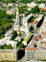
|
KHARKIV. Ukraine's second-largest city (2005 pop 1,465,000), situated at the confluence of the Lopan River, the Udy River, and the Kharkiv River; the historic capital of Slobidska Ukraine, it is an important industrial, commercial, communications, scientific, and cultural center. Kharkiv's proximity to the Donets Basin and its location at the intersection of the trade routes between Russia and the Black Sea and central Ukraine and Caucasia have facilitated its economic growth. The city is over 300 sq km in area. Kharkiv is the most important machine-building industrial center in Ukraine. With over 450 industrial enterprises, it has some of the largest factories in Ukraine. Kharkiv is also a major cultural and scientific center in Ukraine, second only to Kyiv...
|
| Kharkiv |
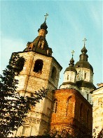
|
SLOBIDSKA UKRAINE. A historical-geographic region in northeastern Ukraine that corresponds closely to the area of the following Cossack regiments: Ostrohozke, Izium, Kharkiv, Okhtyrka, and Sumy regiments. Its name, derived from the sloboda settlements founded there, came into use in the early 17th century and continued until the early 19th century. In the 1630s and 1640s hundreds of slobody were created in the border region between the Cossack Hetman state and Muscovy and they attracted peasants from Left-Bank and Right-Bank Ukraine. Slobidska Ukraine bordered on the Hetman state to the west, the borderlands of the Crimean Khanate and the Zaporizhia to the south, the Don River to the east, and Muscovy to the north... |
| Slobidska Ukraine |
|
KHARKIV OBLAST. An administrative region in northeastern Ukraine, formed on 27 February 1932. Its area is 31,400 sq km; its population peaked at 3,196,600 in 1990; by 2005 it declined to 2,848,000. The oblast is one of the most industrialized in Ukraine. In 2000, with its population accounting for 5.9 percent of the population of Ukraine, the oblast produced 6.8 percent of Ukraine's industrial output by value. Kharkiv oblast is also a major agricultural producer. Occupying 5.2 percent of the land area of Ukraine, it accounts for 6.2 percent of Ukraine's area sown to crops and 5.6 percent of Ukraine's total agricultural output (in 2003) by value... |
| Kharkiv oblast |
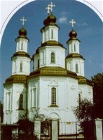
|
IZIUM. City (2005 pop 54,600) and raion center in Kharkiv oblast, situated in a picturesque setting at the foot of Kremianets Mountain on the right bank of the Donets River. A settlement was established there in the second quarter of the 17th century; in 1681 it was fortified by Kharkiv regiment's Col H. Donets, and the fortress served as an important defense outpost against Tatar incursions. From 1685 to 1765 Izium was a regimental town in Slobidska Ukraine. Because of its importance as an industrial and commercial center between Kharkiv and the Donets Basin, it has expanded rapidly (1926 pop 12,000; 1959 pop 38,000; 1970 pop 52,000)... |
| Izium |
|
KUPIANSK. City (2005 pop 31,200) and raion center under Kharkiv oblast jurisdiction, situated on the Oskil River. It was founded in 1655 as a sloboda (self-governing settlement) and was a company town in Kharkiv regiment and Izium regiment of Slobidska Ukraine (1685?1765). It became a county town in Voronezh vicegerency in 1780, in Slobidska Ukraine gubernia (1797), and in Kharkiv gubernia (1835). Since the late 19th century Kupiansk has been an important railway junction: five lines intersect there and at the adjacent town of Kupiansk Vuzlovyi. The city has an agricultural-machinery factory and food-processing industry. There is a historical-regional museum and an automobile-transportation tekhnikum.... |
| Kupiansk |
The preparation, editing, and display of the IEU entries dealing with the history and culture of Kharkiv and Slobidska Ukraine were made possible by the financial support of the FOUNDATION OF THE ENCYCLOPEDIA OF UKRAINE (Toronto, ON, Canada).
 XVI. VINNYTSIA, KHMELNYTSKYI, AND THE LAND OF MIDDLE AND EASTERN PODILIA
The history of Podilia--the land located between Galicia and Subcarpathia in the west and the Dnipro Upland of central Ukraine in the east--was strongly influenced by its proximity to the steppe. According to the Primary Chronicle Podilia was settled by several Ukrainian tribes, and during the reign of Prince Oleh and Prince Ihor it became part of the Kyivan Rus' state. As the power of Kyivan Rus' waned under pressure from the Mongols, it lost interest in eastern Podilia, and the region became a marchland of Galicia. Western Podilia (today's Ternopil oblast) along with Galicia remained under the Romanovych dynasty, and middle and eastern Podilia was administered directly by the Tatar Golden Horde. The political situation changed in the mid-14th century when the Lithuanians defeated the Tatars at Syni Vody (1363) and captured middle Podilia. From the mid-15th century Podilia was the favorite target of Tatar raids. When they diminished, the fertile region attracted Polish colonists from the northwest, who filled the political power vacuum. Later middle and eastern Podilia played an important role in the Cossack Hetman state set up by Hetman Bohdan Khmelnytsky and was the seat of two Cossack regiments: Bratslav regiment and Vinnytsia regiment. In 1699 Podilia was taken by Poland. In 1712, after an unsuccessful rebellion, the Cossack regiments were disbanded. With the Second Partition of Poland (1793) middle and eastern Podilia was transferred to Russia. Kamianets-Podilskyi became the administrative center of Podilia gubernia and Podilia eparchy. The Ukrainian national and cultural movement developed slowly in Podilia, mainly at the end of the 19th century. Its centers were Kamianets-Podilskyi and Vinnytsia... Learn more about the land of middle and eastern Podilia and its history by visiting the following entries:
|
PODILIA. A historical-geographical upland region of southwestern Ukraine, consisting of the western part of the forest-steppe belt. Podilia is bounded in the southwest by the Dnister River, beyond which lie the Pokutian-Bessarabian Upland and Subcarpathia. To the north it overlaps with the historical region of Volhynia, where the Podolian Upland descends to Little Polisia and Polisia. In the west it is bounded by the Vereshchytsia River, beyond which lies the Sian Lowland. To the east Podilia passes imperceptibly into the Dnipro Upland, with the Boh River serving as part of the demarcation line, and in the southeast it descends gradually toward the Black Sea Lowland and is delimited by the Yahorlyk River and the Kodyma River. The Podilia region thus coincides with the Podolian Upland, which occupies an area of approx 60,000 sq km. The name Podilia has been known since the mid-14th century. Today western Podilia encompasses Ternopil oblast (although the Kremianets area historically belonged to Volhynia) and small parts of Lviv oblast and Ivano-Frankivsk oblast, while middle and eastern Podilia includes almost the whole of Khmelnytskyi oblast and Vinnytsia oblast... |
| Podilia |
|
VINNYTSIA. A city (2010 pop 369,195) on the Boh River and an oblast center since 1932. It is first mentioned in historical documents in 1363, as a Lithuanian fortress. The settlement gradually developed from a farming village into a manufacturing and trade center. By the 16th century it held regular fairs, had several guilds, and traded with cities on the Black Sea coast. As a frontier town Vinnytsia was exposed to Tatar attack: between 1400 and 1569 it was raided more than 30 times. In 1558 a new fortress was built on a river island, and then a new town sprang up on the right bank. From 1569 Vinnytsia was under Polish rule. In 1598 it was made the administrative center of Bratslav voivodeship, and in 1640 it was granted the rights of Magdeburg law. An Orthodox brotherhood was set up by the burghers in the 1570s. It sponsored a brotherhood school, which operated for almost two centuries. In 1632 a college was set up at the brotherhood Monastery of the Elevation of the Cross. After being liberated from the Poles by Maksym Kryvonis in 1648, Vinnytsia became a regimental center (1653-67) in the Cossack Hetman state. Under Ivan Bohun's command it withstood a major Polish siege in 1651... |
| Vinnytsia |
|
KHMELNYTSKYI. City (2010 pop 261,654), the capital of Khmelnytskyi oblast. Until 1954 it was called Proskuriv, when it was renamed to honor Hetman Bohdan Khmelnytsky. First mentioned as the Polish royal outpost of Ploskyriv in 1493, it was fortified in the 16th century. Its inhabitants took part in the Cossack-Polish War and in the haidamaka uprisings. In 1780 the town was renamed Proskuriv. In 1793 it came under Russian rule and became a county center (from 1797 in Podilia gubernia). From 1917 to November 1920 Proskuriv was controlled much of the time by the Ukrainian National Republic. Under Soviet rule from 1920, it became an okruha center (1923-30, 1935-7) and then an oblast capital (in 1941 and 1944-54 of Kamianets-Podilskyi oblast). The Second World War brought about radical changes in the national composition of its population: the Ukrainians rose from 39 percent in 1926 to 53 in 1959, and Russians from 7 to 21 percent, while Jews fell from 42 to 10 percent, and Poles from 10 to 7 percent. Until the Soviet period the city's economy was based on sugar refining, grain markets, and cottage industries. Today Khmelnytskyi is a rail junction and an important industrial center... |
| Khmelnytskyi |
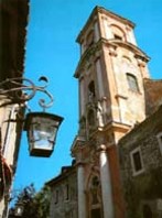
|
KAMIANETS-PODILSKYI. City (2009 pop 101,185) and raion center of Khmelnytskyi oblast. First mentioned in an Armenian chronicle of the 11th century, when it belonged to Halych principality, the town was destroyed by the Mongols in 1240. In the 1360s it fell under the rule of the Lithuanian Koriiatovych princes. In 1430 Poland gained control of the town; in 1432 it was granted the rights of Magdeburg law; and in 1463 it became the capital of Podilia voivodeship. Under the Poles it grew into a center of international trade and artisanry, second only to Lviv. Its wooden Kyivan Rus' fortress was replaced in the 15th and 16th centuries by a large stone citadel, and the city was well fortified with walls and towers. It protected the frontier of the Polish-Lithuanian Commonwealth from the Tatars and Turks. The city's old town lies picturesquely on a high plateau within a loop formed by the Smotrych River. Located there are centuries-old narrow, winding streets and buildings, the citadel, which was separated from the rest of the town by a deep ravine. The city's abundance of architectural monuments (the third most numerous in Ukraine after Kyiv and Lviv) and striking geographic locale have made it a popular tourist destination... |
| Kamianets-Podilskyi |
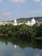
|
MOHYLIV-PODILSKYI. A city (2010 pop 32,562) on the Dnister River and a raion center in Vinnytsia oblast. In 1595 Stanislaw Rewera Potocki founded a town at the site of Ivankivtsi village and named it after his father-in-law, Yarema Mohyla (Movila), a prince of Moldavia. A few years later a castle was built. Located on the trade route from Ukraine to Moldavia, Mohyliv grew rapidly into an important trading center and the largest town in Podilia. Its inhabitants took part in a number of popular uprisings--that of Severyn Nalyvaiko in 1595 and others in 1614 and 1637-8. In 1648 it became a regiment center in Bohdan Khmelnytsky's Cossack Hetman state. It was destroyed during the Cossack-Polish War in 1649 and 1654. After participating in Ivan Sirko's uprisings in 1664 and 1671, Mohyliv was captured by the Turks (1672-99). The town gained the rights of Magdeburg law in 1743 and developed into a flourishing economic and cultural center. In 1616 its Orthodox brotherhood set up a printing press, and in the 18th century printed books in Ukrainian, Russian, Greek, and Moldavian. In 1795 Mohyliv came under Russian rule... |
| Mohyliv-Podilskyi |
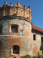
|
STAROKOSTIANTYNIV. A city (2001 pop 35,206) on the Sluch River and a raion center in Khmelnytskyi oblast. It was founded in the 1560s by Prince Kostiantyn Vasyl Ostrozky, who fortified Kolyshchentsi village and raised it to the status of a city with the rights of Magdeburg law. Until the beginning of the 17th century the town was known as Kostiantyniv or Kostiantynivka. In the 16th and 17th centuries it was a major center of Socinianism in Volhynia. Many battles between Cossack and Polish armies, especially during Bohdan Khmelnytsky's rule, were fought in the vicinity of Starokostiantyniv. After the partition of Poland in 1793, the town was annexed by Russia. In the 19th century it was a county center of Volhynia gubernia and a manufacturer of tobacco products, oil, soap, beer, bricks, and potash. By 1911 its population was about 20,000, including 11,800 Jews, 7,200 Ukrainians, and 1,200 Poles. During the Ukrainian-Soviet War, 1917-21, the Ukrainian Galician Army fought the Red Army near the town, and later that year the UNR Army broke through the Bolshevik front there to launch its First Winter Campaign... |
| Starokostiantyniv |
The preparation, editing, and display of the IEU entries featuring the land and history of middle and eastern Podilia were made possible by the financial support of the IVAN AND ZENOVIA BOYKO ENDOWMENT FUND at the CANADIAN INSTITUTE OF UKRAINIAN STUDIES (Edmonton, AB, Canada).
 XVII. THE TERNOPIL REGION AND WESTERN PODILIA
With the First Partition of Poland (1772) western Podilia, east to the Zbruch River, was annexed by Austria, and with the Second Partition (1793) eastern Podilia was transferred to Russia. After this division each part of Podilia developed differently. Eastern Podilia saw the intensification of serfdom under Russian rule. In western Podilia centered around Ternopil, as in all Galicia, the Polish population continued to dominate the administration of the land. Nevertheless western Podilia, along with the rest of Galicia and Bukovyna, became the base of the modern Ukrainian national and political movement. Ternopil was the only major city in Western Ukraine in which Ukrainians outnumbered the Poles and Ukrainian burghers had attained substantial wealth and influence. During the Ukrainian struggle for independence (1917-20) western Podilia was part of the Western Ukrainian National Republic, and from 21 November 1918 to 2 January 1919 Ternopil served as the republic's provisional capital. In the interwar period western Podilia was ruled by Poland, but after the Second World War ir became part of the Ukrainian SSR as Ternopil oblast. Main cities of the region include Berezhany, Buchach, Chortkiv, Terebovilia, and Kremenets (which historically belonged to Volhynia)... Learn more about Ternopil and western Podilia by visiting the following entries:
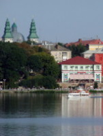
|
TERNOPIL. A city (2012 pop 217,055) on the left bank of the Seret River and the capital of Ternopil oblast. In 1540 the Polish magnate Jan Tarnowski built a fortress there against Tatar attacks, and in 1548 the town was granted the rights of Magdeburg law. In 1570 it became the property of Prince Kostiantyn Vasyl Ostrozky, who set up a hospital foundation and an Orthodox church brotherhood. Subsequently it was owned by other magnates. In spite of frequent Tatar attacks (1544, 1575, 1589, 1618, 1672, 1694) Ternopil developed as a manufacturing and trading center. During the Cossack-Polish War, in 1648 and 1655 it was captured by Bohdan Khmelnytsky's army. In 1675 the Turks dismantled its fortifications. By 1672 Ternopil had a population of 2,400, composed of Ukrainians, Jews, and Poles (mostly soldiers of the garrison). In the 17th century there were three Orthodox churches, a Catholic church, and several synagogues in Ternopil... |
| Ternopil |
|
TEREBOVLIA. A town (2011 pop 13,769) on the Hnizna River and a raion center in Ternopil oblast. It is first mentioned in the Hypatian Chronicle under the year 1097, when it was the center of a separate Terebovlia principality under Prince Vasylko Rostyslavych. Then it became part of Halych principality and the Principality of Galicia-Volhynia. The town was annexed by Poland in 1349, fortified with a new castle in 1366, and granted the rights of Magdeburg law in 1389. As a frontier town Terebovlia was subject to frequent attack and destruction by the Tatars (1453, 1498, 1508, 1516) and Turks (1675, 1688). In 1772 it was annexed by Austria. At that time its population was only 2,100. It grew slowly as a manufacturing and trading center. Today the town's architectural monuments include the remains of the fortress, which was destroyed and rebuilt several times between the 14th and 17th centuries, the 16th-century Saint Nicholas's Church , and the Carmelite monastery and church (1635)... |
| Terebovlia |
|
BEREZHANY. City (2011 pop 18,116) in Podilia on the Zolota Lypa River, a raion center in Ternopil oblast. The first written mention of Berezhany occurs in 1375; in 1530 it was granted Magdeburg law by the Polish king Sigismund I the Old. For 200 years it belonged to a noble Polish family, the Sieniawski family, and later to the Lubomirski and Potocki families. In 1574 M. Sieniawski built a fortified castle there, which withstood the Turkish siege of 1675-6. As a result of its location on the trade route from west to east Berezhany developed commercially during the 17th and 18th centuries. Under Austrian (from 1772) and Polish (from 1919) rule it was a county town and seat of the regional court. In 1789 a gymnasium was established, where the language of instruction was at first German and later Polish; in 1905 teaching in Ukrainian was introduced. Before the Second World War Ukrainians constituted 22.3 percent of the 12,700 inhabitants (86 percent in 1959); Poles, 42.2 percent; and Jews, 35.5 percent... |
| Berezhany |
|
BUCHACH. City (2011 pop 12,514) on the Strypa River, a raion center in Ternopil oblast. Buchach was first mentioned in historical documents from 1397. In 1515 the fortified city was granted Magdeburg law. In the 16th and 17th centuries Buchach protected Galicia from the Tatars and Turks. In 1672 the Buchach Peace Treaty was signed. A Basilian monastery was established in 1712 and a well-known school functioned at the monastery until 1893. From the mid-19th century to 1939 Buchach was a county center. The city developed slowly: in 1880 it had 9,000 inhabitants; in 1939 it had 11,100 inhabitants, of whom 46.4 percent were Jews, 31.9 percent were Poles, and 21.6 percent were Ukrainians. In 1959 Ukrainians constituted 96 percent of the population. Today among the town's architectural monuments are the ruins of the Potocki family's castle; Saint Nicholas's Church (1610); the Basilian monastery (1712) with the baroque Church of the Elevation of the Cross; and the town hall, built in the rococo style by Bernard Meretyn and decorated by the sculptor Johann Pinzel (1751)... |
| Buchach |
|
CHORTKIV. City (2011 pop 24,649) on the Seret River, raion center in Ternopil oblast, situated in the northern part of western Podilia. Chortkiv was first mentioned as the village of Chortkovytsi in 1427. The town with the right of Magdeburg law was established in 1522 by Jerzy Czortkowski who built a wooden castle in Chortkiv, replaced in the early 17th century with a stone castle. The town declined in the second half of the 17th century, during the Polish-Turkish wars. Under Austrian rule it was the center of the Chortkiv district; later it became a county center. On 8 June 1919 the Ukrainian Galician Army broke through the Polish front at Chortkiv and began the Chortkiv offensive. In 1931 the town had 19,000 inhabitants, 22.8 percent of whom were Ukrainians, 46.4 percent Poles, and 30 percent Jews. Today among Chortkiv's architectural monuments are a fortress (16th-17th cent.), two wooden churches of the 17th and 18th centuries, and the Roman Catholic Church of Saint Stanislaus (1619; rebuilt in the 20th century)... |
| Chortkiv |
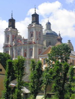
|
KREMENETS (or Kremianets). City (2011 pop 21,624) and raion center in Ternopil oblast. It is located on the site of Ostra Hora, one of the oldest known settlements in Ukraine, which dates from the Paleolithic Period. Unearthed Greek and Roman coins indicate that inhabitants in the area had trade relations with the Dnipro River region in ancient times. Kremenets was first mentioned in the Hypatian Chronicle under the year 1226. It was one of the strongholds of the Principality of Galicia-Volhynia and withstood several sieges, by Hungarians, Poles, Mongols, and Tatars, before being destroyed in 1261. In 1366 it came under Lithuanian rule. In 1438 it was granted the rights of Magdeburg law. The town flourished in the 15th and 16th centuries. In 1793 Kremenets came under Russian rule. With the establishment of the Kremenets Lyceum, the town became an important cultural center in the first half of the 19th century and was known as the 'Volhynian Athens.' In 1895 it had 13,300 inhabitants, 5,300 of whom were Jews... |
| Kremenets or Kremianets |
The preparation, editing, and display of the IEU entries about the Ternopil region and western Podilia were made possible by the financial support of the IVAN AND ZENOVIA BOYKO ENDOWMENT FUND at the CANADIAN INSTITUTE OF UKRAINIAN STUDIES (Edmonton, AB, Canada).
 XVIII. THE QUINTESSENTIALLY UKRAINIAN POLTAVA REGION
A historical-geographic territory in Left-Bank Ukraine, the Poltava region played a crucial role in the history of the Ukrainian nation in its modern formative period of the 19th and early 20th centuries. The former land of the Cossack Hetman state, from 1825 the Poltava region took the lead in Ukrainian civic affairs away from the Chernihiv region, which had been the culturally and politically dominant region in the 18th century. The economic security and estate privileges enjoyed by the local landowners and the presence of a number of Cossack officer families afforded them the independence to preserve Ukrainian traditions in ideology and everyday life and to preserve the Ukrainian character of the people who lived on their estates. Among other prominent cultural leaders, Ivan Kotliarevsky, the founder of modern Ukrainian literature, was born and worked in Poltava. In addition to Poltava itself the regional cultural and political centers included cities such as Hadiach, Lubny, Myrhorod, and Pryluky, as well as the estates of such nobles as Dmytro Troshchynsky, Vasyl Kapnist, the Galagans, the Tarnovskys, and others. The society of these families proved to be receptive to the ideas of Taras Shevchenko and the Cyril and Methodius Brotherhood. It also helped to establish the Ukrainophile nature of the region's zemstvo administration, which until 1917 was perhaps the most nationally conscious and active body in community and cultural life in central and eastern Ukraine. The Poltava region was also vitally important to the new Ukrainian state during Ukraine's struggle for independence in 1917-20. Many of the state's governmental leaders (Symon Petliura, Andrii Livytsky, Borys Martos, Mykola Porsh) were born there and became active there... Learn more about Poltava and the Poltava region by visiting the following entries:
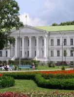
|
POLTAVA. A city (2013 pop 296,760) on the right bank of the Vorskla River and the administrative center of Poltava oblast. The archeological evidence shows that the city site was inhabited as early as the 7th century BC. The city is first mentioned, as Ltava, in the Hypatian Chronicle under the year 1174. In 1240 it was captured by the Mongols, and from the second half of the 14th century it belonged to the Grand Duchy of Lithuania. In the Hetman state set up by Bohdan Khmelnytsky Poltava served as a regimental center (1648-1775) and flourished as a trading town. It obtained the rights of Magdeburg law in the 17th century. During the Russian-Swedish War (1708-9) it withstood a siege by Swedish and Ukrainian forces led by King Charles XII and Hetman Ivan Mazepa and witnessed the allies' defeat by Peter I on 8 July 1709 at the Battle of Poltava. In the 19th century Poltava was completely rebuilt. The old fortifications were leveled, and the new town was designed around Kruhla Square. The founding of Poltava eparchy in 1803 contributed to the town's importance, although the bishop's seat was not transferred to Poltava until 1847... |
| Poltava |
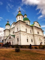
|
POLTAVA REGION. At one time the Poltava region and Chernihiv region were the territory of the Siverianians. After the reign of Grand Prince Yaroslav the Wise of Kyiv, the Poltava region became part of Pereiaslav principality, which came under the control of the Golden Horde in 1240. In 1360 Lithuania established its hegemony over the area, and then Poland (after the Union of Lublin). Waves of attacks by Cumans and then by Tatars depopulated the region. Resettlement began in the 15th century and reached the Sula River before it halted again in the 16th century. It resumed during the Cossack period in the early 17th century, at which time it reached the Vorskla and Orel rivers. Under the Cossack Hetman state the territory was divided into Poltava, Pereiaslav, Myrhorod, Lubny, Pryluky, and (partially) Kyiv regiments. Throughout the 19th century and until 1914 the population of the region increased steadily. In 1857 it stood at 2,778,000, and in 1914, it was 3,790,000. Almost 90% of the population was rural and the region had the highest proportion (93 percent) of Ukrainians of all Ukrainian territories...
|
| Poltava region |
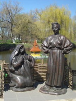
|
MYRHOROD. A city (2012 pop 41,267) on the Khorol River and a raion center in Poltava oblast. It was founded in the mid-16th century, and in 1575 was granted town status and selected as a Cossack regimental center. Myrhorod played an important role in the Cossack-Polish War of 1648-57. In 1650 Hetman Bohdan Khmelnytsky conducted negotiations with Russian envoys there. In 1690-1 the Myrhorod regiment revolted against Hetman Ivan Mazepa. Under Russian rule Myrhorod became a county center in Poltava gubernia in 1802 and a prosperous trade center. Its economic development was strongly affected by the founding of a health resort in 1912-14 and the extraction of oil and natural gas in the 1950s. For centuries Myrhorod has been famous for its handicrafts, particularly its ceramics, embroideries, and folk dress. In 1896 the Gogol Handicrafts School and in 1912 the first Ukrainian ceramics manufacturing association were set up in Myrhorod. Nikolai Gogol (Mykola Hohol) immortalized the town by naming his second volume of Ukrainian stories Mirgorod (Myrhorod, 1835)... |
| Myrhorod |
|
LUBNY. A city (2012 pop 47,827) and raion center in Poltava oblast. It was founded as a fortified frontier town in 988 by Grand Prince Volodymyr the Great of Kyiv. In 1107 the Rus' princes defeated the Cumans in battle there. Lubny was destroyed by the Mongols in 1239. Rebuilt in the latter half of the 16th century, Lubny was granted the rights of Magdeburg law. In May 1596 the Polish army crushed the Cossack-peasant rebellion led by Severyn Nalyvaiko and Hryhorii Loboda in the Battle of Solonytsia near Lubny. In 1637-8 the town was a center of Cossack-peasant unrest. In the Hetman state it was a regimental capital and then a county town in Poltava gubernia in the Russian Empire. A botanical garden with medicinal plants and the first field apothecary in Ukraine were established there in the early 18th century. Today Lubny is an industrial city with machine building and metalworking as its chief industries. Among the city's educational institution is the Lubny Vocational Lyceum. The city has an art gallery and a regional studies museum (est 1897). The Mhar Transfiguration Monastery is located nearby... |
| Lubny |
|
HADIACH. City (2011 pop 24,132) on the Psol River and raion center in Poltava oblast. Founded in the 15th century, it was granted a city status in 1634. A castle was built here in the 17th century and later expanded into a fortress. Under the Hetman state Hadiach was a fortified regimental center. There Hetman Ivan Vyhovsky concluded the Treaty of Hadiach with Poland in 1658. In 1663-68 it was a residence of Hetman Ivan Briukhovetsky and the main center of Left-Bank Ukraine. Under Russian rule it was a county town in Poltava gubernia. The scholar and civic leader Mykhailo Drahomanov was born there in 1841. In the early 20th century Drahomanov's sister, Olena Pchilka, published in Hadiach the journal Ridnyi krai. Today Hadiach's industries include petroleum industry, natural gas industry, machine-building, and food-processing. The Petro Prokopovych National Research Centre of Apiculture and the Drahomanov Family Memorial Museum are located there. As a burial place of Rabbi Shneur Zalman, the founder of Chabad, a branch of Hasidic Judaism, Hadiach is also an important pilgrimage center for Hasidic Jews... |
| Hadiach |
|
KREMENCHUK. City (2013 pop 225,865), raion center, and river port in Poltava oblast, situated on both banks of the Kremenchuk Reservoir on the Dnipro River. Kremenchuk was founded in 1571. A Polish castle was built there in 1596. In the Hetman state the town was a Cossack company center in Chyhyryn and Myrhorod regiments, and briefly the capital of a separate Kremenchuk regiment (1661-3). Under Russian rule it was the capital of New Russia gubernia in 1765-83. In the second half of the 19th century, Kremenchuk became an important manufacturing and trade center. In 1913 it had a population of 88,400 and 95 enterprises, which employed almost half (6,000) of the industrial workers in Poltava gubernia. After the Revolution of 1917 its economy declined, and in 1926 its population was only 58,800 (40.6 percent Ukrainian, 49.2 percent Jewish, and 8.4 percent Russian). During the Second World War the city was devastated, and much of its Jewish population perished in the Nazi Holocaust. After the war the city was extensively reconstructed. Today Kremenchuk is an important center of heavy industry... |
| Kremenchuk |
The preparation, editing, and display of the IEU entries about Poltava and the Poltava region were made possible by the financial support of the CANADIAN FOUNDATION FOR UKRAINIAN STUDIES.
 XIX. SOUTHCENTRAL UKRAINE (1): THE CITY OF KROPYVNYTSKYI AND ITS REGION
From the 9th to 14th centuries, the region in southcentral Ukraine around today's city of Kropyvnytskyi, especially the region's northern parts, belonged to Kyivan Rus'. Then the territory came under Lithuanian rule in 1362 and Polish rule in 1569. By and large it was wild, unpopulated steppe. From the late 16th to the mid-18th centuries it was part of the lands of the Zaporozhian Cossacks, and Ukrainian peasants began settling there. At the beginning of the Cossack-Polish War, in 1648, the Battle of Zhovti Vody took place in this region in which the Cossack forces surrounded and defeated the Polish army. In 1739 Russia acquired nominal rule over the territory and in 1752 created a region called New Serbia for Balkan military settlers. In 1754 the Saint Elizabeth Fortress was built to serve as the administrative center of the territory and in 1775 the fortress became the center of the new town of Yelysavethrad (today's Kropyvnytskyi). During the revolutionary years of 1918-20 various armed conflicts took place on the territory, involving, at various times, Ukrainian National Republic and German troops, the Bolsheviks, Nykyfor Hryhoriiv's partisans, Nestor Makhno's partisans, and the Denikin army. Under Soviet rule, in 1939, the territory was incoprporated into a new administrative unit: Kirovohrad oblast... Learn more about the city of Kropyvnytskyi and its region in southcentral Ukraine by visiting the following entries:
|
KROPYVNYTSKYI. City and oblast capital (2016 pop 231,089) in the southeastern Dnipro Upland on the Inhul River. Some of its former names were Yelysavethrad (1775-1924) and Kirovohrad (1939-2016). The city was founded in 1754 on Zaporozhian Cossack territory as the Saint Elizabeth Fortress, which was built to protect the Russian Empire's southern frontier and the Balkan colonists of New Serbia from raids of Turks and Crimean Tatars. In 1775 the town that grew up around the fortress was named Yelysavethrad; it had a population of 4,750 in 1787 and 9,300 in 1823. Until the First World War it was an important center of trade in grain, wool, lard, flour, timber, cattle, and horses, much of which was exported via Odesa and Mykolaiv. From the 1870s the city was a regional center of cultural and revolutionary activity. Ukrainian theatrical productions were performed on an ongoing basis; such prominent figures as Ivan Karpenko-Kary, Mykola Sadovsky, Panas Saksahansky, Marko Kropyvnytsky, Mariia Zankovetska, and Petro Nishchynsky were instrumental in their mounting. After Soviet rule was established there, the city was renamed Zinovivske in 1924, Kirove in 1934, and Kirovohrad in 1939. In 1939 the city became the capital of a new Kirovohrad oblast. In the postwar period it has been an important industrial city. In 2016 the city was renamed in honor of the dramatist and theater director Marko Kropyvnytsky... |
| Kropyvnytskyi |
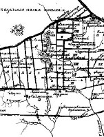
|
NEW SERBIA. A Russian administrative and military territorial unit in Southern Ukraine, created by Empress Elizabeth I in January 1752 out of the northwestern lands of the Zaporizhia between the Syniukha River to the west and the Dnipro River to the east. Although the officially stated purpose of the new territory was defense of the Russian Empire from the attacks by Turks and Crimean Tatars, the territory also gave Russia a base from which it could control the Zaporozhian Cossacks, isolate the Zaporizhia from Right-Bank Ukraine and part of Left-Bank Ukraine, and facilitate Russia's expansionist designs in the Ukrainian steppe frontier. The Russian government evacuated all of its inhabitants (4,008 Cossack and peasant households), despite the protests of Hetman Kyrylo Rozumovsky and the Zaporozhian Sich. In their place it imported Serbian military colonists from Austrian-ruled Slavonia and Hungary and, later, similar Bulgarian, Vlach (Romanian), Greek, and other Orthodox colonists who had fled from Turkish rule. In 1754 the Slobidskyi Regiment of Cossack colonists mostly from Left-Bank Ukraine and Slobidska Ukraine was organized on the southern frontier of New Serbia, and the Saint Elizabeth Fortress was built as the administrative center of the territory. By then two-thirds of New Serbia's population was Ukrainian. In 1764 New Serbia was abolished, and its territory became part of the new New Russia gubernia...
|
| New Serbia |
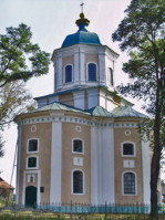
|
NOVOMYRHOROD. A city (2016 pop 11,328) on the Velyka Vys River and a raion center in Kirovohrad oblast. It was founded in 1740 by Zaporozhian Cossacks of the Myrhorod Regiment at the site of an ancient settlement from the Bronze Age. Then it was settled by peasants, mostly from the Myrhorod region. In 1752-64 Novomyrhorod was a center of New Serbia, and from 1803 it was part of Kherson gubernia. In 1959 the town of Zlatopil and the villages of Vynohradivka and Katerynivka were amalgamated with Novomyrhorod. Today the city manufactures bricks, ceramics, leather, preserves, furniture, and construction materials. It has a coal mine. Its famous Saint Elijah's Church, built in 1786, is a tourist attraction... |
| Novomyrhorod |
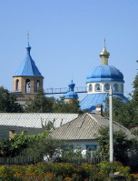
|
OLEKSANDRIIA. A city (2016 pop 82,187) on the Inhulets River and a raion center in Kirovohrad oblast. It was founded in the early 18th century as the settlement Usivka, and it was renamed Becheiu (Becha, Bechka) in the 1750s. Between 1752 and 1764 the town was a regimental military center in New Serbia. In 1784 it was renamed Oleksandriisk and later Oleksandriia and chosen as a county center of Kherson gubernia. The city is the center of the Oleksandriia Lignite Coal Region: it has three strip mines, two mine shafts, and two briquette factories. It also has a machine building and a food industry... |
| Oleksandriia |
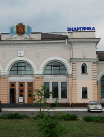
|
ZNAMIANKA. A city (2016 pop 23,201) and raion center in Kirovohrad oblast. It was founded in 1869 as a railway settlement on the Kharkiv-Odesa line, and got its name from the nearby village of Znamianka. The Znamianka-Mykolaiv railway line and the Znamianka-Fastiv line were opened in 1873 and 1876 respectively, and the town developed into an important railroad junction. In 1938 it was granted city status. The city is a railway center with repair yards and metalworking factories. It also has a food industry... |
| Znamianka |
|
SVITLOVODSK. A city (2016 pop 45,673) on the Kremenchuk Reservoir and a raion center in Kirovohrad oblast. It arose in 1961, when the inhabitants of Novoheorhiivske (est 1680s), Taburyshche (est 17th century), and Kryliv (est 12th century, in the 18th century one of the regimental centers of New Serbia) were resettled in the workers' settlement of Kremenchukhesbud (est 1954) to make way for the flooding of the Kremenchuk Reservoir. In 1962 the city was renamed Kremhes, and in 1969, Svitlovodsk. It is a river port and an industrial center with a hydroelectric station, several nonferrous metallurgical plants, and a furniture, a ceramics, and a plastics factory... |
| Svitlovodsk |
The preparation, editing, and display of the IEU entries about the city of Kropyvnytskyi and its region in southcentral Ukraine were made possible by the financial support of the CANADIAN FOUNDATION FOR UKRAINIAN STUDIES.
 XX. SOUTHCENTRAL UKRAINE (2): THE CITY OF DNIPRO AND ITS REGION
As part of southcentral Ukraine, also known as Steppe Ukraine, the region of today's city of Dnipro (formerly Katerynoslav and later Dnipropetrovsk) was permanently and conclusively settled by Ukrainians only in the second half of the 18th century. From the end of the 18th century until 1917 that area, as part of the Russian Empire, was known as New Russia. The history of the Dnipro region and the ethnic composition of its population were influenced by its location adjacent to the Asiatic steppes (the steppes of Southern Ukraine are their western extension). Throughout its history the region was repeatedly invaded by hordes of nomads from Asia, who severed the main territory of Ukraine and its inhabitants from the Black Sea. The emergence of the Cossacks around the Zaporozhian Sich in the mid-16th century resulted in a protracted struggle for control of the steppes. The matter was resolved only in the late 18th century, after Turkey's defeats in the Russo-Turkish wars created the conditions for permanent Ukrainian settlement in the steppes and their unification with the rest of Ukraine. Southern Ukraine thus joined Ukraine, which by that time had been incorporated within the Russian Empire. Since the late 19th century the region around today's city of Dnipro has developwd into one of the most industrialized areas in Ukraine, containing large urban clusters. The largest of them are Dnipro-Kamianske and Kryvyi Rih. Industry in the region is based on the large local deposits of iron ore in the Kryvyi Rih Iron-ore Basin and manganese ore in Nikopol raion (Nikopol Manganese Basin, one of the largest deposits in the world--1.1 billion tonnes), and on deposits (five billion tonnes) of coal near Pavlohrad... Learn more about the city of Dnipro and its region in southcentral Ukraine by visiting the following entries:
_s.jpg)
|
DNIPRO. City (2018 pop 1,000,506), located in the northern part of the steppe belt on the Dnipro River (its main section is on the higher right bank) above the former Dnipro Rapids, at the juncture of the Dnipro River route with the Donbas-Kryvyi Rih railroad. Until 1926 it was called Katerynoslav and then until 2016 it was called Dnipropetrovsk. Dnipro is the third-largest city in Ukraine and one of the largest metallurgical and machine-building centers in Ukraine. It is a railroad center, river port, airport, an important cultural center, and the capital of Dnipropetrovsk oblast. Katerynoslav was founded in 1776 by Prince Grigorii Potemkin, the colonizer of southern Ukraine, at the site of the Cossack village of Polovtsia, built by the Cossack Ivan Hloba. Development proceeded according to a general plan proposed by architects I. Starov in 1790 and V. Geste in 1817. The town was to be the main center for the whole southern part of the Russian Empire, but after Potemkin's death in 1791, Katerynoslav declined. In 1802 the town became a gubernial center. In 1804 the Poltava theological seminary was moved to Katerynoslav, and a year later the first gymnasium was opened. In 1847 the first town theater was built. The intensive development of Katerynoslav began in the 1870s, when a railroad line was built linking the town with Sevastopol and Kharkiv. Since then the city has been at the crossroads of the river route, by which grain and lumber are transported, and the railroad line, which carries iron ore and coal. It quickly became the main center of the metallurgical industry in Ukraine...
|
| Dnipro |
|
KRYVYI RIH. City (2018 pop 629,695) and raion center in Dnipropetrovsk oblast, situated at the confluence of the Inhulets River and the Saksahan River. A major industrial center in the Kryvyi Rih Iron-ore Basin and the eighth-largest city in Ukraine, it is divided into six city raions. It arose in the 17th century as a concentration of winter homesteads of the Zaporozhian Cossacks. It came under Russian rule in 1774 and from 1803 was part of Kherson gubernia. From 1829 to 1860 it was a military settlement. The beginnings of its industrial growth coincided with the exploitation of the Kryvyi Rih Iron-ore Basin from 1881 and the construction of a railroad linking the basin with the Donets Basin. Consequently its population increased from 3,650 in 1859 to 15,000 in 1897 and 18,000 in 1910. Under Soviet rule the city was an okruha center in 1923-32. It underwent intensive industrialization in the 1930s, and its population multiplied from 19,000 in 1923 to 31,300 in 1926 (69 percent Ukrainian, 18 percent Jewish, 10 percent Russian), 197,600 in 1939, and 212,900 in 1941. After the Second World War, Kryvyi Rih was extensively rebuilt and developed, and its population grew to 408,000 in 1959 and 581,000 in 1970. A major center of mining and ferrous metallurgy, it has 24 mines and numerous industrial enterprises. Approximately, 71 percent of the city's population is Ukrainian, 27 percent Russian, and just over 1 percent of other ethnic background... |
| Kryvyi Rih |

|
KRYVYI RIH IRON-ORE BASIN. The most important Ukrainian iron-ore-producing region and the largest single source of iron in the former USSR. A narrow strip about 100 km long and 2-7 km wide, extending through western Dnipropetrovsk oblast from the town of Zhovti Vody in the north to Inhulets in the south, the basin covers an area of approximately 300 sq km. The city of Kryvyi Rih is the major industrial center in the region. The Kryvyi Rih Basin has been excavated for iron ore since the time of the Scythians, but detailed prospecting and commercial exploitation began only in the second half of the 19th century. In 1881 Oleksander Pol founded a joint-stock company with French capital to develop mining in the basin. In its first year the company mined 37,400 tonnes of iron ore. Production rose rapidly when a railway was constructed in 1884 connecting Kryvyi Rih with the coal-producing region of the Donets Basin. By 1913 the Kryvyi Rih Basin provided 6.4 million tonnes, or 74.5 percent of all the iron ore produced in the Russian Empire. Fifty-one mines had been sunk and 23,600 miners worked in the region, making the area one of the largest industrial centers in Ukraine. Today, the Kryvyi Rih Basin, producing 85 percent of total Ukrainian output, supplies iron ore to several metallurgical plants in the Dnipro Industrial Region and the Donets Basin... |
| Kryvyi Rih Iron-Ore Basin |
|
KAMIANSKE. City (2018 pop 235,066) in Dnipropetrovsk oblast, situated on the right bank of the Kamianske Reservoir of the Dnipro River. Between 1936 and 2016 it was called Dniprodzerzhynsk. Today Kamianske is a river port and an important industrial center. The city was first mentioned in 1750. Kamianske owes its development to the metallurgical plant that was built there in 1887-9, the largest plant of its kind in the Russian Empire. The plant was built in Kamianske because of its geographic-economic location: it was linked by railroad to the coal mines of the Donbas and the iron-ore mines of the Kryvyi Rih Iron-ore Basin, and it was close to a large river route. In 1917 the town became a city. Its population grew rapidly: it was 18,000 in 1898, 35,000 in 1910, 34,000 (of which 54.3 percent was Ukrainian, 29 percent Russian, 16.7 percent other) in 1926, 148,000 in 1939, 194,000 (71 percent Ukrainian, 23 percent Russian) in 1959, 227,000 in 1970. The main branches of industry in Kamianske are metallurgy, machine building, a coke-chemical industry, and a building-materials industry; as well there is light industry and a food industry. In 1965 the Dniprodzerzhynsk Hydroelectric Station (now Middle-Dnipro Hydroelectric Station), with a capacity of 352,000 kW, was built. The city houses the Dnipro State Technical University, six colleges, two tekhnikums, a medical school, a teachers' school, a drama theater, and a museum of local history... |
| Kamianske |
|
NIKOPOL or NYKOPIL. A city (2018 pop 112,102) on the right bank of the Kakhovka Reservoir and a raion center in Dnipropetrovsk oblast. In the 16th century there was a portage named Mykytyn Rih at the site, and in the early 17th century the settlement of Mykytyne was established there. After the Russian army destroyed the Zaporozhian Sich in 1775, a fortified town called Sloviansk was built near Mykytyne. In 1782 it was renamed Nikopol. The chumaks passed through Nikopol on their way to the Crimea. As the Nikopol Manganese Basin began to be developed at the end of the 19th century, Nikopol's metallurgical and machine building industries grew rapidly. Besides cranes, pipes, and metal alloys the city manufactures building materials, clothes, and food (Nikopol Crane Plant, Nikopol Ferroalloys Plant, Nikopol Southern Pipe Plant, and others). It is an important river port on the Dnipro River and railway junction... |
| Nikopol or Nykopil |
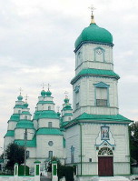
|
NOVOMOSKOVSK. A city (2015 pop 71,434) on the Samara River and a raion center in Dnipropetrovsk oblast. A Cossack settlement was established at the site in the second half of the 16th century, and eventually it became known as Novoselytsia (or Samarchyk). In 1784 the village was raised to city status and renamed Novomoskovsk. From 1796 it was a county town in New Russia gubernia, and from 1802 it was part of Katerynoslav gubernia. Today it manufactures large pipes used for gas and oil pipelines, reinforced-concrete structures, and furniture. It is the home of the famous nine-domed Trinity Cathedral, constructed of wood by Yakym Pohrebniak in 1773-81. The Samara Saint Nicholas's Pustyn Monastery, established by the Zaporozhian Cossacks in the late 16th century, is located near Novomoskovsk... |
| Novomoskovsk |
The preparation, editing, and display of the IEU entries about the city of Dnipro and its region in southcentral Ukraine were made possible by the financial support of the CANADIAN FOUNDATION FOR UKRAINIAN STUDIES.
 XXI. THE SOUTHEASTERN UKRAINE (1): DONETSK OBLAST
In antiquity, the territory of today's Donetsk oblast was part of the domain of the Cimmerians (8th century BC), the Scythians (7th-3rd centuries BC), the Sarmatians (3rd century BC-230 AD), and the Alans (200-550 AD). In the 8th century it was controlled by the Khazar Kaganate. After the princes of Kyivan Rus' (most notably, Sviatoslav I Ihorovych) suppressed the Khazar domination of this region, this territory was taken over by the invading Pechenegs (9th-11th centuries), then the Polovtsians or Cumans (11th-13th centuries), and the Mongol-Tatars of the Golden Horde (13th-15th centuries). In the mid-15th century the Crimean Khanate, having separated from the Golden Horde, initially claimed the southwestern half of this depopulated territory. The Kyiv principality, at that time part of the Grand Duchy of Lithuania, claimed the northwestern part of this region. In the late 16th and early 17th centuries, the Zaporozhian Cossacks, on their Azov campaigns (1570, 1637) to the Don River, penetrated this contested, dangerous borderland. In the mid-17th century, they began to colonize this area, creating the Kalmiius Cossack Sloboda. The colonization of this territory accelerated after the region was captured by the Russian Empire in the 18th century. Apart from the Cossacks, the colonists included invited Serbs, Bulgarians, Macedonians, and Wallachians from the Austrian Empire, Russian gentry, German colonists, and the Greeks forcibly resettled from the Crimea. The discovery of coal (1723) and exploration of the Donets Coal Basin (Donbas) led to coal mining and the development of metallurgy. Rapid industrial growth of the region in the late 19th century increased the demand for labor and most of the migrant workers arrived from Russia rather than Ukraine. As a result of this migration, the region became the most Russified part of Ukraine. During Ukraine's struggle for independence (1917-20) the territory was claimed as part of the Ukrainian National Republic (UNR), but was contested among the UNR Army, the Red Army, the Ukrainian anarchists (such as Nestor Makhno), and the anti-Bolshevik Russian 'White' Army. In 1920 the region came under Soviet control. Established in 1932, Donetsk oblast was an administrative unit in the Ukrainian SSR and after 1991, has been an integral part of independent Ukraine. But following the onset of the Russo-Ukrainian war in the Donbas in 2014, one part of Donetsk oblast--the self-proclaimed and Russia-controlled 'Donetsk People's Republic'--has been separated from the Ukraine-controlled Donetsk oblast by an active front that has severed links in transport, water supply, and power infrastructure... Learn more about Donetsk oblast in southeastern Ukraine by visiting the following entries:
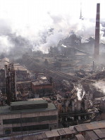
|
DONETSK OBLAST. An administrative region in southeastern Ukraine, it is bounded to the south by the Sea of Azov and to the southeast by Rostov oblast of the Russian Federation. Donetsk oblast consists of an undulating plain dissected by river valleys, ravines, and gullies. Established on 2 July 1932, it was called Stalino oblast until 1961. Its area is 26,500 sq km. The estimated population in 2019 was 4,165,900, of which 90.8 percent or 3,783,400 was urban. The oblast is divided into 18 raions, 52 cities, 131 towns (smt) and 1,115 rural settlements. Donetsk oblast is one of the most developed industrial regions of Ukraine. It contains the principal mining and metallurgical complex of Ukraine. Its industrial development has been based on the huge deposits of high-quality hard coal (anthracite and coking coals) in the Donets Basin. Reserves are estimated at 40 billion tonnes. The best seams, however, have already been exhausted; the remaining thin, steeply sloping and deep deposits are costly to extract, resulting in declining output. Donetsk was the oblast's capital until 2014. After the Euromaidan Revolution, the Russia-curated rebellion in the Donets Basin, and the establishment with Russian assistance of the self-proclaimed 'Donetsk People's Republic' (DPR) with its capital in Donetsk, the administration of Ukraine-controlled Donetsk oblast relocated initially to Mariupol and then to Kramatorsk. The Russian support of the separatists and the orchestrated hostilities following the Battle of Debaltseve (16-18 January 2015), the Minsk II Agreement (12 February 2015), and Russian-aided separatist capture of Debaltseve (12-20 February 2015), resulted in the entrenchment of the DPR with its capital in Donetsk... |
| Donetsk oblast |
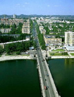
|
DONETSK. City (2020 pop 908,500), called Yuzivka until 1924, then Staline or Stalino until 1961. It was established in 1869 as a settlement for the workers of a company owned by the Welsh industrialist John Hughes and named Yuzivka after him. It was located 5 km south of the village of Oleksandrivka (est 1779) and its first mechanized coal mine in the Russian Empire (est 1841). Rapid industrial growth was promoted by the availability of large anthracite-coal deposits and water and by the construction of the extension from the Donbas-Kryvyi Rih railway line. By 1876 Yuzivka's metallurgical plant was the largest in the Russian Empire. In 1889 a French- and German-owned machine-building plant was constructed that produced equipment for mines (nine by 1899) owned by English, French, Russian, and Ukrainian industrialists. Located on the upper reaches of the Kalmiius River in the steppe region, this industrial settlement (city since 1920) grew to become the largest center of coal mining and metallurgy and the fifth-largest city in Ukraine. The overwhelming majority of the newcomers were migrant Russian workers, as the Ukrainians in the surrounding areas were unwilling to abandon their agricultural pursuits in favor of a grimy urban, industrial lifestyle. Donetsk was the administrative center of Donetsk oblast until April 2014, when it was captured by the Russia-supported separatists to become the capital of their self-proclaimed 'Donetsk People's Republic' (DPR). A focus of railways and highways, Donetsk was severed in 2014 from the rest of Ukraine by war with an active front to the north and west of the city. It also had a modern airport on its northeastern outskirts, destroyed in a fierce 242-day battle (September 2014 to January 2015) for its control...
|
| Donetsk |
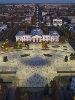
|
KRAMATORSK. City (2020 pop 152,100) in the northern part of Donetsk oblast, situated on the Kazennyi Torets River. It is one of the largest centers of the heavy machine-building industry in Ukraine and an important transportation node, on a major railway trunk line. It arose in the second half of the 19th century, when a station of the Kursk-Azov railway was established next to the village of Petrivka (the station was called Kram-na-Tore in 1868, later conflated into Kramatorsk) and the town grew up around it. Over time, other settlements of Ukrainian peasantry established in the late 18th century on the lands of the Cossack Oril palanka of the liquidated (in 1775) Zaporozhian Sich were incorporated into the new town. The discovery of chalk, sand, sandstone, valuable clays and mineral dyes nearby led to the construction of a building materials factory in 1885. The town grew as the Donets Basin developed. By 1914 the town had 4,000 inhabitants. Kramatorsk gained city status in 1932. Its population continued to grow until 1993 when it peaked at 204,000, and began to decline thereafter. According to the 2001 population census, the ethnic make-up of Kramatorsk was 70.2 percent Ukrainians, 26.9 percent Russians, 0.7 percent Belarusians, 0.6 percent Armenians, 0.2 percent Azeri, and 0.1 percent Jews. With the outbreak of the Russo-Ukrainian war in 2014, from May 12 until July 5 the city was occupied by the so-called 'Donetsk People's Republic' (DPR). Following the city's liberation but the loss of Donetsk to the DPR, Kramatorsk became the provisional administrative center of Donetsk oblast (October 2014) and of the Donetsk Appeals Court (November 2014)... |
| Kramatorsk |
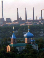
|
MARIUPOL. A port city (2020 pop 437,000) on the Sea of Azov at the mouth of the Kalmiius River in Donetsk oblast. A major industrial center, it is the tenth-largest city in Ukraine. From 1948 to 1989 it was called Zhdanov. Mariupol's origins date back to the beginning of the 16th century, when the Cossack fortress of Domakha, on the site of the former Venetian-Genoese colony, Adomakha, was built. By 1611 Domakha was the center of the Zaporozhian Cossack Kalmiius palanka. In 1734 the fortress spawned Kalmiius, a larger adjoining settlement where the Church of Saint Nicholas was built. In their campaign in 1768, the Crimean Tatars took the fort and settlement. When Russia annexed the territory in 1775, making it part of Azov gubernia, the fortress and settlement with its church were re-built by the Zaporozhian Cossacks and renamed Pavlovsk. In place of the Cossacks (who were removed to the Vovcha River in 1778), Orthodox Greeks from the Crimea were resettled there and in its vicinity. In 1780, Pavlovsk was renamed Mariupol. In the late 19th century Mariupol was developed as a shipping port for the Donets Basin. Fishing, fish processing, and trade grew in importance. In 1882 it was linked with Donetsk by railway, and in 1886-9 the commercial port was built. The main exports were coal and grain. By 1900 the port was handling 1 million t of freight, and the tonnage doubled in the next decade. At the turn of the century a tube-rolling and two metallurgical plants were built. From that time the town's heavy industry grew rapidly... |
| Mariupol |
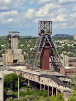
|
HORLIVKA. City (2020 pop 242,000) formerly under oblast jurisdiction in Donetsk oblast 40 km northeast of Donetsk, one of the most important anthracite-mining and industrial centers in the Donets Basin, on the Donets-Donbas Canal, and a major railway and minor highway junction. Founded among the mid-18th century villages of Hosudariv Bairak, Korsun, Mykytivka, Zaitseve, and Zalizna Balka, Horlivka is named after a Russian mining engineer, Petr Gorlov, who built the first coal mine there in 1867. By the early 20th century the mining settlement had developed into an important industrial center. From 10,000 inhabitants in 1898, its population grew to 30,000 in 1916, 23,100 in 1926, and after becoming raion center in 1925 gained city status in 1932, and attained the population of 181,500 in 1939. Horlivka was devastated during the Second World War, but re-built, its water supply enhanced by the Donets-Donbas Canal (1954-8). Its population peaked at 338,000 in 1989. Since Ukraine's independence, the ethnic make-up of the city shifted in favor of Ukrainians. According to the 2001 census, the city's population was comprised of 51.4 percent Ukrainians, 44.8 percent Russians, 1.3 percent Belarusians, and others. Privatization and foreign direct investment revived the economy. But in 2014 the city was taken by the pro-Russian forces and became part of the so-called 'Donetsk People's Republic.' This had a severely negative impact on the socio-political life and the economy of the city... |
| Horlivka |
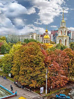
|
SLOVIANSK. A city (2020 pop 108,400) on the Kazennyi Torets River, a raion center in the northern part of Donetsk oblast, a major industrial and resort center, and an important railway and highway junction. The city's site was first mentioned as a temporary fortified outpost at a Crimean Tatar ford on the Tor River (1645). It gained permanency only after Ukrainian settlers established a fort at Maiak Lake in 1663 (now Maiaky, 10 km north of Sloviansk) and then under its protection began salt extraction from saline lakes at Tor (1664), which gave rise to fort Tor (1676) and its settlement of Soliane (now Sloviansk). Tor developed into a salt manufacturing and trading center. In 1685-1764 it was a company center of the Cossack Izium regiment in Slobidska Ukraine. In 1784 it was reclassified as a town and renamed Slovenske. A decade later it was renamed Sloviansk and became part of Slobidska Ukraine gubernia. With the construction of a railway line (1869), the town grew rapidly. The Sloviansk salt deposits were mined by underground leaching (1876-1961). In 2014 Sloviansk was struck by the Russo-Ukrainian war in the Donbas. On May 11, Russian Federation's Special Forces with pro-Russian separatists took the city, terrorizing Ukrainian speakers and political non-conformists. On July 5, the city was liberated from the Russian and pro-Russian forces. Mass graves were uncovered and reconstruction of damaged buildings and infrastructure in Sloviansk began. With de-Communization (2016), the historic names of many streets were restored... |
| Sloviansk |
The preparation, editing, and display of the IEU entries associated with Donetsk oblast in southeastern Ukraine were made possible by the financial support of the CANADIAN FOUNDATION FOR UKRAINIAN STUDIES.
 XXII. THE SOUTHEASTERN UKRAINE (2): LUHANSK OBLAST
The territory of today's Luhansk oblast has been inhabited since the Paleolithic Period. In antiquity, it was part of the domain of the Cimmerians (8th century BC), the Scythians (7th-3rd centuries BC), the Sarmatians (3rd century BC-230 AD), and the Alans (a Sarmatian tribe, 200-550 AD). The territory was part of the Khazar Kaganate in the 8th century. When the Kyivan Rus' princes (most notably, Sviatoslav I Ihorovych) ended the Khazar domination and tried to control the area, the territory was invaded by the nomad Pechenegs (9th-11th centuries), then the Polovtsians or Cumans (11th-13th centuries), and then the Mongol-Tatars of the Golden Horde (13th-15th centuries). From the late 16th century there were two contending streams of colonizers in this area: from the north came Muscovite service personnel for the construction of defense lines against invaders from the Crimean Khanate; from the west came Ukrainian agricultural settlers. In the 1630s and 1650s a large influx of Zaporozhian Cossacks resulted in establishing settlements there as part of their territory known as Slobidska Ukraine. In the 18th century colonization accelerated. Imperial Russia invited Serbs, Bulgarians, Macedonians, and Wallachians from the Austrian Empire to form a belt of settlements on the lands of the Zaporozhian Cossacks south of the Donets River called Sloviano-Serbia. In 1764 Sloviano-Serbia was combined with other military belts of settlement to form the New Russia gubernia. In-migration and rural population in the region continued to grow throughout the 19th century. In the last third of the 19th century the southern part of this region, being part of the Donets Basin, experienced rapid industrialization and urbanization, accompanied by a large influx of Russian workers and administrators. This development continued throughout the 20th century. Luhansk oblast has a slight majority of Ukrainians in its population and, after the Crimea, the second highest proportion of Russians among the regions of Ukraine... Learn more about Luhansk oblast in eastern and southeastern Ukraine by visiting the following entries:
 mine_s.jpg)
|
LUHANSK OBLAST. An administrative region in eastern and southeastern Ukraine. Established on 3 June 1938, it was called Voroshylovhrad oblast until 1958, and again from 1970 until 1990. It has an area of 26,700 sq km, an estimated population in 2019 of 2,151,800, of which 1,872,000 or 87 percent were urban. It is divided into 18 raions, 37 cities, 109 towns (smt), and 780 rural settlements. Luhansk (called Voroshylovhrad, 1935-58, 1970-90) was the oblast's capital until 2014. After the Euromaidan Revolution, the Russia-curated rebellion in the Donbas and the establishment with Russian military assistance of the self-proclaimed "Luhansk People's Republic" (LPR) with its capital in Luhansk, the administration of Ukraine-controlled Luhansk oblast relocated to Sievierodonetsk. Following the Minsk II Agreement (12 February 2015), an active front separates the Russia-controlled LPR from the Ukraine-controlled Luhansk oblast. The front impedes links in transport, water and power infrastructure. All large (over 50,000) cities in Luhansk oblast are located in the southern part of the region: along the Donets River and south of it. The majority of them are currently under the LPR control...
|
| Luhansk oblast |
_s.jpg)
|
LUHANSK. A city (2020 pop 401,300) in eastern Ukraine. It started as the Luhansk Factory in 1797, after the Russian imperial government commissioned (in 1795) Charles Gascoigne, a British industrialist, to build a canon and ammunition factory there. This enterprise stimulated the development of mining in the Donets Basin. By 1880 the Luhansk village with its factory grew into a large industrial center. In 1882 it received city status. In 1896 the German industrialist, Gustav Hartmann, established the largest steam engine locomotive plant in the Russian Empire there. The city's population grew from 20,400 in 1897 to 68,000 in 1914. Much of it (68.2 percent in 1897) was composed of Russian immigrants. In 1935-58 and from 1970 until 1990 Luhansk was called Voroshylovhrad. It was the capital of Luhansk oblast until April 2014, when it was captured by the Russia-supported separatists to become the capital of their self-proclaimed "LPR." As a major industrial center of Ukraine, Luhansk was a focus of railways and highways, but was severed from the rest of Ukraine in 2014 by warfare with an active front to the north of the city along the Donets River... |
| Luhansk |
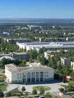
|
SIEVIERODONETSK (the official name, a transliteration from the Russian, but arguably: Siverskodonetsk as etymologically proper conflation of a city from the name of the river, the Siverskyi Donets River). A city (2020 pop 102,400) on the left bank of the Donets River in Luhansk oblast. Founded in 1934 during the construction of a nitrogen-fertilizer manufacturing complex, Sievierodonetsk is today the largest center of chemical industry in Ukraine. Following the Orange Revolution and the victory of Viktor Yushchenko in the 2004 presidential elections, disgruntled supporters of his rival Viktor Yanukovych convened a congress in Sievierodonetsk (28 November 2004), where they proposed to form the "South-East Ukrainian Autonomous Republic" and seek help from the Russian Federation. That event served as a precedent for the partial occupation of the Donbas in 2014. Following the Euromaidan Revolution, in early May 2014 the city administration yielded to the pro-Russian militants of the so-called LPR, but in July 2014 the city was liberated by the Ukrainian forces. Since September 2014 Sievierodonetsk has served as the provisional Ukrainian administrative center of Luhansk oblast... |
| Sievierodonetsk |
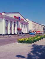
|
LYSYCHANSK. A city (2020 pop 96,200) on the high right bank of the Donets River in Luhansk oblast. On the territory of present-day Lysychansk, in the early 18th century two wintering quarters of the Zaporozhian Cossack Host were located. In 1795 the first coal mine of the Donets Basin was established there. Skilled workers were brought in from Russia, supplemented by local recruits to mine coal. In 1806 the first mining school in the Donbas (now a coal-mining museum) was established in this area. Industrial growth accelerated during the 1930s. In 1931 the Lysychansk thermal-electric power station was built. The Lysychansk petroleum refinery began operations in 1976 and expanded in 1979, making the city known for its chemical and oil refining industry. Its population grew from 35,000 in 1956 to 127,000 in 1989, and then declined to 115,000 in 2001. The 2001 census revealed the ethnic composition of greater Lysychansk (133,140 residents) as follows: Ukrainians, 66.7 percent, Russians, 30.5 percent, Belarusians, 1.0 percent, Tatars, 0.4 percent. Although identification with Ukrainian ethnicity increased, Russian language was declared mother tongue by 62.9 percent of all the residents... |
| Lysychansk |
_s.jpg)
|
ALCHEVSK (formerly Voroshylovsk [1931-61], then Komunarsk [1961-92]). City (2020 pop 107,000) in the southwestern part of Luhansk oblast; since 2014 occupied by the pro-Russian separatists of the LPR. Alchevsk was established in 1895 as a workers' settlement Yuriivka of the Donetsko-Yurievske Metallurgical Company, the only non-foreign-owned metallurgical company in the Donets Basin. The metallurgical plant was founded by the Ukrainian industrialist, Oleksii Alchevsky, a financial supporter of Ukrainian Sunday schools and other Ukrainian cultural initiatives in Russian-ruled Ukraine. During the financial crisis in 1901 Alchevsky, rejected by the Russian government for financial support of his company, committed suicide. In 1903 Yuriivka was re-named Alchevsk in his honor as the plant was acquired by a Belgian-French firm. By 1913 the plant employed 5,135, which supported Alchevsk with a population of 16,200. Before 2014, Alchevsk was, after Luhansk, the second largest industrial producer in Luhansk oblast. Built around its metallurgical complex, the city was one of the largest metallurgical centers in the Donbas. Following the onset of the war in the Donbas in 2014, the Alchevsk Complex ceased production in 2015... |
| Alchevsk |
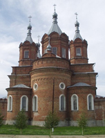
|
STAROBILSK. A city (2020 pop 16,650) on the left bank of the Aidar River and a raion center in Luhansk oblast. The site of Starobilsk, a military outpost in the 16th century, was settled as sloboda Bilska by Cossacks from the Ostrohozke regiment in 1686. The settlement was wiped out by the Muscovite army during Kondratii Bulavin's rebellion in 1708. The new sloboda (i.e., a self-governing Ukrainian settlement), established in 1732, was called Stara Bila. In 1797 it was promoted to city status, renamed Starobilske, and designated a county center in Slobidska Ukraine. From 1835 it was a county center in Kharkiv gubernia (pop 1,800) and hosted fairs. By 1897 its population grew to 9,800; it was comprised of 78.5 percent Ukrainians, 20.3 percent Russians, and 0.9 percent Jews. Situated outside of the industrial Donets Basis, Starobilsk is primarily a food processing center. The Russo-Ukrainian war in the Donbas had a noticable impact on the city. The Ukrainian 80th Airborne Brigade and the Aidar Battalion suffered casualties from an ambush (5 September 2014) near the city of Shchastia; a memorial was erected for them the following year. In September 2014 Starobilsk provided refuge to the Luhansk National University from the occupied city of Luhansk... |
| Starobilsk |
The preparation, editing, and display of the IEU entries associated with Luhansk oblast were made possible by the financial support of the CANADIAN FOUNDATION FOR UKRAINIAN STUDIES.
 XXIII. SOUTHERN UKRAINE (1), WESTERN PART: THE ODESA REGION
The history of Southern Ukraine and the ethnic composition of its population were influenced by its location on the littoral of the Black Sea (into which flow all the major rivers of Ukraine) adjacent to the Asiatic steppes (the steppes of Southern Ukraine are their western extension). Throughout its history the region was repeatedly invaded by hordes of nomads from Asia, who severed the main territory of Ukraine and its inhabitants from the Black Sea. At the same time the Mediterranean seafaring powers tried to establish colonies and extend their influence on the northern littoral of the Black Sea, and the peoples inhabiting the main territory of Ukraine also tried to reach the Black Sea shore. In antiquity the Greeks established ancient states on the northern Black Sea coast, some of which were later incorporated into the Roman Empire and its successor, the Byzantine Empire. The influences of the highly developed Mediterranean cultures contributed to the growth of the Kyivan Rus' state. The latter state's link with the south became tenuous in the 10th to 12th centuries, when the Pechenegs and then the Cumans invaded Southern Ukraine, and was almost completely severed in the 13th century after the Mongol invasion. The collapse of Byzantium and the occupation of Southern Ukraine at the end of the 15th century by Turkey through its vassal, the Crimean Khanate, converted Southern Ukraine into a depopulated steppe controlled by the nomads. The emergence of the Cossacks around the Zaporozhian Sich in the mid-16th century resulted in a protracted struggle for control of the steppes. The matter was resolved only in the late 18th century, after Turkey's defeats in the Russo-Turkish wars created the conditions for permanent Ukrainian settlement in the steppes and their unification with the rest of Ukraine... Learn more about the western part of Southern Ukraine, the Odesa region, by visiting the following entries:
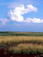
|
SOUTHERN UKRAINE. The largest (250,000 sq km) historical-geographic region of Ukraine, stretching from the Black Sea and the Sea of Azov in the south to the forest-steppe in the north. Also known as Steppe Ukraine, it was permanently and conclusively settled by Ukrainians only in the second half of the 18th century. From the end of the 18th century until 1917 Southern Ukraine, as part of the Russian Empire, was known as New Russia. The northern boundaries of Southern Ukraine are not precise. From the geographical standpoint they consist of a transition zone between the steppe and the forest-steppe. From the historical standpoint they correspond to the southern frontiers of the states of Kyivan Rus', Grand Duchy of Lithuania, and Poland, which together with the Ukrainian farming settlement fluctuated southward deep into the steppe. From the end of the 18th century the northern boundary of Southern Ukraine corresponded to the northern limit of the new possessions of the Russian Empire. The other boundaries of Southern Ukraine included the southern part of Bessarabia in the west and the western part of the Don region in the east, both of which were peopled by Ukrainians... |
| Southern Ukraine |
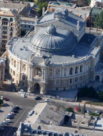
|
ODESA. The fourth-largest city (2012 pop 1,007,419) in Ukraine and the capital of Odesa oblast. It is a major port on the Black Sea, a commercial, industrial, cultural, and administrative center, and a transportation terminal. In prehistoric and early historical times the site of present-day Odesa was settled by various peoples and tribes, among them the Cimmerians, Scythians, Sarmatians, and Greeks. During the time of Kyivan Rus' the territory was inhabited by the Slavic tribes of Ulychians and Tivertsians. In the 14th century Kachybei settlement and harbor arose. They were fortified at the beginning of the 15th century by the Lithuanian grand duke Vytautas the Great. In 1480 the fortress was captured by the Turks and renamed Hadzhybei or Khadzhybei. In 1789, during the Russo-Turkish War, the Russian army and the Zaporozhian Cossacks led by Antin Holovaty and Zakhar Chepiha took the fortress and settlement, and in 1792 the territory was transferred to the Russian Empire. In 1795 the town was renamed Odesa under the mistaken assumption that the Greek colony of Odess had occupied the site from the 4th century BC to the 4th century AD... |
| Odesa |
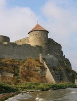
|
BILHOROD-DNISTROVSKYI. City (2011 pop 50,296) in southern Bessarabia on the right bank of the Dnister Liman, 18 km from the Black Sea. In 600 BC this was the site of the Greek colony of Tyras. In the 9th century AD it was a city of the tribes of Tivertsians and Ulychians named Bilhorod; in the 13th century it became part of the Principality of Galicia-Volhynia. In the 14th century it was ruled by the Genoese (and renamed Moncastro), and for a time in the 15th century was part of the Moldavian principality. In 1484 the city was captured by the Turks and in 1503 renamed Akkerman (White Rock). In 1812 it came under Russian rule; from 1918 to 1940 it belonged to Romania and was called Cetatea Alba. In 1940 it became part of the USSR; in 1944 it was renamed Bilhorod-Dnistrovskyi. Between the two world wars the city was the center of Ukrainian cultural life in southern Bessarabia. Bilhorod-Dnistrovskyi's architectural monuments include the well-preserved castle fortress (built in 1438-54 by Master Fedorko), with 26 turrets, 4 gates, and a citadel whose walls are almost 2 km long... |
| Bilhorod-Dnistrovskyi |
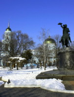
|
BESSARABIA. Region bounded by the middle and lower Dnister River in the north and east, the Prut River in the west, and the mouth of the Danube River and the Black Sea in the south. Until the beginning of the 19th century the name Bessarabia referred only to the southern part of Bessarabia; later it was used for the entire region. Today Bessarabia is a part of Moldova, except for the northern part (the Khotyn region) and the southern part (the Bilhorod-Dnistrovskyi region), which are settled by Ukrainians and comprise 14,400 sq km of the territory of Ukraine. Because of its location between Ukraine and Romania and between Poland and the Balkans, Bessarabia has always served as a route between the west and the east. This fact has influenced its history and the composition of its population. Southern Bessarabia is strategically important, as it controls the mouth of the Danube River and access to the Black Sea. Today this region is located in Odesa oblast at the southwestern tip of Ukraine... |
| Bessarabia |
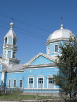
|
KILIIA. City (2011 pop 20,829), fluvial port in southern Bessarabia, and raion center in Odesa oblast situated on the left bank of the Danube River 40 km from the Black Sea. It was first mentioned in the late 7th century BC as the Greek polis of Licostomo. Kiliia belonged to Kyivan Rus' from the 10th century AD and the Principality of Galicia-Volhynia from the early 13th century. Because of its commercial importance and strategic location on the delta it was an object of conquest, and from the 14th century on it was besieged and changed hands numerous times, until it fell into Turkish hands in 1484. As a Turkish port, Kiliia was plundered by Cossacks led by Hryhorii Loboda and Severyn Nalyvaiko (1594-5), Ivan Sulyma (1635), and Semen Palii (1693). Formally ceded to the Russian Empire in 1812, it was restored to Turkey after the Crimean War (in 1856), but was again ceded to Russia in 1878. In 1897 its population of 11,600 consisted of 4,500 Ukrainians, 2,500 Moldavians, 2,200 Russians, and 2,150 Jews... |
| Kiliia |
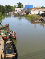
|
VYLKOVE. A city (2011 pop 8,570) in southern Bessarabia in the Danube River delta within Kiliia raion, Odesa oblast. Because of its numerous streams and canals it is known as the 'Ukrainian Venice' or 'Venice on the Danube.' It was founded in 1746 as the settlement of Lypovanske in territory that was under Turkish rule, and in 1762 was granted city status. At that time, the Old Believers, called lipovany, who moved from Muscovy to Southern Ukraine and Bessarabia, constituted the majority of the city's population. In 1812 the city was awarded to the Russian Empire and was renamed. In the interwar period (1918-40) it was occupied by Romania. The city's main industry is fishing. It has a branch of the Antarktyka fishing consortium, a boat repair yard, and a research base of the Institute of Hydrobiology of the National Academy of Sciences of Ukraine. Nearby is a state preserve called the Danube Biosphere Reserve... |
| Vylkove |
The preparation, editing, and display of the IEU entries about the western part of Southern Ukraine, the Odesa region, were made possible by the financial support of the CANADIAN FOUNDATION FOR UKRAINIAN STUDIES.
 XXIV. SOUTHERN UKRAINE (2), CENTRAL PART: THE KHERSON AND MYKOLAIV REGIONS
According to archeological evidence the central regions of Southern Ukraine, today's Kherson and Mykolaiv oblasts, have been inhabited since the Paleolithic Period, as early as the 15th millennium BC. In the 8th to 3rd centuries BC the area was settled by Scythians and Sarmatians. The first Greek settlement on the northern Black Sea coast was established on Berezan Island (near today's Ochakiv) in the 7th century BC. Later this sparsely populated territory belonged nominally to Kyivan Rus', the Grand Duchy of Lithuania, and the Crimean Khanate. It was captured by Turkey in 1475. After the Russo-Turkish War of 1768-74 the region was annexed by Russia. Turkey's defeat and Russian annexation of these lands created the conditions for permanent Ukrainian settlement in the steppes and their unification with the rest of Ukraine, which by that time had been incorporated within the Russian Empire. The territory of the present Kherson and Mykolaiv oblasts was a part of New Russia gubernia (1774-95, 1796-1803), Kherson gubernia (1803-1920), Mykolaiv gubernia (1921), and Odesa gubernia (after 1922). Eventually, Mykolaiv oblast was created in 1937 and Kherson oblast in 1944... Learn more about the central regions of Southern Ukraine, the Kherson and Mykolaiv oblasts, by visiting the following entries:
 Cathedral_s.jpg)
|
KHERSON. A city (2015 pop 296,448), the capital of Kherson oblast, a large sea and river port and railway terminus. The town, with a fortress, admiralty, and shipyard, was founded in 1778 and was named after the ancient city of Chersonese Taurica. Its construction was completed rapidly using thousands of conscripted sailors, laborers, soldiers, prisoners, and serfs. In 1783 the first warship of the Russian Black Sea Fleet was launched there. In 1784 Kherson became a county center and in 1803 a gubernia capital. Shipbuilding, commerce, and shipping (particularly the export of grain and lumber to western Europe) were the cornerstones of its economy. With the deepening of the Dnipro River Estuary waterway at the turn of the 20th century, Kherson's role as an export port increased. A railway link was established in 1907. Its population grew from 2,000 in 1799 to 23,650 in 1846, 43,900 in 1859, 59,100 in 1897, and 81,000 in 1913. In the second half of the 19th century, Kherson became a cultural center with a teacher's seminary and public library (1872), an archeological museum (est 1890 by Viktor Hoshkevych), a gubernia scholarly archival commission (1898), a people's home and a branch of the imperial music society (1905). The writers Dniprova Chaika, Mykola Cherniavsky, and Ivan Karpenko-Kary lived and worked in the city... |
| Kherson |
|
MYKOLAIV. A city (2015 pop 850,763) at the confluence of the Boh River and the Inhul River, the capital of Mykolaiv oblast, raion center, sea and river port, and industrial center. Archeologists have found several settlements from the Neolithic Period, the Bronze Age, and the early Slavic period (3rd-5th century AD) in the vicinity of the city. The region was uninhabited until a fort (1784) and a shipbuilding wharf (1788) were built during the Russo-Turkish War of 1787-91. A settlement, which was named Mykolaiv, sprang up around them. In 1802 it became the capital of a gubernia, and in 1861, a county center of Kherson gubernia. Until 1862 it was an exclusively military port, where sailing ships and steamships (beginning in the 1820s) were built, and where the first iron ship on the Black Sea was constructed, in 1853. During the Crimean War and again in 1870-1900 the command of the Black Sea Fleet was located in Mykolaiv. In the second half of the 19th century Mykolaiv developed into the third-largest port in the Russian Empire and an important industrial center and railway junction. Its population grew from 3,300 in 1792 to 32,500 in 1860, 92,000 in 1897, and 104,000 in 1914. During the Ukrainian struggle for independence (1917-20) Mykolaiv changed hands frequently, and much of its industry was destroyed...
|
| Mykolaiv |
|
OCHAKIV. A city (2014 pop 14,553) at the mouth of the Dnipro-Boh Estuary and a raion center in Mykolaiv oblast. It is believed that a Greek colony existed at the site of present-day Ochakiv in the 7th and 6th centuries BC. In the 14th century the Lithuanian grand duke Vytautas the Great built a fortress called Dashiv there. At the end of the 15th century the territory along the northern coast of the Black Sea came under the control of the Crimean Khanate, and the Crimean Tatars erected a fortress on the site. Soon the Turks established their power over the Tatars and the Black Sea steppe. The name Ochakiv is derived from the Turkish name of the fortified settlement, Achi-Kale. In the 16th and 17th centuries the Zaporozhian Cossacks stormed Ochakiv many times. After Russia acquired the territory from Turkey in 1791 following the Russo-Turkish wars, Ochakiv grew rapidly. As a port it has always been an important trade and fishing center. Today it has a fish-canning complex, wineries, and sewing factories. There are several museums and many sanatoriums in the vicinity... |
| Ochakiv |
|
PERVOMAISK. A city (2014 pop 66,687) at the confluence of the Syniukha River and the Boh River and a raion center in Mykolaiv oblast. It was formed in 1919 through the amalgamation of three separate settlements, Olviopil, Bohopil, and Holta, each of which was founded by a different state. In 1420 the Lithuanian grand duke Vytautas the Great constructed a bridge for merchants and traders near the present site of the city. Later a Zaporozhian Cossack fortress called Orlyka was built on the left bank of the Syniukha River, and by 1774 a village called Orlyk had arisen there. Eventually the settlement was renamed Yekaterynyshanets, and in 1782, Olviopil. Nearby, on the right bank of the Boh River, Cossacks and Ukrainian peasants founded Holta, which was under Turkish rule until 1791, when it was acquired by Russia. The third settlement, Bohopil, arose after the Poles built a fortress and a frontier post on the left bank of the Boh River. In the mid-18th century, the frontiers of three states, the Russian (the Zaporizhia), Ottoman, and Polish, met at that point. Today Pervomaisk is a major industrial center. Its plants produce sugar, beer, furniture, textiles, plastic goods, construction materials, and machines... |
| Pervomaisk |
|
KAKHOVKA. City (2014 pop 37,266), raion center, and river port in Kherson oblast, situated on the left bank of the Dnipro River. Established in 1791 at a site of the Crimean Khanate fortress of Islam Kermen, it grew into an important grain and wool trading town; the largest employment exchange for agricultural laborers in southern Ukraine was located there in the late 19th century. Electric-welding and irrigation equipment, reinforced-concrete materials, furniture, and food products are manufactured there. The Kakhovka Hydroelectric Station, the second-largest of the Dnipro Cascade of Hydroelectric Stations, was built in the vicinity of the city in 1950-6. Since 1957 a historical museum, and since 1964 a branch of the Institute of Electric Welding of the Academy of Sciences of the Ukrainian SSR, have been located there... |
| Kakhovka |

|
ASKANIIA-NOVA BIOSPHERE RESERVE. A state nature preserve in the steppe near the town of Askaniia-Nova, Kherson oblast. A zoo was established there in 1875 by a Prussian colonist, Friedrich Falz-Fein. He acclimatized wild animals from Asia, Africa, America, and Australia that were related to extinct species of steppe fauna. In 1910 Professor I. Ivanov worked at the reserve and conducted experiments in acclimatizing the wild Przewalski horse and the European bison, and in crossing the European bison with the buffalo, the bison-buffalo with horned cattle, the zebra with the domesticated horse, and so on. During the revolutionary period a local peasant, Klym Siianko, who was a self-taught zoologist and Falz-Fein's assistant, saved the reserve from ruin. In 1921 Askaniia-Nova was declated a national nature preserve. In 1985 UNESCO designated it a biosphere reserve under the United Nations' Man and the Biosphere program. Today the Askaniia-Nova Biosphere Reserve has a total area of 33, 307.6 ha and consists of a 11,200 ha section of virgin fescue-feather grass steppe, a large research farm, an acclimatization zoo, a dendrological park, and a botanical garden. Its territory is of particular importance for migratory birds. The zoo contains a unique collection of 114 species of wild animals (including 99 exotic species), such as antelopes, buffalos, zebras, Przewalski horses, etc... |
| Askaniia-Nova Biosphere Reserve |
The preparation, editing, and display of the IEU entries about the central regions of Southern Ukraine, the Kherson and Mykolaiv oblasts, were made possible by the financial support of the CANADIAN FOUNDATION FOR UKRAINIAN STUDIES.
 XXV. SOUTHERN UKRAINE (3), EASTERN PART: THE ZAPORIZHIA REGION
The territory of the today's Zaporizhia region in southern Ukraine was inhabited as early as the Paleolithic period. The most remarkable prehistoric site in the region is Kamiana Mohyla that contains ancient petroglyphs, the oldest of which are dated to 22nd millennium BC. From the 7th century BC the territory was controlled by the Scythians. They were forced by the Sarmatians to retreat southward in the 3rd and 2nd centuries BC. After the Sarmatians the Huns, Avars, and Khazars dominated the steppes. Kyivan Rus' was unable to establish effective control of the region after it vanquished the Khazars in 965. Control fell to the Pechenegs and Cumans and then the Tatars and the Crimean Khanate. In the 16th century the Zaporozhian Cossacks established themselves in the region along the Dnipro Rapids and for centuries resisted Turkish and Polish attacks. By the end of the 18th century Russia, with the help of the Cossacks, defeated the Turks and Tatars. It then promptly crushed the Zaporozhian Sich. It annexed the territory and assigned it to New Russia gubernia (1797-1802) and then divided it between Katerynoslav gubernia and Tavriia gubernia. In the revolutionary period the territory was divided among many local otamans, including the most prominent of them, Nestor Makhno, and witnessed much violence before Soviet rule was entrenched there in the early 1920s. According to the 2001 census, Ukrainians accounted for 70.8 percent of the region's population, Russians for 24.74 percent, Bulgarians for 1.44 percent, and Belarusians for 0.66 percent. The largest cities are Zaporizhia, Melitopol, and Berdiansk... Learn more about the Zaporizhia region in southern Ukraine by visiting the following entries:
|
ZAPORIZHIA. A city (2016 pop 754,619) on the Dnipro River and the administrative center of Zaporizhia oblast and raion. It is a river port, a railway junction, and the second-largest industrial city in the Dnipro Industrial Region. Until 1921 the city was called Oleksandrivske. The city grew up around Oleksandrivske fortress, which was built in 1770, and which formed a link in the defensive front (the Dnipro Line) against the Crimean Khanate. The Zaporizhia Cossack stronghold of Khortytsia Island had been located on the island opposite the new settlement. After Russia's annexation of the Crimea in 1783, the fortress lost its military importance. Many of its demobilized soldiers settled in or around Oleksandrivske, which became a small administrative-commercial town. From 1806 it was a county center in Katerynoslav gubernia. Oleksandrivske's rapid growth did not begin until the 1870s. After being linked by railroad transportation to Moscow in 1873 and Sevastopol in 1875, the town became a major transfer point, at which commodities (notably grain) were transferred from rail to river barges for shipment downriver to the seaports. At the same time its own industry, particularly agricultural machine building, developed. By 1910 there were three large machine-building plants in Oleksandrivske. The completion of a railway line from the Donbas to Kryvyi Rih in 1902 stimulated the growth of metallurgy. The city's population grew from approximately 7,000 in 1885 to 19,000 in 1897 and 38,000 in 1910. The city in 1897 was 43 percent Ukrainian, 28 percent Jewish, and 25 percent Russian... Today Zaporizhia is the sixth-largest city in Ukraine... |
| Zaporizhia |
|
KHORTYTSIA ISLAND. The largest island in the Dnipro River, situated south of the Dnipro Hydroelectric Station and now a part of the city of Zaporizhia. It is 12 km long and 2.5 km wide, and covers an area of over 3,000 ha. The island was located on 'the route from the Varangians to the Greeks' and was first mentioned as Saint Gregory's Island in the mid-10th century. In 972 Prince Sviatoslav I Ihorovych died in battle against the Pechenegs at the nearby Dnipro Rapids. The princes of Kyivan Rus' under Sviatopolk II Iziaslavych gathered on the island in 1103 to begin their campaign against the Cumans. In 1224 the Kyivan Rus' princes conferred there before engaging the Tatars in battle. The island played an important role in the Cossack wars with the Tatars and Poles. In the 1550s Prince Dmytro Vyshnevetsky built a Cossack fortress 10 km north on Mala Khortytsia Island, which served as a bulwark against various invaders. With brief intervals, a garrison of registered Cossacks was stationed on Khortytsia Island between 1596 and 1648. In the 1660s and 1670s the Zaporozhian kish otaman Ivan Sirko used the island as his military base. The island was part of the territory held by the Zaporozhian Sich until its destruction in 1775. During the Russo-Turkish War of 1735-9 a fortress and shipyard were built there in 1737... In 1965 the island was designated to be a historical-cultural preserve. In 2007 the Zaporozhian Sich historical complex was built there. Several health resorts and sanatoriums are located on the island which today is used primarily for recreational purposes...
|
| Khortytsia Island |
|
BERDIANSK. A city (2016 pop 114,205) in Zaporizhia oblast, raion center and port on the northern shore of the Sea of Azov. From 1939 to 1958 it was called Osypenko. Berdiansk was founded in 1827 on the site of the Nogay-Tatar village of Kutur-Ohla near the Berda River. A port from 1836, in 1842 it became a county town of Tavriia gubernia. As a result of trade (it became an important wheat-exporting port), it grew considerably--from a population of 10,100 in 1860 to 26,500 in 1897. After a decline during the revolution (1926 pop 26,400, of which 63 percent were Russians and 22 percent Ukrainians), there was a period of significant growth in the 1930s as a result of industrialization (1939 pop 52,000, 1959 pop 65,000, and 1970 pop 100,000). The city has a cable factory (the Azovkabel factory), an agricultural machine plant, a construction and road-building machine plant, a hydraulic machinery plant, a petroleum byproducts and petrochemical plant; as well as a shoe, a clothing, and a food-processing (specializing in seafood) plant. It also has a pedagogical university (founded in 1932) and an university of business and management; an airport; machine-building, grape-growing and winemaking, and medical tekhnikums; a regional museum (founded in 1930); and an art museum. It is also a port of call for the Azov steamships. There is an important health resort 5 km from Berdiansk, which features mud baths, salt water, and grape cures... |
| Berdiansk |
|
HULIAIPOLE. A city (2016 pop 13,994) on the Haichur River and a raion center in Zaporizhia oblast. It was founded in the 1770s as a military outpost in a defensive line against the Crimean Khanate. In 1785 it was expanded into a military settlement. From 1859 annual fairs were taking part in Huliai-Pole and the village developed into a small town, a local trade and manufacturing center. From 1917 to 1921 Huliai-Pole was the center of Nestor Makhno's anarchist activity (see Partisan movement in Ukraine, 1918-22). It was granted city status in 1938 and became a raion center. The city has agricultural-machinery, automobile-repair, paint, consumer-products, food-processing, mixed-feed, and shoe plants. It also has a regional studies museum the largest exposition in which is dedicated to Nestor Makhno and his partisan movement... |
| Huliaipole |
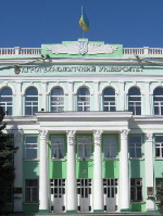
|
MELITOPOL or MELITOPIL. A city (2016 pop 155,595) on the Molochna River and raion center in Zaporizhia oblast. A frontier settlement was established at the site in 1784. In 1816 it was named Novooleksandrivka, and in 1841 renamed Melitopol. From 1841 to 1923 Melitopol was a county center in Tavriia gubernia and then Zaporizhia gubernia. On 18 June 1918 the Army of the Ukrainian National Republic defeated the Red Army near the town. During the Soviet period Melitopol developed into an industrial city. Its chief industries are machine building (automobile engines, refrigerators, tractor parts), metalworking, light industry, and the food industry. Its institutions of higher education are the Tavriia State Agrotechnological University and the Melitopol State Pedagogical University (est 1922). It has a regional museum. The Melitopol kurhan, a Scythian royal burial mound from the 4th-3rd century BC, is located near Melitopol... |
| Melitopol or Melitopil |
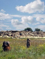
|
KAMIANA MOHYLA. A knoll of sandstone deposits from the Miocene epoch resembling a large kurhan, situated near Terpinnia, Melitopol raion, Zaporizhia oblast. Beneath it 65 caves have been discovered to date containing ancient petroglyphs of wild bulls, wolves, horses, and other animals, human beings, and geometric patterns dating back to the Upper Paleolithic Period, the Mesolithic Period, and the Bronze Age, when this was a site of religious worship. The first caves were discovered by Nikolai Veselovsky in 1890 and were investigated in 1936–8, the 1950s, the 1970s. Between 1983 and 2006 extensive excavations of the site were conducted by archeologist Borys Mykhailov who discovered numerous new caves and grottos. It is estimated that the oldest petroglyphs in Kamiana Mohyla date back to 22nd millennium BC. Neolithic campsites were also excavated nearby... |
| Kamiana Mohyla |
The preparation, editing, and display of the IEU entries about the Zaporizhia region in southern Ukraine were made possible by the financial support of the CANADIAN FOUNDATION FOR UKRAINIAN STUDIES.
 XXVI. UKRAINE'S SOUTHERN BOUNDARY: THE BLACK SEA AND THE SEA OF AZOV
The coasts of the Black Sea and the Sea of Azov form the natural boundary of the Ukrainian territories in the south. These seas link Ukraine with the world. Since ancient times economic, political, and cultural influences from the south have reached Ukraine via the Black Sea. They easily penetrated to the interior of Ukrainian territory along the rivers that flow into the sea: the Danube River, Dnister River, Boh River, and particularly Dnipro River. For many centuries three expansion routes intersected on the north coast of the Black Sea. The peoples that inhabited Ukraine tried to reach the Black Sea, while the Mediterranean peoples--Greeks, Byzantines, Italians--strove to occupy its most northerly coast. But the steppes along the northern coast were continually invaded by nomadic hordes from Asia. The struggle for the northern coasts of the Black Sea and the Sea of Azov lasted for centuries, and the Ukrainian people established a permanent boundary on the Black Sea only at the close of the 18th century... Learn more about the history, nature, and geopolitical importance of the Black Sea and the Sea of Azov by visiting the following entries:
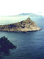
|
BLACK SEA. An interior sea connected to the Atlantic Ocean by several straits and the Aegean and Mediterranean seas. It lies between the East European massif in the north and Asia Minor in the south, between Caucasia in the east and the Balkan Peninsula in the west. Today the Black Sea coast is divided among Ukraine, Russia, Georgia, Turkey, Bulgaria, and Romania. The Black Sea was known under various names in the past. The ancient Greeks called it at one time Pontos Axeinos (the Hostile Sea), because of its storminess and lack of islands. After colonizing its coast, the Greeks renamed it Pontos Euxeinos (the Hospitable Sea). Arab travelers and writers called it the Rus' Sea. The Kyiv Chronicle referred to it as the Pontic or Ponetian Sea. Eventually, various nations adopted the name Black Sea... |
| Black Sea |
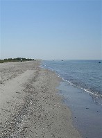
|
BLACK SEA NATURE RESERVE. A state preserve located on the sandy banks of the lower Dnipro River and the coast and the islands of the Tendriv Bay and Yahorlyk Bay of the Black Sea. The preserve was established in 1927. It covers 9,421 ha of dry land and 24,700 ha of water (in 1976, 64,806 ha). It was created to protect nesting, wintering, and migrating birds and to preserve the natural environment. The steppe section of the preserve?the Yahorlyk Kut Peninsula and Potiivka?consists of the remains of the Black Sea steppes and is inhabited by such rare birds as the great bustard, the little bustard, and the white-tailed eagle and smaller animals such as the acclimatized bobac. In the forest-steppe sections are found the remains of island forests and small groves of oak, birch, and willow trees... |
| Black Sea Nature Reserve |
|
SEA OF AZOV. A shallow branch of the Black Sea, connected to it by the Kerch Strait. It covers a part of the Black Sea Depression lying between the Donets Ridge and the Azov Upland in the north and the foothills of the Crimean Mountains and the Caucasus Mountains in the south. It is located between mainland Ukraine in the north, the Crimea in the west, and the Kuban region in the east. The Sea of Azov was important in ancient times when Greek colonies were founded on its shores. These city-states belonged to the Bosporan Kingdom, which eventually gained control of the entire Azov coast. The ancient city-states on the Azov coast fell to the invading Huns in the 4th century. The Antes were the first Slavic people to settle in the Azov area (4th?7th century). Later a Slavic tribe, the Siverianians, occupied this land... |
| Sea of Azov |
|
AZOV-SYVASH GAME PRESERVE. Located in the area of the Sea of Azov and Syvash Lake, the preserve covers an area of 6,850 ha including sandy Byriuchyi Island and the loess islands of Kuiuk-Tuk and Churiuk. The preserve was formed in 1957 out of a reservation established in 1927. The steppe vegetation includes about 240 species. The red deer and the pheasant have been acclimatized on Byriuchyi Island, and the buck and the wild goat have been reacclimatized. The purpose of the preserve is to protect the steppe and coastal flora, particularly waterfowl during their southward migration and wintering... |
| Azov-Syvash Game Preserve |
|
TAHANRIH BAY. The largest bay in the Sea of Azov. Situated in the sea's northeast corner with an entrance marked by Dovhyi Island and the Bilosarai Spit, the bay is approx 150 km long, 31 km wide (at its entrance), and 5 m deep. Its shore is generally quite high and is marked by a number of spits (such as Kryva Spit and Yeia Spit), shallow inlets, and coastal islands. The Don River, the Kalmiius River, the Miius River, and the Yeia River empty into the bay and add several estuaries to its geographical features. The bay freezes from December to March. The largest ports on it include Tahanrih, Mariiupil, and Yeisk... |
| Tahanrih Bay |
The preparation, editing, and display of the IEU entries associated with the Black Sea and the Sea of Azov were made possible by the financial support of the CANADIAN FOUNDATION FOR UKRAINIAN STUDIES.
 XXVII. THE SUMY REGION AND ITS RICH HISTORICAL HERITAGE
The territory of the present-day Sumy region in northeastern Ukraine was settled as early as the Paleolithic period. In the 9th to 11th centuries it belonged to Kyivan Rus', and in the 11th to 13th centuries, to Chernihiv and Siversk principalities. It was under Tatar control until the mid-14th century, when the Grand Duchy of Lithuania expanded into the region. In the 16th century the southern and western parts of the region came under Polish control, and the northern parts (notably Putyvl) fell under Russian control. After Bohdan Khmelnytsky's uprising and the Cossack-Polish War of 1648-57 the northern and western reaches of the Sumy region became part of the Hetman state, and the southern and eastern areas became part of Slobidska Ukraine. It was in the 18th century that this region gained a particular importance in Ukrainian history when Hlukhiv became the capital of the Left-Bank hetmans and one of the important centres of Ukrainian political and cultural life... Learn more about the Sumy region and its historical heritage by visiting the following entries:
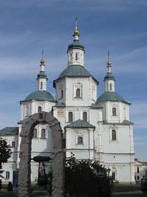
|
SUMY. A city (2011 pop 270,039) at the confluence of the Psol River and the Sumka River and an oblast center. It was founded in 1652 by peasants and Cossacks from Bila Tserkva regiment in Right-Bank Ukraine led by Colonel Herasym Kondratiev. The new settlement was soon fortified to protect the territory from the Tatars. Located on the Putyvl-Moscow trade route, the town prospered. In 1660-1732 its population grew from 2,700 to 7,700. It was the center of Sumy regiment (1658-1765) and the seat of administration for all the regiments of Slobidska Ukraine (1732-43). Then it became the center of Sumy province of Slobidska Ukraine gubernia (1765-80) and a county center in Kharkiv vicegerency (1780-96), Slobidska Ukraine gubernia (1796-1835), and Kharkiv gubernia (1835-1923). By the mid-19th century Sumy was a well-established industrial and trading town: it had a glass factory (est 1710), three tanneries, a coach works, four brick factories, four candle works, a soap factory, and four major fairs a year. In 1732 it had five schools... |
| Sumy |
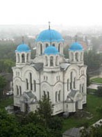
|
HLUKHIV. City (2001 pop 35,800) on the Yesman River and a raion center in Sumy oblast. Mentioned in the Hypatian Chronicle under the year 1152 as a city in Chernihiv principality, in the 13th and 14th centuries it was the capital of an appanage principality. In the mid 13th century Hlukhiv was captured by the Mongols. In the 1350s the region came under Lithuanian rule; it was annexed by Muscovy in 1503 and by Poland in 1618 at which time the city was granted the rights of Magdeburg law. Part of the Hetman state from 1648 on, Hlukhiv was an important trade center and a company town in the Nizhyn regiment. The Hlukhiv Articles were signed here in 1669. After the destruction of Baturyn, Hlukhiv was (during the years 1708-22 and 1727-64) the capital of the Left-Bank hetmans. The city underwent periods of particularly rapid growth under the rule of Hetman Danylo Apostol (1727-34) and Hetman Kyrylo Rozumovsky (1750-64), elected at the Hlukhiv Council of 1750. The renown Hlukhiv Singing School was established there in 1738... |
| Hlukhiv |
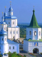
|
PUTYVL (or PUTYVEL). A town (2011 pop 16,329) on the Seim River and a raion center in Sumy oblast. It was first mentioned, as a fortress, in the Hypatian Chronicle under the year 1146. Putyvl was established in 988 at the crossroads of several trade routes. From the 12th century until 1523 Putyvl was the center of an appanage principality, which was part of Kyivan Rus', the Grand Duchy of Lithuania (1356-1503), and Muscovy. The town, which is described in Slovo o polku Ihorevi, withstood a Cuman siege in 1186. In 1239 it was destroyed by Batu Khan's horde. In 1618 it was captured by Hetman Petro Konashevych-Sahaidachny. As Slobidska Ukraine became colonized in the 17th century, Putyvl lost its strategic importance. In the 19th century it was a county center of Kursk gubernia. In 1926 it became part of the Ukrainian Soviet Socialist Republic. Today Putyvl's main industries are food processing and tourism. In 1988 Putyvl, with its numerous architectural monuments, was declared a historical and cultural reserve... |
| Putyvl (or Putyvel) |
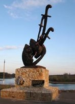
|
KONOTOP (or KONOTIP). City (2011 pop 93,377) and raion center in Sumy oblast under oblast jurisdiction, situated on the Yezuch River. Konotop was first mentioned in a historical document in 1634. From 1654 to 1781 it was a fortified company town in Nizhyn regiment. In the summer of 1659 during the Ukrainian-Muscovite War, it was besieged for three months by Prince A. Trubetskoi's army and defended by Colonel Hryhorii Hulianytsky. On 8 July 1659 Hetman Ivan Vyhovsky, who came to the town's aid, scored his first great victory known as the Battle of Konotop, killing or scattering 30,000 Russians and capturing 5,000. In 1664 Konotop was destroyed by the Poles. From 1782 to the early 1920s it was a county town, from 1802 in Chernihiv gubernia. From 1923 to 1932 it was an okruha center, and from 1932 to 1939 a raion center, in Chernihiv oblast. Its development began only after it became a junction on the Kyiv-Voronezh railway in the mid 19th century. Its major industries are machine building industry and metalworking industry... |
| Konotop (or Konotip) |
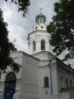
|
ROMNY (or ROMEN). A city (2011 pop 43,937) at the junction of the Romen River and the Sula River and a raion center in Sumy oblast. It was first mentioned, as a border fortress of Kyivan Rus', in the Laurentian Chronicle under the year 1096. From the mid-14th century it belonged to the Grand Duchy of Lithuania, and from the beginning of the 17th century, to the Polish-Lithuanian Commonwealth. After Bohdan Khmelnytsky's uprising and the Cossack-Polish War it became a company center of Myrhorod regiment (1648-58) and later Lubny regiment (1658-1782). With the abolition of the Hetman state the town became part of Chernihiv vicegerency, and in 1783 it obtained the rights of Magdeburg law. In 1802 it became county center in Poltava gubernia. In the 19th century Romny was a prosperous trading town, and until 1852 the home of one of Ukraine's largest annual fairs. Today the city is an industrial center with machine building, a building-materials industry, and a food-processing industry... |
| Romny (or Romen) |
|
OKHTYRKA. A city (2011 pop 49,323) at the junction of the Okhtyrka River and the Vorskla River and a raion center in Sumy oblast. The city was founded in 1641 and was an administrative center of Okhtyrka regiment in 1655-1765. The territory of this regiment suffered extensive damage during the Russo-Swedish conflict of 1708-9 and the Russo-Turkish war of 1735-9. Following the abolition of the Hetman state and the Cossack order, the Okhtyrka Cossack regiment was transformed into a hussar regiment and the territory became part of Slobidska Ukraine gubernia. In 1835, after the dissolution of this gubernia, Okhtyrka became part of Kharkiv gubernia. Starting from the early 18th century Okhtyrka became a regional center of crafts and industry. In 1718 the first tobacco manufacture in Ukraine (and the Russian Empire) was established there. Today it has a machine building industry, a petroleum industry, a light industry, and a food industry. Its architectural monuments include the Cathedral of the Holy Protectress (1753)... |
| Okhtyrka |
The preparation, editing, and display of the IEU entries featuring the Sumy region and its historical heritage were made possible by the financial support of the CANADIAN FOUNDATION FOR UKRAINIAN STUDIES.
 XXVIII. THE PICTURESQUE TRANSCARPATHIA: THE WESTERNMOST REGION OF UKRAINE
Transcarpathia is the only part of Ukraine situated beyond the Carpathian Mountains. Accessible to the main territory of Ukraine through numerous mountain passes, it joins Ukraine with the core of East-Central Europe. Transcarpathia encompasses two different natural regions, the Tysa Lowland and the picturesque southern watershed of the Ukrainian Carpathian Mountains. The Slavic colonization of Transcarpathia began in the 2nd century, with migration from the north across the mountain passes. By the 8th and 9th centuries the lowlands of Transcarpathia were fairly densely peopled by White Croatians (at the time inhabiting both the north and the south side of the Carpathians). In the 10th century, Transcarpathia came under the sphere of influence of Kyivan Rus'. Following its incorporation by Prince Volodymyr the Great into his realm, the name Rus' or Ruthenia became entrenched in Transcarpathia. In the 11th century most of Transcarpathia came under Hungarian rule. Ukrainians constituted the majority of the region's population, but they were a minority element among its aristocracy. Deprived of a political structure and social elite the Transcarpathian Ukrainians preserved their ethnic identity principally through their religious distinction. Mukachevo was the seat of an Orthodox Mukachevo eparchy (first mentioned in 1491), the religion of which was merely tolerated in Hungary, and the clergy and monasteries of which were dependent on the goodwill of the local gentry. Despite its political separation the spiritual contacts of Transcarpathia with other Ukrainian lands were close. Liturgical and theological books published in Kyiv and Lviv were used widely in Transcarpathia and in the 17th and 18th centuries a local religious literature developed there, resembling in character Ukrainian baroque literature, with minor Hungarian and Slovak influences. It was not until the early 1920s that Transcarpathia was established as a separate administrative region. The Ukrainians' struggle for self-rule resulted in the creation of the autonomous Carpatho-Ukraine on 11 October 1938. On 12 February 1939, elections to the first parliament of Carpatho-Ukraine took place in which the Ukrainian National Alliance won a resounding victory. However, on 14 March 1939, Adolf Hitler entrusted Hungary with the occupation of Transcarpathia which marked the actual beginning of the Second World War... Learn more about Transcarpathia, its history, cities, inhabitants, and natural resources by visiting the following entries:
|
TRANSCARPATHIA. A historical-geographic region in southwestern Ukraine, incorporating the southern slopes of the Carpathian Mountains and a portion of the adjoining Tysa Lowland. Until 1919 Transcarpathia denoted that part of Hungary where Ukrainians lived, and the synonymous terms Hungarian Ruthenia (Uhorska Rus') and Hungarian Ukraine (Uhorska Ukraina) were widely used. Bounded by the ethnographic boundary with Romanians and Hungarians in the south and Slovaks in the west, the region encompassed 15,600 sq km. After the First World War Transcarpathia was separated from Hungary, and the bulk of its territory was formed into an autonomous region within Czechoslovakia called Subcarpathian Ruthenia (Pidkarpatska Rus') or Carpatho-Ukraine. A small part of Transcarpathia, located south of the Tysa River became part of Romania (Maramures region); in Transcarpathia's western reaches, the Presov region was allocated to Slovakia. A narrow strip of Hungarian ethnographic territory was added to Carpatho-Ukraine. Within Czechoslovakia Transcarpathia played an important geopolitical role as the bridge linking Czechoslovakia with Romania. At the same time it separated Hungary from its traditional ally, Poland. Later, Transcarpathia provided the USSR with a foothold in the Pannonian Plain. Beginning in 1938 the borders of Carpatho-Ukraine underwent a number of changes. After the Vienna Arbitration, Carpatho-Ukraine was transferred as a dependency to Hungary. Within the borders of Ukraine Transcarpathia occupies almost the same territory as it did within prewar Czechoslovakia, with a slight increase in the southwest around Chop. It constitutes a separate administrative unit, Transcarpathia oblast, with a territory of 12,800 sq km and a population of 1,258,155 (2018)... |
| Transcarpathia |
|
UZHHOROD. A city (2019 pop 114,897) on the Uzh River and the capital of Transcarpathia oblast. According to the archeological evidence the site was inhabited as early as the Stone Age. A Slavic tribe of White Croatians founded a fortified settlement there in the 8th or 9th century. Early in the 10th century it was controlled by the Hungarians and then by Kyivan Rus'. Hungary regained control of the town in the 11th century and remained the dominant influence there until the 20th century. Uzhhorod was sacked by the Tatars in 1242, and its fortress was destroyed. Its economy was initially based on wine-making industry, agriculture, and animal husbandry. Trade and manufacturing, stimulated by the town's military and administrative needs, developed through the 15th to 18th centuries. The religious struggle of the 17th century culminated in the Uzhhorod Union of 1646. The Austrian Habsburg dynasty won control of Uzhhorod in 1691, and the city became involved in Hungarian attempts to throw off Austrian rule--in the Rakoczi uprising of 1703-11 and the Revolution of 1848-9. With the defeat of the revolution the Ukrainian cultural movement in Uzhhorod gained strength for a time. The Society of Saint Basil the Great, the Uniia publishing society, and Ukrainian schools were established. In 1848 the city was granted self-government, and began the process of modernization. With Transcarpathia's incorporation into Czechoslovakia after the First World War, Uzhhorod became the capital of Subcarpathian Ruthenia, the seat of the governor and the administration, and a center of Ukrainian life... |
| Uzhhorod |
|
MUKACHEVO. A city (2019 pop 85,881) on the Liatorytsia River and a raion center in Transcarpathia oblast. The site has been settled since prehistoric times. Archeologists have discovered settlements in the vicinity from the Neolithic Period, the Bronze Age, the Iron Age, and the Slavic period (8th-9th century AD). In the 10th century Mukachevo belonged to Kyivan Rus', and in the 11th century, to Hungary. The fortress, rising high above the town, was destroyed by the Cumans in 1086 and by the Tatars in 1241. It was rebuilt by Prince Fedir Koriiatovych, who also built Mukachevo Saint Nicholas's Monastery. By the end of the 14th century Mukachevo was an important manufacturing and trading center on a trade route between Hungary and Galicia. In 1445 it was granted the rights of Magdeburg law. Because of the monastery the town became a cultural and religious center in the 15th century, and until the end of the 18th century it was the seat of the Mukachevo eparchy. Owing to its strategic location Mukachevo was contested frequently by the Habsburg dynasty and Transylvanian dynasty in the 16th and 17th centuries. At the end of the 17th century the town was annexed by Austria. It flourished in the 18th century and became the chief trade center in Transcarpathia. Mukachevo played an important role in the revolutionary movement of 1848-9. After the First World War the city belonged to Czechoslovakia. Its importance diminished whereas that of Uzhhorod grew. In 1938 Mukachevo came under Hungarian rule. By a Soviet-Czechoslovak treaty of June 1945 Transcarpathia became part of Soviet Ukraine... |
| Mukachevo |
|
KHUST. City (2017 pop 28,473) and raion center in Transcarpathia oblast, situated on the Khustets River in the Maramures Basin. It arose in the 10th century at the foot of a mountain of volcanic origin, on which a Hungarian castle was built from 1090 to 1191 to control access to salt mines 50 km away near the future town of Solotvyna. It was razed by the Mongols in 1242 but was soon rebuilt. Khust belonged to the Principality of Galicia-Volhynia from 1281. In 1321 Hungarian rule was restored. In the 16th and 17th centuries the Habsburg dynasty and the Transylvanian princes fought each other for control of the town and its castle. It was besieged by the Crimean Tatars in 1594, 1659, and 1717, the Poles in 1657, and the Turks in 1661-2. Prince Ferenc II Rakoczi took the town in 1703 and convened a Transylvanian diet there in 1709. The castle burned down after lightning hit its gunpowder tower in 1766. A Ukrainian People's Council was founded there in November 1918. On 21 January 1919 the 425 delegates of the All-People's Congress of Hungarian Ruthenians in Khust created the Central Ruthenian People's Council and voted to unite Transcarpathia with Ukraine. From 1919 to 1938 the city belonged to Czechoslovakia, from 1928 as a county center. Branches of the Prosvita society and Dukhnovych Society were established there. After Hungary occupied southwestern Transcarpathia, in November 1938, the autonomous Carpatho-Ukrainian government headed by Avhustyn Voloshyn was evacuated from Uzhhorod to Khust, which became the capital of Carpatho-Ukraine... |
| Khust |
|
BEREHOVE or Berehovo. A city (2019 pop 23,732, with a substantial Hungarian population), located in the Tysa Lowland; raion center in Transcarpathia oblast. Founded as a Saxon colony in the 11th century AD, Berehove is situated in Hungarian ethnic territory (before the Second World War Ukrainians constituted 10 percent of the population in Bereg komitat [Berehove county]). Under Czechoslovak rule it was a center of Ukrainian cultural life in southern Transcarpathia. A Ukrainian gymnasium was situated here. Berehove has furniture, clothing, brick-and-tile, and ceramics plants and a wine and food industry. Vineyards are located nearby. A 15th-century Gothic Roman Catholic church is located in the city. Berehove is a centre of cultural life of the Hungarian minority in Ukraine. A Hungarian pedagogical institute, the Transcarpathian Hungarian Institute--the only institution of this kind in Ukraine--is located in Berehove... |
| Berehove |
|
VYNOHRADIV. A city (2018 pop 25,462) on the Tysa River and a raion center in Transcarpathia oblast. Until 1946 it was known as Sevliush or Sevlus. The settlement originated in the 9th century around the Slavic fortress of Kanko. At the end of the 11th century it came under Hungarian rule and was renamed Sevliush. At the end of the 17th century it was annexed by Austria, and in 1919 it was awarded to Czechoslovakia. Officially part of Ukraine since 1945, it was granted city status in 1946. Today the city is an industrial and communications center. It is the home of the Elektron Manufacturing Consortium, a plastic sanitary-products plant, and sewing, footwear, canning, and cheese factories. Its architectural monuments include the remains of the medieval castle, the Perenyi palace (15th century), a Franciscan church (14th-15th century), and a 16th-century Church of the Elevation of the Cross... |
| Vynohradiv |
The preparation, editing, and display of the IEU entries dealing with the history, cities, and natural resources of Transcarpathia were made possible by the financial support of the CANADIAN FOUNDATION FOR UKRAINIAN STUDIES.
 XXIX. THE HISTORICAL REGION OF VOLHYNIA IN NORTHWESTERN UKRAINE
The name of Volhynia (Volyn), a historical region in northwestern Ukraine, probably comes from a fortified town from before the 10th century, located at the confluence of the Buh River and the Huchva River. The first historical name of the people of Volhynia was Dulibians. In the 10th century that name was replaced by Buzhanians and Volhynians. In 981 and 993 Prince Volodymyr the Great of Kyiv secured the lands along the Sian River and beyond the Buh River and built Volodymyr-Volynskyi (988), which he gave to his son, Vsevolod. In the 990s a Volhynian eparchy was established. From 1015 to 1030 Volhynia was the battleground of Polish-Rus' wars. In the late 12th century Prince Roman Mstyslavych established a large state encompassing Volhynia, Galicia, and Kyiv and known as the Principality of Galicia-Volhynia. In 1349 this state was partitioned, and Volhynia fell under the control of Prince Liubartas and became part of the Grand Duchy of Lithuania. In the 15th and 16th centuries the Orthodox princely and noble families (most notably, the Ostrozky princes) consolidated their privileged positions in Volhynia. After the Union of Lublin (1569) Volhynia became a Polish crown voivodeship without losing its internal autonomy and Ukrainian character. The union, however, accelerated the Polonization of the administration and the upper estates of Volhynia. The struggle against Roman Catholicism and the Ukrainian national-cultural movement at the beginning of the 17th century was expressed in the writings of the opponents and the supporters of the Church Union of Berestia (1596). During Bohdan Khmelnytsky's uprising some of the battles of the Cossack-Polish War of 1648-57 took place in Volhynia. Nevertheless Volhynia never became part of the Hetman state but remained a province of Poland. After Bohdan Khmelnytsky's death heavy Polish oppression and Tatar raids forced much of the Ukrainian population to emigrate to Left-Bank Ukraine. The Ukrainian nobility in Volhynia lost its political significance. After the partitions of Poland (1772, 1793, and 1795) Volhynia, with the exception of the southern part of Kremianets county, became part of the Russian Empire. The process of the Ukrainian national rebirth began in Volhynia only during the Ukrainian struggle for independence in 1917-21, but in 1921 the region was partitioned according to the Peace Treaty of Riga: the eastern part was annexed by the Ukrainian SSR, the western part by Poland. After 1945 practically the entire region of Volhynia was united within the borders of the Ukrainian SSR... Learn more about the region of Volhynia in northwestern Ukraine by visiting the following entries:
|
VOLHYNIA. A historical region of northwestern Ukraine, located north of Podilia, south of Polisia, east of the Buh River, and west of the upper parts of the Teteriv River and the Uzh River. Its area is approximately 70,000 sq km, and its population exceeds 4 million. Volhynia's borders have changed considerably over the centuries, shifting consistently from west to east. In the 12th century the Volhynia principality was larger than the present region. It extended to the Wieprz River in the west and to the Narev River and the Yaselda River in the northwest and thus encompassed the present Kholm region and Podlachia. Until 1170 it also encompassed the Belz land in the south. Under Poland the smaller Volhynia voivodeship (1569-1793) did not reach west beyond the Buh River, but included new territory to the east and southeast. Within the Russian Empire Volhynia gubernia consisted approximately of the same territory, except for the Zbarazh region, but expanded east to the upper Teteriv and the Uzh rivers. Even its capital, Zhytomyr, belonged once to Kyiv principality, not Volhynia principality. Today Volhynia encompasses most of Volhynia oblast, Rivne oblast, and Zhytomyr oblast, and parts of the former Volhynia gubernia belong to other oblasts--the Kremianets region, to Ternopil oblast, and the Iziaslav (Zaslav) and the Starokostiantyniv regions, to Khmelnytskyi oblast... |
| Volhynia |
|
LUTSK. A city (2013 pop 215,624) on the Styr River and the center of Volhynia oblast. It is first mentioned in the Hypatian Chronicle under the year 1085, but it was probably a tribal center of the Luchanians as early as the 10th century. There is evidence that the area was settled in the Neolithic Period. Lutsk was the capital of an independent principality from 1154. In 1225 it belonged to Volodymyr principality and later to Principality of Galicia-Volhynia. In 1340 it was annexed by Liubartas, who built a castle there and established Lutsk as the capital of an appanage principality within the Lithuanian-Ruthenian state. After the Union of Lublin in 1569, the city came under Polish rule and served as a center of Volhynia voivodeship. In the 15th and 16th centuries it was one of the main trade centers in Ukraine because of its location at the crossroads of major trade routes. The city was also an important Ukrainian religious and cultural center. In 1617 the Lutsk Brotherhood of the Elevation of the Cross was founded, and in 1621 it set up a school. Later in the 17th century Lutsk declined. It was annexed by Russia in 1795, and became a county center. Today the city's most important historic monument is Liubartas's castle, the baroque Roman Catholic church built in 1619-20, the Church of the Holy Protectress, reconstructed from its 15th-century ruins, and the Church of the Elevation of the Cross, rebuilt in 1890 from the remains of the brotherhood's church (1619-20)...
|
| Lutsk |
|
RIVNE. A city (2013 pop 250,333) on the Ustia River and the administrative center of Rivne oblast. The town developed out of a settlement around a fortress in the Principality of Galicia-Volhynia. It is first mentioned in historical documents in 1282. In the second half of the 14th century it became part of the Grand Duchy of Lithuania, and by the end of the century it had been granted the rights of Magdeburg law. Because of its convenient location on the Kyiv--Volodymyr-Volynskyi trade route the town prospered as a commercial center. In 1518-1621 it was owned by the Ostrozky princes. With the Union of Lublin (1569) Rivne became part of the Polish-Lithuanian Commonwealth. With the partitioning of Poland in 1793 it was annexed by Russia. Toward the end of the 19th century Rivne developed from a small administrative and trading town into a major railway junction. Its population jumped from 6,300 in 1870 to 24,600 in 1897 and 33,700 in 1911. From the 1890s over half the population was Jewish. In 1941 the city was captured by the Germans and turned into the administrative center for Reichskommissariat Ukraine. In 1941 and 1942 the Germans killed the majority of local Jews. Soviet troops reoccupied Rivne in 1944. Since the 1950s Rivne has developed rapidly as an industrial center and the city remains an important railway junction. Its chief architectural monuments are the Dormition Church and belfry (1756), the gymnasium building (1839), and the Resurrection Cathedral (1890)... |
| Rivne |
|
VOLODYMYR-VOLYNSKYI. A city (2013 pop 38,894) on the Luha River and a raion center in Volhynia oblast. One of Ukraine's oldest cities, it is first mentioned in the chronicles under the year 988, as the fortified trading town of Volodymyr and the seat of an eparchy. In the 12th century it was the center of Volodymyr principality, and in 1199 it became part of the Principality of Galicia-Volhynia. Frequent Tatar attacks (1240, 1260, 1491, and 1500) brought about its decline. In the late 14th century it came under Lithuanian rule, and in 1431 it obtained the rights of Magdeburg law. From 1569 the town belonged to the Polish-Lithuanian Commonwealth. Prince Kostiantyn Vasyl Ostrozky set up a school there in 1577, and a Basilian college operated there in the 18th century. In 1795 the town was annexed by the Russian Empire. It was renamed Volodymyr-Volynskyi, and served as a county center in Volhynia gubernia. During the First World War the Ukrainian Sich Riflemen opened the first Ukrainian school there, in 1916. In the interwar period Volodymyr-Volynskyi was a county center under Polish rule. Today the city is an industrial and communications center. Its chief architectural monuments are the remains of the 12th- to 13th-century fortifications, the foundations of 10th- to 14th-century residential buildings, the Dormition Cathedral in Volodymyr-Volynskyi (1160), Saint Basil's Church (13th-14th century), and the Renaissance bishops' palace (16th century)... |
| Volodymyr-Volynskyi |
|
OSTROH or OSTRIH. A city (2013 pop 16,658) at the junction of the Viliia River and the Horyn River and a raion center in Rivne oblast. It is first mentioned in the Hypatian Chronicle under the year 1100. In the second half of the 14th century it came under Lithuanian rule. From 1386 Ostroh belonged to the Ostrozky family, who built a castle and the Church of the Epiphany and established Ostroh as an important cultural, religious, and economic center. Until 1630 the town was a leading center of Ukrainian Orthodoxy: in the 1570s an academy and a printing press were set up, and in 1581 an improved translation of the Bible was published there. As the Roman Catholic movement and the state's policy of Polonization increased in strength, Ostroh lost its cultural and religious role. It was captured by Bohdan Khmelnytsky in 1648, and the castle and church were destroyed in the process. In the second half of the 17th century Ostroh became the property of the Zaslawski family, the Wisniowiecki family (in 1673), and finally the Sanguszko family (in 1700). In 1793, with the partition of Poland, it was transferred to Russia, and became a county center in Volhynia gubernia. Today the town's architectural monuments include the remains of the castle (14th-16th century), the 15th-century Church of the Epiphany, a 17th-century synagogue, and a 19th-century academy complex. In 1994, the Ostroh Academy was reestablished and in 2000 it was renamed the Ostroh Academy National University... |
| Ostroh or Ostrih |
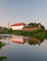
|
DUBNO. City (2013 pop 38,035) on the Ikva River in western Volhynia; raion center in Rivne oblast. It was first mentioned in 1100 as the village of Duben. In 1498 Dubno received Magdeburg law and came under the control of the Ostrozky princes. In the 15th century a fortress was built there that played an important role during the Cossack-Polish War in mid 17th century and survived until the First World War. The Dubno Monastery was founded by Prince Kostiantyn Ostrozky in the late 16th century. Yov Zalizo was the monastery's first hegumen (from 1584 to 1597). Originally an Orthodox monastery, it was taken over by the Catholic church in 1700, but reverted to Orthodox control in the 19th century. Because of its fairs Dubno was a trade center, particularly from 1774 to 1797 when the famous Lviv contract fair was transferred to Dubno. Under Polish and Russian rule the town was a county center known for its trade in hops and cultural activities. Today it has some small industry: a food industry, a woolen-cloth industry, a furniture factory, and a foundry-machinery plant. It has a regional studies museum. Among its architectural monuments are the castle of the Ostrozky princes (16th century), the Lutsk Gate (15th and 16th centuries), the Transfiguration Church (16th century), Saint Nicholas's Church (17th century), Saint George's Church (1700), Church of the Nativity of the Theotokos (17th century)... |
| Dubno |
The preparation, editing, and display of the IEU entries about the historical region of Volhynia in northwestern Ukraine were made possible by the financial support of the PETER SALYGA ENDOWMENT FUND at the CANADIAN INSTITUTE OF UKRAINIAN STUDIES (Edmonton, AB, Canada).
 XXX. THE ZHYTOMYR REGION AND CENTRAL POLISIA
The territory of central Polisia, also known as Zhytomyr Polisia, in northern Ukraine was inhabited as early as the Upper Paleolithic Period (10,000-8000 BC). Toward the end of the 1st century AD it was occupied by the tribe of Derevlianians. They lived to the southeast and south of the Prypiat River and their main towns were Korosten and Ovruch. In fact, the Yaselda-Prypiat line, which now forms the ethnic border between Ukrainians and Belarusians, marked off tribal territories long ago. In the 10th to 12th centuries central Polisia was part of Kyivan Rus' and then of Volodymyr-Volynskyi principality and the Principality of Galicia-Volhynia. After the collapse of the Galician-Volhynian state the whole of Polisia became part of Lithuania. In the middle of the 15th century most of the region was administered by the Olelkovych princes of Kyiv. After the Union of Lublin in 1569 Polisia was divided: the northern part remained in the Grand Duchy of Lithuania, whereas the southern part was acquired by Poland. Polisia gained importance in Ukraine's history during the Tatar conquest of the forest-steppe in the 13th century and the Crimean Tatar raids after the mid-15th century. A large proportion of the Ukrainian population of the forest-steppe sought refuge in Polisia, which was less vulnerable to attack. After the partitions of Poland the whole of Polisia was incorporated into the Russian Empire. This region, including central Polisia, was the most neglected and poorest part of Ukrainian territories within the Russian Empire. Expeditions which drained some parts of the region and railroad transportation brought a significant improvement in Polisia's economy in the 19th century. During Ukraine's struggle for independence in 1917-18 the whole of Ukrainian Polisia, in accordance with the Peace Treaty of Brest-Litovsk, became part of the Ukrainian National Republic... Learn more about the Zhytomyr region and central Polisia by visiting the following entries:
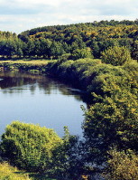
|
POLISIA. A physical-geographical region of lowlands and mixed forests lying between the Belarusian Upland to the north, the Volhynia-Kholm Upland and the Dnipro Upland to the south, the Buh River and Podlachia to the west, and the Dnipro Lowland to the east. Under the broad definition Polisia covers a territory of over 200,000 sq km. Under the narrow definition, which excludes Chernihiv Polisia, Little Polisia, and Volodava Polisia, Polisia proper occupies about 160,000 sq km. The Ukrainian-Belarusian ethnic border crosses Polisia from west to east approximately along the line Pruzhany-Bereza Kartuzka-Vyhonivske Lake, down the Bobryk River and along the Prypiat River to Mozyr, south to the Slovechna River and east along the Ukrainian-Belarusian border to the Dnipro River, and then north along the Dnipro. In the west the political-administrative border between Ukraine and Belarus does not correspond to the ethnic border, because the Soviet regime ceded the northwestern portion of Ukrainian ethnic territory (approximately 27,000 sq km) to the Belorussian SSR. Unlike its northern boundary, Polisia's southern boundary is sharply defined. Today Ukrainian Polisia is defined as Ukraine's forest belt. It encompasses most of Volhynia oblast and Rivne oblast, about two-thirds of Zhytomyr oblast, the northern third of Kyiv oblast, and the Ukrainian-settled parts of Brest oblast (over one-half) and Homel oblast (about one-sixth) in Belarus... |
| Polisia |
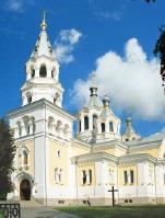
|
ZHYTOMYR. A city (2013 pop 271,172) on the Teteriv River and an oblast and raion center. It was founded, according to local legend, by a favorite of Askold and Dyr, Zhytomyr, in 884. It is first mentioned in the chronicles under the year 1240, when the town was destroyed by the Mongols. In 1320 Gediminas annexed it to the Grand Duchy of Lithuania and fortified it against the Tatars, who besieged it in 1399, 1469, 1482, and 1606. In 1444 Zhytomyr was granted the rights of Magdeburg law, and in 1471 it became a county center of Kyiv voivodeship. After the Union of Lublin of 1569 it became part of the Polish-Lithuanian Commonwealth. Its inhabitants revolted against their Polish overlords in 1594-6, 1618, and at the beginning of the Cossack-Polish War in 1648. Under Bohdan Khmelnytsky's rule the town served briefly as a company center of Kyiv regiment. In 1667 it was restored to Poland by the Treaty of Andrusovo, and in the following century it developed into an important Polish cultural center. It was the seat of a Roman Catholic diocese and the home of a Jesuit college (1720) and monastery (1724), a Bernardine monastery (1761), and a convent of the Sisters of Saint Vincent (1766). Its inhabitants joined the haidamaka uprisings in 1750 and 1768. After the partition of Poland in 1793, the town was annexed by Russia, and in 1804 it was made into the administrative center of Volhynia gubernia and the see of Volhynia eparchy. In the 19th century Zhytomyr developed into a regional manufacturing and trading center...
|
| Zhytomyr |
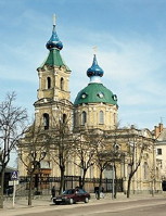
|
BERDYCHIV. A city (2012 pop 78,547) on the Hnylopiat River, a tributary of the Teteriv River, in the northwest part of the Dnipro Upland; a raion center in Zhytomyr oblast. Berdychiv was first mentioned in a historical document of 1545. In 1569 the city changed from Lithuanian to Polish rule, and in 1593 a fortress was erected around it. In 1630 the Kyiv voivode J. Tyszkiewicz built a church and fortified monastery in Berdychiv for the Polish Carmelite monks. The city thus became an important Polish religious center, attracting pilgrimages to the icon of the Virgin Mary, as well as a cultural center, with a school and, from 1760, a publishing center. These institutions and facilities were suppressed by the Russian government in 1866. Berdychiv grew in importance in the first half of the 19th century, when it became a center for wholesale and market trade (grain, cattle) and for light industry (dry goods, footwear). Berdychiv's population grew in response to commercial and industrial development (2,000 in 1789, 19,000 in 1838, and 51,500 in 1860), and it became Ukraine's fourth largest city after Odesa, Kyiv, and Lviv (but before Kharkiv). Berdychiv had a large Jewish population (80-90 percent) and was an important Hasidic center. With the decline of the market trade and with the construction of railroads, Berdychiv's growth ceased temporarily, coming to life again at the beginning of the 20th century. From 1917 to 1920 Berdychiv was, for the most part, under Ukrainian rule, but in the summer of 1920 the Soviets took control of the city... |
| Berdychiv |
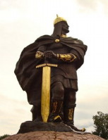
|
KOROSTEN. Industrial city (2012 pop 65,592) and raion center in Zhytomyr oblast on the Uzh River. It was first mentioned in 945 as Iskorosten, the capital of the Derevlianians, ruled by their Prince Mal. Following the death of Prince Ihor at the hands of the Derevlianians, the city was destroyed by Princess Olha. In the 14th century the town became part of the Lithuanian-Ruthenian state, but under the Union of Krevo in 1385 came under Polish influence. In 1585 it was granted the rights of Magdeburg law. After the partition of Poland in 1793, Korosten was annexed by Russia. Since the late 19th century it has been an important railway and highway junction. Because of its strategic importance, the Army of the Ukrainian National Republic and the Red Army fought for its control in 1918, in February and the summer of 1919, and during the Second Winter Campaign in November 1921. Today its plants manufacture road-construction and chemical-industry machinery, reinforced-concrete railway ties, porcelain products, silos, household chemicals, lumber, granite, clothing, cotton thread, meat and dairy products, and wine. Four Kyivan Rus' settlements have been excavated there... |
| Korosten |
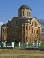
|
OVRUCH. A city (2014 pop 16,515) on the high left bank of the Noryn River and a raion center in Zhytomyr oblast. It is first mentioned in the chronicles under the year 946 as Vruchyi, a Derevlianian settlement. In 977 the princes Oleh Sviatoslavych and Yaropolk I Sviatoslavych fought there; Oleh is purportedly buried in a large grave nearby. In the second half of the 12th century Ovruch was part of Riuryk (Vasylii) Rostyslavych's principality. In 1362 it came under Lithuanian rule as part of the Lithuanian-Ruthenian state, and after the Union of Lublin in 1569 it was transferred to Poland and made a center of Ovruch starostvo. In 1641 Ovruch was granted the rights of Magdeburg law. After the partition of Poland in 1793, it was annexed by Russia and became a county town in Volhynia gubernia. Today the town has a dairy, a canning factory, and a winery, as well as railway enterprises. Its architectural monuments include Saint Basil's Church (12th-13th century, restored 1908-12) and monastery buildings (1907-9)... |
| Ovruch |
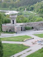
|
NOVOHRAD-VOLYNSKYI. A city (2012 pop 56,066) on the Sluch River and a raion center in Zhytomyr oblast. It is first mentioned in the Galician-Volhynian Chronicle under the year 1256 as the town of Zviahel (Vzviahl, Vozviahl). On year later, as punishment for the disloyalty of its population, the town was burned down by King Danylo Romanovych. The new town of Vzviahl emerged more than a century later under the rule of the Lithuanian-Ruthenian state. In 1499 it was granted to Prince Kostiantyn Ostrozky who built the castle there (1507-95) and rebuilt the town. After the Union of Lublin in 1569, the town was transferred to Poland and renamed Zviahel. During the Cosack-Polish War Zviahel was briefly a Cossack regimental center (1648-9). In 1793 it was taken by Russia, and in 1795 it was given its present name. Today the city produces agricultural machinery, building materials, beer, and furniture. Lesia Ukrainka was born and spent her childhood in Novhorad-Volynskyi. A memorial museum has been established there in her honor. Of the castle built by Kostiantyn Ostrozky, only remnants of the walls and one tower are left... |
| Novohrad-Volynskyi |
The preparation, editing, and display of the IEU entries about the Zhytomyr region and central Polisia were made possible by the financial support of the FRANKO FOUNDATION of Toronto, ON, Canada.
 XXXI. CASTLES AND PALACES OF UKRAINE
Castles were first built in the Middle Ages as shelters from invaders. In Ukraine fortified towns were the precursors of castles. They were established by the princes in the 10th-12th century, particularly in the areas threatened by nomadic tribes and on the Polish frontier. In the 13th century, after the decline of Kyivan Rus' and the Tatar invasions, the focus of political and cultural life moved to the western Ukrainian territories. To defend and restore the Principality of Galicia-Volhynia, its rulers renovated and built numerous fortified towns and castles, which under Tatar pressure they then had to demolish. Castles became widespread at the end of the 14th century when Ukraine became part of the Lithuanian and Polish states. The Lithuanian-Ruthenian state intended to colonize the steppes as far as the Black Sea and undertook the struggle against the Tatars, in which the castles played both a defensive and an offensive role. Castles were built not only on the exposed frontier along the Dnipro River (Kyiv, Kaniv, and Cherkasy) and in Podilia (Bar, Medzhybizh, Zhvanets, Letychiv, Bratslav, Vinnytsia, and others), but also in the interior--in Galicia and Volhynia. The Dnister River line was guarded from the Turks by Kamianets-Podilskyi, the strongest fortress in Poland and Ukraine. In the 17th century, apart from constructing new castles, Ukrainian hetmans, nobles, and the Cossack starshyna begun to build palaces as their elaborate private residences... Learn more about castles and palaces of Ukraine by visiting the following entries:
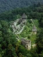
|
CASTLES. Fortified residences of rulers. In Ukraine castles were built in inaccessible places--on steep hills (eg, Kremianets, Kyiv, Lviv, Halych, and Chyhyryn), at river bends (eg, Dubno, Lutsk, and Berezhany), on islands, or in marshes. Building materials consisted of wood (castles in Vinnytsia, Chornobyl, Zhytomyr, Bratslav, or Cherkasy) and sometimes stone (Kremianets, Lviv, and Kholm). Wooden castles were surrounded by a thick stockade covered with mud to protect it from fire. Towers built of beams stood at the corners of the stockade. Sometimes a water-filled moat surrounded the castle, and a drawbridge provided access to the gate. Cossack castles were also usually built of wood with an emphasis on a more solid stronghold but weaker fortifications. The largest number of such castles appeared during the hetmancy of Bohdan Khmelnytsky. Stone castles consisted of exterior walls, towers, and inner buildings. The old castles had a large number of towers which were used as arsenals and warehouses... |
| Castles |
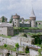
|
KAMIANETS-PODILSKYI. City (2001 pop 100,000) under oblast jurisdiction and raion center of Khmelnytskyi oblast, situated picturesquely on the Smotrych River in eastern Podilia. First mentioned in an Armenian chronicle of the 11th century, when it belonged to Halych principality, the town was destroyed by the Mongols in 1240. In 1430 Poland gained control of the town; in 1432 it was granted the rights of Magdeburg law. The city's first inhabitants were Ukrainians and Armenians; eventually many Poles and Jews settled there. In 1672 the city was captured by Hetman Petro Doroshenko and his Turkish allies; it remained in Turkish hands until 1699, when it was restored, with the rest of Podilia, to Poland. The city's old town lies on a high plateau within a loop formed by the Smotrych River. Located there are centuries-old narrow, winding streets and buildings, and the citadel, which was separated from the rest of the town by a deep ravine and controlled access to it... |
| Kamianets-Podilskyi |
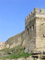
|
BILHOROD-DNISTROVSKYI. City (2001 pop 52,000) in southern Bessarabia on the right bank of the Dnister Liman, 18 km from the Black Sea; a raion center in Odesa oblast. In 600 BC this was the site of the Greek colony of Tyras. In the 9th century AD it was a city of the tribes of Tivertsians and Ulychians named Bilhorod; in the 13th century it became part of the Principality of Galicia-Volhynia. In the 14th century it was ruled by the Genoese (and renamed Moncastro). In 1484 the city was captured by the Turks and in 1503 renamed Akkerman (White Rock); during the 17th and 18th centuries it was the seat of the Bilhorod Horde. In 1812 it came under Russian rule; from 1918 to 1940 it belonged to Romania. In 1940 it became part of the USSR. The city's architectural monuments include the well-preserved castle fortress (built in 1438?54 by Master Fedorko), with 26 turrets, 4 gates, and a citadel whose walls are almost 2 km long, and a restored church built during the 14th and 15th centuries... |
| Bilhorod-Dnistrovskyi |
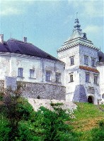
|
OLESKO. A town smt (2001 pop 1,793) in Busk raion, Lviv oblast. Traces of settlements dating from the Bronze Age and the 12th and 13th centuries have been uncovered at the site. Olesko is first mentioned in historical documents in the mid-14th century, when it was under Polish rule. In 1370-7 it belonged to the Lithuanian prince Liubartas. The Poles occupied the castle in 1432 and granted the town the rights of Magdeburg law in 1441. The Cossacks took control of the town during Bohdan Khmelnytsky's uprising in 1648. In the 1680s the Polish king Jan III Sobieski, who had been born in Olesko, rebuilt the castle and tried unsuccessfully to revive the town's economy. The town's architectural monuments include a Roman Catholic church from the 15th century, a castle from the 14th to 17th centuries, and a baroque Capucines monastery from the 18th century. In 1975 the castle was restored and turned into a historical preserve. It houses a fine collection of Ukrainian art... |
| Olesko |

|
PALACE. An elaborate residence built by a monarch or noble. Palaces of the Kyivan Rus? period have not survived. During the 13th to 16th centuries many castles but few palaces were built. It was only in the 17th century that members of the Cossack starshyna, particularly hetmans, began commissioning them. Most of the palaces built during the Hetmanate era have not survived. All that remains of Hetman Bohdan Khmelnytsky's palaces in Chyhyryn and Subotiv are written descriptions and drawings of the ruins. All traces of Hetman Ivan Mazepa's imposing baroque palace in Baturyn were destroyed on the orders of Peter I in 1708. The palaces built by Polish nobles in Right-Bank Ukraine fared much better, including the Renaissance-baroque one in Pidhirtsi (1654) and others in Zbarazh, Berezhany, and Bar. Most of the surviving palaces in Ukraine date from the late 18th and early 19th centuries. They were constructed in the classical style then popular in the Russian Empire... |
| Palace |
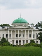
|
SOKYRYNTSI. A village (2001 pop 1,386) in Sribne raion, Chernihiv oblast. It is first mentioned in the chronicles under the year 1092. As the estate of the Galagan family the locality was developed into a cultural center. A dendrological park was set up in 1763 and redesigned as a landscape park in 1825?35, a vertep puppet theater was established in 1781, and a palace was built by the architect P. Dubrovsky in 1829. The kobzar Ostap Veresai lived in Sokyryntsi in the 19th century. One of the first co-operatives in Ukraine, an agricultural credit union, was organized in Sokyryntsi by Hryhorii Galagan in 1871. Today the Galagan palace and park are used by an agricultural tekhnikum... |
| Sokyryntsi |
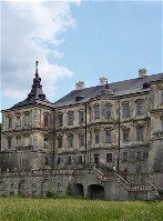
|
PIDHIRTSI. A village (2001 pop 1,076) in Brody raion, Lviv oblast. It is first mentioned, as Plisnesk or Plisnysk, in chronicles in 1188 and 1233. The town's ruins--a complex of ramparts and moats covering nearly 160 ha--are the largest and finest of old Rus? fortifications to survive. In the 12th and 13th centuries Plisnesk was one of the largest cities of the Halych pricipality and the Principality of Galicia-Volhynia and an important trade center. It was destroyed in 1241 by the Mongols, and had disappeared by the mid-15th century. The village of Pidhirtsi was founded close by. It is first mentioned in historical documents in 1432. The Polish grand hetman Stanislaw Koniecpolski built a fortified Renaissance palace there in 1635?40. Besides the palace a number of architectural monuments, including a Basilian monastery from 1659, a Roman Catholic church (1752-66), and an Orthodox church from 1726, have been preserved... |
| Pidhirtsi |
The preparation, editing, and display of the IEU entries featuring castles and palaces of Ukraine were made possible by the financial support of the IVAN AND ZENOVIA BOYKO ENDOWMENT FUND at the CANADIAN INSTITUTE OF UKRAINIAN STUDIES (Edmonton, AB, Canada).
 XXXII. NATIONAL PARKS AND NATURE PRESERVES IN UKRAINE
Protected areas in Ukraine are divided into eleven categories of territories and objects of national or local importance. The first category consists of nature preserves that have been given a supplemental title, that of a biosphere reserve, under the United Nations' Man and the Biosphere program. As of 2007, four nature preserves in Ukraine, the Askaniia-Nova Biosphere Reserve, the Black Sea Biosphere Reserve, the Danube Biosphere Reserve, the Carpathian Biosphere Reserve and the Uzhanskyi National Nature Park as a constituent part of the trilateral East Carpathian Biosphere Reserve, are so designated. Apart from that there are 17 national parks and 45 regional landscape parks in Ukraine. Nature preserves represent the principal focus of Ukraine's nature preservation effort. The system was initiated in the former USSR shortly after the Revolution of 1917, and by 1988 it encompassed more than 150 nature preserves, of which 12 were in Ukraine. National parks are large, mostly forested tracts that are set aside for both conservation and outdoor recreation. Two most important national parks in Ukraine are the Carpathian National Nature Park (est 1980, 47,300 ha) and the Shatsk National Nature Park (est 1983, 32,500 ha). Game (hunting) preserves are a companion category of partially protected areas. Wildlife refuges constitute a category of smaller parcels of land or bodies of water designated for the purpose of protecting some elements of nature (usually an endangered plant or animal species) but not the entire natural complex (as in the case of the nature preserves). The most common wildlife refuges are established for the purpose of protecting valuable animals and birds by disallowing hunting for 10 years or more. Fishing refuges are established for the protection of spawning grounds or young fish. A landscape wildlife refuge may serve to protect a picturesque river valley or a lake with scenic shores. Small plots of forest, steppe, or wetlands may be designated wildlife refuges for the protection of their unique complex of plants. As of 2007, there are 2709 wildlife refuges in Ukraine... Learn more about national parks and nature preserves in Ukraine by visiting the following entries:
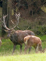
|
NATURE PRESERVES. Territories recognized as having intrinsic value that are designated for protection from commercial exploitation so that their natural characteristics will be maintained. In Ukraine a system of different kinds of nature preserves has evolved. The preserves differ in the scope of their protection activities, the jurisdiction under which they serve, the size of the territory they control, and the extent to which they are open to the public for popular education and outdoor recreation. The need for establishing a system of nature preserves and national parks in Ukraine emerged as a result of the widespread and increasingly intensive use of land for agriculture, the growth of large-scale exploitation of forests and minerals, and rapid industrialization and urbanization. In 2007, the total area of all types of protected areas, nature preserves, and parks in Ukraine was approximately 2.8 million ha which represents about 4.7 percent of the total land area of Ukraine. Preserves were established primarily to function as scientific research facilities and to promote biosphere conservation activities. They also preserve representative portions of a particular type of landscape or biome, such as steppe, estuary, or forest ecosystems, and are sometimes called 'standards of nature' (etalony). Some nature preserves, such as the Ukrainian Steppe Nature Reserve, are made up of several discontinuous sections so that isolated remnant enclaves of biotic importance will be preserved. The nature preserves are not intended to have any significant tourist function; that role is assigned to the national parks... |
| Nature preserves |
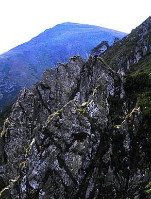
|
CARPATHIAN NATIONAL NATURE PARK. Ukraine's first national park, established in 1980 on an area of 50,303 ha with the aim of preserving the ecosystem as well as historical, architectural, and ethnographical monuments in the Chornohora and Gorgany Mountains. One of the Carpathian protected areas, the park stretches along the eastern slopes of the Ukrainian Carpathian Mountains at altitudes ranging from 500 to 2,061 m and is located in Ivano-Frankivsk oblast. It borders on the Carpathian Bioshepre Reserve with which it shares Ukraine's highest peak, Hoverlia (2,061 m). Chornohora's largest lakes--Nesamovyte and Maricheika--as well as numerous glacial peat bogs are located on the park's territory in the upper reaches of the Prut River and Chornyi Cheremosh River. One of the distinctive features of the Carpathian National Nature Park are relict patches of Scots pine, Swiss stone pine, and European white birch--the largest in the Ukrainian Carpathians. More than 1,100 vascular plant species, 75 of which are listed in Ukraine's Red Data Book of endangered plants and 35 of which are endemic to the region, have been registered in the park. The local fauna includes 48 mammals, 110 birds, 11 fish, 10 amphibians, and 6 reptile species. 32 of these species, including brown bear, wolf, otter, and Eurasian lynx, are listed in the IUCN and Ukraine's Red Data Books of endangered species...
|
| Carpathian National Nature Park |
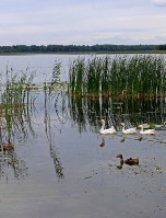
|
SHATSK NATIONAL NATURE PARK. The second national park to be created in Ukraine, after the Carpathian National Nature Park. It was proposed in the 1970s and set up in 1983. The park covers 48,977 ha in the northwestern part of Volhynia oblast, near the borders with Belarus and Poland. Its vegetation consists mainly of mixed forests and peat marshes on the upper watershed of the Prypiat River. More than 25 lakes dot the area, the largest of which is Svytiaz Lake. The intermittent forests are predominantly pine and hornbeam. Numerous organizations have established recreational bases in the area, particularly around Svytiaz Lake. Besides providing camping and hiking facilities the park conserves the natural landscape and its forest and wetland ecosystems, and supports scientific research. The local flora and fauna are very diverse. Over 780 vascular plant species, more than 30 of which are included in Ukraine's Red Data Book, are found there. The park has 333 registered animal species, of which 44 are mammals, 241 are birds, 19 are amphibians or reptiles, and 29 are various species of fish. 33 animal species are included in Ukraine's Red Data Book... |
| Shatsk National Nature Park |
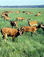
|
ASKANIIA-NOVA BIOSPHERE RESERVE. A state nature preserve in the steppe near the town of Askaniia-Nova, Chaplynka raion, Kherson oblast. A zoo was established there in 1875 by a Prussian colonist, Friedrich Falz-Fein, on the lands of his father, a wealthy landowner. He acclimatized wild animals from Asia, Africa, America, and Australia that were related to extinct species of steppe fauna. In 1910 Professor I. Ivanov worked at the reserve and conducted experiments in acclimatizing the wild Przewalski horse, the European bison, zebra, and other species. During the revolutionary period a local peasant, Klym Siianko, who was a self-taught zoologist and Falz-Fein's assistant, saved the reserve from complete ruin. In 1921 Askaniia-Nova was declared a national nature preserve under government supervision. An experimental station, zoo, botanical garden, zootechnical station, and breeding farm were set up at the enlarged reserve in 1921-5 under Mikhail Ivanov. In 1985, UNESCO designated the Askaniia-Nova Nature Reserve a biosphere reserve under the United Nations' Man and the Biosphere program. Today the Askaniia-Nova Biosphere Reserve has a total area of 33,307.6 ha and consists of a 11,200 ha section of virgin fescue-feather grass steppe, a large research farm, an acclimatization zoo, a dendrological park, and a botanical garden... |
| Askaniia-Nova Biosphere Reserve |
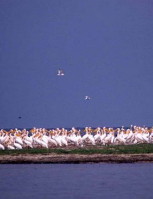
|
BLACK SEA BIOSPHERE RESERVE. A state nature preserve located on the sandy banks of the lower Dnipro River and the coast and the islands of the Tendriv Bay and Yahorlyk Bay of the Black Sea. The preserve was established in 1927 as part of a larger Black Sea preserve and it became a separate Black Sea Nature Reserve in 1933. In 1998 UNESCO designated the preserve as a biosphere reserve under the United Nations' Man and the Biosphere program and its name was changed to the Black Sea Biosphere Reserve. The preserve covers 14,158 ha of dry land and 74,971 ha of water (in 2007, total 89,129 ha) and constitutes the largest nature preserve in Ukraine. It was created to protect nesting, wintering, and migratory birds and to preserve the natural environment. The steppe section of the preserve--the Yahorlyk Kut Peninsula and Potiivka--consists of the remains of the Black Sea steppes and is inhabited by such rare birds as the great bustard, the little bustard, and the white-tailed eagle and smaller animals such as the acclimatized bobak marmot. In the forest-steppe sections are found the remains of island forests and small groves of oak, birch, and willow trees. The pheasant and the sika deer, which was brought in 1957 from the Askaniia-Nova Reserve, are acclimatized here. Numerous sea gulls, swallows, snipe, ducks, and grouse nest here. The only nesting ground in the former USSR of the Mediterranean black-headed sea gull is located here... |
| Black Sea Biosphere Reserve |
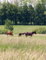
|
UKRAINIAN STEPPE NATURE RESERVE. A state nature preserve established in 1961 as an amalgamation of three nature reserves, Khomutivskyi Steppe, Kamiani Mohyly Nature Reserve, and Mykhailivka Virgin Soil Preserve. The preserve is dedicated to preserving a portion of the original steppe environment. It has a total area of 1,634 ha. The largest (1,030 ha) of the components, Khomutivskyi Steppe, is situated in Novoozivsk raion, Donetsk oblast, in the Black Sea Depression. It provides sanctuary for animals such as the European hare, the mole rat, the tiger weasel, the steppe viper, the black-headed bunting, marmots, and the like, some of which faced almost total extinction at the turn of the century. It also features approximately 560 varieties of flora. The Kamiani Mohyly component of the preserve consists of two parallel granite ridges separated by a valley. With an area of 404 ha, it stretches across the border between Donetsk oblast and Zaporizhia oblast in Volodarsk and Kuibysheve raions. A variety of vegetation can be found in the reserve. The Mykhailivka Virgin Soil component (202 ha) is situated farther to the north, in Lebedyn raion of Sumy oblast. Although in the forest-steppe zone, the Mykhailivka Reserve is primarily a steppe-type reserve. Among its 960 varieties of flora are approximately 40 rare plants, including several vetches, carnations, wedge larkspurs, and irises. The reserve also shelters 26 species of mammals, 115 of birds, and 10 of fish... |
| Ukrainian Steppe Nature Reserve |

|
WILDLIFE REFUGE. An area of land or a body of water designated for the purpose of protecting some specific plants or animal species. Such areas do not constitute fully rounded natural complexes, as in nature preserves. The most common wildlife refuges were established to protect valuable wild animals and birds by means of the prohibition of hunting on their territory for 10 years or more. Fishing refuges protect spawning grounds or young fish. A landscape refuge may protect a picturesque river valley or lake so that its esthetic qualities will be maintained for the benefit of outdoor recreation and tourism. Small plots of forest, steppe, or wetlands may be designated as plant refuges for the purpose of protecting their unique flora. Geological features such as caves or sites rich in fossils may also be protected. Even a site of historical significance may be designated as a refuge (zakaznyk). Wildlife refuges were established on the basis of decisions made by the Council of National Ministers of Ukraine or by local (oblast or even raion) councils. Activities on their sites are regulated by the national government, the organs responsible for the protection of nature, and the executive committees of local councils. Hunting, fishing, logging, grazing, hay cutting, and mining are usually prohibited on the refugees. In 2007 Ukraine had 2,709 zakaznyky of various kinds, occupying a total area of over 900,000 ha... |
| Wildlife refuge |
The preparation, editing, and display of the IEU entries about national parks and nature preserves in Ukraine were made possible by the financial support of the CANADIAN FOUNDATION FOR UKRAINIAN STUDIES.
ABOUT IEU: Once completed, the Internet Encyclopedia of Ukraine will be the most comprehensive source of information in English on Ukraine, its history, people, geography, society, economy, and cultural heritage. With close to 20,000 detailed encyclopedic entries supplemented with thousands of maps, photographs, illustrations, tables, and other graphic and/or audio materials, this immense repository of knowledge is designed to present Ukraine and Ukrainians to the world.
At present, only 61% of the entire planned IEU database is available on the IEU site. New entries are being edited, updated, and added daily. However, the successful completion of this ambitious and costly project will be possible only with financial assistance from IEU supporters. Become an IEU supporter and help the CIUS in creating the world?s most authoritative electronic information resource about Ukraine and Ukrainians!