IEU'S FEATURED TOPIC CONCERNING THE PEOPLE OF UKRAINE AND UKRAINIANS ABROAD
THE EXPRESSIVE CULTURE OF TRADITIONAL UKRAINIAN FOLKLORE
Ukrainian folk oral literature, poetry, and songs (including epic historical songs and dumas) are among the most distinctive ethnocultural features of Ukrainians as a people. The particularly vital role of folklore in the formation of modern Ukrainian culture and national consciousness was the result of an unusually important role that peasantry played in the history of Ukraine. Not only did peasants make up the overwhelming majority of the Ukrainian population until the 1930s, but they also contributed much to the preservation and development of the Ukrainian language and traditional way of life. Their conservative attitude toward traditions, language, and faith--in short, their fostering of national and ethnic characteristics, some of which extend back to pre-Christian times and even to Indo-European roots--was of great importance for the Ukrainian nation, which had been subdued by powerful neighbors and, particularly in the case of the upper classes and the urban strata, exposed to assimilatory influences. In the 19th century, folk songs and folk oral literature not only served as the basis for the reconstruction of the Ukrainian literary language, but also provided Ukrainian writers, composers, and intellectuals with the components for the creation of a modern national culture. Apart from collecting and studying works of Ukrainian folk oral literature, the leading Ukrainian cultural figures and intellectuals have also been fascinated with the richness of Ukrainian folk customs and such aspects of traditional folk culture as dances, regional costumes, folk art, and unique folk architecture... Learn more about the expressive culture of traditional Ukrainian folklore by visiting the following entries:

|
FOLKLORE. In Ukrainian folklore scholarship there is an overwhelming tendency to equate folklore with folk oral literature. In this discipline folk tales (tales of magic, animal tales, legends, anecdotes, etc), folk songs (ritual songs and non-ritual songs), and items of the minor verbal genres (proverbs and riddles) have been collected and studied. Some of the above (animal tales, some songs and games, and certain types of proverbs and riddles) are children's folklore. Oral literature consists of variant texts whose authorship is unknown, the texts being passed along by word of mouth and in the process changed to some degree by each performer. Some descriptions of Ukrainian folklore originated back in the Middle Ages. Pre-Christian Ukrainian folk customs and rites were described in medieval Arabic and Byzantine sources. Other documentation of Ukrainian folklore is found in the earliest of literary monuments in Ukraine (ie, the chronicles and Slovo o polku Ihorevi), where instances of folk prose, proverbs, and ritual songs can be found. Christianity introduced into Ukraine not only dogma but also apocryphal and classical folklore traditions. A systematic study and publication of Ukrainian oral folklore originated in the 19th century, and the largest organized folklore collecting took place then under the leadership of Pavlo Chubynsky...
|
| Folklore |

|
FOLK ORAL LITERATURE. The sum of oral works, both poetry and prose, which are produced usually by anonymous authors and are preserved in the people's memory for a long time by being passed on orally from generation to generation. Ukrainian folk oral literature has its distinctive artistic qualities, its unique poetic devices--metaphors, similes, epithets, and symbolism. The poetic folk literature consists mostly of folk songs, which are subdivided into various genres. Folk prose can be divided into fables, fairy tales, stories, legends, anecdotes, and others. Poetic-prose folk literature consists of spells, proverbs, sayings, and riddles. In the 19th century the works of folk oral literature were held to be the products of a collective popular mind. Today folklorists favor the theory that individuals are the creators of the oral tradition. With the coming of Christianity and the church's rejection of folk literature and folk customs as pagan relics, folk oral literature nevertheless managed to retain its vitality and to absorb the Christian influences of medieval written literature. Beginning with the Renaissance and baroque periods there was a constant interchange between oral and written literature. Mixed folklore-literary genres of the baroque appeared, such as interludes, through which Christmas, Easter, and satirical verse passed into folklore... |
| Folk oral literature |

|
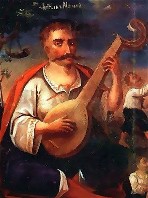
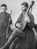
FOLK SONGS. The song is one of the oldest and most prevalent forms of folklore. It unites a poetic text with a melody. The poetic imagery determines the character and emotive quality of the melody. Songs usually have a well-defined strophic structure: all stanzas are set to the same melody as the first stanza. Each stanza is often followed by a refrain. Folk songs are usually monodic choral songs, but Ukrainian folk songs are exceptional for their rich polyphony. The folk songs express the common experience of the Ukrainian people: all the important events in life from the cradle to the grave are accompanied by song. By their content and function folk songs can be divided into four basic groups: (1) ritual songs; (2) harvest songs and wedding songs; (3) historical and political songs, such as dumas and ballads; and (4) lyrical songs. Chumak songs, wanderers' songs, and cradle songs belong to separate groups. Together these genres of folk song encompass the variegated life of the Ukrainian people. The universal content and the artful clarity of expression of Ukrainian folk songs account for their survival for many centuries. In many songs--historical, social--the epic and lyrical elements form an organic unity. In numerous Ukrainian folk songs nature manifests human emotions.... |
| Folk songs |

|
FOLK CUSTOMS AND RITES. Ritual actions and verbal formulas belonging to the traditions of familial, tribal, and folk life and connected with the changing seasons and the resulting changes in agricultural or other work. These customs and rites are regulated by the folk calendar and are often accompanied by magical acts, religious ceremonies, incantations, folk songs, dances, and dramatic plays. They arose in prehistoric times and evolved through the centuries of Ukrainian history, blending in many cases with Christian rites. They can be divided into: (1) familial customs and rites, which consist of birth, wedding, and burial rites; (2) seasonal-productive customs and rites, which are tied to farming, herding, and hunting tasks; and (3) communal customs and rites, which mark certain events in the life of the community. With the spread of modern civilization and urban culture, as well as the changes triggered by the two world wars, the folk customs and rites in Ukraine have been greatly transformed. However, Soviet efforts to eradicate them did not succeed. Believers continued to practice the folk customs of the Christian calendar, particularly those of Christmas and Easter, while the country people were turning to ancient folk rites such as New Year's rites... |
| Folk customs and rites |

|
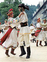
FOLK DANCE. In prehistoric and ancient times dance was a ritual means of communicating with nature and the divine forces. Only isolated elements of ancient folk calendar ritual and cult dances have survived through the centuries. With the introduction of Christianity in Ukraine, the archaic relics of these dances blended with Christian rituals and were adapted to the church calendar and Christian festivals. Ancient Ukrainian dances were actually agricultural dance games (khorovody); their basic form was the circle, associated with the cult of the sun, the greatest life-giving power. The most widely known are the spring khorovody (circular choral dances). In the summer the dances of the Kupalo festival were performed. In the late summer and early autumn the harvest feast was celebrated by circular dances, which constituted a dramatization of the song content and an imitation of agricultural work. The pre-Lenten carnival period was also the time for weddings, which have in part preserved the traditional ritual character of dance. Ukrainian ritual dances are performed mostly to the accompaniment of a churchlike, antiphonic chant. They are rarely performed to music. In general, Ukrainian folk dances can be divided into two groups: those performed to the accompaniment of songs and those performed to music... |
| Folk dance |

|
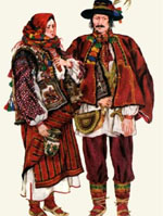
FOLK COSTUMES. In general, Ukrainian folk dress can be classified into five regional groups. The people of the Middle Dnipro River region, including the Left-Bank and steppe areas, dressed in clothes originating in the Cossack Hetmanate period. In the second region, Polisia, very old features of dress, dating back to the Princely era, have been preserved. In general, women wore an embroidered blouse with a predominance of red, a colorful woven skirt, and a white headband; men wore a shirt outside the trousers and a white or gray coat. In the third region, Podilia, women wore a multicolored embroidered blouse, a rectangular, woven wraparound skirt, and a coat of dark woolen cloth; men wore a mantle, coat, short woolen overcoat, and sheepskin coat. The fourth region, consisting of central Galicia and Volhynia, preserved many old features of dress but also displayed foreign influences. The extensive use of linen in men's and women's outerwear is distinctive of this region. The fifth region encompasses the Carpathian Mountains and Subcarpathia and can be subdivided into four districts--Pokutia and Bukovyna, the Hutsul region, the Boiko region, and the Lemko region. The clothing of the Hutsul area was particularly distinguished by its vivid colors and rich ornaments... |
| Folk costumes |
The preparation, editing, and display of the IEU entries about the expressive culture of traditional Ukrainian folklore were made possible by the financial support of the CANADIAN FOUNDATION FOR UKRAINIAN STUDIES.
ABOUT IEU: Once completed, the Internet Encyclopedia of Ukraine will be the most comprehensive source of information in English on Ukraine, its history, people, geography, society, economy, and cultural heritage. With close to 20,000 detailed encyclopedic entries supplemented with thousands of maps, photographs, illustrations, tables, and other graphic and/or audio materials, this immense repository of knowledge is designed to present Ukraine and Ukrainians to the world.
At present, only 62% of the entire planned IEU database is available on the IEU site. New entries are being edited, updated, and added daily. However, the successful completion of this ambitious and costly project will be possible only with financial assistance from IEU supporters. Become an IEU supporter and help the CIUS in creating the world's most authoritative electronic information resource about Ukraine and Ukrainians!
|
Click Home to get to the IEU Home page; to contact the IEU editors click Contact. To learn more about IEU click About IEU and to view the list of donors and to become an IEU supporter click Donors. ©2001 All Rights Reserved. Canadian Institute of Ukrainian Studies. |
