Kamianets-Podilskyi
Kamianets-Podilskyi [Кам’янець-Подільський; Kam'ianec’-Podil’s’kyj]. Map: V-7. City (2009 pop 101,185) under oblast jurisdiction and raion center of Khmelnytskyi oblast, situated picturesquely on the Smotrych River in eastern Podilia.
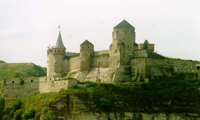
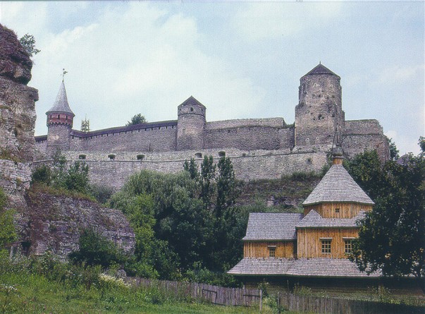
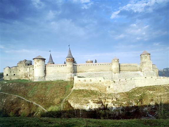
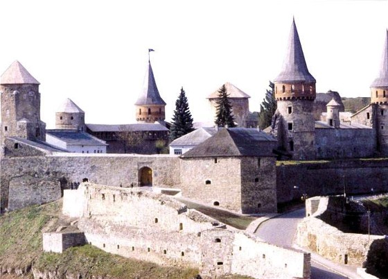
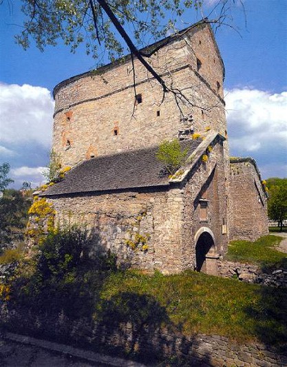
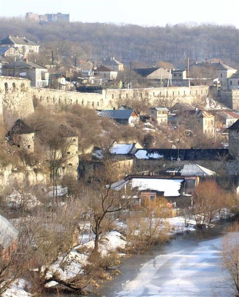
First mentioned in an Armenian chronicle of the 11th century, when it belonged to Halych principality, the town was destroyed by the Mongols in 1240. In the 1360s it fell under the rule of the Lithuanian Koriiatovych princes. In 1430 Poland gained control of the town; in 1432 it was granted the rights of Magdeburg law; and in 1463 it became the capital of Podilia voivodeship. Under the Poles it grew into a center of international trade and artisanry, second only to Lviv. Its wooden Kyivan Rus’ fortress was replaced in the 15th and 16th centuries by a large stone citadel (photo: Kamianets-Podilskyi fortress), and the city was well fortified with walls and towers. It protected the south eastern frontier of the Polish Commonwealth from the Tatars and Turks. In 1463 Kamianets-Podilskyi was proclaimed a royal city and was granted duty-free status.
The city's first inhabitants were Ukrainians and Armenians; eventually many Poles and Jews settled there. The Ukrainian, Armenian, and Lithuanian-Polish burghers each had municipal self-government (see Municipal government), beginning in the Lithuanian period. Under the Poles, however, the Ukrainian citizens saw their rights diminished: in 1534 they were forced to live outside the city walls, and in 1670 the Ukrainian municipal council (magistrat) was united with the Polish council, in effect annulling Ukrainian self-government. During the Cossack-Polish War the city was besieged by Cossack forces in 1648, 1651, and 1655. In 1672 the city was captured by Hetman Petro Doroshenko and his Turkish allies; it remained in Turkish hands until 1699, when it was restored, with the rest of Podilia, to Poland by the Treaty of Karlowitz.
Under the Turks the city declined economically and demographically. Slow growth resumed under Russian rule in 1793. The city was a Russian vicegerency (1795–7) (Podilia vicegerency) and capital of the Podilia gubernia (1797–1917). In 1812 its citadel, which had been strengthened by the Turks, was dismantled. Because of the absence of a railway link (established only in 1914) the city remained primarily a center of trade and artisanship, with very little industry. Its population grew from 3,450 in 1793 (a third of what it had been in the mid-16th century) to 16,000 in 1820, 22,800 in 1860, 37,000 in 1893, and 50,000 on the eve of the First World War. It played a far greater role as the cultural capital of Podilia: an Orthodox brotherhood school had been established there in 1589; many prominent figures—including Mykola Leontovych, Anatolii Svydnytsky, Mykhailo Kotsiubynsky, and Stepan Rudansky—studied at its theological seminary (est 1805); it had one of the first Prosvita societies in Russian-ruled Ukraine; it was the home of the Podilia Church Historical-Archeological Society and an eparchial historical-archeological museum, founded in 1890 by Yevtym Sitsinsky; and it had 10 secondary schools and a theater.
Under Ukrainian rule (1917–20) the Kamianets-Podilskyi Ukrainian State University was established there in the summer of 1918 by the Hetman government. In 1919 and 1920 the city served on several occasions as the seat of the Directory of the Ukrainian National Republic and the government of the Western Ukrainian National Republic.
In November 1920 the city fell under Soviet rule and functioned as an okruha (1923–30) and oblast (1937–41) capital. The destruction it had suffered during the First World War and the Ukrainian struggle for independence (1917–20) was repeated during the Second World War, and the city grew very slowly until the 1960s. In 1926 it had a population of 32,100, consisting of Ukrainians (45 percent), Jews (40 percent), Russians (7 percent), and Poles (6 percent). By 1959 its population had grown to 40,000, by 1970 to 57,000, and by 1979 to 84,000. In 1959 Ukrainians made up 71 percent of its population, Russians 21 percent, Poles 5 percent, and Jews 3 percent.
Today the city’s industries produce auto parts, farm machinery, electrical machines and equipment, cables, tools, woodworking instruments, reinforced-concrete structures, asphalt, concrete, wall materials, cement, food products, furniture, textiles, and clothing. The city has a classical university (Kamianets-Podilskyi National University), an agrarian university (est 1921) (Podilia Technical University of Agrarian Science), seven specialized secondary schools, three technical schools, a historical museum (since 1919), a botanical garden (est 1930), and a dendrological park.
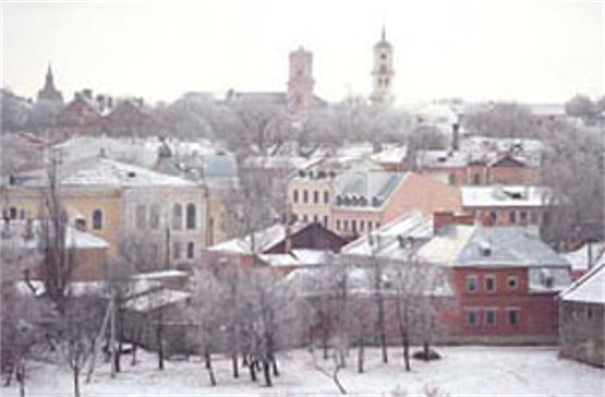
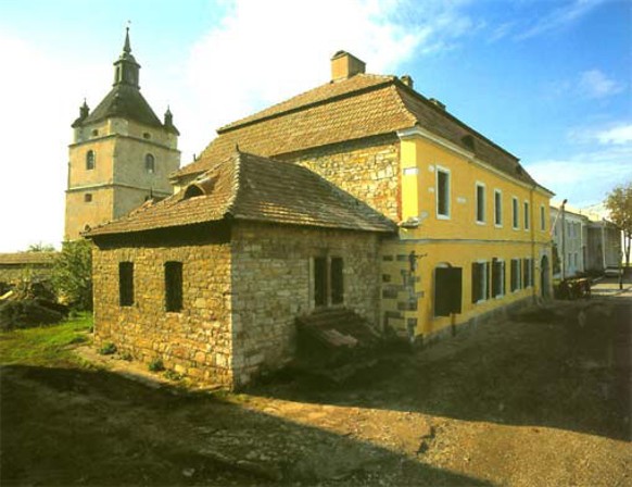
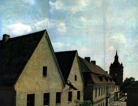
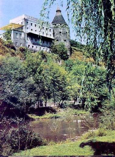
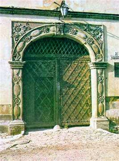
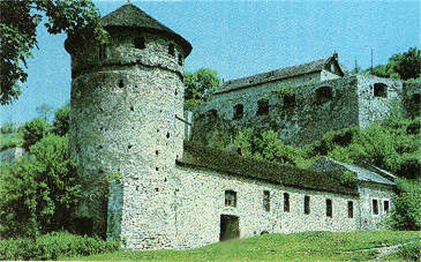
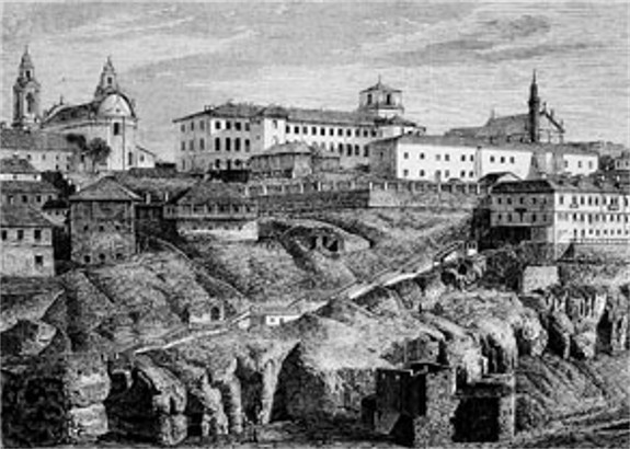
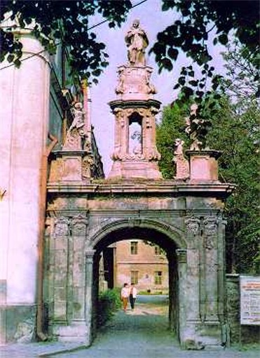
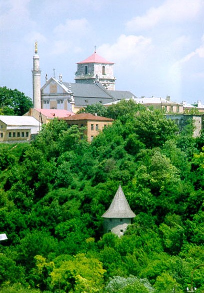
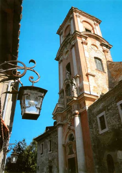
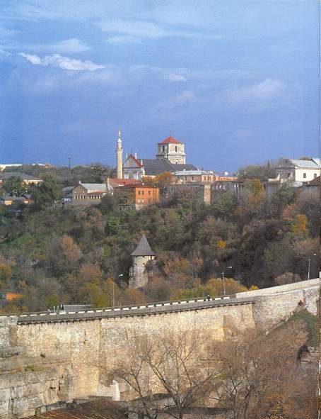
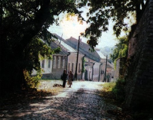
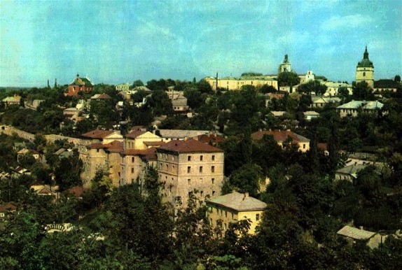
The city’s old town lies on a high plateau within a loop formed by the Smotrych River. Located there are centuries-old narrow, winding streets and buildings, the citadel, which was separated from the rest of the town by a deep ravine and controlled access to it, remnants of the city walls, several towers, and the fortified Ruska and Polska gates. Other architectural monuments have also been preserved in the city: the town hall (16th–18th century), Saint Nicholas's Church (1280, the oldest Armenian church in Ukraine), the Church of Saint John the Baptist (16th century), the Church of SS Peter and Paul (15th–16th century), a late Renaissance Dominican Church of St. Nicholas, the Catholic Gothic cathedral (late 15th century) with a minaret added in the Turkish period, and a number of Renaissance and baroque buildings. The city’s abundance of architectural monuments (the third most numerous in Ukraine after Kyiv and Lviv) and striking geographic locale have made it a popular tourist destination.
In 1928 the Ukrainian SSR proclaimed the Kamianets-Podilskyi fortress a cultural and historical preserve (see Kamianets-Podilskyi Historical Museum and Preserve). This designation was extended to include the old town by the Ukrainian SSR Council of Ministers in 1977, and the entire complex reconstituted as the ‘Kamianets’ National Historical and Architectural Preserve in 1998. The Ukrainian SSR submitted an application for the designation of the castle and old town as a world heritage site.
BIBLIOGRAPHY
Setsinskii, E. Gorod Kamenets-Podol’skii (Kyiv 1895)
Plamenyts’ka, Ie.; Vynokur, I.; Khotiun, H.; Medvedovs’kyi, I. Kam'ianets’ Podil’s’kyi (Kyiv 1968)
Kam'ianets’ Podil’s’kyi: Putivnyk (Lviv 1970)
Kiryk, Feliks. Kamieniec Podolski: Studia z dziejów miasta i regionu, 2 vols (Cracow 2000)
Mandzy, A. A City on Europe's Steppe Frontier: An Urban History of Early Modern Kamianets-Podilsky, Origins to 1672 (Boulder–New York 2004)
Rasshchupkin, O., Trabchaninov, Serhii. Kamianets’ na Podilli (Kamianets-Podilskyi 2008)
Petrov, Mykola. Misto Kamianets'-Podils'kyi v 30-kh rokakh XV–XVIII stolit' (Kamianets-Podilskyi 2012)
Volodymyr Kubijovyč
[This article was updated in 2010.]
.jpg)
.jpg)
.jpg)
.jpg)
.jpg)